

Neilston Pad
Good walks are even better shared.
NS4755 : Neilston Pad
Alec MacKinnon Photo source
Overview
Neilston Pad
Situated in the stunning Southern Uplands, Neilston Pad is a delightful Marilyn that charms locals and visitors alike. Standing at an elevation of 397 meters, this hill offers a proper workout, guaranteed to shred those crisps-induced calories you might have tucked into at the village pub!
Geology
The geological foundation of Neilston Pad boasts ancient volcanic rocks, remnants from the Carboniferous period. As you ascend, you can practically hear the rocks reminiscing about their long-lost molten past. It’s a history lesson, but remember—no touching the rocks to show off your newfound trivia!
Routes
The most popular route begins in Neilston village, taking you through beautiful fields and woodlands before leading you to the summit. The Neilston to Neilston Pad route stretches about 6.5 km and takes approximately 2.5 hours to complete at a moderate pace. This journey is a lovely way to soak in the surrounding nature while getting in your daily steps.
Summit Features
Once on the summit, you’ll find a proud trig point that stands like a witness to countless adventures. It’s the perfect spot for a quick photograph and a much-deserved snack break—because what’s an ascent without a snack?
Terrain Type
The terrain varies from grassy slopes to a few rocky outcrops, accessible and manageable for most hikers. Just watch out for those cheeky mud patches after a good downpour!
Views
On days clear enough to make the weatherman blush, the summit offers enchanting views of the Clyde Valley and Ben Lomond. Don’t forget your camera; you’ll want to document this breathtaking sight, as it’s one for the Instagram books! Best seasons for these views are spring and autumn when the weather is kinder and Mother Nature is showing off her palette of colours!
Hazards
As lovely as Neilston Pad is, it does come with a few hazards. The paths can get muddy, especially following heavy rain, so sturdy footwear is highly recommended to avoid turning your walk into a slip ‘n’ slide.
Access
Accessing Neilston Pad is a breeze. There’s a car park in Neilston village, and those relying on public transport can hop on a train or bus to Neilston. It’s a getaway that won’t leave you stranded!
Facilities
While you might have to pack your lunch and snacks, Neilston has a few charming cafes and pubs to refuel post-hike. Treat yourself to a hot beverage and some local treats—perfect after a day conquering the hills!
History
The name Neilston means the farm of Njal, spotlighting its Viking heritage. The charm of Neilston Pad lies not only in its physical beauty but also in its cultural significance, having served as inspiration for poets and wanderers alike over the years.
So lace up those hiking boots, pack a few sandwiches, and embark on a journey to Neilston Pad—a delightful spot with its own tales to tell!
Explore routes near Neilston Pad
Walks starting near this hill. Open a route to check its map, distance and full itinerary.
Paisley Walk with Men Walking & Talking
View route
Cambuslang Walk with Men Walking & Talking
View route
Motherwell: Strathclyde Loch full shoreline circuit
View route
Kirkintilloch to Twechar Bridge: Forth and Clyde Canal Return
View route
Route planning notes
These notes describe possible approaches. Check a route's map and access information when planning your walk.
Neilston to Neilston Pad
A scenic route starting from the village of Neilston, winding through fields and woodland before ascending to the summit.
Make a day of it, together
Find someone to share the walk with, or organise a day out along a route you like.
Photo Gallery
View all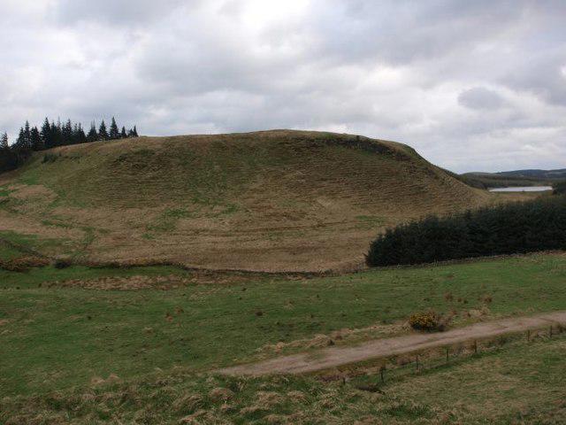 Photo could not load
NS4755 : Neilston Pad
Alec MacKinnon
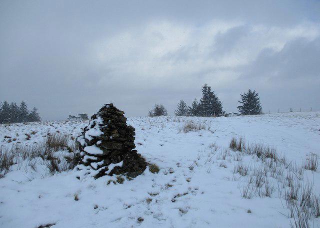 Photo could not load
NS4755 : Summit cairn on Neilston Pad
Alan O'Dowd
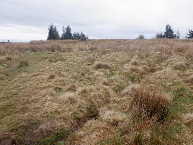 Photo could not load
NS4755 : Cairn on Neilston Pad
Richard Webb
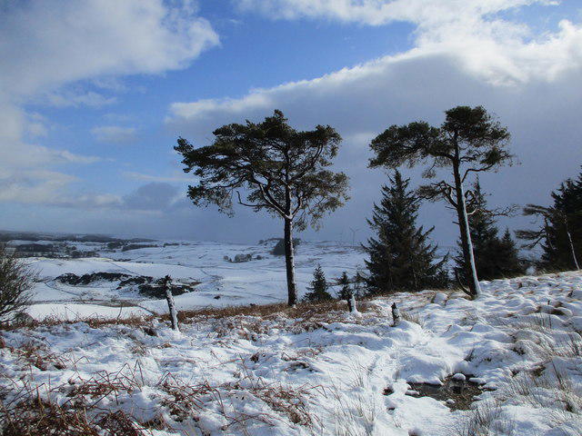 Photo could not load
NS4755 : Scots pines on Neilston Pad
Alan O'Dowd
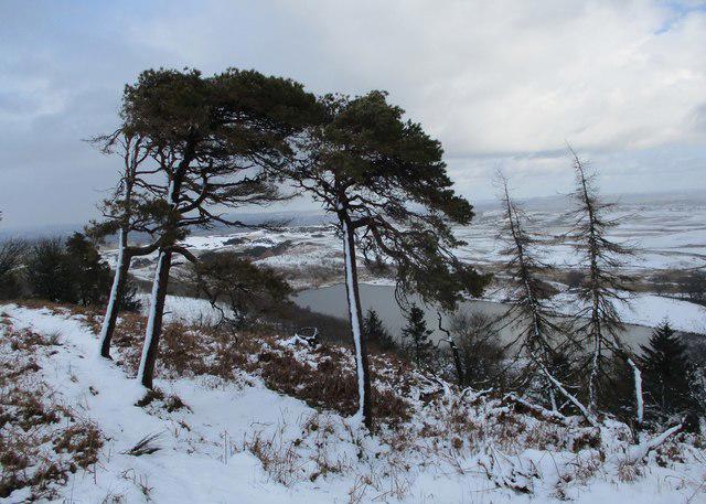 Photo could not load
NS4755 : Windswept trees on Neilston Pad
Alan O'Dowd
Hill facts and local notes
Classifications
Elevation
261m
856 ft
Prominence
50m
Coordinates
55.7653, -4.4296
NS476551
OS Map
64
Explorer: 333 342
At the Summit
The summit is adorned with a trig point, providing a handy perch for selfies and that all-important summit snack. Keep your eyes peeled for the occasional sheep; they make excellent spectators!
Terrain & Geology
Neilston Pad is primarily composed of volcanic rock that dates back to the Carboniferous period, providing a rugged landscape shaped by ancient geological processes. The views from the top can tell tales of geological upheaval!
Views & Scenery
Dazzling views of the Clyde Valley, Ben Lomond, and on a clear day, the Renfrewshire hills stretch beyond. It’s like a painting that keeps changing with the light!
History & Heritage
Name Origin
The name 'Neilston' is derived from the Old Norse ‘Njal’s farm’, creatively showing its Viking roots.
Historical Significance
The area historically served as farmland, and the hills have been a source of inspiration for many poets and writers over the years.
Getting There & Facilities
Parking
There is a car park in Neilston village itself, which provides easy access to the start of the trail.
Public Transport
Neilston is served by a train station on the Glasgow to Neilston line, along with local bus services.
Nearby Facilities
There are no facilities directly on the mountain, but Neilston boasts a few cafes and pubs where you can hydrate and carb-load after your adventure!
Safety Information
Known Hazards
- Muddiness in wet conditions, especially in winter; appropriate footwear is recommended!
General Safety Tips
- Check weather conditions before setting out
- Carry appropriate clothing and equipment
- Let someone know your planned route
- Take a map, compass, and GPS device
- Carry emergency supplies: food, water, first aid kit, torch
Hills
Some common questions about the hills answered
Are there group walks up Neilston Pad?
Many walkers use Walkmates to join or organise walks with others. You can check for group walks around Neilston Pad through the maps
Are there other walkers around Neilston Pad?
Activity varies by location and time, but Walkmates lets you see whether others have shared walks or shown interest in this area. Find other people through the walking friends search walking friends for Neilston Pad search or of course create your own walk for Neilston Pad
Can I organise a walk to Neilston Pad?
Yes. If there aren’t any walks listed already, you can create a walk and make it available for others to join.
If you're signed up to Walkmates, you can create a walk to Neilston Pad.
How do I find a walk up this hill?
There are often multiple ways to walk this hill, depending on experience and route preference. Walkmates helps you explore walks and routes that others have shared.
Can I suggest a new route up Neilston Pad?
Yes. You can suggest or create routes to share with others. Walkmates focuses on the social side of walking, so routes are used to help people organise walks and explore areas together, rather than as detailed navigation tools or route libraries.
Other uses really appreciate knowledgeable walkers sharing their routes. Share your favourite route to Neilston Pad here
The is an error or something incorrect about this hill. How do I let you know?
We always strive to keep the information on Walkmates as accurate as possible. If you find an error, please let us know through the contact form and we'll aim to correct it as quickly as possible
Community Discussion
Comments
Location
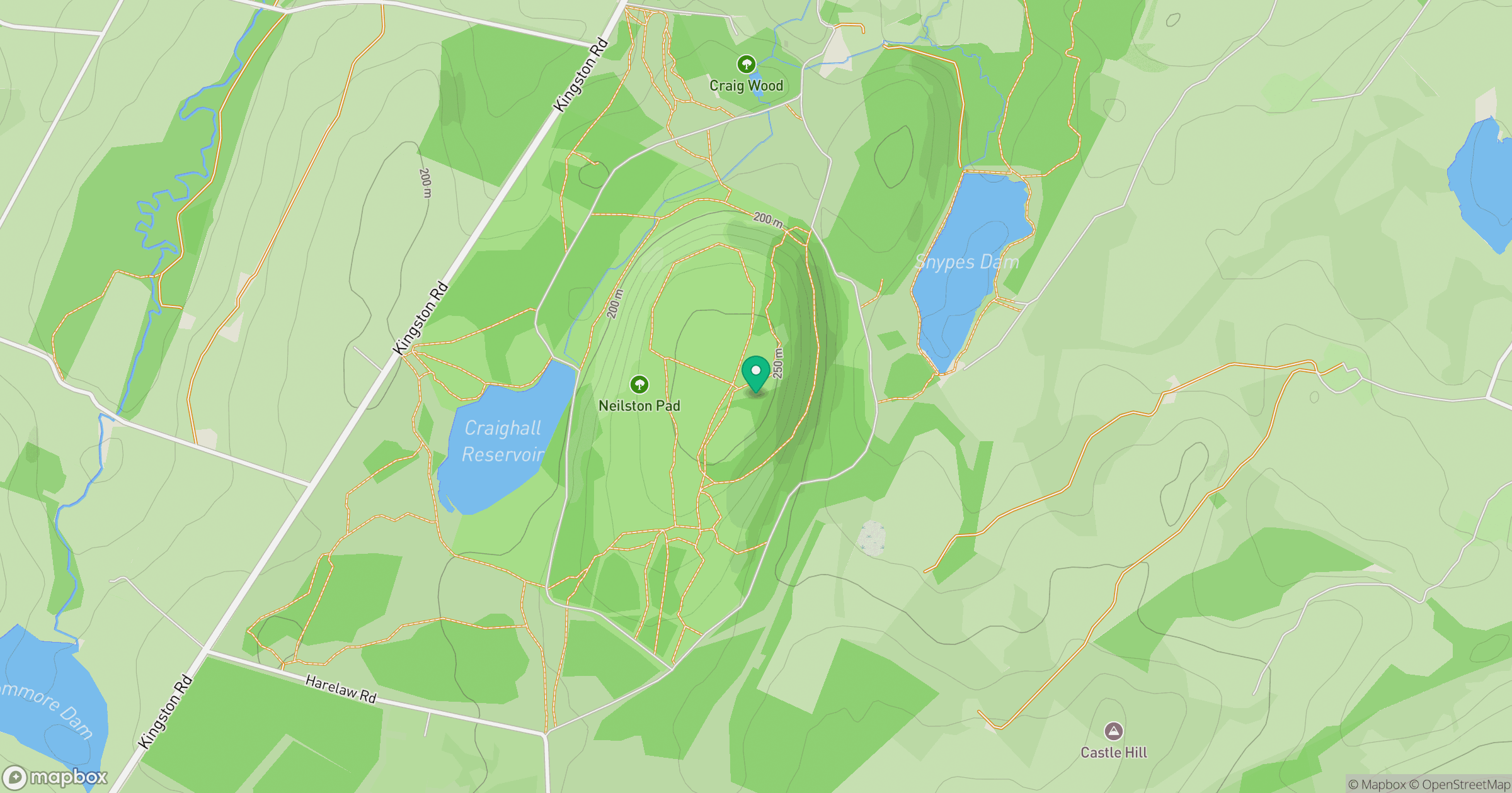
Grid reference: NS476551
View on OpenStreetMapOpens a map in a new tab, centred on the hill.
No comments yet. Be the first.