

Corlick Hill
Good walks are even better shared.
Overview
Corlick Hill: A Glimpse into the Highlands
Corlick Hill, reaching a height of 482 metres, stands proudly among the picturesque Scottish Highlands. Known as a Marilyn, it offers an inviting challenge for both seasoned hikers and those just testing the waters of outdoor adventures.
Geology
The geology of Corlick Hill is primarily dominated by schist, a layered metamorphic rock. This gives the hill its unique character, alongside evidence of ancient volcanic activity. As you hike, spare a thought for the many geological processes that formed this landscape over millions of years. Trust me, your friends won’t find your geology knowledge as dry as the rock!
Routes
The Corlick Hill Circular Route stretches approximately 5.5 km, with a moderate difficulty level. Expect to spend around 2.5 hours enjoying the diverse terrains, ranging from grassy knolls to rocky outcrops – just don’t forget to wear comfortable shoes and your best walking socks!
Summit Features
At the summit, you’ll discover a modest cairn, perfect for taking a breather and snapping a photo of yourself against the stunning backdrop of the Highlands. Just avoid posing like you’re lifting the hill – it may start a trend!
Terrain Type
The trek encompasses a mixture of grassy pathways and rocky sections, so it’s a good idea to watch your step, particularly after rainfall when the ground can get soggy. A little mud adds character, or so they say!
Views
From the peak, you'll be treated to breathtaking views of the Cairngorms and Loch Rannoch, perfect for snapping that 'I was here' photo. Aim to hike in spring or early autumn for the best views when the landscape is alive with colour.
Hazards
Watch out for sudden weather changes in the Highlands; they can sneak up on you faster than you can say 'gale force winds'. Slippery spots are common, especially after a rain shower, so tread carefully, folks!
Nearby Summits
The prominent Meall an t-Suidhe, standing at 471 metres, is just a stone's throw away, offering a chance for an extended adventure if you're up for it!
Access
There’s a small parking area at the foot of the hill along the A822 road that accommodates about 10 cars. Public transport is a bit dodgy; better to rely on a taxi from Aberfeldy. Speaking of Aberfeldy, it’s a charming town about 15 km away where you can enjoy local amenities!
Facilities
You can fuel up at a local café in Aberfeldy before your hike, serving hearty meals and refreshments, along with public toilets for convenience’s sake!
History
The etymology of 'Corlick' hints at its round hills in Gaelic, embracing a history that links it as a traditional hunting ground rich in folklore and legends. Imagine what the trees have witnessed; they might just be the wisest of us all!
With its scenic views, engaging routes, and historic significance, Corlick Hill is definitely worthy of a place on your hiking list. Just remember your sense of adventure and perhaps a snack or two!
Happy hiking!
Explore routes near Corlick Hill
Public walks starting within 80 km of this hill. Nearby does not mean a route reaches the summit; check its map and access before setting out.
Greenock Cut: the full circuit from Cornalees
View route
West Bay walk and talk
View route
West Bay walk and talk
View route
Bishop’s Glen group walk
View route
Route planning notes
These notes describe possible approaches, not verified navigable routes or permission to cross land. Check current paths, local access rules and conditions before setting out.
Corlick Hill Circular Route
A pleasant circular trail that provides a mix of ascent and descent, allowing hikers to take in various views along the way.
Make a day of it, together
Find someone to share the walk with, or organise a day out along a route you like.
Photo Gallery
View all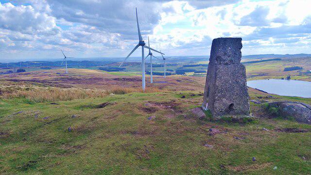 Photo could not load
NS2972 : The trig point on Corlick Hill
Gordon Brown
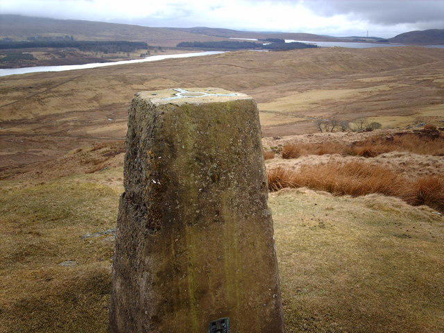 Photo could not load
NS2972 : Triangulation Pillar on Corlick Hill
Thomas Nugent
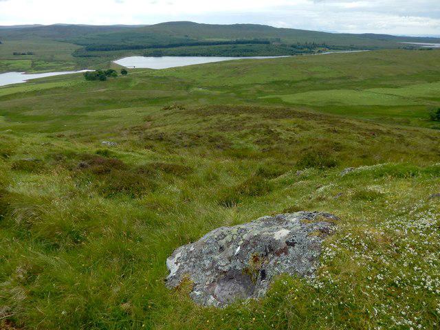 Photo could not load
NS2872 : Exposed rock near the summit of Corlic Hill
Lairich Rig
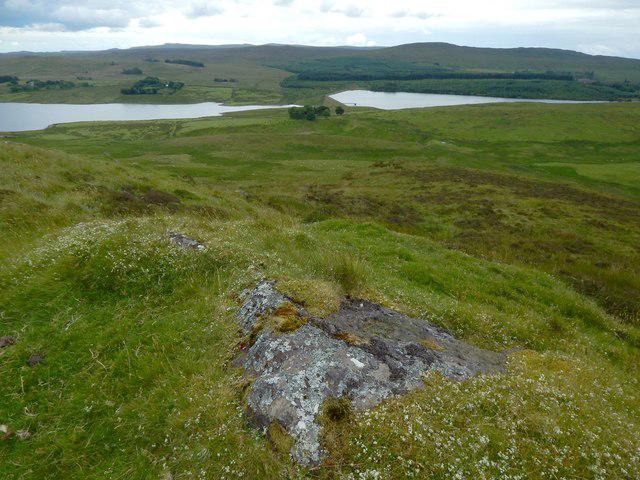 Photo could not load
NS2872 : Exposed rock near the summit of Corlic Hill
Lairich Rig
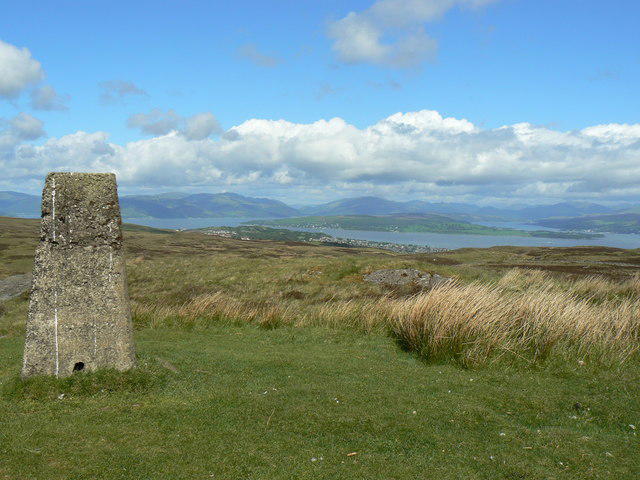 Photo could not load
NS2972 : Corlick Hill
william craig
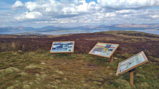 Photo could not load
NS2972 : Information boards near the summit of Corlick Hill
Gordon Brown
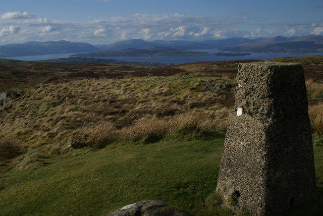 Photo could not load
NS2972 : View north from Corlic Hill
Andy Phanco
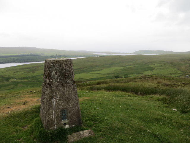 Photo could not load
NS2972 : Triangulation pillar on Corlick Hill 303m
John Ferguson
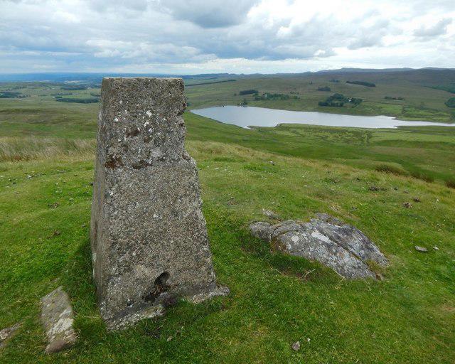 Photo could not load
NS2972 : Corlic Hill trig point
Lairich Rig
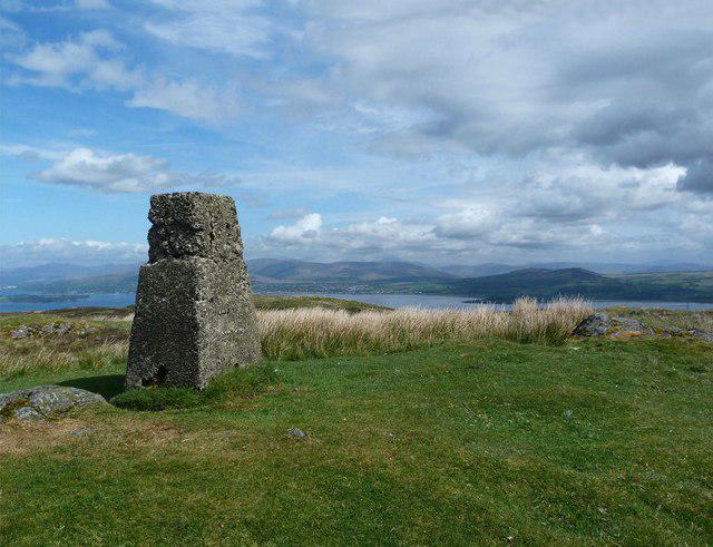
NS2972 : Corlick Hill (trig point)
Raibeart MacAoidh
Hill facts and local notes
Classifications
Elevation
303m
994 ft
Prominence
108m
Coordinates
55.9183, -4.7371
NS290728
OS Map
63
Explorer: 341N
At the Summit
The summit is marked by a modest cairn that offers a perfect spot for a well-deserved break and a selfie with the Highlands in the background.
Terrain & Geology
Corlick Hill is primarily composed of schist, a metamorphic rock known for its layered appearance. The area also showcases remnants of ancient volcanic activity, which adds a unique touch to the landscape.
Views & Scenery
On a clear day, you can see the impressive peaks of the nearby Cairngorms as well as Loch Rannoch sparkling in the distance.
History & Heritage
Name Origin
The name 'Corlick' likely derives from Gaelic origins, with interpretations suggesting links to 'round hill'.
Historical Significance
Corlick Hill holds historical significance as a traditional hunting ground, steeped in myths and folklore from the local area.
Getting There & Facilities
Check current local access restrictions, parking rules and transport timetables before travelling. These notes do not confirm public access to the summit.
Parking
There is a small parking area at the foot of the hill along the A822 road, with space for about 10 cars. Be mindful of local restrictions while parking.
Public Transport
The nearest bus stop is in the village of Killin, which is approximately 10 km away. From there, a taxi might be necessary to reach the trailhead.
Nearby Facilities
Nearby facilities include a lovely café in Aberfeldy offering hearty meals and public toilets, making it a convenient stop before or after your hike.
Safety Information
Known Hazards
- Be cautious of sudden weather changes in the Highlands; conditions can alter in the blink of an eye. Also, watch out for slippery patches, especially after rain.
General Safety Tips
- Check weather conditions before setting out
- Carry appropriate clothing and equipment
- Let someone know your planned route
- Take a map, compass, and GPS device
- Carry emergency supplies: food, water, first aid kit, torch
Hills
Some common questions about the hills answered
Are there group walks up Corlick Hill?
Many walkers use Walkmates to join or organise walks with others. You can check for group walks around Corlick Hill through the maps
Are there other walkers around Corlick Hill?
Activity varies by location and time, but Walkmates lets you see whether others have shared walks or shown interest in this area. Find other people through the walking friends search walking friends for Corlick Hill search or of course create your own walk for Corlick Hill
Can I organise a walk to Corlick Hill?
Yes. If there aren’t any walks listed already, you can create a walk and make it available for others to join.
If you're signed up to Walkmates, you can create a walk to Corlick Hill.
How do I find a walk up this hill?
There are often multiple ways to walk this hill, depending on experience and route preference. Walkmates helps you explore walks and routes that others have shared.
Can I suggest a new route up Corlick Hill?
Yes. You can suggest or create routes to share with others. Walkmates focuses on the social side of walking, so routes are used to help people organise walks and explore areas together, rather than as detailed navigation tools or route libraries.
Other uses really appreciate knowledgeable walkers sharing their routes. Share your favourite route to Corlick Hill here
The is an error or something incorrect about this hill. How do I let you know?
We always strive to keep the information on Walkmates as accurate as possible. If you find an error, please let us know through the contact form and we'll aim to correct it as quickly as possible
Community Discussion
Comments
Location
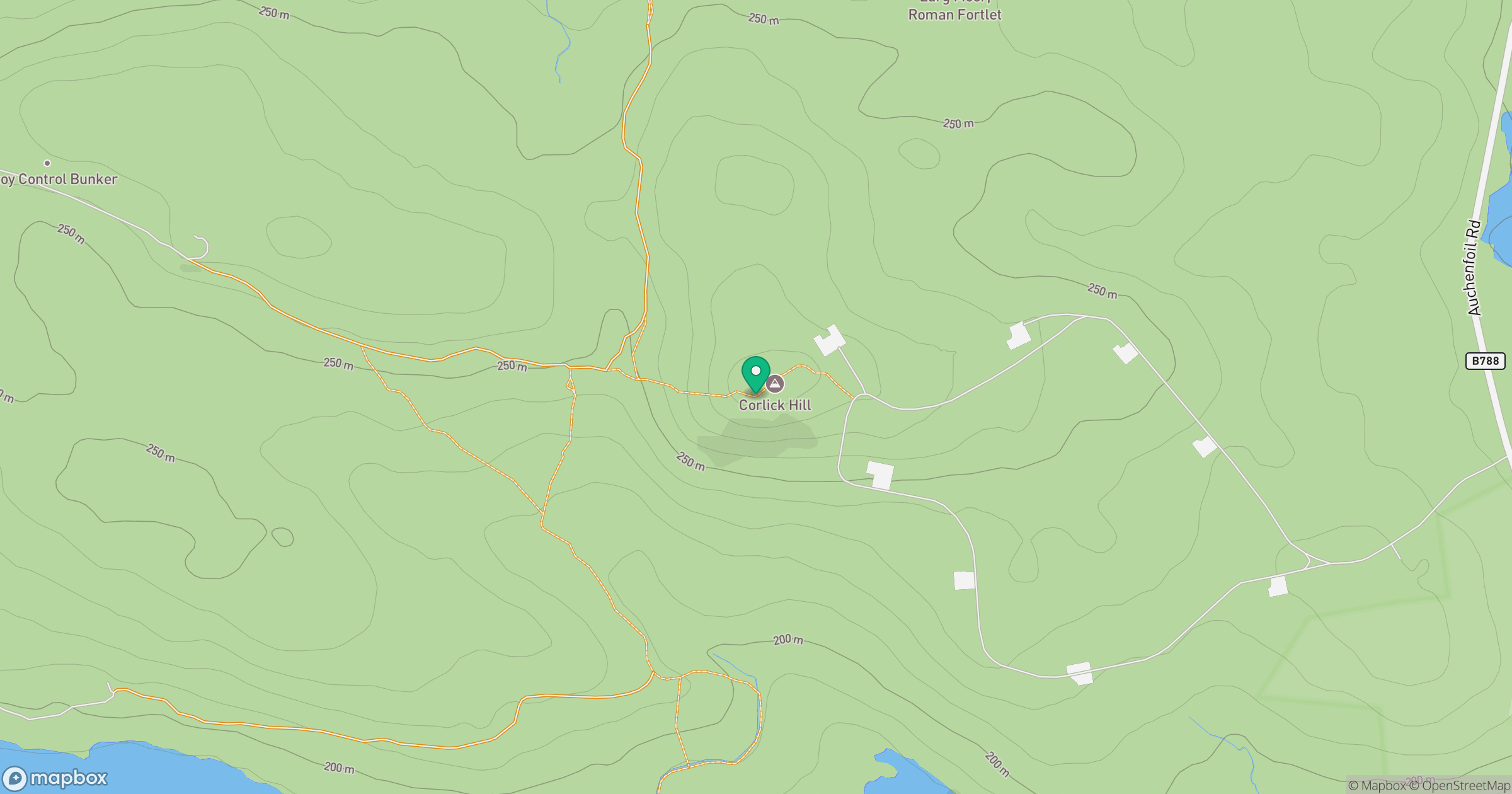
Grid reference: NS290728
View on OpenStreetMapOpens a map in a new tab, centred on the hill.
Hills within 30 km
Straight-line distance, not a walking route or confirmation of access.
No comments yet. Be the first.