

nameless (Bannisdale Horseshoe - Ancrow Brow N)
Good walks are even better shared.
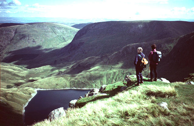
NY5005 : Ancient wall near Ancrow Brow
David Brown Photo source
Overview
Nameless (Bannisdale Horseshoe - Ancrow Brow N)
Overview
Nestled snugly within the scenic landscape of the Lake District, the Nameless peak offers a chance to escape the crowds and enjoy nature’s peaceful embrace. While it may not have the elegance or fame of its towering neighbours, this hill delivers rewarding views that are sure to make you smile.
Geology
Primarily comprised of Skiddaw slate, the geology here is diverse, boasting layers of sedimentary and volcanic rock. This interplay of geological formations creates an intricate and fascinating landscape, providing a glimpse into the Earth’s storied past. Just be careful not to trip over a rock while marveling at it!
Routes
The Bannisdale Horseshoe Circuit is the main route, providing a splendid circular walk that not only includes the Nameless peak but also takes walkers past its more illustrious companions like Harter Fell. At approximately 14.5 km, it’s a moderate trek that generally takes about 5.5 hours, depending on how many photos you take of the stunning views.
Summit Features
Upon reaching the upper slopes, don't expect banners or flares—the summit features simply a gentle grassy rise with no formal marker. But therein lies its charm! The summit allows for a chance to truly enjoy nature without the frills.
Terrain Type
The characteristics of the terrain change as you ascend. Generally, expect grassy slopes adorned with rocky patches and even the occasional bog—perfect for adding some ‘character’ to your hiking experience.
Views
From the top, the panoramic vistas extend over the glorious Kentmere and Longsleddale valleys. On a clear day, you can spot Harter Fell standing proudly to the south, flanked by the stunning fells of the southern Lake District. For the best views, aim for late spring through early autumn when the scenery is at its finest.
Hazards
Adventurers should stay vigilant for slippery rocks, particularly after a good rain, as well as quickly changing weather conditions that can creep up on you faster than a sheep on a mission.
Nearby Summits
- Harter Fell (778 meters)
- Kentmere Pike (730 meters)
Access
Parking: You can park at the Kentmere Village car park, which is about 3 km from where your adventure begins.
Public Transport: Pro tip: Buses barrel towards Staveley, where you can catch a connector to Kentmere, but be sure to check the schedule as they might run less frequently than a tortoise under pressure!
Nearest Town: The delightful village of Staveley is your closest point of civilisation, offering a few basic amenities.
Facilities
The quaint village of Kentmere offers a few essentials: a small café to grab a bite and public toilets if nature calls after all that fresh air and exercise.
History
The rather uninspired name reflects the insignificance of historical significance, but what it lacks in lore, it surely makes up for in tranquillity. The Nameless peak and its surrounding areas provide a contemplative experience, away from the bustling trails.
In conclusion, Nameless (Bannisdale Horseshoe - Ancrow Brow N) may not have the glitz of the major peaks, but its serene landscapes and stunning views make it an underrated gem worth discovering. So, lace up your hiking boots, pack a picnic, and go explore—who knows, you might just come back with a few tales of your own to share!
Explore routes near nameless (Bannisdale Horseshoe - Ancrow Brow N)
Walks starting near this hill. Open a route to check its map, distance and full itinerary.
Windermere west shore: Ash Landing to Wray and back
View route
Striding Edge, Helvellyn and Catstye Cam
View route
Helvellyn via Striding Edge
View route
Sizergh: Park End Moss and Brigsteer Park Wood Circuit
View route
Route planning notes
These notes describe possible approaches. Check a route's map and access information when planning your walk.
Bannisdale Horseshoe Circuit
A popular circular route that takes in several peaks in the Bannisdale horseshoe including the Nameless peak.
Make a day of it, together
Find someone to share the walk with, or organise a day out along a route you like.
Photo Gallery
View all Photo could not load
NY5005 : Ancient wall near Ancrow Brow
David Brown
 Photo could not load
NY5005 : Remains of fence above Bannisdale Head
Philip Halling
 Photo could not load
NY5005 : Ancrow Brow, North Top
Michael Graham
Hill facts and local notes
Classifications
Elevation
541m
1,775 ft
Prominence
16m
Coordinates
54.4462, -2.7680
NY502059
OS Map
90
Explorer: OL7N
At the Summit
The summit sports a small, unassuming grassy knoll with no formal marker, but the surrounding vistas compensate for its lack of bling.
Terrain & Geology
Primarily composed of Skiddaw slate, this area features a mix of sedimentary and volcanic rocks, leading to fascinating strata and an intricate landscape.
Views & Scenery
Panoramic views of both the Kentmere and Longsleddale valleys, with peaks like Harter Fell and the distant fells of the southern Lake District in sight.
History & Heritage
Name Origin
The mountain's designation as 'Nameless' reflects the lack of historical significance or traditional naming.
Historical Significance
While not steeped in legend, it offers a serene walking experience in the lesser-trodden parts of the Lake District, making it a hidden gem.
Getting There & Facilities
Parking
Parking is available at the Kentmere Village car park, approximately 3 km from the route's starting point.
Public Transport
Buses run to Staveley, with connections to Kentmere, although service frequency can be limited, so check on schedule.
Nearby Facilities
Basic amenities available in Kentmere, including a small café and public toilets.
Safety Information
Known Hazards
- Watch out for slippery rocks, particularly after rainfall, and be mindful of changing weather conditions which can be unpredictable.
General Safety Tips
- Check weather conditions before setting out
- Carry appropriate clothing and equipment
- Let someone know your planned route
- Take a map, compass, and GPS device
- Carry emergency supplies: food, water, first aid kit, torch
Hills
Some common questions about the hills answered
Are there group walks up nameless (Bannisdale Horseshoe - Ancrow Brow N)?
Many walkers use Walkmates to join or organise walks with others. You can check for group walks around nameless (Bannisdale Horseshoe - Ancrow Brow N) through the maps
Are there other walkers around nameless (Bannisdale Horseshoe - Ancrow Brow N)?
Activity varies by location and time, but Walkmates lets you see whether others have shared walks or shown interest in this area. Find other people through the walking friends search walking friends for nameless (Bannisdale Horseshoe - Ancrow Brow N) search or of course create your own walk for nameless (Bannisdale Horseshoe - Ancrow Brow N)
Can I organise a walk to nameless (Bannisdale Horseshoe - Ancrow Brow N)?
Yes. If there aren’t any walks listed already, you can create a walk and make it available for others to join.
If you're signed up to Walkmates, you can create a walk to nameless (Bannisdale Horseshoe - Ancrow Brow N).
How do I find a walk up this hill?
There are often multiple ways to walk this hill, depending on experience and route preference. Walkmates helps you explore walks and routes that others have shared.
Can I suggest a new route up nameless (Bannisdale Horseshoe - Ancrow Brow N)?
Yes. You can suggest or create routes to share with others. Walkmates focuses on the social side of walking, so routes are used to help people organise walks and explore areas together, rather than as detailed navigation tools or route libraries.
Other uses really appreciate knowledgeable walkers sharing their routes. Share your favourite route to nameless (Bannisdale Horseshoe - Ancrow Brow N) here
The is an error or something incorrect about this hill. How do I let you know?
We always strive to keep the information on Walkmates as accurate as possible. If you find an error, please let us know through the contact form and we'll aim to correct it as quickly as possible
Community Discussion
Comments
Location
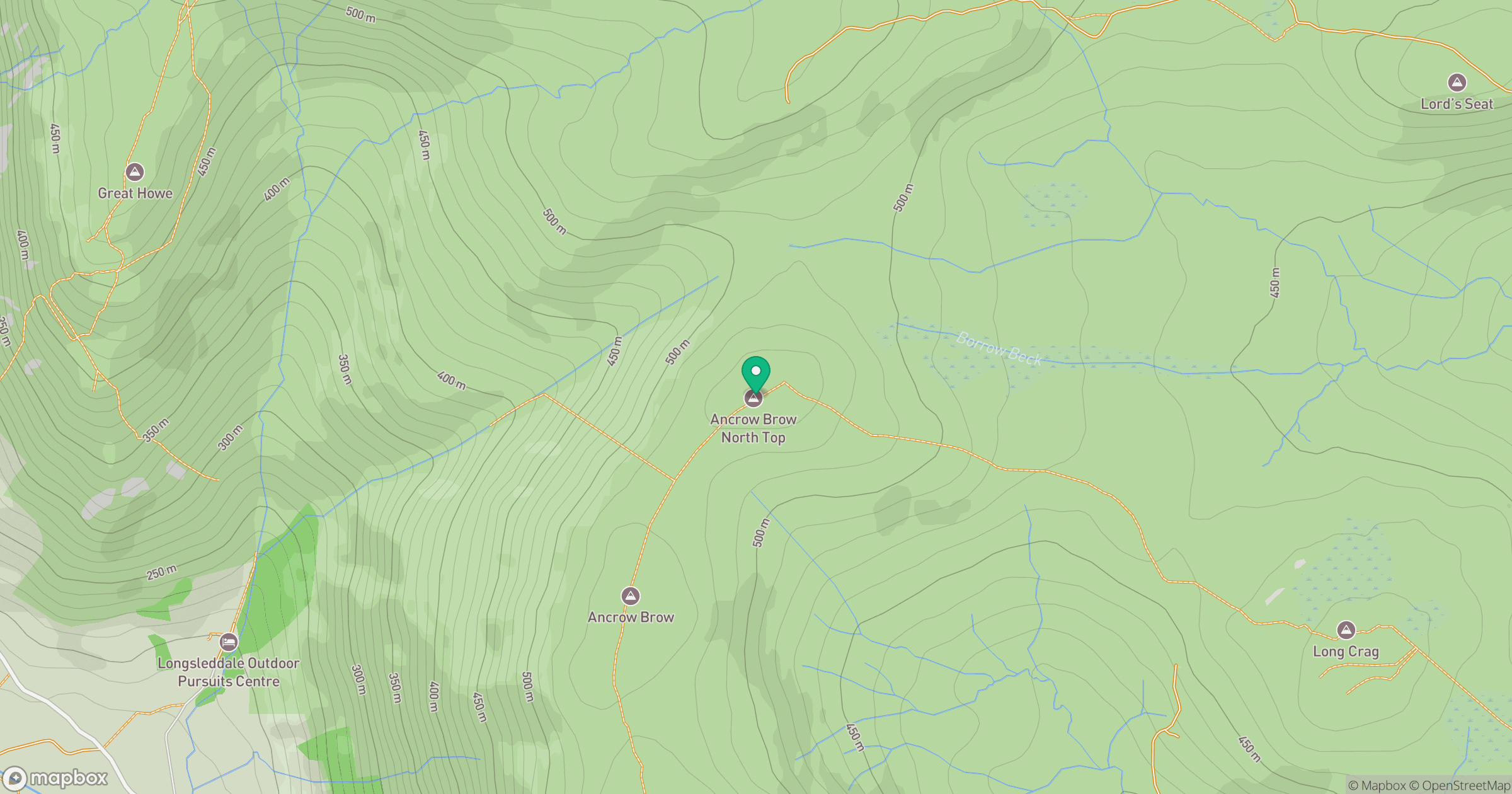
Grid reference: NY502059
View on OpenStreetMapOpens a map in a new tab, centred on the hill.
No comments yet. Be the first.