
Mynydd Garth-Gwynion
Good walks are even better shared.
Overview
Mynydd Garth-Gwynion
Introduction
Mynydd Garth-Gwynion, a hidden gem of the Brecon Beacons, stands at a respectable 524 meters. It might not be the tallest in the area, but it’s definitely a contender for the most charming!
Geology
The mountain is a collage of sedimentary rocks, primarily sandstone and mudstone. These rocks tell a story, a geological narrative spanning millions of years. The layers often lead to fascinating rock formations that are a joy for amateur geologists and curious hikers alike.
Routes
The Garth-Gwynion Trail is a popular choice among visitors. Starting from the picturesque village of Trefriw, this 6.5 km route can be tackled comfortably in about 2.5 hours. Despite some moderate slopes, it's quite manageable for most hikers. Remember, every step is a step closer to the summit!
Summit Features
At the top, you'll be greeted by a quirky cairn and a trig point that screams ‘I’ve conquered this hill!’ So don’t forget to take a heroic selfie!
Terrain Type
The paths are mainly grassy, albeit with some rocky sections to keep you on your toes. Perfect for those looking for a bit of adventure!
Views
On a fine day, the views are simply spectacular. From the summit, Pen y Fan steals the show with its grandeur, while the River Usk glimmers enticingly in the distance. The best times to admire these landscapes are in late spring or early autumn, when nature is at its most vibrant.
Hazards
Don't let the weather catch you off guard; pack layers! Conditions can shift from sunny days to torrential downpours in the blink of an eye. Many trails can become slippery with rain, so sturdy footwear is essential.
Nearby Summits
Nearby, you’ll find notable heightened companions such as Pen y Fan (886 meters) and Corn Du (873 meters). They all make for great additions to a day's adventure!
Access
Reachable from the Trefriw village car park, this mountain is accessible, and with public transport links from Brecon, you can leave your car behind. The quaint village of Trefriw adds to the overall experience with its local charm.
Facilities
After an exhilarating trek, head back to Trefriw to enjoy lovely café offerings which will include well-deserved cakes and brews. Clean public toilets are also just a stone’s throw away!
History
The name itself beckons stories from the past! Garth-Gwynion evokes images of ancient cultures and folklore, giving the mountain an added aura. It's not just a hike, it’s a journey through history.
Conclusion
In summary, Mynydd Garth-Gwynion is an enchanting mountain that promises a satisfying day out for hikers and nature lovers alike. So lace up those boots, grab your walking stick, and let the adventure begin!
Happy hiking!
Explore routes near Mynydd Garth-Gwynion
Public walks starting within 80 km of this hill. Nearby does not mean a route reaches the summit; check its map and access before setting out.
Hafren Forest: full Source of the Severn Trail
View route
Cadair Idris - Pony Path
View route
Mawddach Trail: Dolgellau to Barmouth
View route
Mawddach Trail: Penmaenpool to Dolgellau Riverside Return
View route
Route planning notes
These notes describe possible approaches, not verified navigable routes or permission to cross land. Check current paths, local access rules and conditions before setting out.
Garth-Gwynion Trail
A scenic route beginning from the nearby village of Trefriw, offering gentle slopes and stunning views of the surrounding valleys.
Make a day of it, together
Find someone to share the walk with, or organise a day out along a route you like.
Hill facts and local notes
Classifications
Elevation
228m
748 ft
Prominence
133m
Coordinates
52.5705, -3.8709
SN732986
OS Map
135
Explorer: OL23W
At the Summit
At the summit, you'll find a prominent cairn and a very photogenic trig point. Ensure you snap a selfie; it’ll be the pinnacle of your hiking career!
Terrain & Geology
The mountain is primarily composed of sedimentary rock, with layers of sandstone and mudstone that evoke the region's distant geological past. It’s a testament to the forces of nature, as well as a great spot for rock enthusiasts.
Views & Scenery
On a clear day, bask in stunning views of the Central Beacons, with Pen y Fan towering majestically in the distance. Look south and you might even spot the glimmer of the River Usk.
History & Heritage
Name Origin
The name ‘Garth-Gwynion’ is derived from Welsh, with ‘Garth’ meaning ‘hill’ and ‘Gwynion’ signifying ‘white features’, likely referring to the mist often seen around its peak.
Historical Significance
This mountain has long been a feature in local folklore, with tales of ancient people who once roamed its slopes; it carries a certain magical quality.
Getting There & Facilities
Check current local access restrictions, parking rules and transport timetables before travelling. These notes do not confirm public access to the summit.
Parking
There is ample parking available at the Trefriw village car park, just a short walk away from the trailhead.
Public Transport
Regular bus services operate from nearby towns such as Brecon and Merthyr Tydfil to Trefriw.
Nearby Facilities
Facilities in Trefriw include a charming café where you can enjoy a hot drink and cake after your hike, and public toilets are available by the village hall.
Safety Information
Known Hazards
- Weather can change rapidly, so be prepared for everything from bright sunshine to sudden rain showers. Slippery paths are common, especially after rain, so solid footwear is a must.
General Safety Tips
- Check weather conditions before setting out
- Carry appropriate clothing and equipment
- Let someone know your planned route
- Take a map, compass, and GPS device
- Carry emergency supplies: food, water, first aid kit, torch
Hills
Some common questions about the hills answered
Are there group walks up Mynydd Garth-Gwynion?
Many walkers use Walkmates to join or organise walks with others. You can check for group walks around Mynydd Garth-Gwynion through the maps
Are there other walkers around Mynydd Garth-Gwynion?
Activity varies by location and time, but Walkmates lets you see whether others have shared walks or shown interest in this area. Find other people through the walking friends search walking friends for Mynydd Garth-Gwynion search or of course create your own walk for Mynydd Garth-Gwynion
Can I organise a walk to Mynydd Garth-Gwynion?
Yes. If there aren’t any walks listed already, you can create a walk and make it available for others to join.
If you're signed up to Walkmates, you can create a walk to Mynydd Garth-Gwynion.
How do I find a walk up this hill?
There are often multiple ways to walk this hill, depending on experience and route preference. Walkmates helps you explore walks and routes that others have shared.
Can I suggest a new route up Mynydd Garth-Gwynion?
Yes. You can suggest or create routes to share with others. Walkmates focuses on the social side of walking, so routes are used to help people organise walks and explore areas together, rather than as detailed navigation tools or route libraries.
Other uses really appreciate knowledgeable walkers sharing their routes. Share your favourite route to Mynydd Garth-Gwynion here
The is an error or something incorrect about this hill. How do I let you know?
We always strive to keep the information on Walkmates as accurate as possible. If you find an error, please let us know through the contact form and we'll aim to correct it as quickly as possible
Community Discussion
Comments
Location
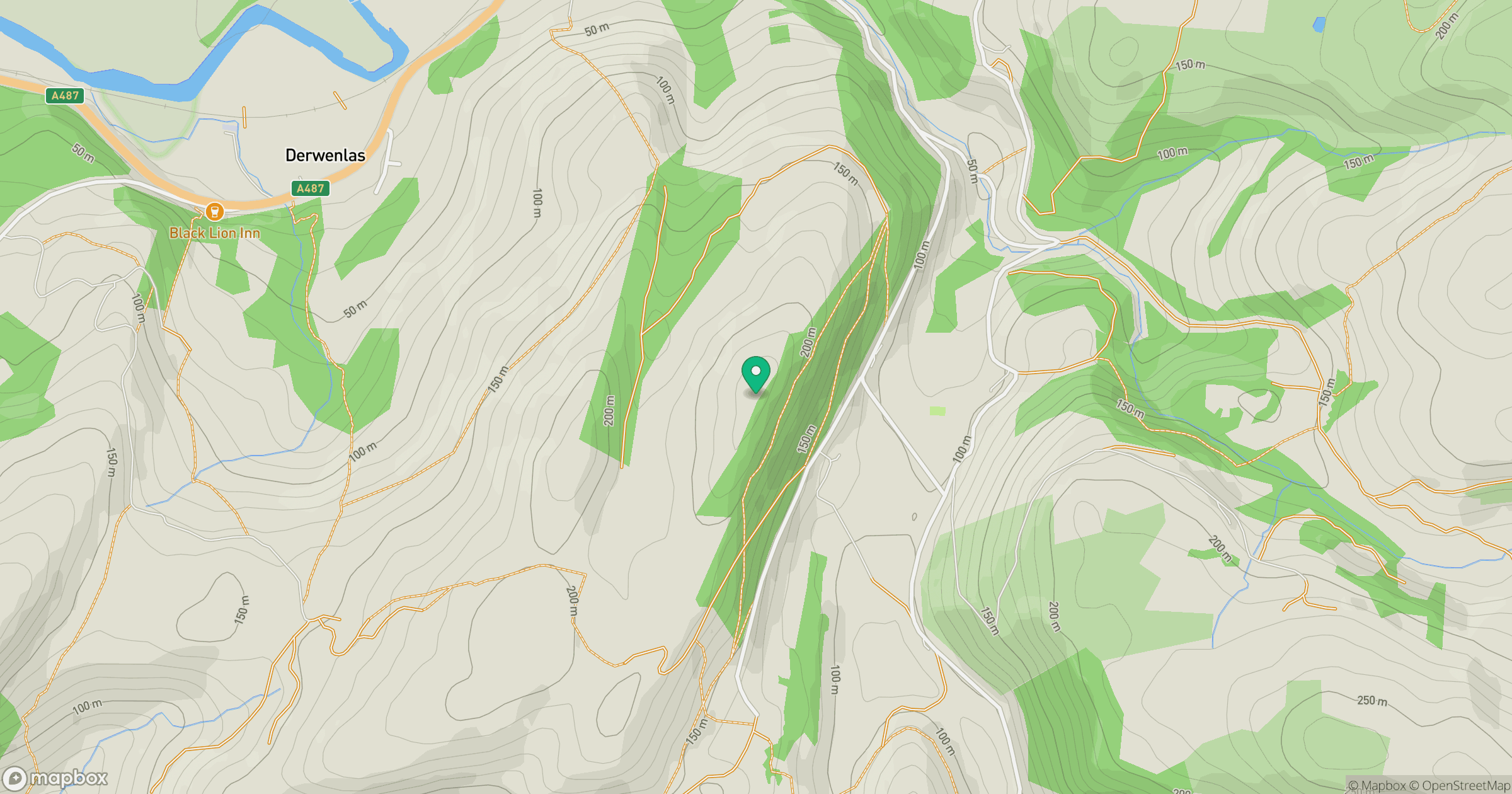
Grid reference: SN732986
View on OpenStreetMapOpens a map in a new tab, centred on the hill.
Hills within 30 km
Straight-line distance, not a walking route or confirmation of access.
Cadair Idris - Penygadair
893m
Pumlumon Fawr [Plynlimon]
753m
Y Garn
629m
Aran Fawddwy
906m
Pen y Darren [Moel Hyddgen]
529m
No comments yet. Be the first.