

Moel y Llyn
Good walks are even better shared.
Overview
Moel y Llyn: An Introduction
Perched in the heart of Snowdonia National Park, Moel y Llyn stands as a splendid destination for hikers of all levels. With an elevation of 615 meters, this Marilyn might not be the tallest of giants, but its beauty and accessibility make it a favourite among outdoor enthusiasts.
Geology
The allure of Moel y Llyn lies not only in its stunning views but also in its rocky composition. The hill is primarily formed from volcanic rocks, including rhyolite and tuff, which create a rugged but picturesque landscape. The varied geology adds character, offering photographers plenty of striking shots to snap.
Routes to the Summit
A visit to Moel y Llyn wouldn't be complete without exploring its well-trodden paths.
- Moel y Llyn from Waunfawr: This easy route is perfect for families and beginners. At 6.5 km, the gentle ascent makes it a delightful stroll through the stunning surroundings. It won't take long before you reach the summit and boast about your achievement.
- Watkin Path: For those seeking a little more excitement, this moderately challenging route extends 7.2 km and involves some rocky terrain. It presents the perfect opportunity to test your fitness while enjoying spectacular views.
Summit Features
Standing proudly at the summit is a modest stone cairn, serving as a reliable guide in the event of misty weather. Here lies a breathtaking view stretching across valleys and peaks, allowing you to revel in your conquest.
Terrain
Expect mixed terrain on your journey: a delightful blend of rocky paths and grassy slopes, with the occasional boggy sections catching you off guard. Consider bringing wellies if you plan on exploring after rain!
Views
The panoramic vistas from the peak include iconic sights like Snowdon, the Glyderau range, and on clear days, the faraway shimmer of the Irish Sea. The view is particularly enchanting during autumn when the foliage is at its most colourful.
Hazards
Although Moel y Llyn is generally considered safe for hikers, one must remain vigilant. Sudden weather changes can occur, turning the landscape into a soggy mess. Keep an eye out for slippery rocks in wet conditions and avoid carelessly charging through marshy patches.
Nearby Summits
If you’re feeling energetic, why not extend your adventure? Nearby, Moel Hebog and the majestic Snowdon await your exploration, each offering unique features and challenges.
Access
The nearest parking is conveniently located at Waunfawr, which can get busy on weekends. Public transport options include local bus services heading to Waunfawr from Caernarfon, making access straightforward.
Conclusion
In essence, Moel y Llyn may not boast the heights of its taller neighbours, but it undoubtedly has charm aplenty. With trails suitable for all, stunning views, and rich history, it embodies the spirit of adventure. So lace up those boots, pack your snacks, and prepare for an unforgettable day out. Happy hiking!
Explore routes near Moel y Llyn
Public walks starting within 80 km of this hill. Nearby does not mean a route reaches the summit; check its map and access before setting out.
Hafren Forest: full Source of the Severn Trail
View route
Ystwyth Trail: Black Covert to Llanilar and back
View route
Cadair Idris - Pony Path
View route
Mawddach Trail: Dolgellau to Barmouth
View route
Route planning notes
These notes describe possible approaches, not verified navigable routes or permission to cross land. Check current paths, local access rules and conditions before setting out.
Moel y Llyn from Waunfawr
A straightforward route that skirts the base of the hill before making a gentle ascent to the summit. Ideal for beginners and families.
Watkin Path
An alternative approach that combines stunning views with a bit of challenge as you navigate some rocky terrain. Recommended for those looking for a bit more adventure.
Make a day of it, together
Find someone to share the walk with, or organise a day out along a route you like.
Photo Gallery
View all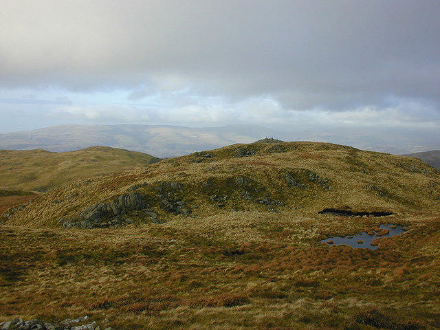 Photo could not load
SN7191 : The northern cairn on Moel y Llyn
Nigel Brown
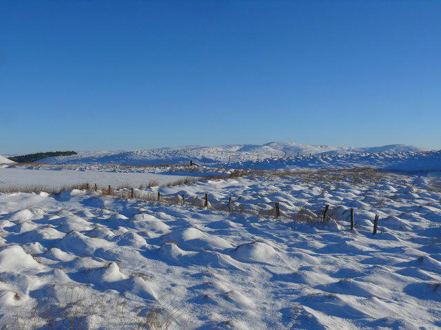 Photo could not load
SN7191 : Llyn Moel y Llyn
Ian Medcalf
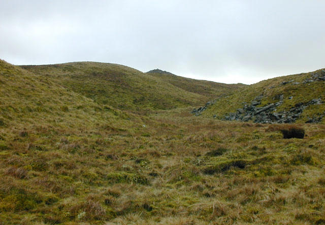 Photo could not load
SN7191 : Summit of Moel Y Llyn
Nigel Brown
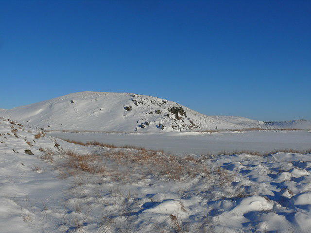 Photo could not load
SN7191 : Moel y Llyn
Ian Medcalf
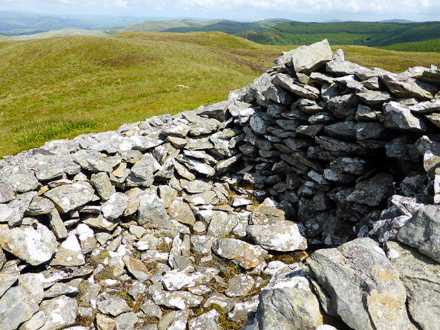 Photo could not load
SN7191 : Summit shelter on Moel y Llyn
John Lucas
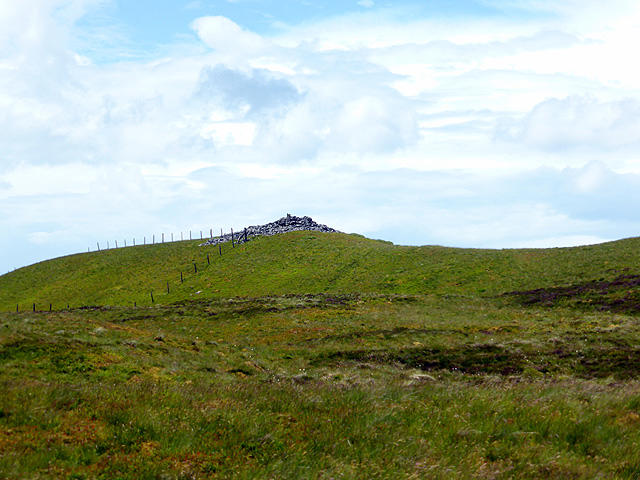 Photo could not load
SN7191 : Moel y Llyn
John Lucas
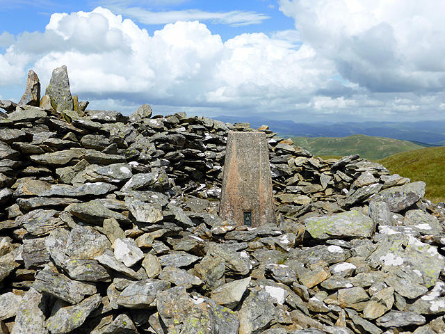 Photo could not load
SN7191 : The Moel y Llyn trig pillar constructed within the summit cairn
John Lucas
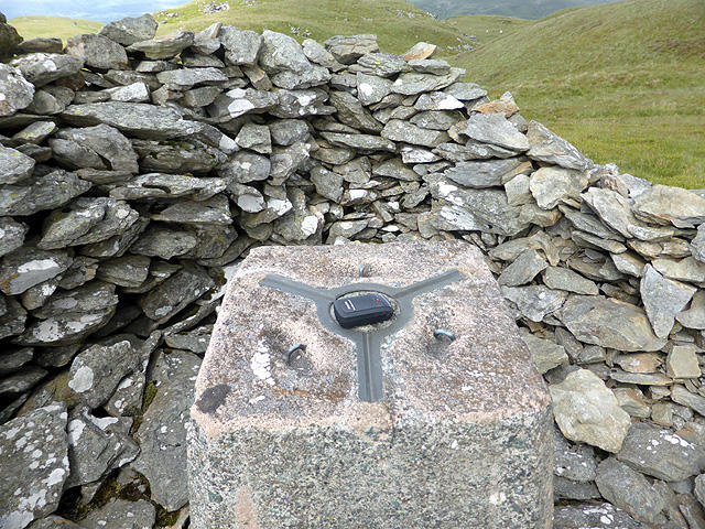 Photo could not load
SN7191 : Moel y Llyn trig point
John Lucas
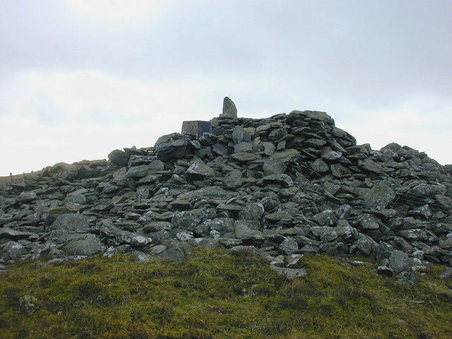 Photo could not load
SN7191 : Summit cairn of Moel y Llyn
Nigel Brown
Hill facts and local notes
Classifications
Elevation
521m
1,709 ft
Prominence
105m
Coordinates
52.5079, -3.8982
SN712916
OS Map
135
Explorer: OL23W
At the Summit
The summit is crowned with a small stone cairn, a trusty marker in the fog, and overlooks a stunning vista of the surrounding valleys and peaks.
Terrain & Geology
Moel y Llyn is primarily composed of volcanic rock, with notable outcrops of rhyolite and tuff, giving the mountain a rugged appearance that can be both beautiful and treacherous, depending on the weather.
Views & Scenery
From the summit, you can see Snowdon, the Glyderau range, and expansive views of the Dyfi Valley. On clear days, the Irish Sea can be spotted far in the distance.
History & Heritage
Name Origin
Moel y Llyn translates to 'Hill of the Lake', a nod to its proximity to the nearby lakes that dot the landscape.
Historical Significance
The area holds historical importance, with evidence of ancient settlements in the surroundings, and the landscape steeped in local folklore.
Getting There & Facilities
Check current local access restrictions, parking rules and transport timetables before travelling. These notes do not confirm public access to the summit.
Parking
There is a small car park at Waunfawr, which provides a convenient starting point for hikers. It can fill up quickly, especially on weekends, so arrive early.
Public Transport
Buses run from Caernarfon to Waunfawr, with connections from Bangor and other towns. Check local schedules for current routes.
Nearby Facilities
Facilities in Caernarfon include cafes, restaurants, and public toilets. Be sure to stock up on snacks before heading up the hill!
Safety Information
Known Hazards
- Watch out for sudden weather changes, unstable footing on rocky sections, and the possibility of encountering boggy patches when the ground is wet.
General Safety Tips
- Check weather conditions before setting out
- Carry appropriate clothing and equipment
- Let someone know your planned route
- Take a map, compass, and GPS device
- Carry emergency supplies: food, water, first aid kit, torch
Hills
Some common questions about the hills answered
Are there group walks up Moel y Llyn?
Many walkers use Walkmates to join or organise walks with others. You can check for group walks around Moel y Llyn through the maps
Are there other walkers around Moel y Llyn?
Activity varies by location and time, but Walkmates lets you see whether others have shared walks or shown interest in this area. Find other people through the walking friends search walking friends for Moel y Llyn search or of course create your own walk for Moel y Llyn
Can I organise a walk to Moel y Llyn?
Yes. If there aren’t any walks listed already, you can create a walk and make it available for others to join.
If you're signed up to Walkmates, you can create a walk to Moel y Llyn.
How do I find a walk up this hill?
There are often multiple ways to walk this hill, depending on experience and route preference. Walkmates helps you explore walks and routes that others have shared.
Can I suggest a new route up Moel y Llyn?
Yes. You can suggest or create routes to share with others. Walkmates focuses on the social side of walking, so routes are used to help people organise walks and explore areas together, rather than as detailed navigation tools or route libraries.
Other uses really appreciate knowledgeable walkers sharing their routes. Share your favourite route to Moel y Llyn here
The is an error or something incorrect about this hill. How do I let you know?
We always strive to keep the information on Walkmates as accurate as possible. If you find an error, please let us know through the contact form and we'll aim to correct it as quickly as possible
Community Discussion
Comments
Location
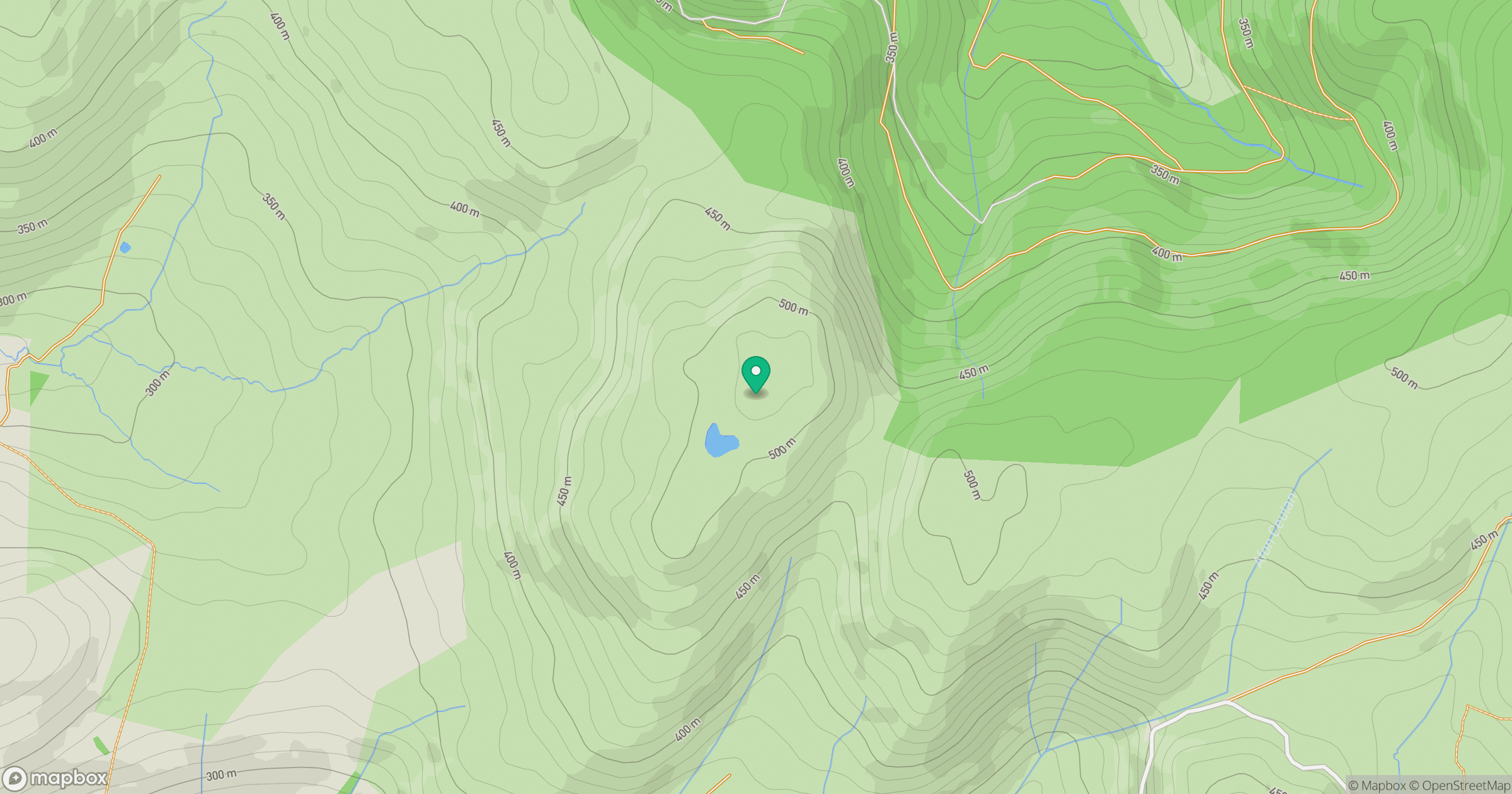
Grid reference: SN712916
View on OpenStreetMapOpens a map in a new tab, centred on the hill.
Hills within 30 km
Straight-line distance, not a walking route or confirmation of access.
Pumlumon Fawr [Plynlimon]
753m
Cadair Idris - Penygadair
893m
Banc y Garn
437m
Mynydd Garth-Gwynion
228m
Disgwylfa Fawr
507m
No comments yet. Be the first.