

Muncaster Fell - Hooker Crag
Good walks are even better shared.
SD1198 : Hooker Moss
Callum Black Photo source
Overview
Muncaster Fell - Hooker Crag
Nestled within the stunning Lake District, Muncaster Fell, particularly its proud pinnacle Hooker Crag, offers both charm and challenge to hikers and outdoor enthusiasts alike. At an elevation of 610 meters, it may not be the tallest in the region, but dont let that fool you; the views and rugged beauty more than make up for it!
Geology
The underlying geology is intriguing for those with a penchant for rocks. Composed mainly of sandstone, it whispers stories of ancient oceans that once blanketed this landscape. The weathered surfaces and interesting outcrops make it a playground for geology lovers who can amuse themselves identifying different formations while trying not to trip over loose stones.
Routes
The most popular route is the Muncaster Fell Circular, which spans about 8 km and typically takes around 3.5 hours. It is classified as moderate, perfect for families and casual walkers. For those wanting a bit more bite, the Hooker Crag Ascent is a challenging 2.5 km that will get your heart racing in just 1.5 hours.
Summit Features
The summit, marked by a humble stone cairn, boasts rocky outcrops that provide fantastic photo opportunities. Standing atop Hooker Crag not only feels exhilarating but offers plenty of moments to ‘take it all in’ while perhaps pretending to be atop the world!
Terrain and Views
The terrain ranges from rugged and rocky to grassy patches, perfect for those who enjoy a bit of variety underfoot. When you reach the summit, you will be greeted by panoramic views of the Irish Sea to the west and the majestic Scafell range to the north. Late spring and early autumn are ideal times to visit, presenting clear skies and a vibrant display of wildflowers and heather.
Hazards
Vigilance is key; the rocky terrain can be loose, and the weather changes quicker than a British summer’s day! Remember to bring proper footwear and check the conditions before you go.
Access
Nearby facilities, including toilets and a lovely café, can be found at Muncaster Castle, making it convenient to fuel up before or after your hike. Bus transportation from Ravenglass makes it accessible for those who prefer to leave the car behind.
History
Interestingly, the name Muncaster originates from Old Norse, hinting at a monastic past that makes this area even more enchanting. Coupled with its significance for local climbers, Hooker Crag is indeed a diamond in the rough.
Whether you’re an experienced mountaineer or simply in search of a lovely day out amidst nature, Muncaster Fell - Hooker Crag offers unique rewards for all who venture its trails. Remember, nature isn’t a place to visit; it’s home!
Bring your sense of adventure and a good sense of humour, and you’re bound to have a grand time!
Explore routes near Muncaster Fell - Hooker Crag
Walks starting near this hill. Open a route to check its map, distance and full itinerary.
Scafell Pike via Brown Tongue and Hollow Stones
View route
Great Carrs Halifax Wreckage from Wrynose Pass
View route
Steeple, Scoat Fell and Haycock from Ennerdale
View route
Scafell Pike from Seathwaite via the Corridor Route
View route
Route planning notes
These notes describe possible approaches. Check a route's map and access information when planning your walk.
Muncaster Fell Circular
A scenic circular route starting from the village of Muncaster, offering a mix of paths and gentle inclines with stunning views.
Hooker Crag Ascent
A direct ascent from the nearby parking area leading directly up to Hooker Crag, suitable for those seeking a quick challenge.
Make a day of it, together
Find someone to share the walk with, or organise a day out along a route you like.
Photo Gallery
View all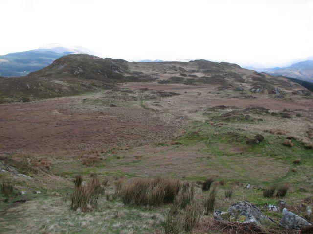 Photo could not load
SD1198 : Hooker Moss
Callum Black
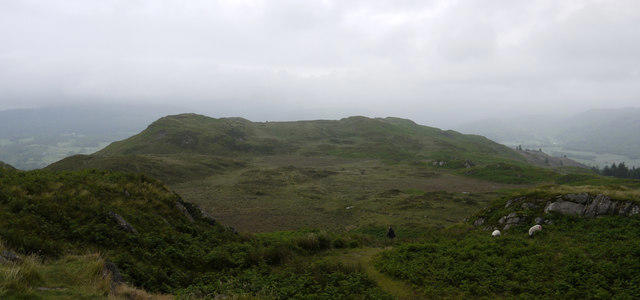 Photo could not load
SD1198 : Muncaster Fell
Trevor Littlewood
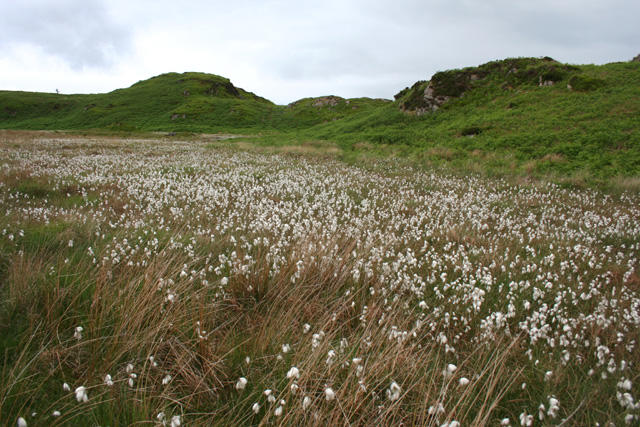 Photo could not load
SD1198 : A sea of cotton grass
Espresso Addict
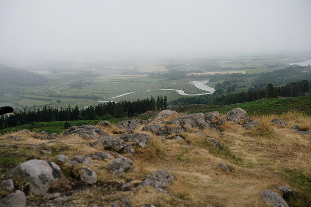 Photo could not load
SD1198 : View From Hooker Crag
Peter Trimming
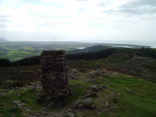 Photo could not load
SD1198 : Trig pillar, Hooker Crag
David Brown
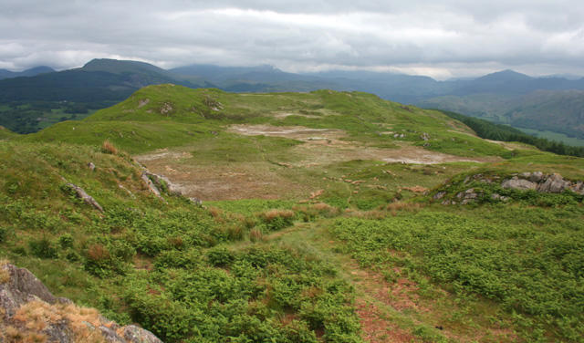 Photo could not load
SD1198 : View over Muncaster Fell from Hooker Crag
Espresso Addict
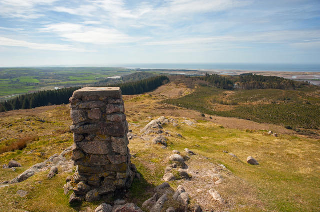 Photo could not load
SD1198 : Trigpoint on Muncaster Fell
Tom Richardson
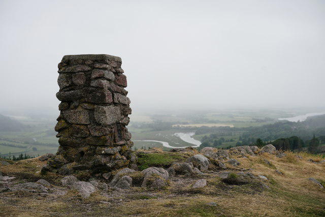 Photo could not load
SD1198 : Hooker Crag
Peter Trimming
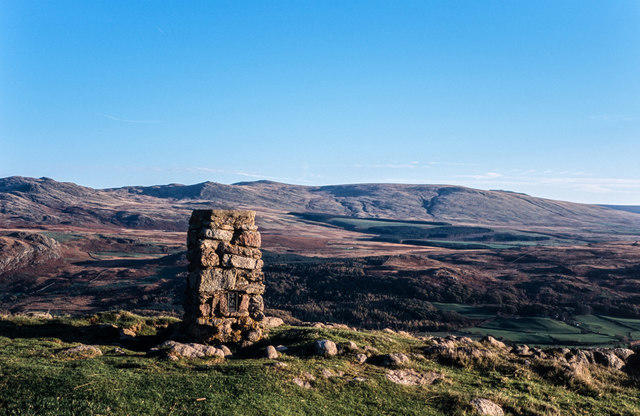 Photo could not load
SD1198 : Trig point at Hooker Crag
Trevor Littlewood
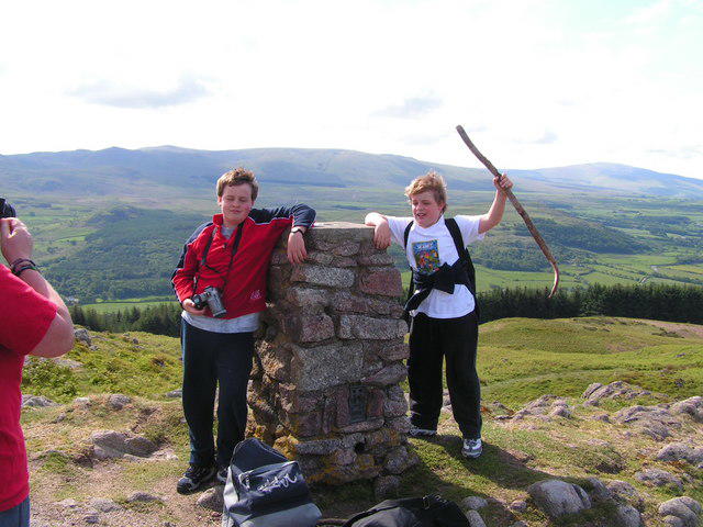
SD1198 : Top of Hooker Fell
N Chadwick
Hill facts and local notes
Classifications
Elevation
231m
759 ft
Prominence
30m
Coordinates
54.3729, -3.3683
SD112983
OS Map
96
Explorer: OL6N
At the Summit
The summit features a small stone cairn and a rocky outcrop that provides excellent photo opportunities, perfect for those who like to snap and share.
Terrain & Geology
Muncaster Fell is composed primarily of sandstone, with sedimentary layers that tell a tale of an ancient ocean bed. The rock formations can present interesting outcrops and weathered surfaces, making it a notable site for geology enthusiasts.
Views & Scenery
On a clear day, the summit rewards hikers with sweeping views of the Irish Sea to the west, the Scafell range to the north, and the pretty valleys below.
History & Heritage
Name Origin
Muncaster is thought to derive from the Old Norse 'Munkastæɾ', meaning 'the place of the monks'. A fitting name given the tranquil beauty of the area!
Historical Significance
Hooker Crag has long been a favourite among local climbers and a spot for geological studies due to its unique rock formations.
Getting There & Facilities
Parking
The nearest parking area is at Muncaster Castle, which provides ample space but may require a fee during busy seasons.
Public Transport
Buses run regularly from Ravenglass to Muncaster, allowing for a more eco-friendly approach to your adventure.
Nearby Facilities
There are toilet facilities available at Muncaster Castle, and a café serving lovely refreshments to refuel post-hike.
Safety Information
Known Hazards
- Loose rocks, especially near summit areas; weather can change rapidly, so always check conditions before setting out.
General Safety Tips
- Check weather conditions before setting out
- Carry appropriate clothing and equipment
- Let someone know your planned route
- Take a map, compass, and GPS device
- Carry emergency supplies: food, water, first aid kit, torch
Hills
Some common questions about the hills answered
Are there group walks up Muncaster Fell - Hooker Crag?
Many walkers use Walkmates to join or organise walks with others. You can check for group walks around Muncaster Fell - Hooker Crag through the maps
Are there other walkers around Muncaster Fell - Hooker Crag?
Activity varies by location and time, but Walkmates lets you see whether others have shared walks or shown interest in this area. Find other people through the walking friends search walking friends for Muncaster Fell - Hooker Crag search or of course create your own walk for Muncaster Fell - Hooker Crag
Can I organise a walk to Muncaster Fell - Hooker Crag?
Yes. If there aren’t any walks listed already, you can create a walk and make it available for others to join.
If you're signed up to Walkmates, you can create a walk to Muncaster Fell - Hooker Crag.
How do I find a walk up this hill?
There are often multiple ways to walk this hill, depending on experience and route preference. Walkmates helps you explore walks and routes that others have shared.
Can I suggest a new route up Muncaster Fell - Hooker Crag?
Yes. You can suggest or create routes to share with others. Walkmates focuses on the social side of walking, so routes are used to help people organise walks and explore areas together, rather than as detailed navigation tools or route libraries.
Other uses really appreciate knowledgeable walkers sharing their routes. Share your favourite route to Muncaster Fell - Hooker Crag here
The is an error or something incorrect about this hill. How do I let you know?
We always strive to keep the information on Walkmates as accurate as possible. If you find an error, please let us know through the contact form and we'll aim to correct it as quickly as possible
Community Discussion
Comments
Location
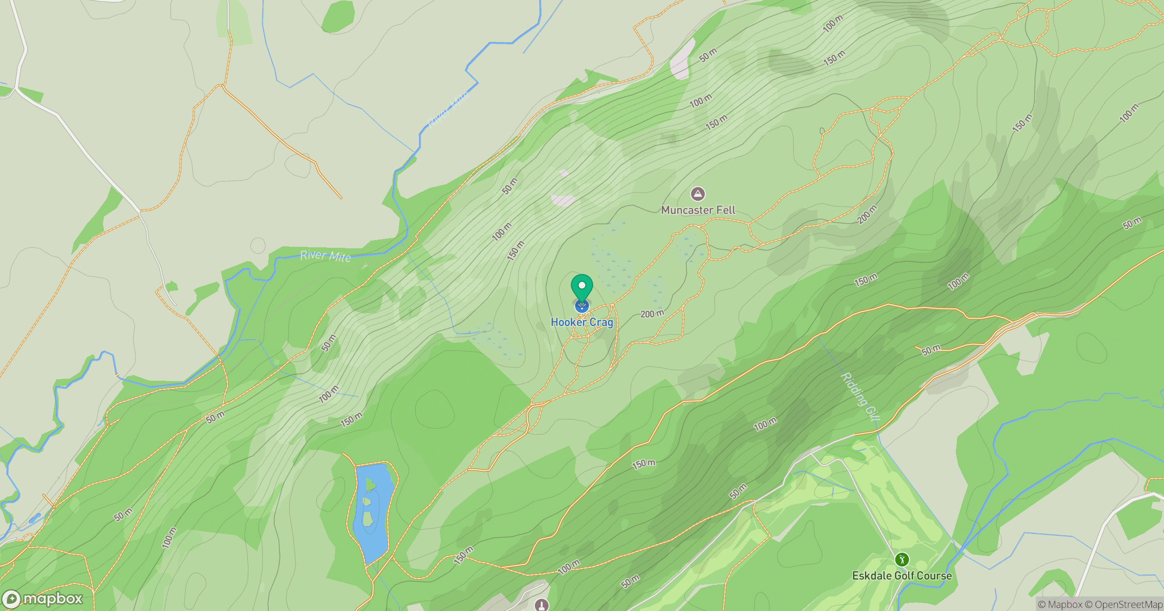
Grid reference: SD112983
View on OpenStreetMapOpens a map in a new tab, centred on the hill.
Nearby Hills
Black Combe
600m
Pillar
892m
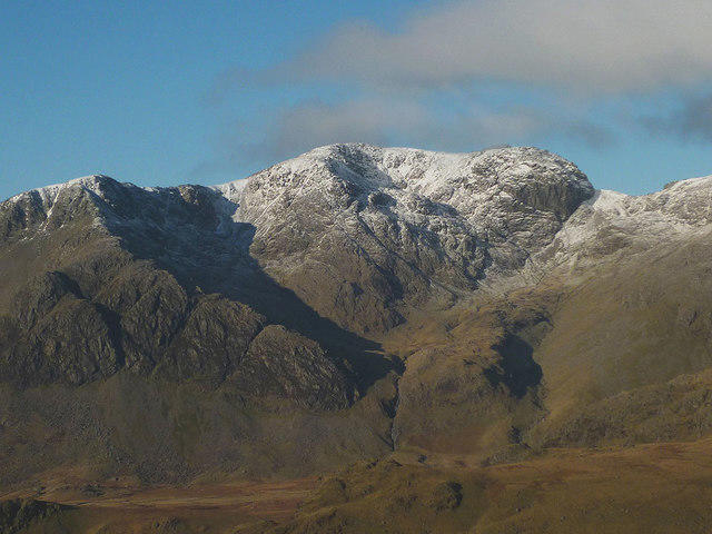
Scafell
964m
High Stile [Grey Crag - High Stile]
806m
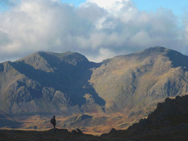
Scafell Pike
978m
No comments yet. Be the first.