

Moelwyn Bach
Good walks are even better shared.
SH6643 : Path ascending the blunt northern end of Moelwyn Bach
Eric Jones Photo source
Overview
Moelwyn Bach
Moelwyn Bach is a 712 m summit in the Moelwynion, Eryri. Its 127 m prominence makes it a HuMP, not a Marilyn; it is also a Simm, Hewitt and Nuttall. The recorded summit is a rock at SH6605843776. The similar-height rib to the southwest and lower stone pile to the northeast should not be confused with a new summit measurement. Primary record
Routes
Two published circuits have different starts and totals:
- From Croesor, Walking Britain gives 12.2 km, 915 m ascent and about 6.5 hours. It visits the old quarries, Moel-yr-hydd, Moelwyn Mawr, Craigysgafn and Moelwyn Bach, then descends towards the woodland and returns by path and lane to Croesor. Croesor circuit
- From upper Tanygrisiau, Mud and Routes gives 12.43 km and 805 m ascent via Llyn Stwlan, Moelwyn Bach, Craigysgafn, Moelwyn Mawr and Moel-yr-hydd, returning through Rhosydd Quarry and Cwmorthin. It publishes no fixed duration. Tanygrisiau circuit
Both are substantial mountain days. Steep loose ground, faint paths and exposed quarry workings make them unsuitable for an unprepared casual outing. Avoid adits and unstable structures and carry navigation equipment.
Landscape
The surrounding rocks include Ordovician sandstone, mudstone and volcanic tuffs. The mountain is not predominantly granite. Llyn Stwlan lies below the ridge, and the slate-quarry remains are an important part of the area's industrial landscape. BGS geology
Access
Croesor's National Park car park is at SH631446. The Tanygrisiau guide describes limited village-side parking; a farmstead is not an authorised parking alternative. Blaenau Ffestiniog's mainline rail service follows the Conwy Valley via Llandudno Junction, with onward transport to the chosen start requiring planning. Current rail timetable
Sources checked 18 October 2026. The current 712 m summit datum is retained; older sources quoting 710 m are not used to relocate it or change its imported survey revision.
Explore routes near Moelwyn Bach
Walks starting near this hill. Open a route to check its map, distance and full itinerary.
Beddgelert Forest: Derwen Circuit and Llyn Llywelyn
View route
Beddgelert Forest: Llyn Llywelyn Woodland Circuit
View route
Snowdon Pyg Track returning by Miner's Track
View route
Northern Rhinogydd guided mountain walk
View route
Route planning notes
These notes describe possible approaches. Check a route's map and access information when planning your walk.
The Moelwyns from Croesor: full circuit
Start at Croesor National Park car park SH631446. Follow the valley and quarry tracks to Moel-yr-hydd, Moelwyn Mawr and Craigysgafn, then cross Bwlch Stwlan to Moelwyn Bach. Descend towards the plantation and return along its edge and the minor road to Croesor. Walking Britain publishes 12.2 km, 915 m ascent and 6.5 hours for this complete circuit. Source: https://www.walkingbritain.co.uk/walk-3035-description
Moelwyn Bach, Mawr and Cwmorthin from Tanygrisiau
From upper Tanygrisiau follow the road to Llyn Stwlan, climb via Bwlch Stwlan to Moelwyn Bach, then return to the col and cross Craigysgafn, Moelwyn Mawr and Moel-yr-hydd. Descend through Rhosydd Quarry and Cwmorthin, returning by the village road to the start. Mud and Routes publishes 12.43 km and 805 m ascent for the whole circuit, without a fixed duration. Source: https://www.mudandroutes.com/routes/moelwyn-bach-mawr-and-cwmorthin-from-tanygrisiau/
Make a day of it, together
Find someone to share the walk with, or organise a day out along a route you like.
Photo Gallery
View all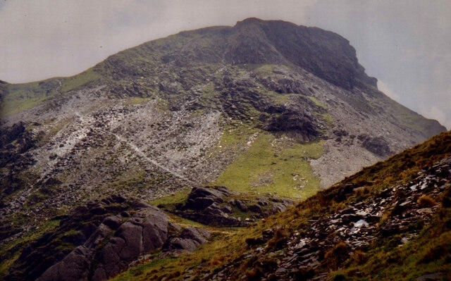 Photo could not load
SH6643 : Path ascending the blunt northern end of Moelwyn Bach
Eric Jones
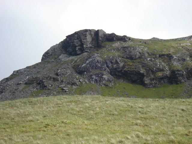 Photo could not load
SH6643 : Moelwyn Bach
Paul Glover
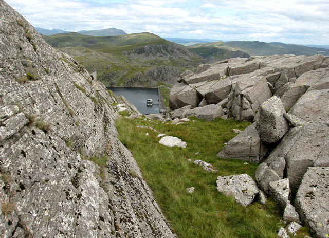 Photo could not load
SH6643 : Rocks on Moelwyn Bach
Dave Croker
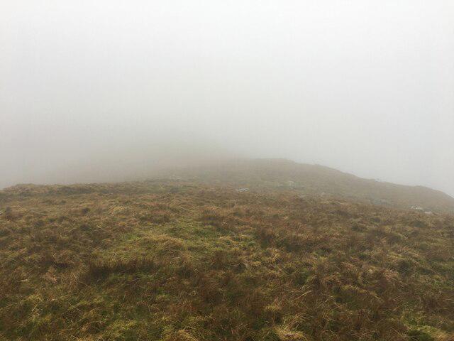 Photo could not load
SH6543 : Western slopes of Moelwyn Bach
Steven Brown
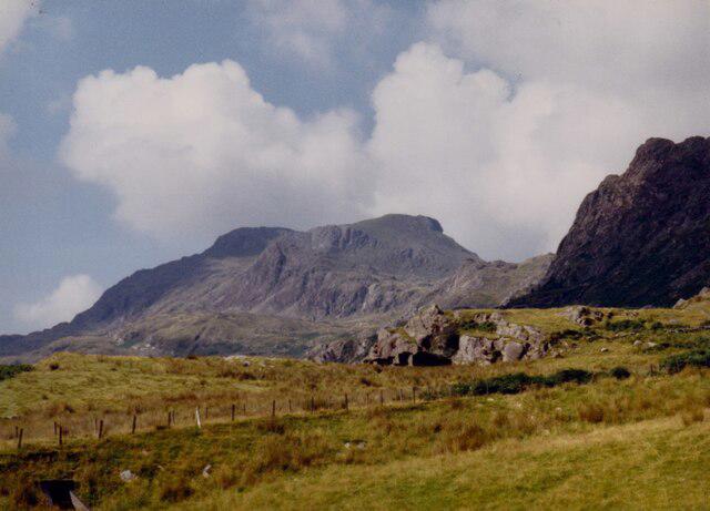 Photo could not load
SH6643 : Moelwyn Bach from below Craig Ysgafn
Eric Jones
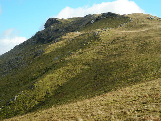 Photo could not load
SH6543 : Moelwyn Bach
John Lynch
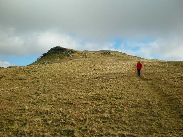 Photo could not load
SH6543 : Below Summit of Moelwyn Bach
John Lynch
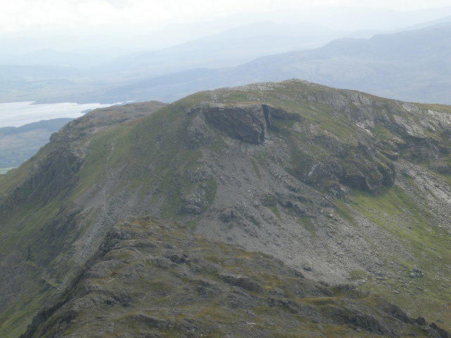 Photo could not load
SH6643 : Moelwyn Bach
John Lynch
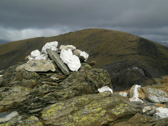 Photo could not load
SH6643 : Summit cairn of Moelwyn Bach
John Lynch
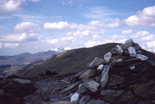
SH6643 : Cairn, Moelwyn Bach
Richard Webb
Hill facts and local notes
Classifications
Elevation
712m
2,336 ft
Prominence
127m
Coordinates
52.9745, -3.9962
SH660437
OS Map
124
Explorer: OL18W
At the Summit
The recorded high point is a rock at SH6605843776. DoBIH notes a similar-height rock rib 40 m southwest and a small stone pile 60 m northeast that is more than 1 m lower; the cairn is not the summit datum.
Terrain & Geology
Moelwyn Bach is part of an Ordovician sedimentary and volcanic landscape. BGS describes sandstone and silty mudstone on its flanks, with tuffs and other volcanic deposits in the Moelwyn sequence. Describing the mountain simply as granite is inaccurate.
Views & Scenery
Moelwyn Bach overlooks Llyn Stwlan and the surrounding Moelwynion. In clear conditions the wider Eryri mountains provide an extensive mountain panorama.
History & Heritage
Name Origin
The name Moelwyn Bach translates to 'Little White Hill', capturing its modest stature compared to its towering siblings.
Historical Significance
Historically, the area plays a significant role in the Welsh slate industry, with remnants of mining activities visible in the surrounding landscape.
Getting There & Facilities
Parking
For the Croesor circuit, use the National Park car park in Croesor at SH631446. The separate Tanygrisiau circuit starts at the upper end of that village, where its guide reports limited parking. Do not assume parking is available at a farmstead.
Public Transport
Blaenau Ffestiniog is on the Conwy Valley rail line from Llandudno and Llandudno Junction. Plan any longer-distance interchange and the onward trip to Croesor or Tanygrisiau separately; check current timetables rather than assuming a direct train from Manchester.
Nearby Facilities
There are a couple of delightful cafes in Blaenau Ffestiniog, as well as public toilets in the town centre.
Safety Information
Known Hazards
- Steep rocky slopes and loose sections require care; wet rock and strong wind increase difficulty.
- Paths can become faint on the open mountain. Carry a map and compass and be able to use them in mist.
- The longer circuits pass abandoned quarry workings, open adits, unfenced drops and unstable buildings. Keep to the route and do not enter the workings.
General Safety Tips
- Check weather conditions before setting out
- Carry appropriate clothing and equipment
- Let someone know your planned route
- Take a map, compass, and GPS device
- Carry emergency supplies: food, water, first aid kit, torch
Hills
Some common questions about the hills answered
Are there group walks up Moelwyn Bach?
Many walkers use Walkmates to join or organise walks with others. You can check for group walks around Moelwyn Bach through the maps
Are there other walkers around Moelwyn Bach?
Activity varies by location and time, but Walkmates lets you see whether others have shared walks or shown interest in this area. Find other people through the walking friends search walking friends for Moelwyn Bach search or of course create your own walk for Moelwyn Bach
Can I organise a walk to Moelwyn Bach?
Yes. If there aren’t any walks listed already, you can create a walk and make it available for others to join.
If you're signed up to Walkmates, you can create a walk to Moelwyn Bach.
How do I find a walk up this hill?
There are often multiple ways to walk this hill, depending on experience and route preference. Walkmates helps you explore walks and routes that others have shared.
Can I suggest a new route up Moelwyn Bach?
Yes. You can suggest or create routes to share with others. Walkmates focuses on the social side of walking, so routes are used to help people organise walks and explore areas together, rather than as detailed navigation tools or route libraries.
Other uses really appreciate knowledgeable walkers sharing their routes. Share your favourite route to Moelwyn Bach here
The is an error or something incorrect about this hill. How do I let you know?
We always strive to keep the information on Walkmates as accurate as possible. If you find an error, please let us know through the contact form and we'll aim to correct it as quickly as possible
Community Discussion
Comments
Location
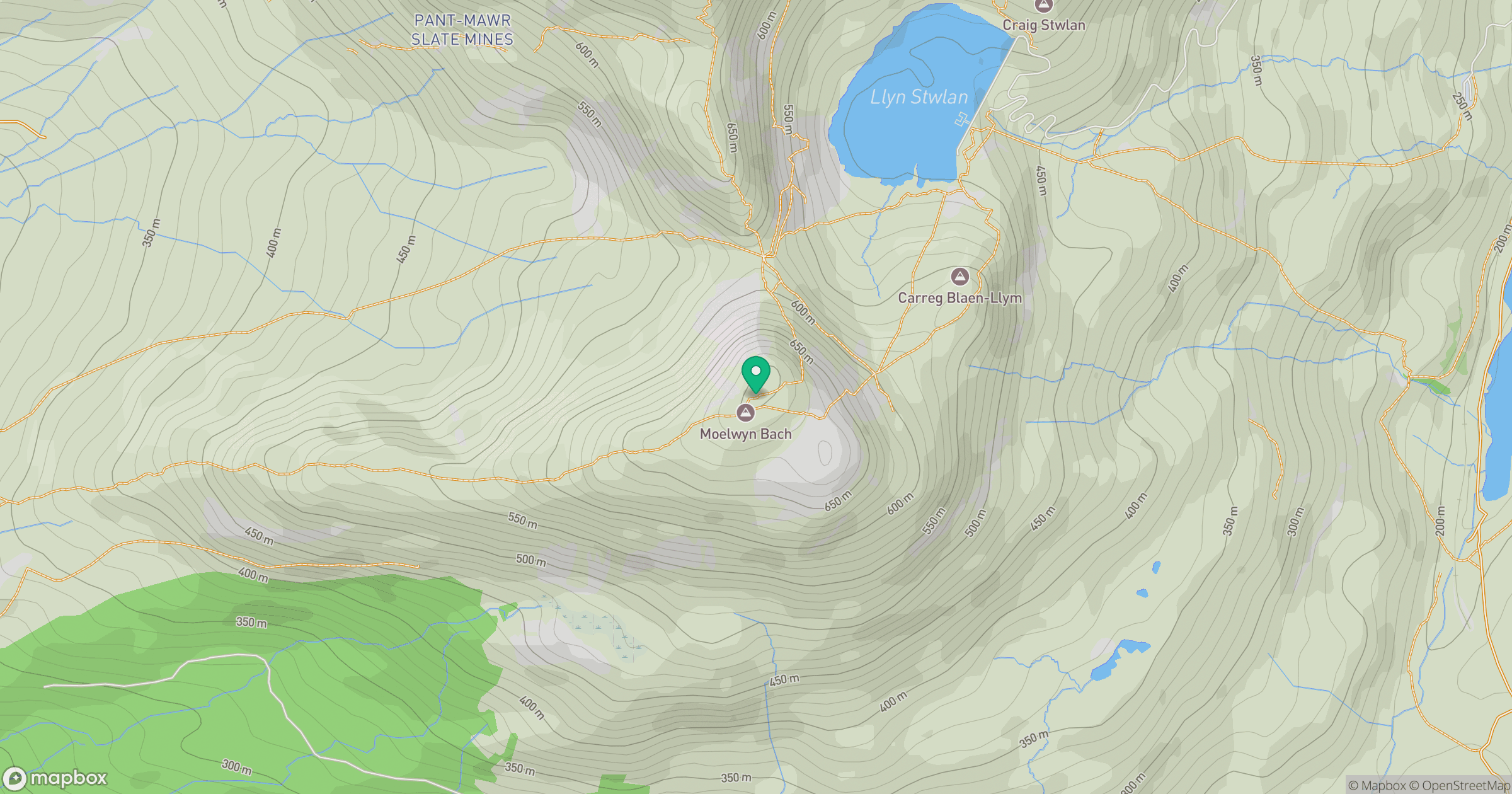
Grid reference: SH660437
View on OpenStreetMapOpens a map in a new tab, centred on the hill.
No comments yet. Be the first.