

Migdale Rock
Good walks are even better shared.
Overview
Migdale Rock Overview
Migdale Rock is a charming Marilyn located in the heart of the Scottish Highlands, rising to a modest elevation of 90 meters. Though it may not reach the heights of some towering Munros, it offers a delightful escape into nature with stunning vistas that can elevate your spirit.
Geology
The area around Migdale Rock features ancient gneiss, evidence of the intense geological forces that shaped Scotland. This rocky outcrop stands as a testament to the earth's dynamic history and is a popular stop for budding geologists.
Hiking the Migdale Hill Trail
The most frequented route is the Migdale Hill Trail, an invigorating circular hike that spans approximately 4.5 km. As you wind your way through beautiful glades and rocky outcrops, you're likely to encounter local wildlife, perhaps a curious deer or, if you're lucky, spotting a golden eagle soaring overhead. The ascent is moderately challenging, making it accessible for most hikers.
Summit Features
Upon reaching the summit, you are greeted by a quaint cairn, a small monument to fellow adventurers before you. It's the perfect spot to catch your breath, indulge in a snack, and soak in the breathtaking views of the Dornoch Firth and the distant Sutherland hills.
Views and Best Seasons
The summit rewards your efforts with spectacular views — best appreciated on a clear day. Late spring and early autumn provide the best visibility, and the added touch of colourful foliage can transform the landscape into a painter’s dream. Remember to bring your camera!
Hazards
Keep your wits about you on this adventure. The trails can become slippery after rainfall, and winds can whip up unexpectedly. Always dress in layers and make sure to have a map or GPS handy.
Access and Facilities
Accessing Migdale Rock is a breeze. The nearest parking is at the entrance of Migdale Woods, where adventurers can leave their vehicles in a small car park. Public transport in the area includes regular bus services from Inverness to nearby Tain, making it easy to embark on your adventure after a quick taxi ride.
Though the area is tranquil, the charming town of Tain, just a stone's throw away, has cafes, pubs, and necessary facilities for tired hikers looking to refuel after their trek.
History
The name 'Migdale' holds a whimsical meaning, translating to 'Valley of the Pigs'. Legends abound regarding the region's history, particularly relating to the folklore surrounding its wildlife. Overall, Migdale Rock encapsulates the essence of Scottish adventure and exploration.
In summary, whether you're a seasoned hiker or a casual walker, Migdale Rock is well worth a visit, offering not just exercise but an uplifting experience amidst nature's splendour. So lace up those boots, grab your walking stick, and go out and discover what it has to offer!
Explore routes near Migdale Rock
Public walks starting within 80 km of this hill. Nearby does not mean a route reaches the summit; check its map and access before setting out.
Loch Migdale from Torroy: Spinningdale pinewood and loch shore walk
View route
Ben Klibreck
View route
Culbin Forest: Hill 99, Gravel Pit Ponds and Dragonfly Pool
View route
Inverness: River Ness and Caledonian Canal circuit
View route
Route planning notes
These notes describe possible approaches, not verified navigable routes or permission to cross land. Check current paths, local access rules and conditions before setting out.
Migdale Hill Trail
A popular circular trail starting at the edge of Migdale woods, meandering through scenic glades and emerging at the rocky summit, where hikers can enjoy panoramic views.
Make a day of it, together
Find someone to share the walk with, or organise a day out along a route you like.
Photo Gallery
View all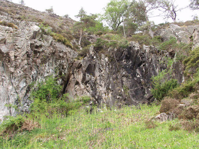 Photo could not load
NH6590 : Migdale Rocks
Mick Crawley
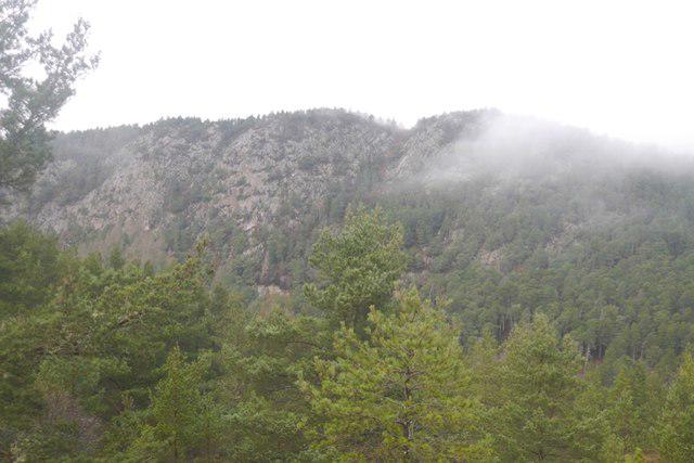 Photo could not load
NH6590 : Migdale Rock
Richard Webb
Hill facts and local notes
Classifications
Elevation
231m
758 ft
Prominence
127m
Coordinates
57.8876, -4.2767
NH651909
OS Map
21
Explorer: 438W 441W
At the Summit
At the summit, you'll find a modest cairn made from the surrounding stones — a perfect spot for a well-earned snack while you take in the views. Note: it's also a great spot for a selfie, if you fancy capturing your adventure.
Terrain & Geology
Migdale Rock is primarily composed of ancient metamorphic rock, specifically gneiss, shaped by the forces of nature over millions of years. Its rugged profile and steep crags make it a perfect playground for rock climbers and an intriguing subject for geological study.
Views & Scenery
From the summit, you can spot the shimmering waters of the Dornoch Firth and the distant peaks of the Sutherland hills. On a clear day, the views are simply breathtaking!
History & Heritage
Name Origin
The name 'Migdale' may be derived from the Gaelic 'Muc-dail', which roughly translates to 'Valley of the Pigs'. Sounds like quite the party back in the day!
Historical Significance
Migdale Rock is noted in local legends, often mentioned in stories of the area's rich folklore, particularly related to its wildlife and the Highland Clearances.
Getting There & Facilities
Check current local access restrictions, parking rules and transport timetables before travelling. These notes do not confirm public access to the summit.
Parking
There is a small car park by the entrance to Migdale Woods, located at NH653904. It accommodates around 10 vehicles but fills up quickly on weekends.
Public Transport
There are regular bus services from Inverness to Tain, with a short taxi ride required to reach the trailhead. Do check local timetables.
Nearby Facilities
While there are no facilities directly on site, Tain offers various cafes, pubs, and toilet facilities for your comfort before or after your adventure.
Safety Information
Known Hazards
- Uneven and slippery paths, especially after rain. Be cautious of sudden changes in weather, typical in the Highlands.
General Safety Tips
- Check weather conditions before setting out
- Carry appropriate clothing and equipment
- Let someone know your planned route
- Take a map, compass, and GPS device
- Carry emergency supplies: food, water, first aid kit, torch
Hills
Some common questions about the hills answered
Are there group walks up Migdale Rock?
Many walkers use Walkmates to join or organise walks with others. You can check for group walks around Migdale Rock through the maps
Are there other walkers around Migdale Rock?
Activity varies by location and time, but Walkmates lets you see whether others have shared walks or shown interest in this area. Find other people through the walking friends search walking friends for Migdale Rock search or of course create your own walk for Migdale Rock
Can I organise a walk to Migdale Rock?
Yes. If there aren’t any walks listed already, you can create a walk and make it available for others to join.
If you're signed up to Walkmates, you can create a walk to Migdale Rock.
How do I find a walk up this hill?
There are often multiple ways to walk this hill, depending on experience and route preference. Walkmates helps you explore walks and routes that others have shared.
Can I suggest a new route up Migdale Rock?
Yes. You can suggest or create routes to share with others. Walkmates focuses on the social side of walking, so routes are used to help people organise walks and explore areas together, rather than as detailed navigation tools or route libraries.
Other uses really appreciate knowledgeable walkers sharing their routes. Share your favourite route to Migdale Rock here
The is an error or something incorrect about this hill. How do I let you know?
We always strive to keep the information on Walkmates as accurate as possible. If you find an error, please let us know through the contact form and we'll aim to correct it as quickly as possible
Community Discussion
Comments
Location
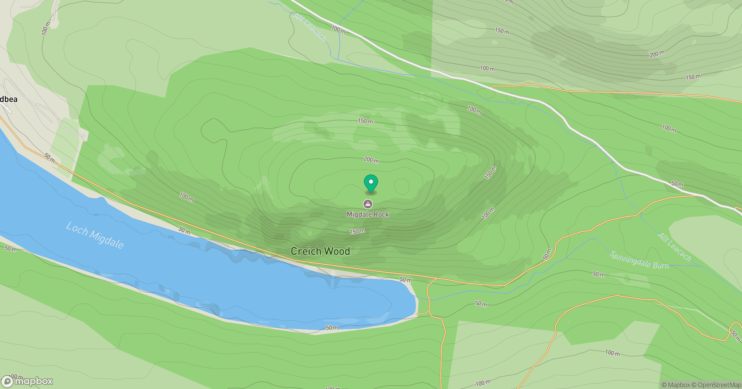
Grid reference: NH651909
View on OpenStreetMapOpens a map in a new tab, centred on the hill.
Hills within 30 km
Straight-line distance, not a walking route or confirmation of access.
No comments yet. Be the first.