

An Stoc-bheinn
Good walks are even better shared.
Overview
An Stoc-bheinn: A Jewel in the Scottish Highlands
Nestled in the heart of the Scottish Highlands, An Stoc-bheinn stands tall at 880 meters, beckoning adventurers with its impressive rugged beauty and welcoming charm. Known as a Marilyn, its prominence of 160 meters ensures it's no slouch amongst the towering giants of the region, yet still offers a fairly approachable challenge for amateur mountaineers and seasoned hikers alike.
Geology
An Stoc-bheinn is primarily composed of ancient schist, giving the area its distinctive rocky formations and diverse terrain. These weathered layers of rock have captured the essence of millions of years of geological history, creating a playground for geology enthusiasts and curious minds. As you tread along its stony paths, take a moment to appreciate the natural sculpture work by wind and time.
Routes
The most renowned path starts from Acharacle, a village blessed with the warmth of locals and the charm of Scottish hospitality. Spanning approximately 8.5 kilometres, the trail is moderate in difficulty and typically takes around four hours to summit. Expect to be treated to delightful woodlands and striking vistas while on your way up. Remember, every uphill step is one closer to that glorious panoramic view!
Summit Features
Reaching the summit, you'll be greeted by a prominent cairn that has stood as a guiding light for many. The top is a theatre of natural beauty, offering astonishing views of the surrounding landscape, including Loch Shiel and the magnificent Màm Ratagan peaks. Don't forget your camera; this is one summit you’ll want to remember!
Terrain Type
The terrain is a delightful mix of rocky slopes and blooming heather patches that ignite bursts of colour, much like a painter’s palette. Well-trodden paths give you a reasonable footing, but keep those boots laced up tight!
Views
When it comes to views, An Stoc-bheinn does not disappoint. From the summit, you're privy to sights that stretch for miles—Loch Shiel glistening in the sunlight and the distant shadows of Skye peeking through. The best times to soak in this beauty are late spring through early autumn, especially at sunrise when the world wakes gently from slumber, draped in soft, golden light.
Hazards
While the scenery might tempt you to dance along the summit ridge, take care! Loose rocks and sudden changes in weather can catch you off guard. Scottish weather changes faster than you can say 'Haggis!' so always be prepared.
Nearby Summits
If you're feeling peckish for more elevation, nearby peaks like Beinn a'Chairn (919 meters) and Meall an t-Suidhe (706 meters) are just a hop, skip, and a jump away. These charming companions only add to the allure of your hiking journey.
Access
Getting to An Stoc-bheinn is a breeze from Acharacle, where parking is available. If you fancy public transport, there are bus services that run from Fort William, making it more convenient than finding a needle in a haystack.
Facilities
Post-hike, you'll be cheered by the sight of a café in Acharacle, serving hot drinks and delicious snacks to refuel those tired legs. Toilets are also a welcome sight here, ensuring you exit with comfort!
History
The name An Stoc-bheinn itself, translating to 'The Stock Hill,’ provides a glimpse into its unique geographical identity. The mountain not only holds physical stature but is steeped in local history and folklore, often whispering tales of faeries and Highland warriors.
In conclusion, An Stoc-bheinn welcomes all who seek its lofty heights and stunning views. It’s the kind of adventure that fills the soul and promises stories for years to come. Pack your gear and lace up those boots—it’s time to make some memories!
Explore routes near An Stoc-bheinn
Public walks starting within 80 km of this hill. Nearby does not mean a route reaches the summit; check its map and access before setting out.
Loch Migdale from Torroy: Spinningdale pinewood and loch shore walk
View route
Ben Klibreck
View route
Culbin Forest: Hill 99, Gravel Pit Ponds and Dragonfly Pool
View route
Findhorn guided night walk
View route
Route planning notes
These notes describe possible approaches, not verified navigable routes or permission to cross land. Check current paths, local access rules and conditions before setting out.
The Regular Route from Acharacle
A moderately challenging hike that begins in Acharacle, winding through scenic woodlands before ascending rocky slopes to the summit.
Make a day of it, together
Find someone to share the walk with, or organise a day out along a route you like.
Photo Gallery
View all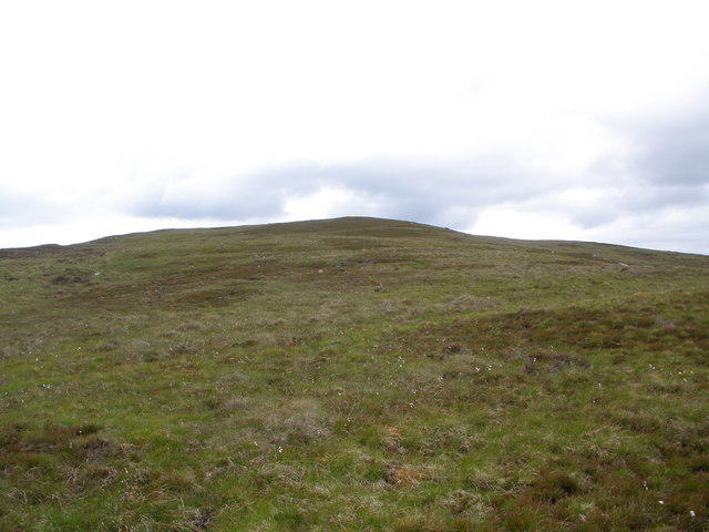 Photo could not load
NC6402 : Looking uphill to the 336m top of An Stoc-Bheinn
John Ferguson
Hill facts and local notes
Classifications
Elevation
336m
1,103 ft
Prominence
147m
Coordinates
57.9910, -4.2995
NC641025
OS Map
16
Explorer: 441W
At the Summit
The summit boasts a distinct cairn that has been a marker for many wandering adventurers. The panoramic views from the top are simply breathtaking, offering a 360-degree snapshot of the surrounding hills and lochs.
Terrain & Geology
The mountain is primarily composed of ancient schist, giving it a rugged appearance with scattered boulders and patches of heather. The weathered rock formations provide fascinating insights into geological processes over millions of years.
Views & Scenery
On a clear day, visitors can see the majestic Loch Shiel, the jagged peaks of the Màm Ratagan hills, and even as far as Skye in the distance. The beauty here is the icing on the cake!
History & Heritage
Name Origin
An Stoc-bheinn translates to 'The Stock Hill' in English, possibly owing to its distinctive shape reminiscent of a stocky figure.
Historical Significance
The region is steeped in local folklore and history, with many tales of faeries and Highland warriors shaping the culture of the area.
Getting There & Facilities
Check current local access restrictions, parking rules and transport timetables before travelling. These notes do not confirm public access to the summit.
Parking
Parking is available at the Acharacle car park, along with information boards about the area.
Public Transport
The nearest bus service operates from Fort William to Acharacle, but be sure to check the schedule to avoid being left high and dry.
Nearby Facilities
The village of Acharacle offers a few local shops and a café serving up warm drinks and snacks for weary hikers. Toilets are also available here.
Safety Information
Known Hazards
- Be cautious of loose rocks and sudden weather changes; the Scottish weather can be as fickle as a cat's affection!
General Safety Tips
- Check weather conditions before setting out
- Carry appropriate clothing and equipment
- Let someone know your planned route
- Take a map, compass, and GPS device
- Carry emergency supplies: food, water, first aid kit, torch
Hills
Some common questions about the hills answered
Are there group walks up An Stoc-bheinn?
Many walkers use Walkmates to join or organise walks with others. You can check for group walks around An Stoc-bheinn through the maps
Are there other walkers around An Stoc-bheinn?
Activity varies by location and time, but Walkmates lets you see whether others have shared walks or shown interest in this area. Find other people through the walking friends search walking friends for An Stoc-bheinn search or of course create your own walk for An Stoc-bheinn
Can I organise a walk to An Stoc-bheinn?
Yes. If there aren’t any walks listed already, you can create a walk and make it available for others to join.
If you're signed up to Walkmates, you can create a walk to An Stoc-bheinn.
How do I find a walk up this hill?
There are often multiple ways to walk this hill, depending on experience and route preference. Walkmates helps you explore walks and routes that others have shared.
Can I suggest a new route up An Stoc-bheinn?
Yes. You can suggest or create routes to share with others. Walkmates focuses on the social side of walking, so routes are used to help people organise walks and explore areas together, rather than as detailed navigation tools or route libraries.
Other uses really appreciate knowledgeable walkers sharing their routes. Share your favourite route to An Stoc-bheinn here
The is an error or something incorrect about this hill. How do I let you know?
We always strive to keep the information on Walkmates as accurate as possible. If you find an error, please let us know through the contact form and we'll aim to correct it as quickly as possible
Community Discussion
Comments
Location
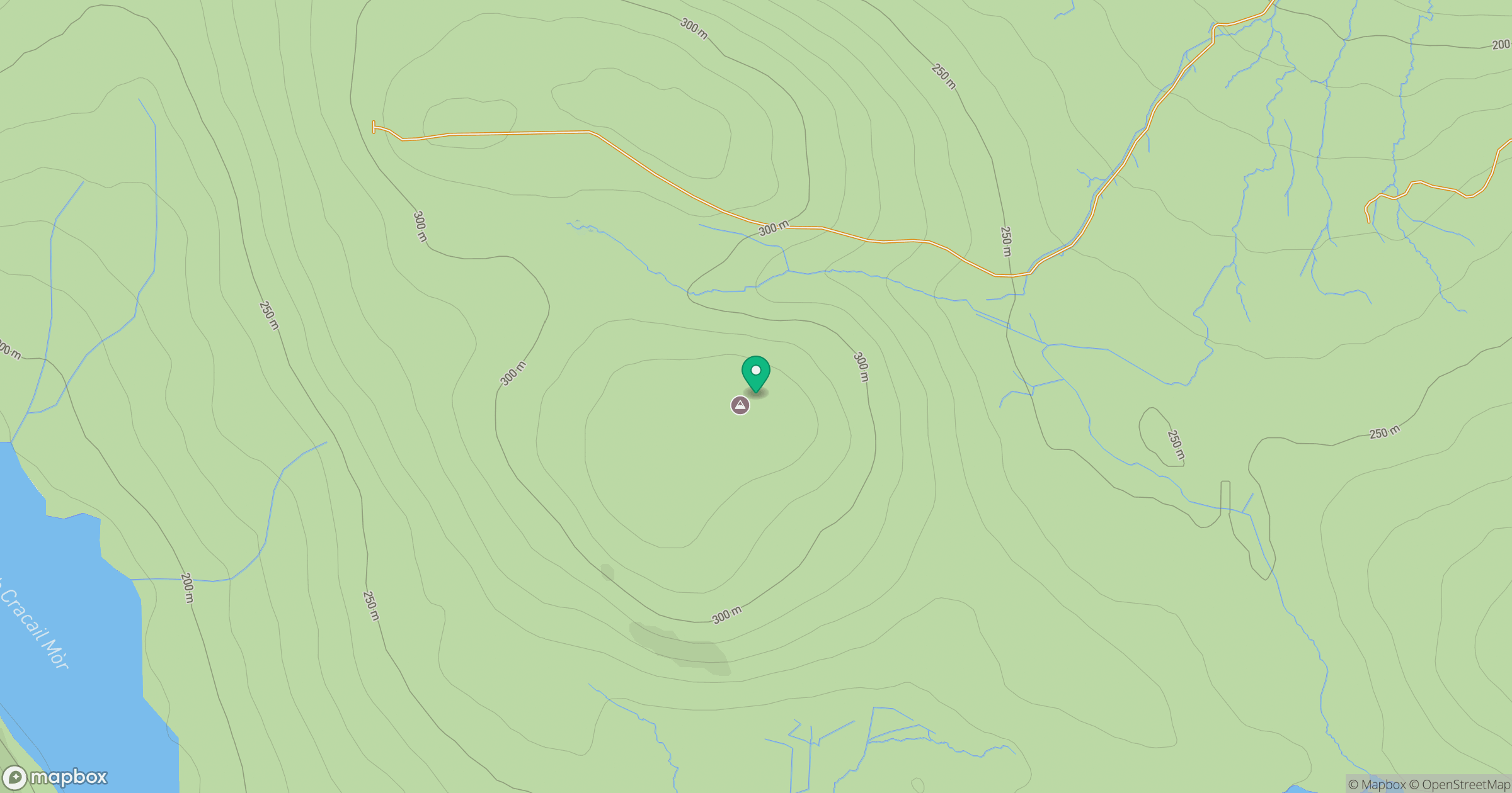
Grid reference: NC641025
View on OpenStreetMapOpens a map in a new tab, centred on the hill.
Hills within 30 km
Straight-line distance, not a walking route or confirmation of access.
Meall Eachainn
344m
Meall Dola
323m
Cnoc a' Choire Bhuidhe
298m
Creag a' Ghobhair
345m
Beinn Domhnaill
349m
No comments yet. Be the first.