

Meall nan Damh
Good walks are even better shared.
NM9174 : Meall nan Damh
Trevor Littlewood Photo source
Overview
Meall nan Damh
Meall nan Damh, standing tall at 948 meters, is a stunning Munro located in the breathtaking Scottish Highlands. It is renowned for its rugged beauty and has earned a spot among the hearts of hiking enthusiasts.
Geology
The geological makeup of Meall nan Damh primarily consists of granite and schist. These age-old rocks bear witness to the powerful forces of nature, marked by glacial sculpting. When standing at the summit, one can appreciate not only the view but also the vast geological history beneath one’s feet. It’s like walking on ancient history!
Routes
There are two popular routes to the summit:
- North East Ridge Route: This moderate ascent is the more commonly taken path. It spans 8 km and typically takes around 3.5 hours. Along the way, hikers will enjoy thrilling views and perhaps even a cheeky visit from a creature or two if they're lucky!
- South West Approach: For those who seek a more challenging trek, this 9.5 km route takes approximately 4 hours. It offers a quieter experience but be prepared for terrain that can occasionally resemble a damp sponge!
Summit Features
At the peak, hikers will find a sizable stone cairn, a traditional marker of a summit. The panoramic views are nothing short of spectacular, particularly with Loch Awe sprawling below.
Terrain Type
The terrain can be a mix of rocky passages and grassy moorland, interspersed with patches that can be a tad boggy after a rainfall. Appropriate footwear is a must, unless you enjoy unexpected puddles!
Views
The views from Meall nan Damh are simply breathtaking. On clear days, you can see the formidable Ben Cruachan and even the enticing silhouettes of Mull and Iona. Late spring and early autumn offer the prime conditions for optimal views, so plan accordingly!
Hazards
As with any mountain trek, one should be aware of potential hazards. The steep drops on the north side and loose rocks demand respect. Also, be wary of the ever-changing weather; it can transform quicker than you can say 'Scottish rain'.
Nearby Summits
Just to the east, the majestic Ben Cruachan rises to 1126 meters, offering another adventure for the enthusiastic hiker. Stob Dearg is another friendly neighbour, standing at 1024 meters.
Access
To get to Meall nan Damh, park your car at Auchnacarrie, where there's space for several vehicles. The nearest town is Dalmally, about 7 km away. A bus service connects from Oban, but renting a vehicle can make your travel much easier.
Facilities
In the charming village of Dalmally, you’ll find a small shop and a couple of cafes perfect for grabbing a bite before your hike. Don’t forget to use the public toilets there, as they can be a lifesaver!
History
The name 'Meall nan Damh' means 'Hill of the Stags' in Gaelic, making it a fitting tribute to the area's wildlife. Historically, this mountain holds cultural significance and has been part of local folklore, enhancing its enchanting atmosphere.
In summary, whether you're a seasoned hillwalker or a curious beginner, Meall nan Damh offers a delightful and invigorating experience infused with the charm of the Scottish Highlands. Pack your boots, bring some snacks, and, most importantly, don’t forget your camera!
Last Updated
This information is as fresh as the morning dew on a Scottish summer day, last updated on 2023-10-01.
Explore routes near Meall nan Damh
Walks starting near this hill. Open a route to check its map, distance and full itinerary.
Banavie to Glen Loy Aqueduct: Neptune’s Staircase Canal Towpath
View route
Ben Nevis via Mountain Path
View route
Fort Augustus to Kytra Lock: Caledonian Canal Towpath
View route
Glen Affric: Coire Loch Woodland Trail
View route
Route planning notes
These notes describe possible approaches. Check a route's map and access information when planning your walk.
North East Ridge Route
A scenic ascent along the north east ridge provides a well-trodden path to the summit, offering stunning views along the way.
South West Approach
Starting from the nearby road, this route is less popular but offers a peaceful trek through heather and rocky outcrops.
Make a day of it, together
Find someone to share the walk with, or organise a day out along a route you like.
Photo Gallery
View all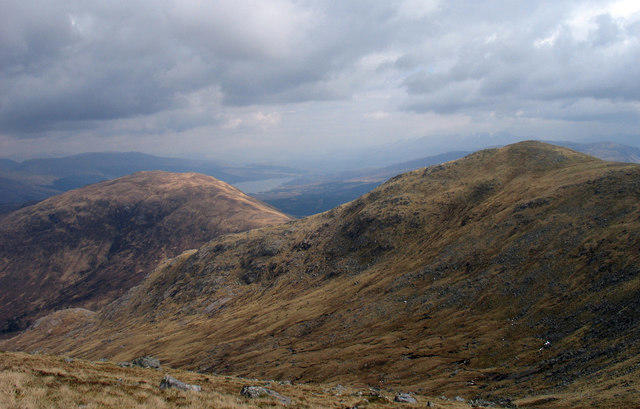 Photo could not load
NM9174 : Meall nan Damh
Trevor Littlewood
Hill facts and local notes
Classifications
Elevation
723m
2,373 ft
Prominence
344m
Coordinates
56.8153, -5.4103
NM919744
OS Map
40
Explorer: 391
At the Summit
The summit features a large stone cairn and offers a panoramic view that includes Loch Awe and the surrounding peaks.
Terrain & Geology
Meall nan Damh is primarily composed of granite and schist, typical of the geological landscape of the Highlands. The steep slopes and rugged terrain provide a fascinating insight into the area's glacial history.
Views & Scenery
From the summit, enjoy views of Ben Cruachan, Loch Awe, and the distant islands of Mull and Iona on a clear day.
History & Heritage
Name Origin
Meall nan Damh translates to 'Hill of the Stags' in Gaelic, a nod to the wildlife that once roamed the area.
Historical Significance
This mountain has historical significance due to its association with local folklore and as a traditional hunting ground for clans.
Getting There & Facilities
Parking
Parking is available at Auchnacarrie with space for several cars. Follow the signs while keeping an eye out for sheep!
Public Transport
The nearest bus service is from Oban, which connects to various parts of the Highlands; however, a car is recommended for easier access.
Nearby Facilities
Dalmally has a small shop and cafes that offer light snacks and drinks, while public toilets are available in the village.
Safety Information
Known Hazards
- Steep drops on the north side, possible loose rocks, and changing weather conditions can pose a risk, especially in winter.
General Safety Tips
- Check weather conditions before setting out
- Carry appropriate clothing and equipment
- Let someone know your planned route
- Take a map, compass, and GPS device
- Carry emergency supplies: food, water, first aid kit, torch
Hills
Some common questions about the hills answered
Are there group walks up Meall nan Damh?
Many walkers use Walkmates to join or organise walks with others. You can check for group walks around Meall nan Damh through the maps
Are there other walkers around Meall nan Damh?
Activity varies by location and time, but Walkmates lets you see whether others have shared walks or shown interest in this area. Find other people through the walking friends search walking friends for Meall nan Damh search or of course create your own walk for Meall nan Damh
Can I organise a walk to Meall nan Damh?
Yes. If there aren’t any walks listed already, you can create a walk and make it available for others to join.
If you're signed up to Walkmates, you can create a walk to Meall nan Damh.
How do I find a walk up this hill?
There are often multiple ways to walk this hill, depending on experience and route preference. Walkmates helps you explore walks and routes that others have shared.
Can I suggest a new route up Meall nan Damh?
Yes. You can suggest or create routes to share with others. Walkmates focuses on the social side of walking, so routes are used to help people organise walks and explore areas together, rather than as detailed navigation tools or route libraries.
Other uses really appreciate knowledgeable walkers sharing their routes. Share your favourite route to Meall nan Damh here
The is an error or something incorrect about this hill. How do I let you know?
We always strive to keep the information on Walkmates as accurate as possible. If you find an error, please let us know through the contact form and we'll aim to correct it as quickly as possible
Community Discussion
Comments
Location
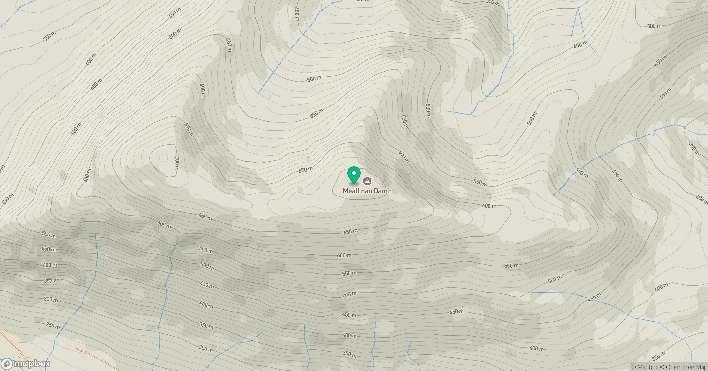
Grid reference: NM919744
View on OpenStreetMapOpens a map in a new tab, centred on the hill.
No comments yet. Be the first.