

Meall nam Bradhan
Good walks are even better shared.
Overview
Meall nam Bradhan: An Adventurer’s Guide
Overview
Nestled in the heart of the Scottish Highlands, Meall nam Bradhan is a Corbett that promises adventurers both beauty and a touch of challenge. Known as the 'Hill of the Bracken', it is a popular destination for hikers who yearn for expansive views and a taste of Highland hospitality.
Geology
Meall nam Bradhan stands proudly at 858 meters and is formed from ancient volcanic rock, specifically schist and granite. This robust geology creates striking cliffs and rugged terrain that enhance the mountain's charm.
Routes
The most common ascent is via the East Ridge Route, a moderate hike of approximately 6.5 km. It typically takes around 3 hours to reach the summit, where a sizable cairn greets you—an emblematic tribute to numerous explorers before you.
Terrain
The terrain encompasses a mixture of rocky paths and grassy slopes, interspersed with vibrant heather. After a rain shower, you might find yourself navigating boggy patches, so sturdy footwear is recommended.
Views
The summit offers breathtaking views, showcasing Loch Ness in the backdrop and rolling valleys. For the best experience, hike during late spring or autumn when the landscape is a canvas of blooms and colours, respectively.
Hazards
Be prepared for the unpredictable Scottish weather! The mist can descend rapidly, so keep an eye on the trail markers. And remember, while the bog may look tempting to saunter across, it can surprise you if you’re not careful.
Access
The closest car park is located at Glen Urquhart, a short 3 km from the trailhead. Drumnadrochit is the nearest town and boasts eateries and public toilets for your convenience. Public transport options also exist from nearby Inverness.
Facilities
Drumnadrochit offers a range of facilities, from cozy cafes perfect for warming up after your hike, to shops for any last-minute supplies.
History and Culture
The name Meall nam Bradhan evokes imagery of lush bracken. Local lore and the mountain's significance are rooted in ancient hunting traditions, steeping the area in cultural richness.
In summary, Meall nam Bradhan is not just a mountain; it's an adventure waiting to unfold. So lace up your boots, pack a sandwich (preferably with the local cheese), and get ready to embrace both the challenge and the breathtaking beauty that the Highlands have to offer.
Happy hiking!
Explore routes near Meall nam Bradhan
Public walks starting within 80 km of this hill. Nearby does not mean a route reaches the summit; check its map and access before setting out.
Loch Migdale from Torroy: Spinningdale pinewood and loch shore walk
View route
Ben Klibreck
View route
Beinn Eighe Lancaster Wreckage at Coire Mhic Fhearchair
View route
Fairy Lochs Liberator Wreckage Circuit
View route
Route planning notes
These notes describe possible approaches, not verified navigable routes or permission to cross land. Check current paths, local access rules and conditions before setting out.
East Ridge Route
This route takes you along the scenic east ridge, offering stunning views as you ascend to the summit of Meall nam Bradhan.
Make a day of it, together
Find someone to share the walk with, or organise a day out along a route you like.
Photo Gallery
View all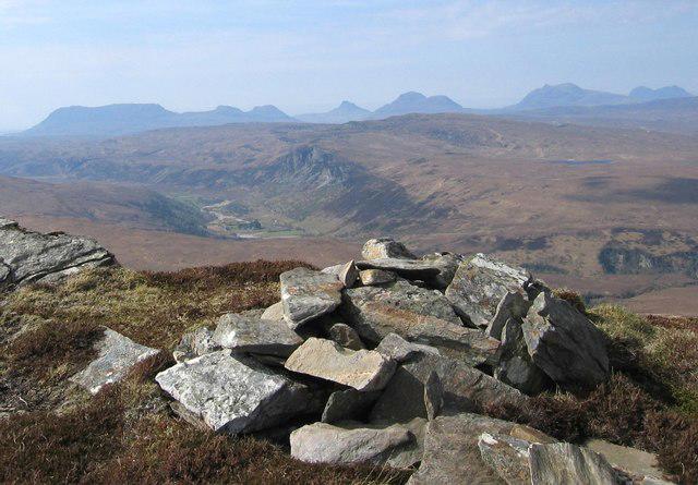 Photo could not load
NH2690 : Meall nam Bradham
Hill Walker
Hill facts and local notes
Classifications
Elevation
679m
2,228 ft
Prominence
137m
Coordinates
57.8683, -4.9227
NH267902
OS Map
20
Explorer: 436N
At the Summit
The summit features a substantial cairn, which stands as a beacon for weary wanderers. On a clear day, you might even spot the occasional bird of prey gliding above.
Terrain & Geology
The terrain is predominantly made up of ancient volcanic rock formations, providing a rugged backdrop for your hike. The area features a mix of schist and granite, giving rise to a unique texture and structure of the landscape.
Views & Scenery
From the summit, you can enjoy panoramic views of the surrounding valleys, including Loch Ness in the distance and the imposing peaks of the Scottish Highlands.
History & Heritage
Name Origin
The name 'Meall nam Bradhan' translates to 'Hill of the Bracken', a nod to the lush vegetation that characterises the area.
Historical Significance
Historically, the area has been a vital hunting ground, and it is steeped in local folklore, often associated with spirits and ancient clans.
Getting There & Facilities
Check current local access restrictions, parking rules and transport timetables before travelling. These notes do not confirm public access to the summit.
Parking
The nearest parking area is at the Glen Urquhart car park, located approximately 3 km from the starting point of the route.
Public Transport
Public transport options include bus services that operate between Inverness and Drumnadrochit, with a short taxi ride to the trailhead.
Nearby Facilities
In Drumnadrochit, you will find a variety of cafes and restaurants, as well as public toilets. Perfect for a pre- or post-hike refuel.
Safety Information
Known Hazards
- Boggy ground can be deceptive, so sturdy footwear is a must. Be mindful of sudden weather changes, as mist can quickly descend, obscuring visibility.
General Safety Tips
- Check weather conditions before setting out
- Carry appropriate clothing and equipment
- Let someone know your planned route
- Take a map, compass, and GPS device
- Carry emergency supplies: food, water, first aid kit, torch
Hills
Some common questions about the hills answered
Are there group walks up Meall nam Bradhan?
Many walkers use Walkmates to join or organise walks with others. You can check for group walks around Meall nam Bradhan through the maps
Are there other walkers around Meall nam Bradhan?
Activity varies by location and time, but Walkmates lets you see whether others have shared walks or shown interest in this area. Find other people through the walking friends search walking friends for Meall nam Bradhan search or of course create your own walk for Meall nam Bradhan
Can I organise a walk to Meall nam Bradhan?
Yes. If there aren’t any walks listed already, you can create a walk and make it available for others to join.
If you're signed up to Walkmates, you can create a walk to Meall nam Bradhan.
How do I find a walk up this hill?
There are often multiple ways to walk this hill, depending on experience and route preference. Walkmates helps you explore walks and routes that others have shared.
Can I suggest a new route up Meall nam Bradhan?
Yes. You can suggest or create routes to share with others. Walkmates focuses on the social side of walking, so routes are used to help people organise walks and explore areas together, rather than as detailed navigation tools or route libraries.
Other uses really appreciate knowledgeable walkers sharing their routes. Share your favourite route to Meall nam Bradhan here
The is an error or something incorrect about this hill. How do I let you know?
We always strive to keep the information on Walkmates as accurate as possible. If you find an error, please let us know through the contact form and we'll aim to correct it as quickly as possible
Community Discussion
Comments
Location
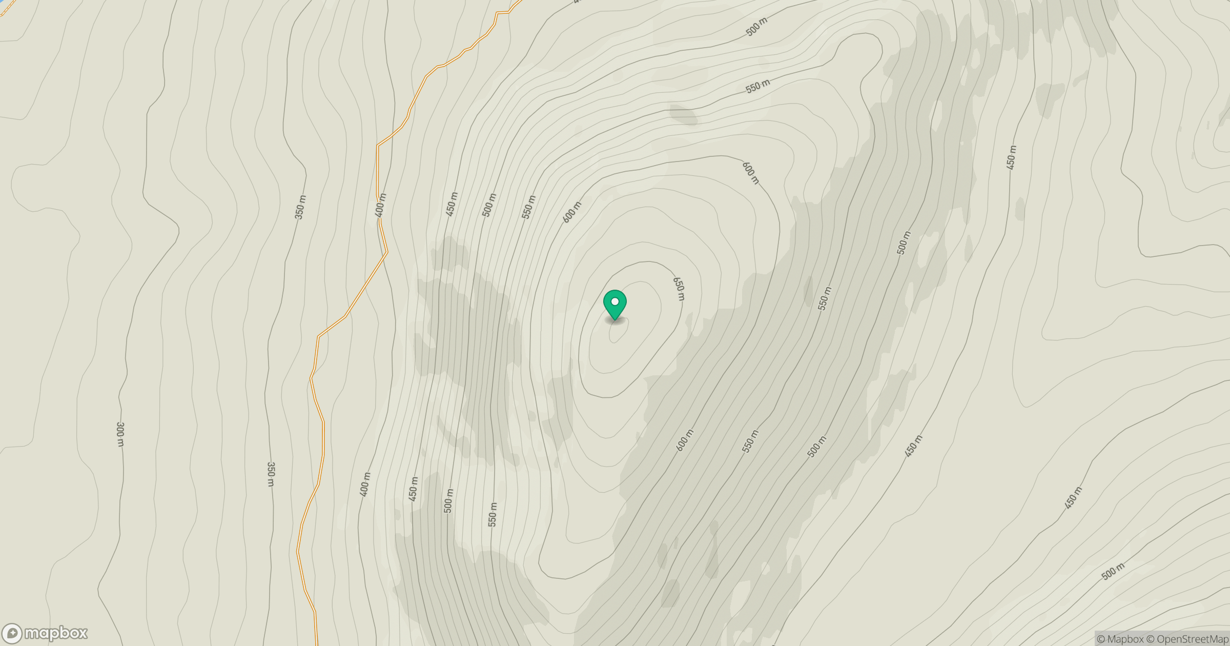
Grid reference: NH267902
View on OpenStreetMapOpens a map in a new tab, centred on the hill.
Hills within 30 km
Straight-line distance, not a walking route or confirmation of access.
Seana Bhraigh
926m
Cul Mor
850m
Canisp
847m
Ben More Coigach [Beinn Mhor na Coigich]
743m
An Teallach - Bidein a' Ghlas Thuill
1,063m
No comments yet. Be the first.