
Meall Glac an Ruighe
Good walks are even better shared.
Overview
Meall Glac an Ruighe: An Overview
Meall Glac an Ruighe, standing tall at 834 meters, is a true gem of the Scottish Highlands. This Munro offers not only a good challenge for those looking to scratch that hiking itch but also breathtaking views for those who pass the summit test.
Geology
The mountain is primarily composed of granite, giving rise to awe-inspiring rock formations that intrigue geologists and casual onlookers alike. Keep an eye out for glacial features etched into the landscape, reminding us of a time when massive ice sheets shaped this rugged terrain.
Routes
One of the most popular routes leads hikers from Coire a' Chàrnain, a path weaving through lush glens and alongside sparkling streams. This moderate trail spans about 11 km and typically takes around 4.5 hours to complete. Perfect for a day’s outing, just remember to take your time and enjoy the scenery – it's not a race!
Terrain
Upon setting foot on Meall Glac an Ruighe, you’ll encounter a mix of rocky outcrops and grassy expanses, with some boggy patches to keep you on your toes – don't forget your gaiters!
Summit Features
At the summit, you'll find a humble cairn marking your achievement, perfect for that well-deserved photo op. Enjoy the feeling of standing atop a Highland icon, with the wind in your hair (or whipping it in your face, whichever you prefer)!
Views
From the top, be prepared to have your breath taken away. You can gaze over the distant peaks of the Cairngorms and, if you’re lucky, catch a glimpse of Loch Ness shimmer in the sunlight. Best times for such splendid sights? Late spring to early autumn when the skies tend to be clearer.
Hazards
As with most Highland adventures, tread carefully – be wary of loose rocks on steeper sections. The weather here can also change quicker than you can say 'Scottish summer', so keep an eye on the forecast and come prepared!
Nearby Summits
When you've conquered Meall Glac an Ruighe, consider tackling nearby peaks such as Beinn Fhionnlaidh and Sgurr na Ciche for added adventure. The Highlands are full of surprises, so don’t leave that energy behind!
Access
Getting there is a breeze. There’s parking available at the trailhead located conveniently near Fort Augustus. And if you prefer public transport, buses run from Inverness, making this Munro easily accessible.
Facilities
When you finish your hike, head back to Fort Augustus where a charming selection of cafes awaits, perfect for a cream tea or hearty meal. Don’t forget to pop by the public toilets before you set off.
History
The name Meall Glac an Ruighe has its roots in the local Gaelic, translating to 'Hill of the Hollow of the Road'. This mountain has seen its fair share of history, with ancient sites scattered throughout the region, telling tales of clans and their lively histories.
So, whether you’re a seasoned hiker or a keen novice, Meall Glac an Ruighe is waiting to welcome you with open arms!
Conclusion
To sum it all up, lace up those boots and pack your enthusiasm. This Munro is not just a mountain; it’s an experience. Just remember to take in the views – the camera loves a good Highland backdrop!
Explore routes near Meall Glac an Ruighe
Public walks starting within 80 km of this hill. Nearby does not mean a route reaches the summit; check its map and access before setting out.
Loch Migdale from Torroy: Spinningdale pinewood and loch shore walk
View route
Beinn Eighe Lancaster Wreckage at Coire Mhic Fhearchair
View route
Ben Klibreck
View route
Fairy Lochs Liberator Wreckage Circuit
View route
Route planning notes
These notes describe possible approaches, not verified navigable routes or permission to cross land. Check current paths, local access rules and conditions before setting out.
From Coire a' Chàrnain
A scenic route that takes you through beautiful glens and past crystal-clear streams, leading up to the summit of Meall Glac an Ruighe.
Make a day of it, together
Find someone to share the walk with, or organise a day out along a route you like.
Hill facts and local notes
Classifications
Elevation
858m
2,815 ft
Prominence
113m
Coordinates
57.8314, -4.9235
NH265861
OS Map
20
Explorer: 436N
At the Summit
The summit is marked by a small cairn, providing an excellent photo opportunity and a reminder of the many trekkers who have stood on its peak.
Terrain & Geology
The mountain is primarily composed of granite, which adds to its rugged beauty and offers a variety of rock formations that are fascinating for geology enthusiasts.
Views & Scenery
On a clear day, one can see the distant peaks of the Cairngorms as well as Loch Ness shimmering in the distance.
History & Heritage
Name Origin
The name 'Meall Glac an Ruighe' translates roughly to 'Hill of the Hollow of the Road', referring to its location and topography.
Historical Significance
The area is rich in history, with ancient burial sites and stories of the clans that once roamed these lands.
Getting There & Facilities
Check current local access restrictions, parking rules and transport timetables before travelling. These notes do not confirm public access to the summit.
Parking
There is parking available at the trailhead on the A82 near the village of Fort Augustus, approximately 12 km from the summit.
Public Transport
Regular bus services run from Inverness to Fort Augustus, making it accessible for public transport users.
Nearby Facilities
Fort Augustus offers a variety of cafes and shops for refreshments, and public toilets can be found near the village centre.
Safety Information
Known Hazards
- Potential for loose rocks, particularly on steeper slopes; watch your footing! Also, be cautious of rapidly changing weather conditions typical of the Highlands.
General Safety Tips
- Check weather conditions before setting out
- Carry appropriate clothing and equipment
- Let someone know your planned route
- Take a map, compass, and GPS device
- Carry emergency supplies: food, water, first aid kit, torch
Hills
Some common questions about the hills answered
Are there group walks up Meall Glac an Ruighe?
Many walkers use Walkmates to join or organise walks with others. You can check for group walks around Meall Glac an Ruighe through the maps
Are there other walkers around Meall Glac an Ruighe?
Activity varies by location and time, but Walkmates lets you see whether others have shared walks or shown interest in this area. Find other people through the walking friends search walking friends for Meall Glac an Ruighe search or of course create your own walk for Meall Glac an Ruighe
Can I organise a walk to Meall Glac an Ruighe?
Yes. If there aren’t any walks listed already, you can create a walk and make it available for others to join.
If you're signed up to Walkmates, you can create a walk to Meall Glac an Ruighe.
How do I find a walk up this hill?
There are often multiple ways to walk this hill, depending on experience and route preference. Walkmates helps you explore walks and routes that others have shared.
Can I suggest a new route up Meall Glac an Ruighe?
Yes. You can suggest or create routes to share with others. Walkmates focuses on the social side of walking, so routes are used to help people organise walks and explore areas together, rather than as detailed navigation tools or route libraries.
Other uses really appreciate knowledgeable walkers sharing their routes. Share your favourite route to Meall Glac an Ruighe here
The is an error or something incorrect about this hill. How do I let you know?
We always strive to keep the information on Walkmates as accurate as possible. If you find an error, please let us know through the contact form and we'll aim to correct it as quickly as possible
Community Discussion
Comments
Location
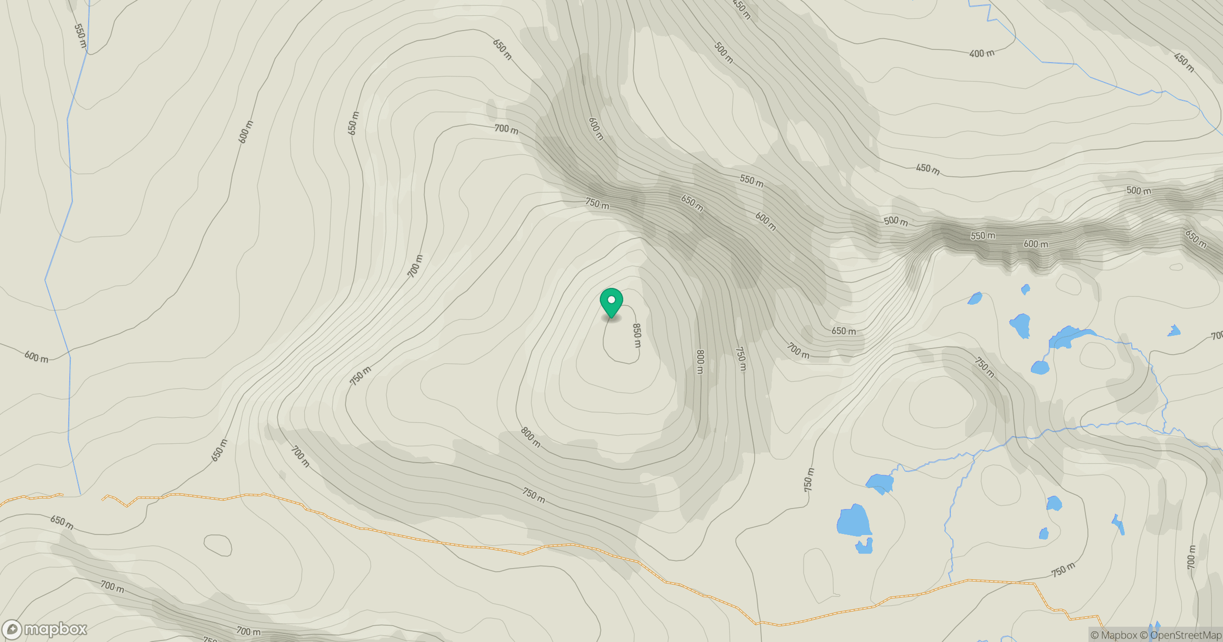
Grid reference: NH265861
View on OpenStreetMapOpens a map in a new tab, centred on the hill.
Hills within 30 km
Straight-line distance, not a walking route or confirmation of access.
Seana Bhraigh
926m
Cul Mor
850m
An Teallach - Bidein a' Ghlas Thuill
1,063m
An Teallach - Sgurr Fiona
1,059m
Ben More Coigach [Beinn Mhor na Coigich]
743m
No comments yet. Be the first.