
Meall Iain
Good walks are even better shared.
Overview
Meall Iain: An Adventure Awaits
Nestled in the picturesque Scottish Highlands, Meall Iain stands tall at 762 meters. A proud Hewitt, it offers both challenging and gentle routes, making it suitable for a variety of hikers. Whether you're a seasoned pro or just lacing your boots for the first time, this hill has a little something for everyone.
Geology
The mountain is primarily composed of metamorphic rocks, specifically schist and gneiss. These geological formations tell tales of ancient environments and glacial activity. Keep an eye out for erratic boulders, as they provide clues to Meall Iain's exciting geological past. They may even have stories of their own!
Routes
North Approach from Glen Mor
- Distance: 8.5 km
- Time: 2.5 hours
- Difficulty: Moderate
This scenic route will take you through breathtaking heather moorland, ultimately leading you to a steady ascent to the summit. Be on the lookout for wildlife, especially if you’re an early bird!
South Ridge Route
- Distance: 6.2 km
- Time: 4 hours
- Difficulty: Challenging
If you’re up for a bit of a scramble, the Southern Ridge offers a lively climb that demands your focus and energy - perfect for adrenaline junkies!
Summit Features
At the very top, you’ll be greeted by a stone cairn, a classic feature of many Scottish summits. Don’t forget to snag a photograph, because if there are no pictures, did it even happen?
Terrain Type
Expect a blend of rocky outcrops and grassy slopes. This diverse terrain makes for an engaging climb, akin to a buffet where you get to choose every step along the way!
Views
Once you reach the peak, feast your eyes on stunning vistas that include Loch Awe and the expansive Argyll Forest Park. The views are particularly striking during the spring and early summer, but autumn adds a breathtaking palette of colours too.
Hazards
As with any Highland venture, be cautious of loose stones on steep paths and keep an eye on rapidly changing weather conditions. It’s always better to come prepared!
Access
The nearest parking is at NM 795 663. Feel free to arrive early to snag your spot, as it can fill up during weekends or holidays. For those relying on public transport, a bus to Auchnacraig is your ticket, though a bit of a trek from parking to the path is needed.
Facilities
While Meall Iain offers no facilities directly, you can find cafes and toilets in the nearby town of Taynuilt. Make time to relax and refill your water bottles after a day of adventure.
History
The name ‘Meall Iain’ comes from Gaelic, translating to ‘John's Hill’. Its historical significance and local heritage make it a place of charm and reflection, cherished by those who visit.
So lace up those boots, pack a snack, and head out into the wild. Meall Iain awaits – adventure is calling!
Explore routes near Meall Iain
Public walks starting within 80 km of this hill. Nearby does not mean a route reaches the summit; check its map and access before setting out.
Ben Nevis via Mountain Path
View route
Banavie to Glen Loy Aqueduct: Neptune’s Staircase Canal Towpath
View route
West Highland Way: Tyndrum to Bridge of Orchy
View route
Loch Affric full circuit from River Affric
View route
Route planning notes
These notes describe possible approaches, not verified navigable routes or permission to cross land. Check current paths, local access rules and conditions before setting out.
North Approach from Glen Mor
A scenic route that weaves through heather moorland before making a steady ascent to the summit.
South Ridge Route
A more challenging climb up the southern ridge, offering some technical sections that will get your heart racing.
Make a day of it, together
Find someone to share the walk with, or organise a day out along a route you like.
Hill facts and local notes
Classifications
Elevation
502m
1,647 ft
Prominence
119m
Coordinates
56.7367, -5.5820
NM810662
OS Map
40
Explorer: 391
At the Summit
The summit is marked by a stone cairn, which is perfect for a photo op. Just don’t expect it to take selfies!
Terrain & Geology
Primarily composed of metamorphic rocks, including schist and gneiss, which adds an interesting layered texture to the landscape. Watch out for the occasional glacial erratic! They’re like nature’s version of lost socks.
Views & Scenery
From Meall Iain, you can see the beautiful Loch Awe and the expansive hills of the Argyll Forest Park, with occasional wildlife making an appearance - think of it as nature’s little performance.
History & Heritage
Name Origin
The name 'Meall Iain' translates to 'John's Hill' in Gaelic, a testament to its local heritage.
Historical Significance
This hill has been steeped in local lore, often regarded as a place of reflection and natural beauty for generations of hillwalkers.
Getting There & Facilities
Check current local access restrictions, parking rules and transport timetables before travelling. These notes do not confirm public access to the summit.
Parking
There is a small parking area at NM 795 663, which can accommodate a few cars. Arrive early to ensure a spot!
Public Transport
The nearest bus stop is in Auchnacraig, about 5km away; plan ahead to catch a lift or prepare for a short hike to the start.
Nearby Facilities
While there are no facilities directly at the summits, Taynuilt offers several cafes and public toilets, along with a charming atmosphere.
Safety Information
Known Hazards
- Loose stones on steep slopes can cause slips, and be mindful of rapidly changing weather conditions in the Highlands.
General Safety Tips
- Check weather conditions before setting out
- Carry appropriate clothing and equipment
- Let someone know your planned route
- Take a map, compass, and GPS device
- Carry emergency supplies: food, water, first aid kit, torch
Hills
Some common questions about the hills answered
Are there group walks up Meall Iain?
Many walkers use Walkmates to join or organise walks with others. You can check for group walks around Meall Iain through the maps
Are there other walkers around Meall Iain?
Activity varies by location and time, but Walkmates lets you see whether others have shared walks or shown interest in this area. Find other people through the walking friends search walking friends for Meall Iain search or of course create your own walk for Meall Iain
Can I organise a walk to Meall Iain?
Yes. If there aren’t any walks listed already, you can create a walk and make it available for others to join.
If you're signed up to Walkmates, you can create a walk to Meall Iain.
How do I find a walk up this hill?
There are often multiple ways to walk this hill, depending on experience and route preference. Walkmates helps you explore walks and routes that others have shared.
Can I suggest a new route up Meall Iain?
Yes. You can suggest or create routes to share with others. Walkmates focuses on the social side of walking, so routes are used to help people organise walks and explore areas together, rather than as detailed navigation tools or route libraries.
Other uses really appreciate knowledgeable walkers sharing their routes. Share your favourite route to Meall Iain here
The is an error or something incorrect about this hill. How do I let you know?
We always strive to keep the information on Walkmates as accurate as possible. If you find an error, please let us know through the contact form and we'll aim to correct it as quickly as possible
Community Discussion
Comments
Location
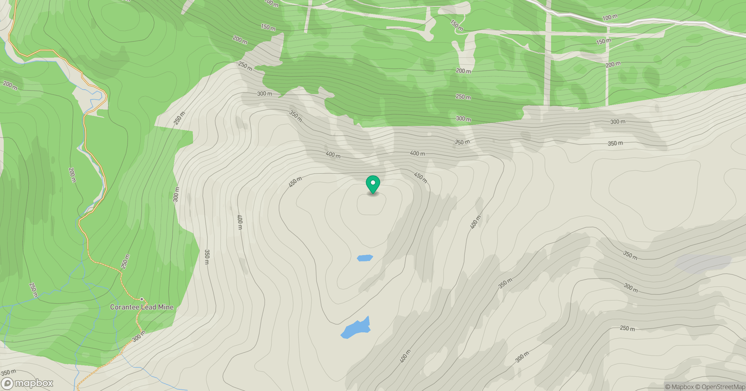
Grid reference: NM810662
View on OpenStreetMapOpens a map in a new tab, centred on the hill.
Hills within 30 km
Straight-line distance, not a walking route or confirmation of access.
Beinn Mheadhoin
739m
Beinn a' Bheithir - Sgorr Dhonuill
1,002m
Beinn a' Bheithir - Sgorr Dhearg
1,024m
Beinn a' Chaorainn
527m
Sgorr an Tarmachain
756m
No comments yet. Be the first.