

Beinn Gaire
Good walks are even better shared.
Overview
Beinn Gaire
Overview
Beinn Gaire is a picturesque hill located in the heart of the Scottish Highlands, boasting an elevation of 776 metres and a prominence of 152 metres. As a Marilyn, it may not be the tallest but it certainly rewards those adventurous enough to tackle its slopes with stunning views and a sense of achievement.
Geology
The geology of Beinn Gaire is predominantly schist and gneiss, common in this area of Scotland. These ancient metamorphic rocks provide a rugged terrain that showcases the beauty of natural erosion and mountain formation over millennia.
Routes
The most popular route is the Beinn Gaire Circuit, a well-trodden path that takes approximately 4 hours to complete. Spanning 8.5 km, this moderate walk will take hikers through a mix of grassy slopes, rocky outcrops, and even some boggy patches that can surprise the unwary. Don’t forget your gaiters!
Summit Features
At the summit, hikers will find a modest yet proud cairn that serves as a worthy marker for the ascent. The panoramic views from the top are nothing short of spectacular, offering an unmatched perspective of Loch Linnhe and its surrounding peaks.
Terrain Type
The terrain is mostly grassy, with sections that may require careful footing due to loose rocks and occasional boggy areas in the lower sections. Prepare for some leg stretching!
Views
From the summit, the vistas are nothing short of breathtaking. On a clear day, you can catch a glimpse of the Isle of Mull in the distance, along with the shimmering waters of Loch Linnhe. The best season to enjoy these views would be spring or early autumn when the landscapes are at their most vibrant.
Hazards
While the hike is not overly challenging, caution is advised for loose rocks on steeper parts of the trail. The fickle Scottish weather can be a friend one moment and a foe the next, so always be prepared with a waterproof jacket and a willingness to weather the storm!
Access
Beinn Gaire is conveniently located near the village of Appin. There’s a small car park that can accommodate about 10 vehicles, and public transport can get you to Appin with ease.
Facilities
In Appin, you’ll find several welcoming cafes, perfect for a pre or post-hike treat. Public toilets are available near the car park to ensure that your comfort needs are met.
History
The name Beinn Gaire translates to 'Hill of the Wagtail', an amusing nod to the sprightly birds that flit about in the area. The mountain is steeped in local folklore and has been a cherished hiking spot for the community for generations.
Conclusion
Whether you’re a seasoned hiker or just wish to stretch your legs and take in some jaw-dropping scenery, Beinn Gaire offers the perfect blend of challenge and natural beauty. Don’t forget your camera; the Instagram opportunities here are irresistible!
Explore routes near Beinn Gaire
Public walks starting within 80 km of this hill. Nearby does not mean a route reaches the summit; check its map and access before setting out.
Banavie to Glen Loy Aqueduct: Neptune’s Staircase Canal Towpath
View route
Ben Nevis via Mountain Path
View route
Loch Affric full circuit from River Affric
View route
Fort Augustus to Kytra Lock: Caledonian Canal Towpath
View route
Route planning notes
These notes describe possible approaches, not verified navigable routes or permission to cross land. Check current paths, local access rules and conditions before setting out.
Beinn Gaire Circuit
A circular route that offers a variety of terrains, views, and challenges, making it a favourite among local hikers.
Make a day of it, together
Find someone to share the walk with, or organise a day out along a route you like.
Photo Gallery
View all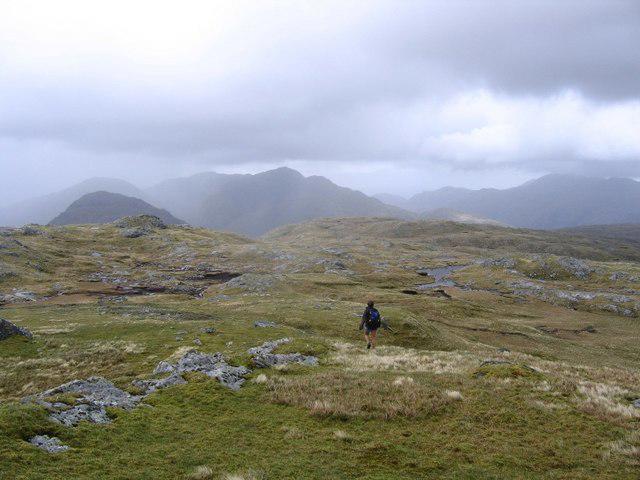 Photo could not load
NM7874 : Summit of Beinn Gaire
Andrew Spenceley
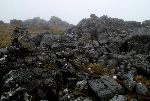 Photo could not load
NM7874 : Broken Rocks Near Summit of Beinn Gaire
Trevor Littlewood
Hill facts and local notes
Classifications
Elevation
666m
2,185 ft
Prominence
320m
Coordinates
56.8124, -5.6368
NM781748
OS Map
40
Explorer: 390E
At the Summit
The summit features a modest cairn and a stunning panoramic viewpoint that rewards the ascent with breathtaking vistas.
Terrain & Geology
The mountain is primarily composed of schists and gneisses, characteristic of the Scottish Highlands, which contribute to its rugged landscape and dramatic slopes.
Views & Scenery
From the summit, admire the sprawling vistas over Loch Linnhe and the surrounding hills including the distant peaks of Mull.
History & Heritage
Name Origin
The name 'Beinn Gaire' roughly translates to 'Hill of the Wagtail' in Scottish Gaelic, likely named for the birds that can be seen around its slopes.
Historical Significance
This mountain holds local significance in Scots folklore and has been a popular hiking destination for generations.
Getting There & Facilities
Check current local access restrictions, parking rules and transport timetables before travelling. These notes do not confirm public access to the summit.
Parking
There is a small car park at the beginning of the walk near the village of Appin, typically accommodating around 10 cars.
Public Transport
Public buses regularly run to Appin from nearby towns, offering convenient access to the starting point.
Nearby Facilities
The village of Appin has a few cafes and small shops for refreshments, and public toilets can be found near the car park.
Safety Information
Known Hazards
- Be aware of loose rocks, particularly on steep sections. Weather can change rapidly, so be prepared for sudden rain or wind.
General Safety Tips
- Check weather conditions before setting out
- Carry appropriate clothing and equipment
- Let someone know your planned route
- Take a map, compass, and GPS device
- Carry emergency supplies: food, water, first aid kit, torch
Hills
Some common questions about the hills answered
Are there group walks up Beinn Gaire?
Many walkers use Walkmates to join or organise walks with others. You can check for group walks around Beinn Gaire through the maps
Are there other walkers around Beinn Gaire?
Activity varies by location and time, but Walkmates lets you see whether others have shared walks or shown interest in this area. Find other people through the walking friends search walking friends for Beinn Gaire search or of course create your own walk for Beinn Gaire
Can I organise a walk to Beinn Gaire?
Yes. If there aren’t any walks listed already, you can create a walk and make it available for others to join.
If you're signed up to Walkmates, you can create a walk to Beinn Gaire.
How do I find a walk up this hill?
There are often multiple ways to walk this hill, depending on experience and route preference. Walkmates helps you explore walks and routes that others have shared.
Can I suggest a new route up Beinn Gaire?
Yes. You can suggest or create routes to share with others. Walkmates focuses on the social side of walking, so routes are used to help people organise walks and explore areas together, rather than as detailed navigation tools or route libraries.
Other uses really appreciate knowledgeable walkers sharing their routes. Share your favourite route to Beinn Gaire here
The is an error or something incorrect about this hill. How do I let you know?
We always strive to keep the information on Walkmates as accurate as possible. If you find an error, please let us know through the contact form and we'll aim to correct it as quickly as possible
Community Discussion
Comments
Location
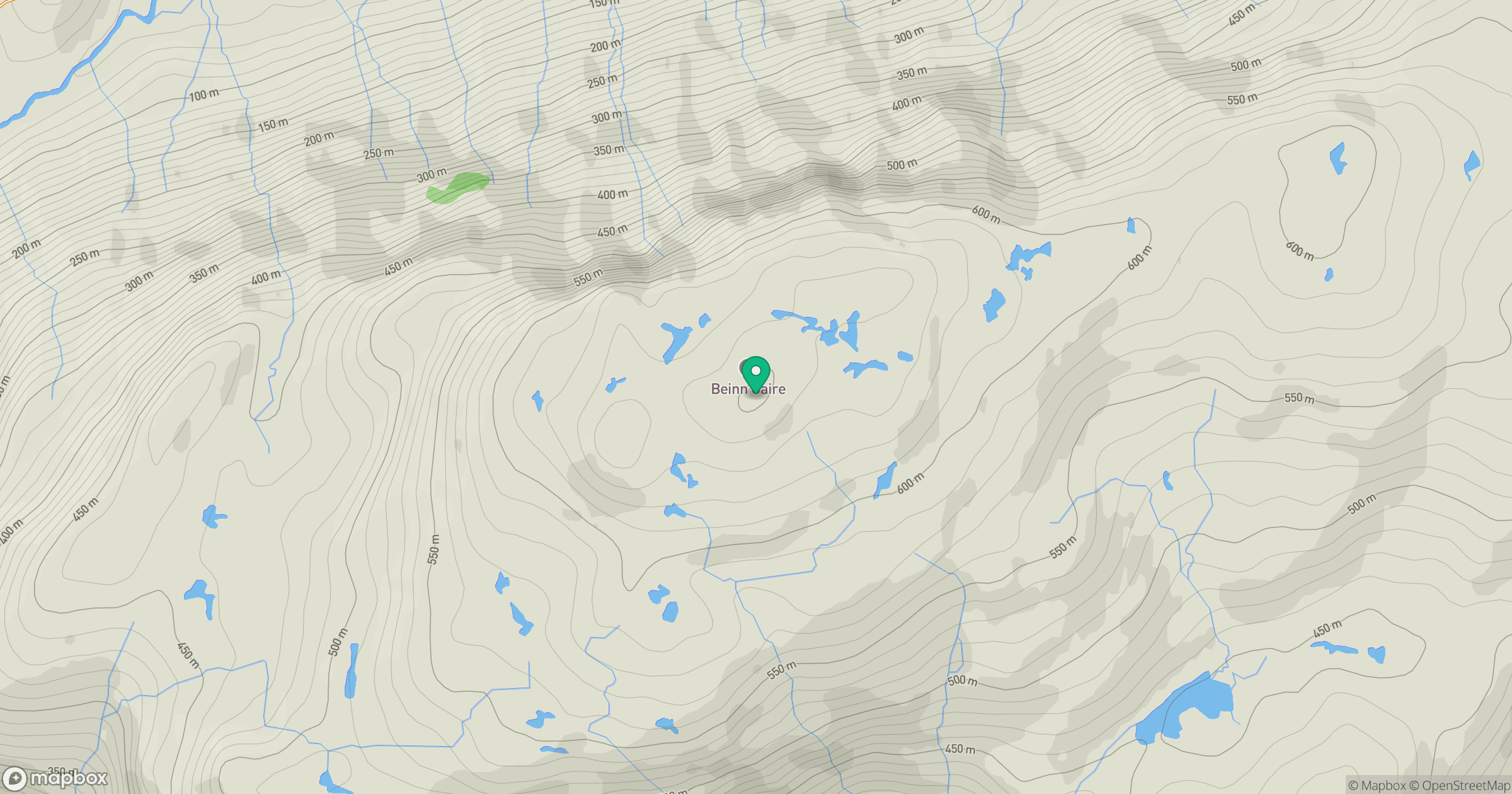
Grid reference: NM781748
View on OpenStreetMapOpens a map in a new tab, centred on the hill.
Hills within 30 km
Straight-line distance, not a walking route or confirmation of access.
Beinn Mheadhoin
739m
Ladhar Bheinn
1,020m
Sgurr na Ba Glaise
874m
Creag nan Lochan
499m
Rois-Bheinn
882m
No comments yet. Be the first.