

Little Yarlside
Good walks are even better shared.
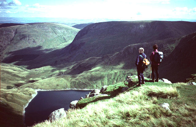
NY5307 : On Little Yarlside
Michael Graham Photo source
Overview
Little Yarlside: A Gem in the Lake District
Nestled within the enchanting Lake District, Little Yarlside is a Marilyn that beckons to hikers and nature lovers alike. Standing proudly at an elevation of 393 meters, this mountain may not be the tallest, but its charm is undeniable.
Geology
The geology of Little Yarlside tells a story of time. Composed mainly of sandstone and limestone, the region showcases layers that have withstood millennia of erosion. You'll find remnants of ancient seabeds and evidence of glacial activity, which lends a historic aspect to your climb. Don't worry, no rocks will be rolling underfoot if you keep your eyes peeled!
Routes
There are two popular routes to summit Little Yarlside:
From the A66: A straightforward and popular path that offers a continuous ascent with ample opportunities for stunning photographic moments.
- Distance: 6 km
- Estimated Time: 2.5 hours
- Difficulty: Moderate
Crosby Ravensworth: A more challenging but rewarding trek through captivating countryside that could serve as an impromptu nature safari.
- Distance: 8 km
- Estimated Time: 3.5 hours
- Difficulty: Challenging
Summit Features
Upon reaching the summit, you'll be greeted by a small stone cairn and a trig point—a true cherry on top that adds some historical flair. The grassy area at the peak is simply waiting for you to unfurl your picnic blanket and enjoy your hard-earned views.
Terrain
The terrain is a delightful mix of grassy slopes and rocky outcrops, interspersed with some boggy patches. Hiking boots are a must unless you're in the mood for an unexpected splash!
Views
The views from the top are frankly spectacular. On a clear day, the iconic shapes of Helvellyn and Blencathra emerge on the horizon, standing like sentinels over this picturesque landscape. The best time to enjoy these views is during early spring and late autumn, when the scenery is at its most breathtaking.
Hazards
As with any adventure in the British outdoors, be prepared for changing weather—what starts as a sunny day may quickly turn into a damp affair! The rocky outcrops call for careful footing, so keep your wits about you to avoid a tumble.
Nearby Summits
Just a stone's throw away are several other notable summits:
- Yarlside (484 meters)
- Harter Fell (778 meters)
Access
Little Yarlside is easily accessible. The nearest parking is along the A66, where you'll find ample spots to leave your vehicle. If you're using public transport, Penrith train station is the closest major hub, with regular bus services to the A66. The cozy village of Kirkby Stephen is just a short drive away, offering a warm welcome before or after your hike.
Facilities
Ensure you're well-fed before your adventure! Kirkby Stephen hosts several cafes and toilet facilities, allowing you to revitalise before or celebrate after your expedition.
History
The moniker 'Yarlside' hints at an ancient past: possibly linked to Old Norse words meaning 'manor' or 'noble place'. This reflects the cultural heritage of the region, where echoes of the past still linger amidst the beauty of nature.
So lace up your boots, pack a sandwich, and set off to discover Little Yarlside—where adventure awaits and laughter can be heard echoing down the valleys!
Last Updated
2023-10-01
Source
OpenStreetMap
Explore routes near Little Yarlside
Walks starting near this hill. Open a route to check its map, distance and full itinerary.
Striding Edge, Helvellyn and Catstye Cam
View route
Helvellyn via Striding Edge
View route
Sizergh: Park End Moss and Brigsteer Park Wood Circuit
View route
Tarn Hows Fast Route
View route
Route planning notes
These notes describe possible approaches. Check a route's map and access information when planning your walk.
From the A66
A straightforward ascent from the western approach, providing stunning views as you climb.
Crosby Ravensworth
This route meanders through beautiful countryside, rewarding hikers with picturesque views and occasional wildlife sightings.
Make a day of it, together
Find someone to share the walk with, or organise a day out along a route you like.
Photo Gallery
View all Photo could not load
NY5307 : On Little Yarlside
Michael Graham
 Photo could not load
NY5307 : A premature fence
Ian Dodds
 Photo could not load
NY5207 : Dry stone wall below Great Yarlside
John H Darch
 Photo could not load
NY5307 : Heading for Great Yarlside
Karl and Ali
 Photo could not load
NY5307 : Wall. Little Yarlside
Michael Graham
 Photo could not load
NY5307 : Across Little Yarlside
Karl and Ali
 Photo could not load
NY5307 : Wall on Little Yarlside
David Brown
Hill facts and local notes
Classifications
Elevation
518m
1,699 ft
Prominence
11m
Coordinates
54.4577, -2.7250
NY530071
OS Map
90
Explorer: OL7N
At the Summit
The summit boasts a small stone cairn and a grassy platform perfect for a scenic picnic. A trig point stands proud, marking the elevation and adding a touch of nostalgia to the climb.
Terrain & Geology
The mountain is primarily composed of sandstone and limestone, which is characteristic of the Lake District. The geological formations provide a fascinating insight into ancient seabeds and glacial activity.
Views & Scenery
From the summit, revel in breathtaking views of the surrounding fells, including the distinctive outlines of Helvellyn and Blencathra.
History & Heritage
Name Origin
The name 'Yarlside' is derived from Old Norse, possibly referring to a 'manor' or 'place of the noble', highlighting the region's rich heritage.
Historical Significance
Little Yarlside has been a notable destination for walkers and nature enthusiasts, showcasing the interplay of nature and human history in the Lake District.
Getting There & Facilities
Parking
The nearest parking is at the A66 layby, which accommodates a reasonable number of vehicles. It's strategically placed for easy access to several routes.
Public Transport
The nearest train station is located in Penrith, approximately 13 km away. Buses frequently run to the A66, allowing easy access to the starting points.
Nearby Facilities
The nearest facilities, including toilets and cafes, can be found in Kirkby Stephen. It's a great idea to fuel up before or after your hike!
Safety Information
Known Hazards
- Beware of sudden weather changes, as the Lake District can be notoriously fickle. Also, watch your footing on the rocky outcrops.
General Safety Tips
- Check weather conditions before setting out
- Carry appropriate clothing and equipment
- Let someone know your planned route
- Take a map, compass, and GPS device
- Carry emergency supplies: food, water, first aid kit, torch
Hills
Some common questions about the hills answered
Are there group walks up Little Yarlside?
Many walkers use Walkmates to join or organise walks with others. You can check for group walks around Little Yarlside through the maps
Are there other walkers around Little Yarlside?
Activity varies by location and time, but Walkmates lets you see whether others have shared walks or shown interest in this area. Find other people through the walking friends search walking friends for Little Yarlside search or of course create your own walk for Little Yarlside
Can I organise a walk to Little Yarlside?
Yes. If there aren’t any walks listed already, you can create a walk and make it available for others to join.
If you're signed up to Walkmates, you can create a walk to Little Yarlside.
How do I find a walk up this hill?
There are often multiple ways to walk this hill, depending on experience and route preference. Walkmates helps you explore walks and routes that others have shared.
Can I suggest a new route up Little Yarlside?
Yes. You can suggest or create routes to share with others. Walkmates focuses on the social side of walking, so routes are used to help people organise walks and explore areas together, rather than as detailed navigation tools or route libraries.
Other uses really appreciate knowledgeable walkers sharing their routes. Share your favourite route to Little Yarlside here
The is an error or something incorrect about this hill. How do I let you know?
We always strive to keep the information on Walkmates as accurate as possible. If you find an error, please let us know through the contact form and we'll aim to correct it as quickly as possible
Community Discussion
Comments
Location
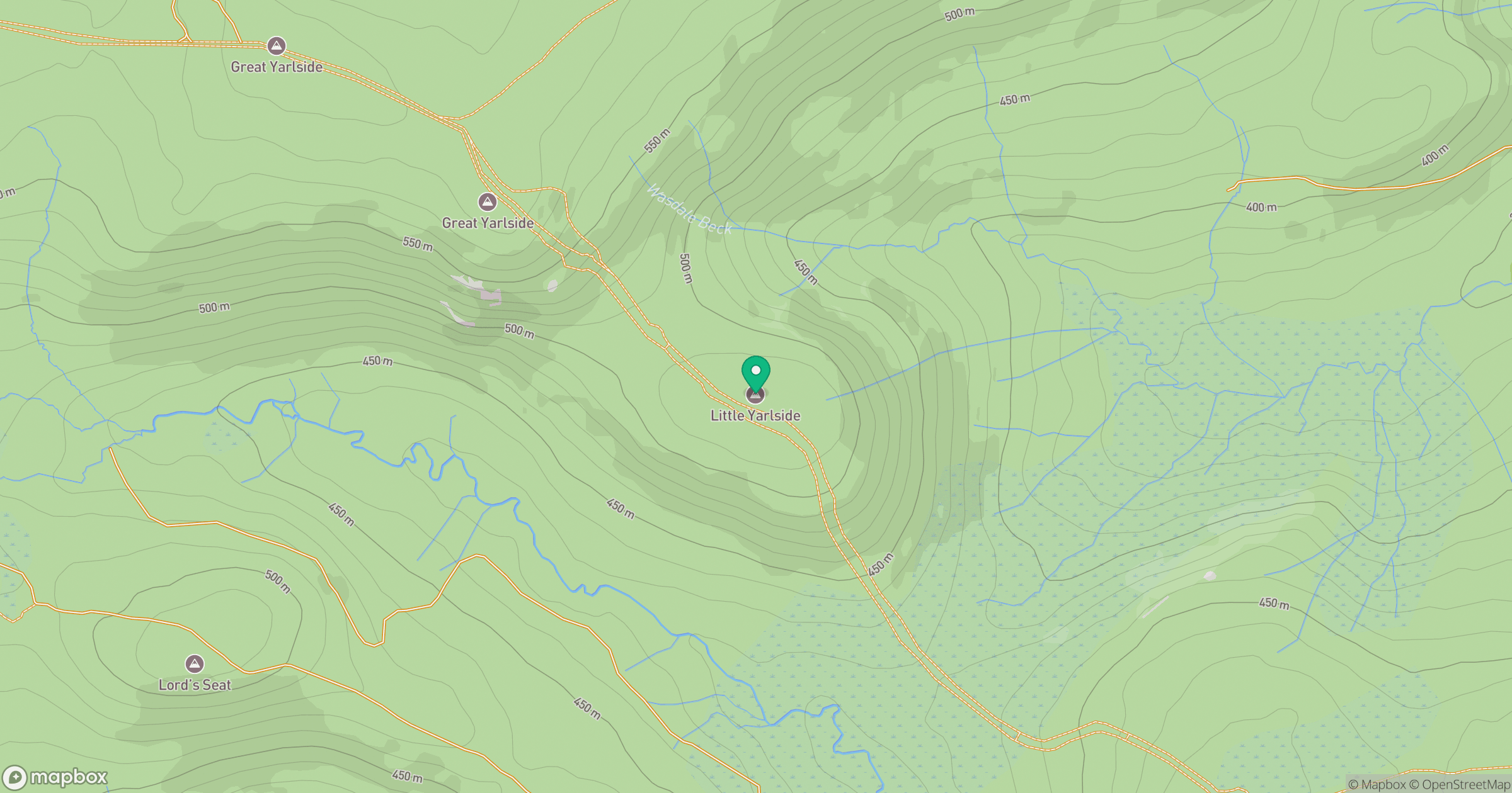
Grid reference: NY530071
View on OpenStreetMapOpens a map in a new tab, centred on the hill.
No comments yet. Be the first.