

Little Mell Fell
Good walks are even better shared.
NY4224 : Little Mell Fell Summit
Shaun Ferguson Photo source
Overview
Little Mell Fell: A Gem of the Lake District
Little Mell Fell, standing at a modest 505 meters, might not steal the spotlight from its towering neighbours, but don’t let its size fool you. This Marilyn is a haven for those looking for stunning views without the scramble.
Geology
Little Mell Fell’s rich volcanic geology tells a story of ancient eruptions and geological forces at play. Composed mainly of volcanic rock, it features smooth grassy slopes perfect for a leisurely hike. Geology enthusiasts will find this fascinating as they explore the old lava flows and formations.
Hiking Routes
Two popular routes lead hikers to the summit:
- Mell Fells Trail: This route is the preferred choice for families and less experienced walkers. Starting from Watermillock, it’s a pleasant stroll with gentle gradients and takes about 1.5 hours to reach the top.
- Direct Ascent from Matterdale: For those seeking a more exhilarating experience, this moderate climb involves steeper sections and takes roughly an hour. Perfect for the early bird wanting to catch those breathtaking views!
Summit Features
Upon reaching the summit, hikers are greeted by a stone cairn and a trig point. Don’t forget your camera, as the views over Ullswater and surrounding fells are nothing short of spectacular! Perhaps the perfect opportunity to assert your hiking prowess on social media.
Terrain
Expect a mix of grassy slopes with a few rocky outcrops. It’s mostly easy on the foot, making it accessible for a wide range of hiking abilities. Just be cautious of muddy paths when it's been raining—after all, no one wants their day out turning into a slip 'n' slide.
Views
The summit opens to panoramic views, with notable sights including Ullswater and the impressive Helvellyn. Best enjoyed in the late spring to early autumn, clear days offer the best panoramas.
Hazards
Be aware of potential muddy paths in damp conditions, and remember that the weather can change in a heartbeat in the Lake District. Preferably, don’t go climbing in your flip-flops!
Access
Access is easy, with parking available near Watermillock and public transport options from Penrith.
Facilities
The nearby Watermillock Hotel is a fabulous spot to quell your thirst and hunger after a day on the hills. Flush toilets? Not a problem, they’re in Penrith!
History
The name ‘Mell’ comes from Old Norse, translating to ‘hill’. Its significance as a local landmark has been treasured by hikers and farmers alike.
In summary, whether you’re a seasoned hiker or just looking to blow off the cobwebs, a visit to Little Mell Fell promises a charming day in the great outdoors. Just remember to pack snacks and your sense of adventure!
Explore routes near Little Mell Fell
Walks starting near this hill. Open a route to check its map, distance and full itinerary.
Striding Edge, Helvellyn and Catstye Cam
View route
Helvellyn via Striding Edge
View route
Bannerdale Crags from Mungrisdale Wainwright
View route
Mungrisdale Common and Bowscale Fell from Mosedale Valley Wainwright
View route
Route planning notes
These notes describe possible approaches. Check a route's map and access information when planning your walk.
Mell Fells Trail
A gentle and straightforward ascent from the village of Watermillock, following well-defined paths.
Direct Ascent from Matterdale
A steeper, quicker ascent that offers beautiful views over Ullswater.
Make a day of it, together
Find someone to share the walk with, or organise a day out along a route you like.
Photo Gallery
View all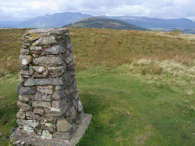 Photo could not load
NY4224 : Little Mell Fell Summit
Shaun Ferguson
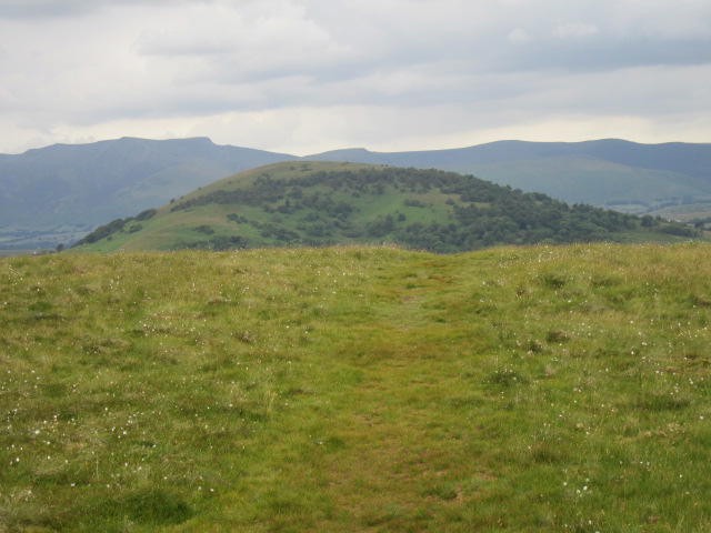 Photo could not load
NY4224 : Little Mell Fell summit
T Eyre
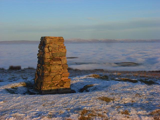 Photo could not load
NY4224 : Trig point, Little Mell Fell
Andrew Smith
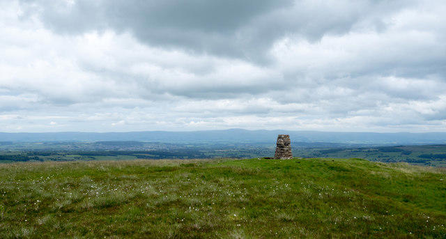 Photo could not load
NY4224 : Summit area of Little Mell Fell
Trevor Littlewood
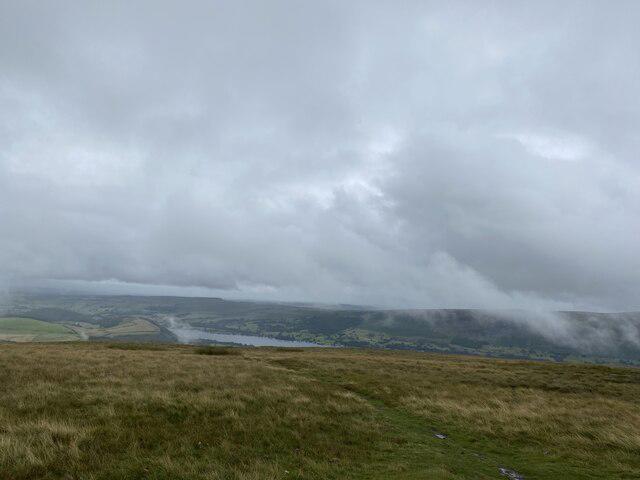 Photo could not load
NY4224 : Ullswater from Little Mell Fell
thejackrustles
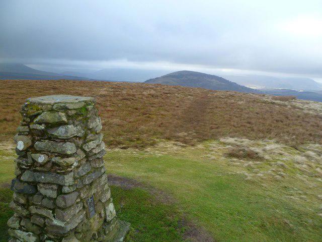 Photo could not load
NY4224 : On Little Mell Fell
Michael Graham
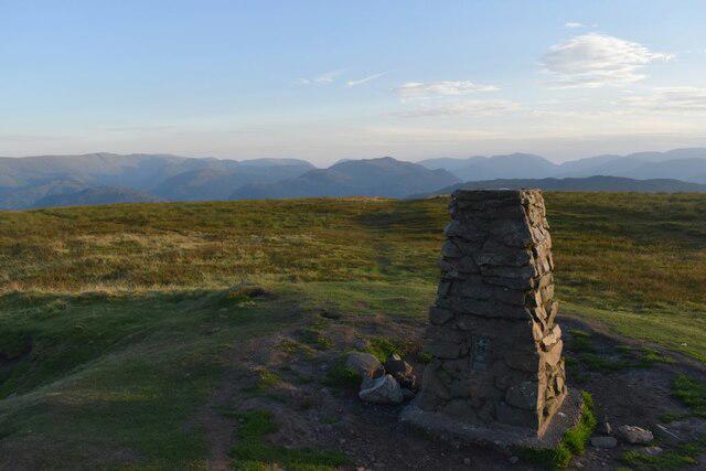 Photo could not load
NY4224 : Little Mell Fell Summit
Robert Struthers
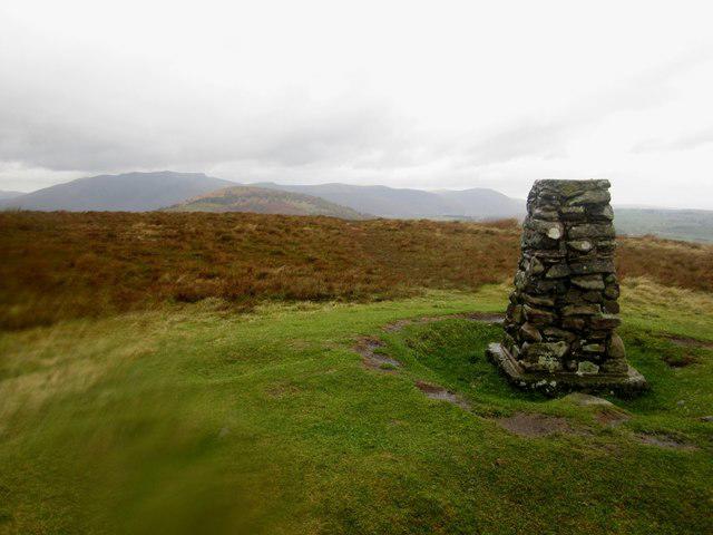 Photo could not load
NY4224 : Summit of Little Mell Fell
Graham Robson
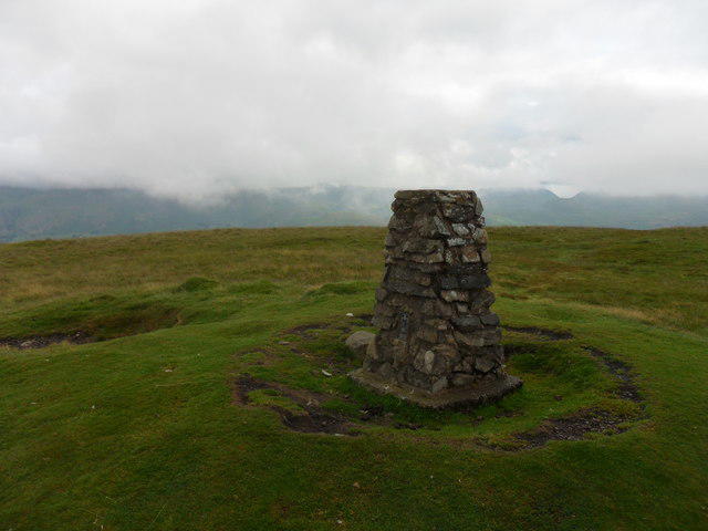 Photo could not load
NY4224 : Little Mell Fell Triangulation Pillar
Anthony Foster
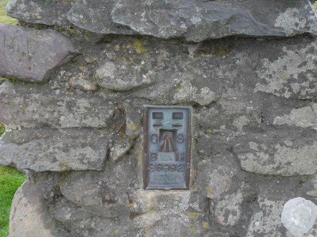
NY4224 : Flush Bracket, Little Mell Fell Triangulation Pillar
Anthony Foster
Hill facts and local notes
Classifications
Elevation
505m
1,657 ft
Prominence
225m
Coordinates
54.6080, -2.8945
NY423240
OS Map
90
Explorer: OL5S
At the Summit
The summit features a simple stone cairn, which provides a perfect photo opportunity against a backdrop of stunning views. A trig point can also be found, standing like a sentinel over the beautiful landscape.
Terrain & Geology
Little Mell Fell is primarily composed of volcanic rock, which offers a unique eroded landscape. The steep slopes are characteristic of the ancient lava flows, providing a fascinating study for geology enthusiasts.
Views & Scenery
Panoramic views of Ullswater, Helvellyn, and the surrounding fells, making this a photographer's dream (or the perfect excuse to insist on a coffee break at the summit).
History & Heritage
Name Origin
The name 'Mell' is derived from the Old Norse word for 'hill', a testimony perhaps to the fell's rugged yet inviting character.
Historical Significance
Little Mell Fell has been an important point of reference for local farmers and hikers for generations, providing access to some of the idyllic landscapes of the Lake District.
Getting There & Facilities
Parking
There is a small car park at the end of the road near Watermillock, approximately 200 meters from the trailhead.
Public Transport
Buses run from Penrith to Watermillock, making it accessible for those relying on public transport. Check local schedules.
Nearby Facilities
Nearby facilities include the Watermillock Hotel, which serves food and drink, and there are several public toilets located in Penrith.
Safety Information
Known Hazards
- Muddy paths in wetter months, potential for sudden weather changes common to the Lake District, so be prepared!
General Safety Tips
- Check weather conditions before setting out
- Carry appropriate clothing and equipment
- Let someone know your planned route
- Take a map, compass, and GPS device
- Carry emergency supplies: food, water, first aid kit, torch
Hills
Some common questions about the hills answered
Are there group walks up Little Mell Fell?
Many walkers use Walkmates to join or organise walks with others. You can check for group walks around Little Mell Fell through the maps
Are there other walkers around Little Mell Fell?
Activity varies by location and time, but Walkmates lets you see whether others have shared walks or shown interest in this area. Find other people through the walking friends search walking friends for Little Mell Fell search or of course create your own walk for Little Mell Fell
Can I organise a walk to Little Mell Fell?
Yes. If there aren’t any walks listed already, you can create a walk and make it available for others to join.
If you're signed up to Walkmates, you can create a walk to Little Mell Fell.
How do I find a walk up this hill?
There are often multiple ways to walk this hill, depending on experience and route preference. Walkmates helps you explore walks and routes that others have shared.
Can I suggest a new route up Little Mell Fell?
Yes. You can suggest or create routes to share with others. Walkmates focuses on the social side of walking, so routes are used to help people organise walks and explore areas together, rather than as detailed navigation tools or route libraries.
Other uses really appreciate knowledgeable walkers sharing their routes. Share your favourite route to Little Mell Fell here
The is an error or something incorrect about this hill. How do I let you know?
We always strive to keep the information on Walkmates as accurate as possible. If you find an error, please let us know through the contact form and we'll aim to correct it as quickly as possible
Community Discussion
Comments
Location
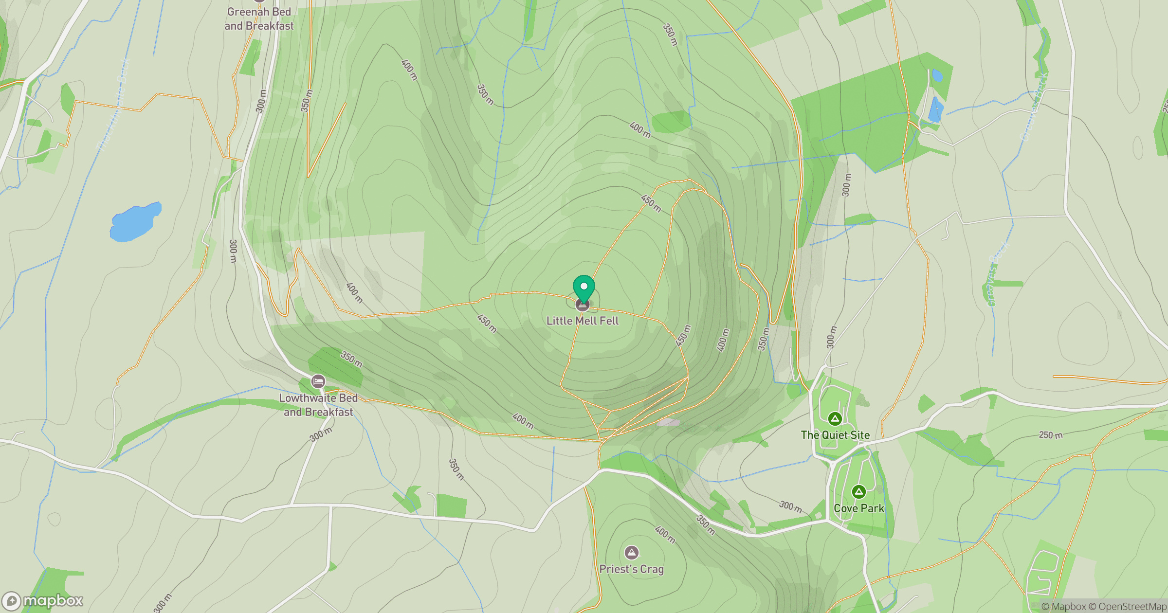
Grid reference: NY423240
View on OpenStreetMapOpens a map in a new tab, centred on the hill.


No comments yet. Be the first.