

Leathad an Taobhain
Good walks are even better shared.
NN8285 : Leathad an Taobhain summit trigpoint
Simon Waddicor Photo source
Overview
Leathad an Taobhain
Introduction
Leathad an Taobhain rises gracefully at 926 meters in the scenic Scottish Highlands. A Munro that is often overshadowed by its towering neighbours, it features a less trodden path that reveals stunning panoramas and tranquil surroundings. Its name, meaning 'The Slope of the Side', seems fitting as it rises gently, beckoning hikers to explore its beauty.
Geology
This mountain showcases the characteristic geology of the Highlands, primarily composed of schist and granite. As you trek along, you’ll notice the rugged textures and colours that change with the light, providing a feast for the eyes at every turn. Don’t forget your camera – these rocks are nothing short of photogenic!
Routes
One of the most popular routes starts from the Glen Falloch car park. This moderate trek, winding through lush greenery and alongside a sparkling river, is perfect for a family day out or a solo adventure. Just keep in mind that the old adage 'no good hike goes unpunished' might apply if you wander too close to those mud patches!
Distance and Time
- Distance: Approximately 14.5 km round trip
- Time: Expect to spend around 5.5 hours on this journey, with ample time to soak in the views at the summit.
Summit Features
The summit of Leathad an Taobhain is marked by a grand stone cairn that stands as a testament to all the hikers who have conquered this Munro. Take a moment to relish the panorama and maybe even contemplate life while battling the brisk Highland winds.
Terrain
The terrain is predominantly rocky and grassy, with some grassy slopes and the occasional tricky bog. It's advised to watch your step, especially if you’re wearing your fancy new hiking boots; they don’t appreciate a good mud bath!
Views
The views from Leathad an Taobhain are nothing less than spectacular. On a clear day, expecting to feast your eyes on majestic Ben More and the glacial valleys is a given. Ensure you pack a snack and a flask of your favourite brew; you’ll want to linger! The best time for these views is during late spring to early autumn when the visibility is at its peak.
Hazards
The unpredictability of Scottish weather can turn a perfectly sunny day into a rain-drenched adventure in no time. Be mindful of muddy paths post-rain and perhaps carry a snack to appease any hungry sheep you come across; they can be quite insistent!
Access
Accessing Leathad an Taobhain is fairly straightforward. The nearest parking area at Glen Falloch has ample space, but do arrive early to secure your spot during peak times. Public transport options may require a bit of planning, as the nearest bus drops you off in Crianlarich, followed by a taxi.
Nearby Facilities
Make sure to stop at the café in Crianlarich post-hike: nothing beats a hot cuppa and a slice of cake after a day spent embracing all that nature has to offer.
Conclusion
Leathad an Taobhain is a fantastic Munro that often goes unnoticed. For those who venture here, the rewards are plentiful. With breathtaking views, a variety of terrains, and a gentle ascent, it is ideal for hikers looking to expand their experience in the Scottish Highlands. Give it a go; just don’t forget to wear your adventurous spirit!
Explore routes near Leathad an Taobhain
Walks starting near this hill. Open a route to check its map, distance and full itinerary.
Glen Banvie Trail with the Bruar viewpoint
View route
Rothiemurchus: Beaver Trail and Lochan Mor
View route
Aviemore: Loch an Eilein and the Croft Track from Rothiemurchus
View route
Coire Ardair lochan from Aberarder and back
View route
Route planning notes
These notes describe possible approaches. Check a route's map and access information when planning your walk.
Glen Falloch access route
Starting from the car park at Glen Falloch, this route offers a scenic trek alongside the river before ascending up a well-defined path leading to the summit.
Make a day of it, together
Find someone to share the walk with, or organise a day out along a route you like.
Photo Gallery
View all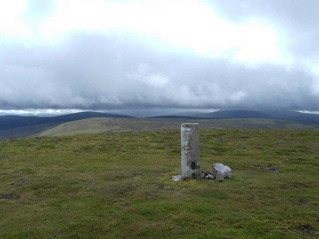 Photo could not load
NN8285 : Leathad an Taobhain summit trigpoint
Simon Waddicor
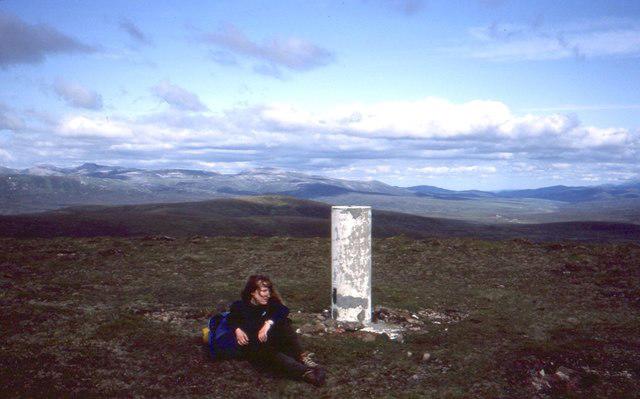 Photo could not load
NN8285 : Summit, Leathad an Taobhain
Richard Webb
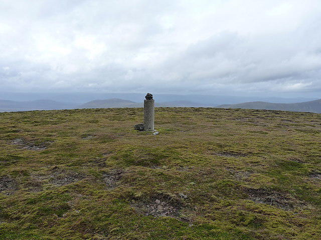 Photo could not load
NN8285 : Not so busy today
Richard Law
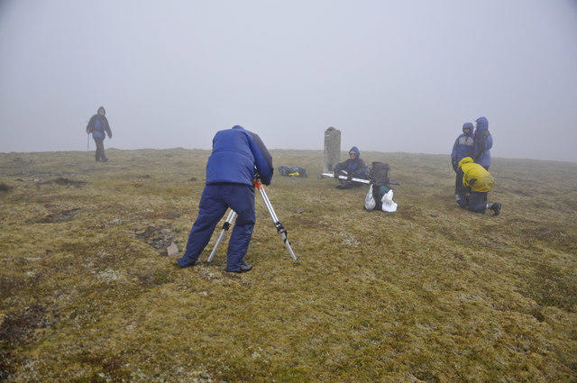 Photo could not load
NN8285 : The trig point at Point 912m, 10m higher than the adjacent Leathad an Taobhain
Iain A Robertson
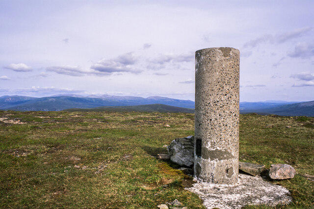 Photo could not load
NN8285 : Wind-clipped heath and trig point at summit of Leathad an Taobhain
Trevor Littlewood
Hill facts and local notes
Classifications
Elevation
912m
2,991 ft
Prominence
155m
Coordinates
56.9487, -3.9387
NN821858
OS Map
43
Explorer: OL51E 394E
At the Summit
The summit features a large stone cairn which provides an excellent vantage point, perfect for that all-important summit selfie.
Terrain & Geology
Leathad an Taobhain primarily comprises schist and granite, typical of the rugged Scottish Highlands, which lends itself to both stunning vistas and gritty scrambles.
Views & Scenery
From the summit, vistas include the glacial valleys of the Highlands, the distant lochs, and a panorama of surrounding peaks, including Ben More.
History & Heritage
Name Origin
The name 'Leathad an Taobhain' translates to 'The Slope of the Side', which pretty much sums up its gentle ascent towards the summit.
Historical Significance
Like many Munros, it holds a place in the hearts of Highland hikers both for its beauty and its challenging weather.
Getting There & Facilities
Parking
The closest parking can be found at the Glen Falloch car park (NN 651 245), which provides ample space but can fill up quickly on weekends.
Public Transport
The nearest bus service operates from Glasgow to Crianlarich, and from there, it's a short taxi ride to Glen Falloch.
Nearby Facilities
There are toilets at the Glen Falloch car park, and you might find a lovely café in Crianlarich for post-hike treats.
Safety Information
Known Hazards
- Unpredictable weather can change rapidly, mudslides after heavy rain, and the occasional wayward sheep that might take a liking to your sandwich.
General Safety Tips
- Check weather conditions before setting out
- Carry appropriate clothing and equipment
- Let someone know your planned route
- Take a map, compass, and GPS device
- Carry emergency supplies: food, water, first aid kit, torch
Hills
Some common questions about the hills answered
Are there group walks up Leathad an Taobhain?
Many walkers use Walkmates to join or organise walks with others. You can check for group walks around Leathad an Taobhain through the maps
Are there other walkers around Leathad an Taobhain?
Activity varies by location and time, but Walkmates lets you see whether others have shared walks or shown interest in this area. Find other people through the walking friends search walking friends for Leathad an Taobhain search or of course create your own walk for Leathad an Taobhain
Can I organise a walk to Leathad an Taobhain?
Yes. If there aren’t any walks listed already, you can create a walk and make it available for others to join.
If you're signed up to Walkmates, you can create a walk to Leathad an Taobhain.
How do I find a walk up this hill?
There are often multiple ways to walk this hill, depending on experience and route preference. Walkmates helps you explore walks and routes that others have shared.
Can I suggest a new route up Leathad an Taobhain?
Yes. You can suggest or create routes to share with others. Walkmates focuses on the social side of walking, so routes are used to help people organise walks and explore areas together, rather than as detailed navigation tools or route libraries.
Other uses really appreciate knowledgeable walkers sharing their routes. Share your favourite route to Leathad an Taobhain here
The is an error or something incorrect about this hill. How do I let you know?
We always strive to keep the information on Walkmates as accurate as possible. If you find an error, please let us know through the contact form and we'll aim to correct it as quickly as possible
Community Discussion
Comments
Location
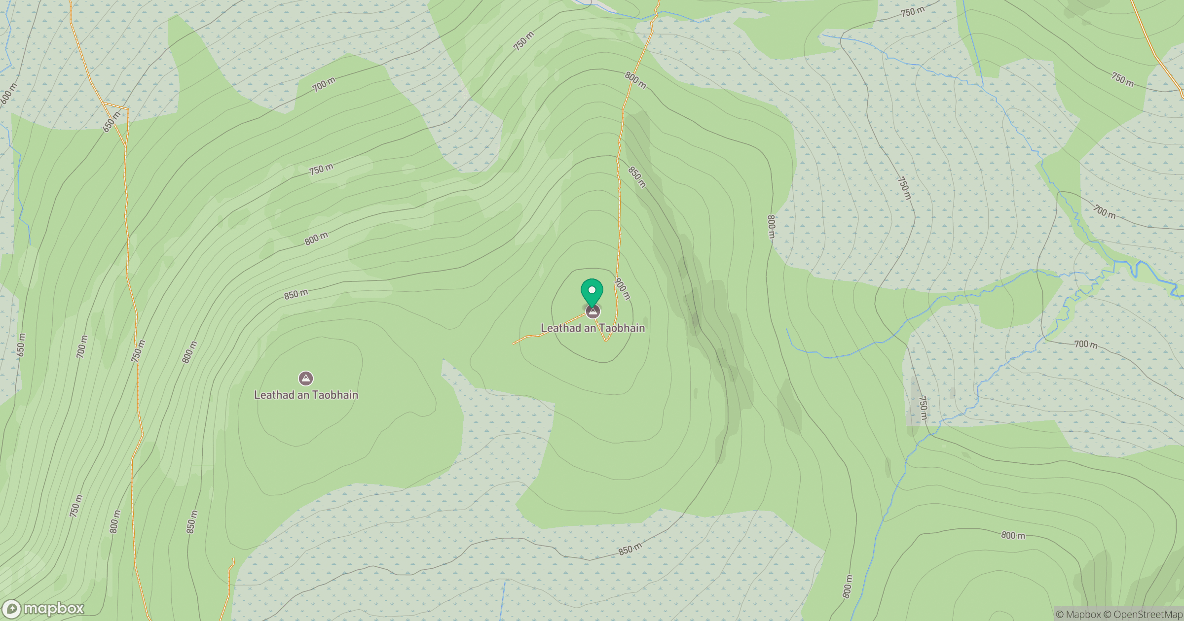
Grid reference: NN821858
View on OpenStreetMapOpens a map in a new tab, centred on the hill.
No comments yet. Be the first.