

Killiney Hill
Good walks are even better shared.
O2625 : Water Pillar
kevin higgins Photo source
Overview
Killiney Hill rises to 153.5 m above the coast of south County Dublin, Ireland. Its obelisk and rocky summit area overlook Killiney Bay, Dublin Bay and the Wicklow Mountains. Woodland paths link it with the separate Dalkey Hill in Killiney Hill Park; the two-hill circuit includes steps and short steep sections.
Killiney Hill
Killiney Hill is a 153.5 m coastal hill in south County Dublin, Ireland, overlooking Killiney Bay. Its woodland paths, exposed rock and obelisk form part of Killiney Hill Park. Dalkey Hill, immediately to the north, is a separate summit within the same park.
Summit and views
The obelisk is the best-known landmark in the summit area. The stepped pyramid or Wishing Stone is nearby, rather than a separate hilltop to climb. The summit is recorded at Irish grid O260255. Enjoy the monuments from ground level.
Views extend over Dublin Bay, the Irish Sea, Bray Head and the Wicklow Mountains; exceptionally clear air may reveal the Welsh coast. Visibility depends on weather, not a guaranteed season.
Complete return walk
The Dalkey and Killiney Hill circuit starts and finishes at the main car park off Burton Road. It climbs through park woodland to Killiney’s obelisk, continues towards Dalkey Hill and returns beside Dalkey Quarry. AllTrails’ exact circuit is 2.9 km with 120 m ascent, graded Moderate, with 1–1.5 hours estimated before longer stops. Use its route map alongside the park signs.
Station approaches add walking before and after this circuit. The frequently quoted 700 m short outing visits Dalkey Hill only; it is not this Killiney summit circuit.
Access and facilities
The main car-park entrance is via Burton Road off Dalkey Avenue. Spaces can fill; do not assume parking is plentiful. DART serves Dalkey and Killiney, with uphill street approaches to the park. Route 59 links Dún Laoghaire and Killiney Hill. Check current services and include the return to your station or bus stop.
There is a playground, a café at the tea rooms and council-listed public toilets. Café and toilet availability depend on operating hours. The current council park webpage labels access as open; the visitor map reproduced in its management plan says dawn to dusk. Plan a daylight visit and follow signs and any temporary restrictions. Paths to the summits include steps and steep sections.
Geology and history
GSI describes 405-million-year-old Leinster Granite sculpted by Ice Age glaciers. Smooth abraded rock and rough plucked faces form roches moutonnées at the scale of individual outcrops and the hill itself. Aplite and pegmatite veins add geological interest. Leave rocks and minerals in place.
John Mapas built the obelisk in 1742 to provide employment during severe hardship. The pyramid dates from 1852, and the public park was dedicated in 1887 as Victoria Hill. Granite from neighbouring Dalkey Quarry helped build Dún Laoghaire Harbour and was transported along the Metals. Killiney’s name refers to the church of the daughters of Léinín.
Walking safely and caring for the park
Wet steps, rock, leaves and mud can be slippery. Keep well back from quarry edges and steep slopes, supervise children and dogs, and do not use climbing routes as walking shortcuts. Open hilltops can be windy; mist can obscure the views and junctions.
Stay on paths and protect woodland, heath and wildlife. The published park by-laws exempt Killiney from the general dog-leash rule, but dogs must remain controlled and waste must be removed. Obey all local restrictions, including leads around any conservation-grazing areas. Do not light fires or barbecues.
Other nearby hills
Carrickgollogan (275.2 m), Two Rock Mountain / Fairy Castle (536 m), and Great Sugar Loaf (501.2 m) are separate walks. Dalkey Hill and its tower are the neighbouring features included in the park circuit.
References
Explore routes near Killiney Hill
Walks starting near this hill. Open a route to check its map, distance and full itinerary.
Route planning notes
These notes describe possible approaches. Check a route's map and access information when planning your walk.
Dalkey and Killiney Hill circuit from Burton Road car park
Start and finish at the main Killiney Hill car park, reached from Burton Road. Follow the mapped park paths past the playground and through woodland to Killiney Hill’s obelisk summit area. Continue towards Dalkey Hill, passing the Thomas Higgin Memorial, then return along the paths beside Dalkey Quarry to the same car park. AllTrails gives this complete circuit as 2.9 km with 120 m ascent and 1–1.5 hours; allow longer for stops. Steps, steep inclines and quarry edges require care.
Make a day of it, together
Find someone to share the walk with, or organise a day out along a route you like.
Photo Gallery
View all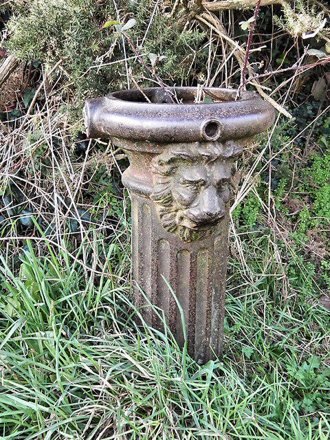 Photo could not load
O2625 : Water Pillar
kevin higgins
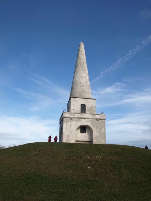 Photo could not load
O2625 : Monument in Victoria Park, Killiney
Andrew Abbott
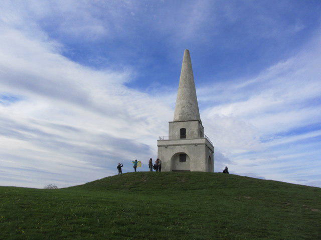 Photo could not load
O2625 : Mount Mapas Obelisk, Victoria Hill, Killiney
Colin Park
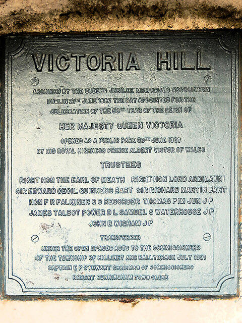 Photo could not load
O2625 : Plaque
kevin higgins
Hill facts and local notes
Classifications
Elevation
154m
504 ft
Prominence
117m
Coordinates
53.2656, -6.1119
O260255
OS Map
50
At the Summit
The prominent 1742 obelisk is the landmark in Killiney Hill’s summit area. The nearby stepped pyramid, also known as the Wishing Stone, is a separate monument; Dalkey Hill and its tower are a different summit to the north. Enjoy the views from ground level and do not climb the monuments.
Terrain & Geology
Killiney Hill exposes Leinster Granite formed about 405 million years ago. Ice moving northwest to southeast during the last Ice Age sculpted the hill and smaller outcrops into roches moutonnées, with smoother abraded sides and rougher plucked sides. Aplite and pegmatite veins cut the granite. The geological site is also known for killinite, named after Killiney; leave rocks and minerals undisturbed.
Views & Scenery
Views take in Dublin and Dublin Bay to the northwest, the Irish Sea to the east, and Killiney Bay, Bray Head and the Wicklow Mountains to the south. Distant Welsh mountains may be visible in exceptionally clear conditions.
History & Heritage
Name Origin
Killiney comes from Cill Iníon Léinín, meaning “church of the daughters of Léinín”, referring to the district’s ancient church. The hill is also known in Irish as Cnoc Chill Iníon Léinín.
Historical Significance
John Mapas erected the obelisk in 1742 as an employment project during a period of severe hardship. Robert Warren added the stepped pyramid in 1852. The park was dedicated to public use in 1887 as Victoria Hill for Queen Victoria’s Jubilee. Nearby Dalkey Quarry supplied granite for Dún Laoghaire Harbour, carried on the route now known as the Metals.
Getting There & Facilities
Parking
The main Killiney Hill car park is reached from Burton Road off Dalkey Avenue. It can fill at busy times, especially weekends; parking by the tea rooms is very limited. Use marked spaces, keep entrances clear and follow current signs. The hill car park is separate from Killiney DART station and beach parking.
Public Transport
DART trains serve Dalkey and Killiney. The council gives approximate walks to the park of 15 minutes from Dalkey station and 25 minutes from Killiney station, before the hill walk itself. Go-Ahead Ireland route 59 connects Dún Laoghaire and Killiney Hill. Check Irish Rail and the bus operator for current services, and allow time to walk back to your station or stop.
Nearby Facilities
The park has a playground and a café at the tea rooms, currently operated by Mister Magpie Coffee. The council lists public toilets at Killiney Hill Tea Rooms; opening is subject to operating hours, maintenance and events. The park is free to visit. Some approaches have steps and steep gradients, so an accessible entrance does not make every summit route step-free.
Safety Information
Known Hazards
- Stone steps, uneven rock and steep paths can be slippery when wet. Wear footwear with good grip and choose a route suited to your mobility.
- Keep well back from the sheer edges of Dalkey Quarry and steep coastal slopes. Closely supervise children and dogs; the quarry’s climbing routes are not walking shortcuts.
- The open hilltops can be windy and views can disappear in mist. Use a map at path junctions and plan the circuit in daylight.
- Keep dogs under close control, clean up waste, and follow local lead or exclusion signs, especially around any conservation-grazing areas. Stay on paths to protect wildlife and vegetation.
Seasonal Hazards
Wet leaves, mud, frost and rain increase the slipping risk on steps and rock. Gorse and heath can be vulnerable to wildfire in dry weather; do not light fires or barbecues, and obey temporary closures.
General Safety Tips
- Check weather conditions before setting out
- Carry appropriate clothing and equipment
- Let someone know your planned route
- Take a map, compass, and GPS device
- Carry emergency supplies: food, water, first aid kit, torch
Hills
Some common questions about the hills answered
Are there group walks up Killiney Hill?
Many walkers use Walkmates to join or organise walks with others. You can check for group walks around Killiney Hill through the maps
Are there other walkers around Killiney Hill?
Activity varies by location and time, but Walkmates lets you see whether others have shared walks or shown interest in this area. Find other people through the walking friends search walking friends for Killiney Hill search or of course create your own walk for Killiney Hill
Can I organise a walk to Killiney Hill?
Yes. If there aren’t any walks listed already, you can create a walk and make it available for others to join.
If you're signed up to Walkmates, you can create a walk to Killiney Hill.
How do I find a walk up this hill?
There are often multiple ways to walk this hill, depending on experience and route preference. Walkmates helps you explore walks and routes that others have shared.
Can I suggest a new route up Killiney Hill?
Yes. You can suggest or create routes to share with others. Walkmates focuses on the social side of walking, so routes are used to help people organise walks and explore areas together, rather than as detailed navigation tools or route libraries.
Other uses really appreciate knowledgeable walkers sharing their routes. Share your favourite route to Killiney Hill here
The is an error or something incorrect about this hill. How do I let you know?
We always strive to keep the information on Walkmates as accurate as possible. If you find an error, please let us know through the contact form and we'll aim to correct it as quickly as possible
Community Discussion
Comments
Location
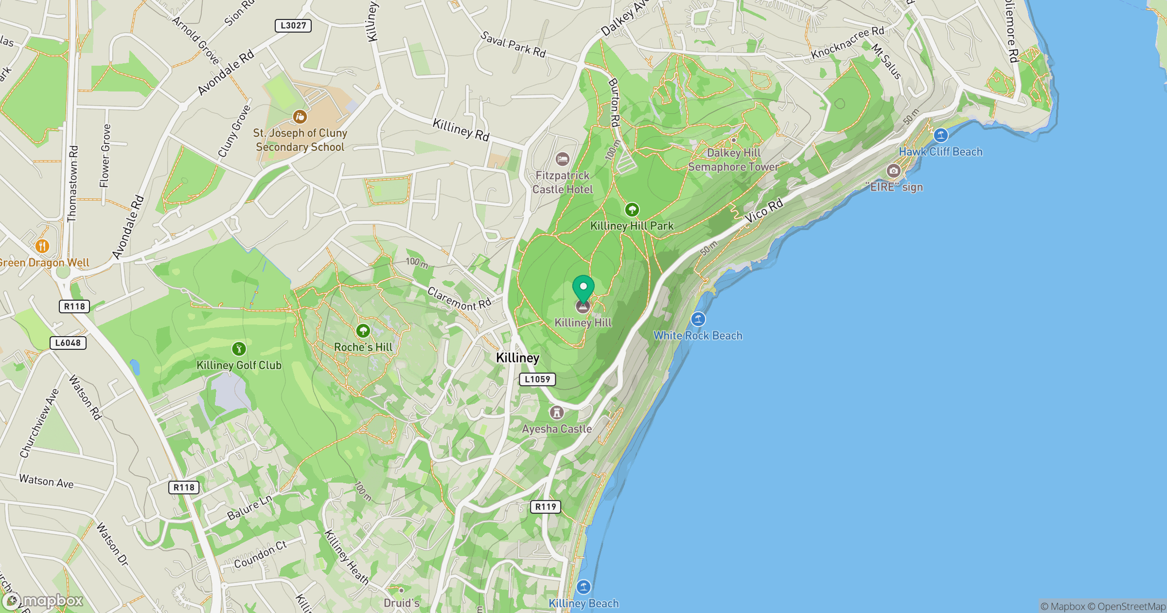
Grid reference: O260255
View on OpenStreetMapOpens a map in a new tab, centred on the hill.
Nearby Hills
Mullaghcleevaun
847m
Lugnaquilla [Log na Coille]
925m
Slieve Foye
587m
Slieve Binnian
746m
Slievelamagan
702m
No comments yet. Be the first.