

Bray Head Hill
Good walks are even better shared.
O2815 : Ballynamuddagh Triangulation Pillar
Rossographer Photo source
Overview
Bray Head Hill is a 238.9 m coastal hill in County Wicklow, south of Bray. Its true summit is a trig point on a rocky rise farther south along the headland than the familiar Bray Head Cross. A northern approach visits the cross before continuing to the trig and returning the same way. The waymarked Bray Head Loop passes below the true summit. The lower Bray–Greystones Cliff Walk is closed because of landslides; use the upper routes and obey closure barriers.
Bray Head Hill
Overview
Bray Head Hill is a 238.9 m coastal hill in County Wicklow, south of Bray. Its true summit is a trig point on a rocky rise farther south along the headland than the familiar Bray Head Cross. A northern approach visits the cross before continuing to the trig and returning the same way. The waymarked Bray Head Loop passes below the true summit. The lower Bray–Greystones Cliff Walk is closed because of landslides; use the upper routes and obey closure barriers.
Summit and views
The true high point is the trig point at O282158, on a rocky rise in the southern part of the headland. The familiar Bray Head Cross stands on a lower northern viewpoint. Continuing beyond the cross is necessary to reach the trig summit.
In clear weather the upper headland gives wide views along the east coast and across Dublin Bay, with the Irish Sea to the east and Wicklow hills inland. The lower cross viewpoint overlooks Bray and its seafront.
Walking routes
Bray Head trig summit from Raheen Park, same-way return
Start and finish at Raheen Park car park at the southern end of Bray seafront. Take the established northern uphill path through the trees towards Bray Head Cross, with care on the steep, eroded and rocky upper section. From the cross, continue south along the upper headland path, beyond the intervening knolls, to the rocky trig summit at O282158. Use existing gates and respect current access signs; turn back if access is closed. Return by the same upper path via the cross, then descend the northern approach to Raheen Park. Do not descend onto the closed Bray–Greystones Cliff Walk or attempt to bypass its barriers.
Waymarked Bray Head Loop, without the trig summit
Start and finish at the steps off the Vevay Road/Southern Cross Road roundabout in Bray (O2709416851). Follow the red arrows through Manweiler’s Wood, climbing close to the cross, then continue south on the upper headland path above the coast. Follow the waymarked route inland towards Lower Windgates and Ballynamuddagh Road, then take the public footpath beside the R761 back to the starting roundabout. Sport Ireland gives 5.9 km, 120 m ascent and about 1.5 hours for this complete loop. Its mapped line passes below the trig summit; a summit detour or a promenade start is a different outing. Stay on the upper loop and roadside return rather than following a downhill path onto the closed Cliff Walk. Keep dogs on leads around grazing cattle.
Terrain and safety
Steep woodland paths on the northern ascent, eroded dirt paths and rocky steps near the cross, rough grass and rock on the upper headland, farm tracks and gates, surfaced roadside footpath on the official loop’s R761 return
The Bray–Greystones Cliff Walk is closed because of landslides and unstable ground. Wicklow County Council’s 2 September 2026 update confirms the closure; its live notice still said there was no through route when checked on 17 October 2026. Obey barriers and do not use the lower cliff path as a return route.
The ascent to the cross is steep and heavily eroded in places. Mud, wet rock and uneven steps can be slippery, and some rocky sections require hands for balance. Wear footwear with good grip and allow time for the descent.
The upper headland is exposed to coastal wind and weather. Keep well back from cliff edges and do not descend into railway cuttings or onto the tracks.
Upper paths cross grazing farmland. Keep dogs on leads, use existing gates and follow current access signs. If an intended path or gate is closed, turn back rather than crossing fences or making a shortcut.
The true trig summit lies beyond the cross. Follow the established upper path and identify the summit spur carefully; the intervening knolls are not the high point.
Access and facilities
Raheen Park car park, at the southern end of Bray seafront, serves the northern hill approach. Check current parking signs and keep entrances clear. Bray (Daly) station has a separately managed, charged car park on Florence Road; walking from the station adds an approach through the town and along the seafront.
Bray (Daly) station on Florence Road is served by DART and Dublin commuter trains. Walk through Bray to the seafront and then south to the northern hill approach. Allow for this extra walk when planning the outing and check Irish Rail or Transport for Ireland for current services.
Bray has cafés and other town services. Bray (Daly) station lists toilets, refreshments and a water-refill unit. These are town facilities, so bring food and drinking water for the hill.
Geology and habitat
Bray Head is formed from Cambrian rocks of the Bray Group. Geological Survey Ireland describes greywacke slate and resistant quartzite, with quartzite forming the prominent ridges. The headland is an important locality for Oldhamia trace fossils, evidence of ancient animal activity preserved in the rock.
Bray Head Cross is a separate northern viewpoint. Manweiler’s Wood lies on the western approach to the waymarked loop. The headland includes Bray Head Special Area of Conservation, protected for its vegetated sea cliffs and dry heath. The lower coastal path and railway run beneath the upper walking routes.
Nearby hills
Little Sugar Loaf (342.4 m), Great Sugar Loaf (501.2 m) and Carrickgollogan (275.2 m) are nearby hills. Each requires its own route planning.
History
The cross on the lower northern viewpoint was erected for the Holy Year in 1950. The De Buitléar Way opened in May 2014 in memory of Bray filmmaker and conservationist Éamon de Buitléar.
Explore routes near Bray Head Hill
Walks starting near this hill. Open a route to check its map, distance and full itinerary.
Route planning notes
These notes describe possible approaches. Check a route's map and access information when planning your walk.
Bray Head trig summit from Raheen Park, same-way return
Start and finish at Raheen Park car park at the southern end of Bray seafront. Take the established northern uphill path through the trees towards Bray Head Cross, with care on the steep, eroded and rocky upper section. From the cross, continue south along the upper headland path, beyond the intervening knolls, to the rocky trig summit at O282158. Use existing gates and respect current access signs; turn back if access is closed. Return by the same upper path via the cross, then descend the northern approach to Raheen Park. Do not descend onto the closed Bray–Greystones Cliff Walk or attempt to bypass its barriers.
Waymarked Bray Head Loop, without the trig summit
Start and finish at the steps off the Vevay Road/Southern Cross Road roundabout in Bray (O2709416851). Follow the red arrows through Manweiler’s Wood, climbing close to the cross, then continue south on the upper headland path above the coast. Follow the waymarked route inland towards Lower Windgates and Ballynamuddagh Road, then take the public footpath beside the R761 back to the starting roundabout. Sport Ireland gives 5.9 km, 120 m ascent and about 1.5 hours for this complete loop. Its mapped line passes below the trig summit; a summit detour or a promenade start is a different outing. Stay on the upper loop and roadside return rather than following a downhill path onto the closed Cliff Walk. Keep dogs on leads around grazing cattle.
Make a day of it, together
Find someone to share the walk with, or organise a day out along a route you like.
Photo Gallery
View all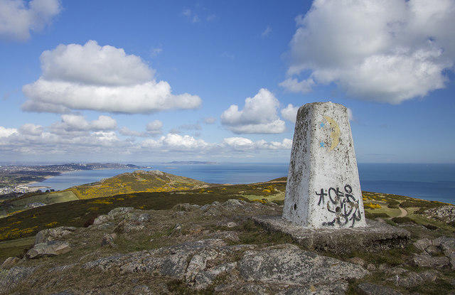 Photo could not load
O2815 : Ballynamuddagh Triangulation Pillar
Rossographer
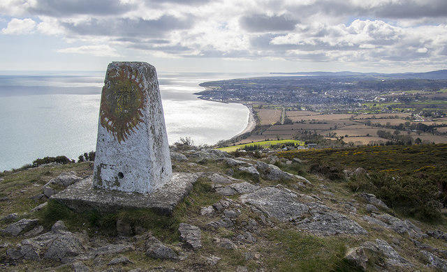 Photo could not load
O2815 : Ballynamuddagh Triangulation Pillar
Rossographer
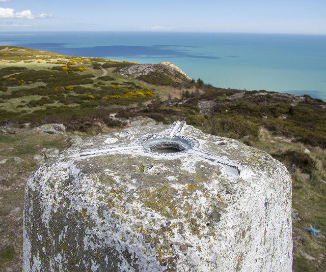 Photo could not load
O2815 : Spider, Ballynamuddagh Triangulation Pillar
Rossographer
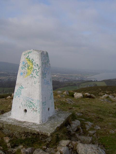 Photo could not load
O2815 : Bray Head Triangulation Pillar
David Quinn
Hill facts and local notes
Classifications
Elevation
239m
784 ft
Prominence
126m
Coordinates
53.1777, -6.0828
O282158
OS Map
56
At the Summit
The true high point is the trig point at O282158, on a rocky rise in the southern part of the headland. The familiar Bray Head Cross stands on a lower northern viewpoint. Continuing beyond the cross is necessary to reach the trig summit.
Terrain & Geology
Bray Head is formed from Cambrian rocks of the Bray Group. Geological Survey Ireland describes greywacke slate and resistant quartzite, with quartzite forming the prominent ridges. The headland is an important locality for Oldhamia trace fossils, evidence of ancient animal activity preserved in the rock.
Views & Scenery
In clear weather the upper headland gives wide views along the east coast and across Dublin Bay, with the Irish Sea to the east and Wicklow hills inland. The lower cross viewpoint overlooks Bray and its seafront.
History & Heritage
Historical Significance
The cross on the lower northern viewpoint was erected for the Holy Year in 1950. The De Buitléar Way opened in May 2014 in memory of Bray filmmaker and conservationist Éamon de Buitléar.
Getting There & Facilities
Parking
Raheen Park car park, at the southern end of Bray seafront, serves the northern hill approach. Check current parking signs and keep entrances clear. Bray (Daly) station has a separately managed, charged car park on Florence Road; walking from the station adds an approach through the town and along the seafront.
Public Transport
Bray (Daly) station on Florence Road is served by DART and Dublin commuter trains. Walk through Bray to the seafront and then south to the northern hill approach. Allow for this extra walk when planning the outing and check Irish Rail or Transport for Ireland for current services.
Nearby Facilities
Bray has cafés and other town services. Bray (Daly) station lists toilets, refreshments and a water-refill unit. These are town facilities, so bring food and drinking water for the hill.
Safety Information
Known Hazards
- The Bray–Greystones Cliff Walk is closed because of landslides and unstable ground. Wicklow County Council’s 2 September 2026 update confirms the closure; its live notice still said there was no through route when checked on 17 October 2026. Obey barriers and do not use the lower cliff path as a return route.
- The ascent to the cross is steep and heavily eroded in places. Mud, wet rock and uneven steps can be slippery, and some rocky sections require hands for balance. Wear footwear with good grip and allow time for the descent.
- The upper headland is exposed to coastal wind and weather. Keep well back from cliff edges and do not descend into railway cuttings or onto the tracks.
- Upper paths cross grazing farmland. Keep dogs on leads, use existing gates and follow current access signs. If an intended path or gate is closed, turn back rather than crossing fences or making a shortcut.
- The true trig summit lies beyond the cross. Follow the established upper path and identify the summit spur carefully; the intervening knolls are not the high point.
General Safety Tips
- Check weather conditions before setting out
- Carry appropriate clothing and equipment
- Let someone know your planned route
- Take a map, compass, and GPS device
- Carry emergency supplies: food, water, first aid kit, torch
Hills
Some common questions about the hills answered
Are there group walks up Bray Head Hill?
Many walkers use Walkmates to join or organise walks with others. You can check for group walks around Bray Head Hill through the maps
Are there other walkers around Bray Head Hill?
Activity varies by location and time, but Walkmates lets you see whether others have shared walks or shown interest in this area. Find other people through the walking friends search walking friends for Bray Head Hill search or of course create your own walk for Bray Head Hill
Can I organise a walk to Bray Head Hill?
Yes. If there aren’t any walks listed already, you can create a walk and make it available for others to join.
If you're signed up to Walkmates, you can create a walk to Bray Head Hill.
How do I find a walk up this hill?
There are often multiple ways to walk this hill, depending on experience and route preference. Walkmates helps you explore walks and routes that others have shared.
Can I suggest a new route up Bray Head Hill?
Yes. You can suggest or create routes to share with others. Walkmates focuses on the social side of walking, so routes are used to help people organise walks and explore areas together, rather than as detailed navigation tools or route libraries.
Other uses really appreciate knowledgeable walkers sharing their routes. Share your favourite route to Bray Head Hill here
The is an error or something incorrect about this hill. How do I let you know?
We always strive to keep the information on Walkmates as accurate as possible. If you find an error, please let us know through the contact form and we'll aim to correct it as quickly as possible
Community Discussion
Comments
Location
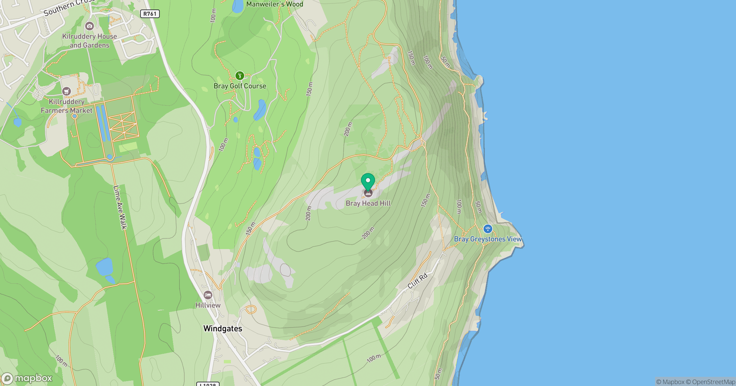
Grid reference: O282158
View on OpenStreetMapOpens a map in a new tab, centred on the hill.
Nearby Hills
Mullaghcleevaun
847m
Lugnaquilla [Log na Coille]
925m
Slieve Foye
587m
Slieve Binnian
746m
Slievelamagan
702m
No comments yet. Be the first.