

Great Sugar Loaf
Good walks are even better shared.
O2312 : Great Sugar Loaf (south west)
Carroll Pierce Photo source
Overview
Great Sugar Loaf rises to 501.2 m above Kilmacanogue in County Wicklow. Its distinctive quartzite cone stands apart from the main Wicklow uplands, with wide coastal views in clear weather. The short southern approach starts at Red Lane; a longer approach follows the Sugar Loaf Way from Kilmacanogue. Restored stone steps opened in May 2025, but the steep, rocky upper cone still requires sure-footedness and care on descent.
Great Sugar Loaf
Overview
Great Sugar Loaf rises to 501.2 m above Kilmacanogue in County Wicklow. Its distinctive quartzite cone stands apart from the main Wicklow uplands, with wide coastal views in clear weather. The short southern approach starts at Red Lane; a longer approach follows the Sugar Loaf Way from Kilmacanogue. Restored stone steps opened in May 2025, but the steep, rocky upper cone still requires sure-footedness and care on descent.
Summit
A rock outcrop marks the 501.2 m summit of the quartzite cone at Irish grid reference O237130.
Red Lane: complete summit return
Start at the Great Sugar Loaf car park on Red Lane (L1031), beneath the concrete arch. Follow the main southern path across the open lower slopes towards the cone, then use the restored stepped line for the steep upper ascent to the summit outcrop. Descend carefully by the same southern path to the Red Lane car park. Allow roughly one to two hours for the complete return, depending on pace and stops, with longer in difficult conditions. The upper section remains steep and rocky despite the 2025 restoration. Keep to the designated path rather than the eroded gullies.
Kilmacanogue: complete summit return
Start at the 1916 Commemorative Garden in Kilmacanogue. Follow the Sugar Loaf Way signs across the R755 and along the lanes of the old Car Road, then climb through open grazing towards the junction with the southern summit path. Leave the linear Way at this junction and follow the designated stepped summit path to the outcrop. Return down the same summit path to the junction, then retrace the Sugar Loaf Way and lanes to the 1916 garden. This is a longer outing than the Red Lane ascent, with road crossings, uneven mountain paths and the same steep upper cone. The advertised Kilmacanogue-to-Red Lane linear-trail distance does not include this full summit return.
Terrain and safety
Open grassy lower slopes, mountain paths, restored stone steps and drainage on the southern ascent, steep rocky quartzite upper cone, loose scree beside the path. The restoration officially opened on 21 May 2025. Follow the designated stepped route and avoid eroded gullies and recovering vegetation.
The upper cone is steep and rocky, with stone steps and uneven ground. Be prepared to use hands for balance on rough sections and take particular care descending; wet or icy rock can be slippery.
The summit is exposed to wind and rapidly changing weather. Carry suitable footwear, waterproofs, warm layers, food, water and navigation equipment; turn back if conditions exceed your ability. Wet weather can make stone steps and quartzite slippery, while snow or ice can make the steep cone substantially more difficult. Strong wind and low cloud can affect the summit in any season. Check the forecast, daylight and on-site notices before starting.
Access and conservation
Keep to the restored path and respect signs, barriers and habitat-recovery areas. Do not shortcut across scree or fragile vegetation. Dogs must be kept on leads. The longer Kilmacanogue approach crosses open grazing and includes road crossings; follow waymarks and use care around traffic and livestock. Follow any current local access notices; the May 2025 opening records completion of the works, not a guarantee of present-day conditions.
Parking and public transport
The standard southern start is the Great Sugar Loaf car park on Red Lane (L1031), entered beneath a concrete arch, at 53.144956, -6.155013. The car park was upgraded as part of the restoration opened in May 2025. For the longer village approach, use the public parking beside Kilmacanogue’s 1916 Commemorative Garden, rather than a business’s private parking. Follow current signs and keep the narrow approach road and entrances clear. Bus Éireann route 133 links Dublin and Wicklow and stops in Kilmacanogue. Check the operator’s current timetable and plan the return service before walking. The village is a start for the longer Sugar Loaf Way approach; its bus stop is not at the Red Lane summit-path car park.
Facilities
The 2025 restoration added landscaped picnic areas on the lower slopes. Kilmacanogue has shops and places to eat or drink; check opening hours before relying on them. Bring food and water for the complete walk and check toilet availability before setting out.
Views
In clear weather, the summit overlooks the Wicklow coast and Irish Sea, Dublin and the surrounding Wicklow Mountains. Exceptionally clear conditions can reveal the mountains of Wales across the Irish Sea.
Geology
Great Sugar Loaf is formed mainly from Cambrian quartzite of the Bray Head Formation, with greywacke and quartzite on its southern and southwestern slopes. The resistant quartzite forms its distinctive cone, contrasting with the rounded granite mountains to the west. Angular scree on the upper slopes was produced by freeze-thaw weathering.
Names and history
The English name refers to the mountain’s resemblance to a traditional conical sugarloaf. Its Irish name is Ó Cualann. The precise interpretation is debated: MountainViews suggests “youth of Cualu/Cualainn”, rather than treating a single translation as certain. The Sugar Loaf Way uses part of the old coach road from Kilmacanogue towards Roundwood, known locally as the Car Road. The modern trail was developed with support from the commonage holders and local organisations. A further path-and-habitat restoration project was officially opened on 21 May 2025 after severe erosion had affected the mountain.
Nearby
Kilmacanogue lies below the northern and eastern approaches. Little Sugar Loaf is a separate hill across the Kilmacanogue valley and N11 corridor. The Sugar Loaf Way is a linear linking trail; walking it between Kilmacanogue and Red Lane is not the same as completing a summit return.
Explore routes near Great Sugar Loaf
Walks starting near this hill. Open a route to check its map, distance and full itinerary.
Route planning notes
These notes describe possible approaches. Check a route's map and access information when planning your walk.
Red Lane summit path and back
Start at the Great Sugar Loaf car park on Red Lane (L1031), beneath the concrete arch. Follow the main southern path across the open lower slopes towards the cone, then use the restored stepped line for the steep upper ascent to the summit outcrop. Descend carefully by the same southern path to the Red Lane car park. Allow roughly one to two hours for the complete return, depending on pace and stops, with longer in difficult conditions. The upper section remains steep and rocky despite the 2025 restoration. Keep to the designated path rather than the eroded gullies.
Kilmacanogue via Sugar Loaf Way and back
Start at the 1916 Commemorative Garden in Kilmacanogue. Follow the Sugar Loaf Way signs across the R755 and along the lanes of the old Car Road, then climb through open grazing towards the junction with the southern summit path. Leave the linear Way at this junction and follow the designated stepped summit path to the outcrop. Return down the same summit path to the junction, then retrace the Sugar Loaf Way and lanes to the 1916 garden. This is a longer outing than the Red Lane ascent, with road crossings, uneven mountain paths and the same steep upper cone. The advertised Kilmacanogue-to-Red Lane linear-trail distance does not include this full summit return.
Make a day of it, together
Find someone to share the walk with, or organise a day out along a route you like.
Photo Gallery
View all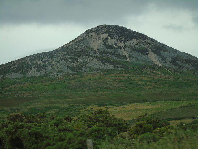 Photo could not load
O2312 : Great Sugar Loaf (south west)
Carroll Pierce
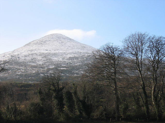 Photo could not load
O2313 : The Great Sugar Loaf, County Wicklow
Sarah777
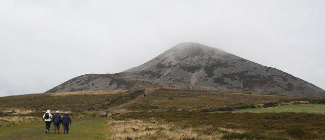 Photo could not load
O2312 : Sugarloaf Mountain
Alan James
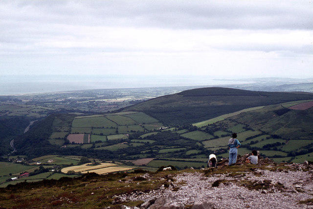 Photo could not load
O2313 : On the summit of Great Sugar Loaf, Co. Wicklow
Colin Park
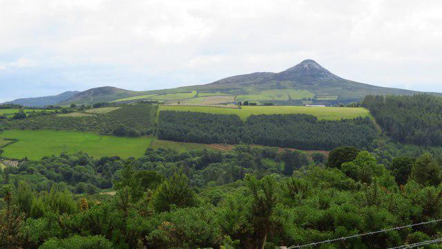 Photo could not load
O2313 : Great Sugar Loaf from Crone Woods
Colin Park
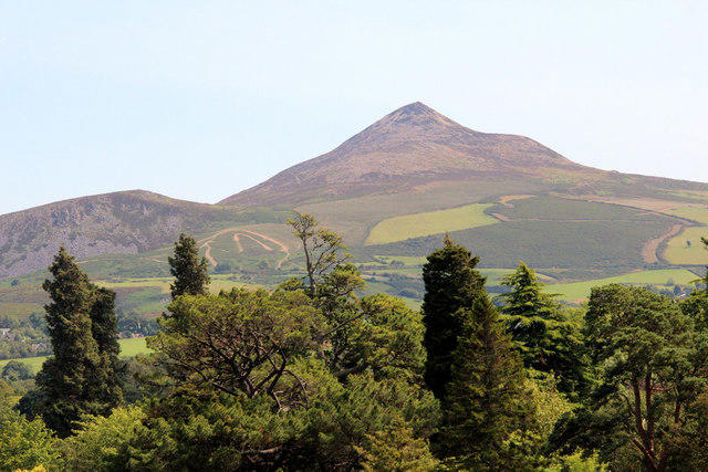 Photo could not load
O2313 : Great and Little Sugarloaf Mountains, County Wicklow, Ireland
Christine Matthews
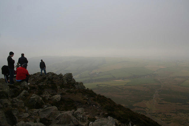 Photo could not load
O2313 : On top of Great Sugarloaf
Alan James
Hill facts and local notes
Classifications
Elevation
501m
1,644 ft
Prominence
228m
Coordinates
53.1542, -6.1505
O237130
OS Map
56
At the Summit
A rock outcrop marks the 501.2 m summit of the quartzite cone at Irish grid reference O237130.
Terrain & Geology
Great Sugar Loaf is formed mainly from Cambrian quartzite of the Bray Head Formation, with greywacke and quartzite on its southern and southwestern slopes. The resistant quartzite forms its distinctive cone, contrasting with the rounded granite mountains to the west. Angular scree on the upper slopes was produced by freeze-thaw weathering.
Views & Scenery
In clear weather, the summit overlooks the Wicklow coast and Irish Sea, Dublin and the surrounding Wicklow Mountains. Exceptionally clear conditions can reveal the mountains of Wales across the Irish Sea.
History & Heritage
Name Origin
The English name refers to the mountain’s resemblance to a traditional conical sugarloaf. Its Irish name is Ó Cualann. The precise interpretation is debated: MountainViews suggests “youth of Cualu/Cualainn”, rather than treating a single translation as certain.
Historical Significance
The Sugar Loaf Way uses part of the old coach road from Kilmacanogue towards Roundwood, known locally as the Car Road. The modern trail was developed with support from the commonage holders and local organisations. A further path-and-habitat restoration project was officially opened on 21 May 2025 after severe erosion had affected the mountain.
Getting There & Facilities
Parking
The standard southern start is the Great Sugar Loaf car park on Red Lane (L1031), entered beneath a concrete arch, at 53.144956, -6.155013. The car park was upgraded as part of the restoration opened in May 2025. For the longer village approach, use the public parking beside Kilmacanogue’s 1916 Commemorative Garden, rather than a business’s private parking. Follow current signs and keep the narrow approach road and entrances clear.
Public Transport
Bus Éireann route 133 links Dublin and Wicklow and stops in Kilmacanogue. Check the operator’s current timetable and plan the return service before walking. The village is a start for the longer Sugar Loaf Way approach; its bus stop is not at the Red Lane summit-path car park.
Nearby Facilities
The 2025 restoration added landscaped picnic areas on the lower slopes. Kilmacanogue has shops and places to eat or drink; check opening hours before relying on them. Bring food and water for the complete walk and check toilet availability before setting out.
Safety Information
Known Hazards
- The upper cone is steep and rocky, with stone steps and uneven ground. Be prepared to use hands for balance on rough sections and take particular care descending; wet or icy rock can be slippery.
- The summit is exposed to wind and rapidly changing weather. Carry suitable footwear, waterproofs, warm layers, food, water and navigation equipment; turn back if conditions exceed your ability.
- Keep to the restored path and respect signs, barriers and habitat-recovery areas. Do not shortcut across scree or fragile vegetation.
- Dogs must be kept on leads. The longer Kilmacanogue approach crosses open grazing and includes road crossings; follow waymarks and use care around traffic and livestock.
Seasonal Hazards
Wet weather can make stone steps and quartzite slippery, while snow or ice can make the steep cone substantially more difficult. Strong wind and low cloud can affect the summit in any season. Check the forecast, daylight and on-site notices before starting.
General Safety Tips
- Check weather conditions before setting out
- Carry appropriate clothing and equipment
- Let someone know your planned route
- Take a map, compass, and GPS device
- Carry emergency supplies: food, water, first aid kit, torch
Hills
Some common questions about the hills answered
Are there group walks up Great Sugar Loaf?
Many walkers use Walkmates to join or organise walks with others. You can check for group walks around Great Sugar Loaf through the maps
Are there other walkers around Great Sugar Loaf?
Activity varies by location and time, but Walkmates lets you see whether others have shared walks or shown interest in this area. Find other people through the walking friends search walking friends for Great Sugar Loaf search or of course create your own walk for Great Sugar Loaf
Can I organise a walk to Great Sugar Loaf?
Yes. If there aren’t any walks listed already, you can create a walk and make it available for others to join.
If you're signed up to Walkmates, you can create a walk to Great Sugar Loaf.
How do I find a walk up this hill?
There are often multiple ways to walk this hill, depending on experience and route preference. Walkmates helps you explore walks and routes that others have shared.
Can I suggest a new route up Great Sugar Loaf?
Yes. You can suggest or create routes to share with others. Walkmates focuses on the social side of walking, so routes are used to help people organise walks and explore areas together, rather than as detailed navigation tools or route libraries.
Other uses really appreciate knowledgeable walkers sharing their routes. Share your favourite route to Great Sugar Loaf here
The is an error or something incorrect about this hill. How do I let you know?
We always strive to keep the information on Walkmates as accurate as possible. If you find an error, please let us know through the contact form and we'll aim to correct it as quickly as possible
Community Discussion
Comments
Location
View the hill's mapped position and surrounding paths.
Grid reference: O237130
View on OpenStreetMapOpens a map in a new tab, centred on the hill.
Nearby Hills
Mullaghcleevaun
847m
Lugnaquilla [Log na Coille]
925m
Slieve Foye
587m
Slieve Binnian
746m
Slieve Gullion
576m
No comments yet. Be the first.