

Kentmere Pike
Good walks are even better shared.
NY4607 : The south side of Kentmere Pike
Bill Boaden Photo source
Overview
Kentmere Pike: The Hidden Gem of the Lake District
Kentmere Pike stands at a proud 730 metres and is a must-visit for any budding fellwalker. Nestled within the breathtaking Lake District, this Wainwright is often overshadowed by its more famous neighbours but is cherished by those in the know.
Geology
The rocky terrain is primarily made up of volcanic andesite that dates back to the Ordovician period, approximately 450 million years ago. Its fascinating geology contributes to the rugged allure of the surrounding fells.
Routes
Kentmere Trail
Starting from the quaint village of Kentmere, this route is a favourite among locals and visitors alike. Spanning 8 km, expect it to take around 3.5 hours to reach the summit. The trail is moderate in difficulty, suitable for those with a bit of hiking experience. Be sure to bring water and maybe a snack—there’s nothing quite like reaching the summit with a biscuit in hand!
Summit Features
At the summit, you’re greeted by a prominent trig point and a large stone cairn, perfect for a celebratory photo or two!
Terrain Type
The terrain primarily consists of rocky paths peppered with grass and the occasional bog. As you approach the summit, things can get a wee bit slippery, especially after a downpour, so tread carefully.
Views
Once you’ve conquered Kentmere Pike, the 360-degree views are nothing short of spectacular. Notable landmarks include the serene Kentmere Valley and fellow peaks like Yoke and Ill Bell. For the best vistas, plan your hike for spring or autumn when the landscape is particularly vibrant.
Hazards
While it’s a rewarding hike, don’t underestimate the terrain. Slippery rocks can be tricky, especially when wet. A sturdy pair of boots is essential!
Nearby Summits
If you’ve got the energy, consider bagging a few more peaks. Yoke (706 meters) and Ill Bell (757 meters) are just a hop, skip, and a jump away.
Access
Nearest Parking
Parking is available in Kentmere Village, with enough space for about 20 vehicles. Arrive early to secure a spot!
Public Transport
Limited public transport is available, with a bus service connecting Kendal to Kentmere. Be sure to check the schedule before you go, as it’s not the most frequent service.
Nearest Town
Kendal is the closest sizeable town, offering amenities if you need to stock up on snacks or equipment.
Facilities
While there are no facilities directly on the mountain, the local pub in Kentmere is a lovely spot to relax after your adventure. Don’t forget to make use of the public toilets before heading up!
History
Name Meaning
The name Kentmere blends Old Norse terms meaning “to know” and “lake”, reflecting the region's heritage.
Significance
The area is steeped in history, with evidence of ancient settlements suggesting that it has been a significant site for centuries, adding to its allure for visitors today.
If you’re after a hike that offers solitude, stunning landscapes, and a slice of history, Kentmere Pike is calling your name!
Ready your hiking boots and keep your biscuit tin at the ready—it’s time to tackle Kentmere Pike!
Explore routes near Kentmere Pike
Walks starting near this hill. Open a route to check its map, distance and full itinerary.
Striding Edge, Helvellyn and Catstye Cam
View route
Helvellyn via Striding Edge
View route
Windermere west shore: Ash Landing to Wray and back
View route
Tarn Hows Fast Route
View route
Route planning notes
These notes describe possible approaches. Check a route's map and access information when planning your walk.
Kentmere Trail
A popular route starting from the village of Kentmere, leading hikers through scenic valleys and up to the rocky summit.
Make a day of it, together
Find someone to share the walk with, or organise a day out along a route you like.
Photo Gallery
View all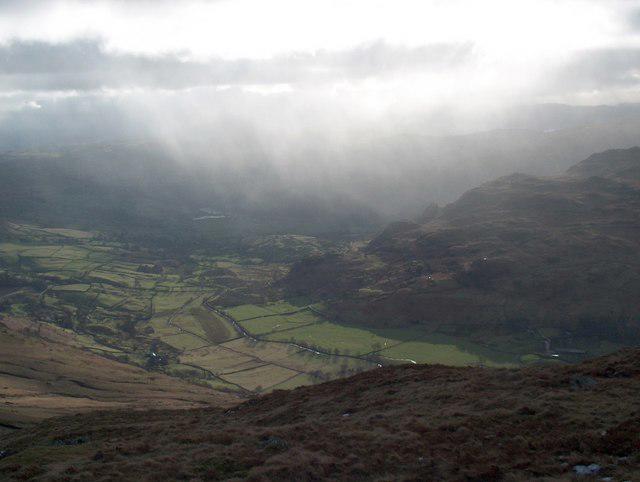 Photo could not load
NY4607 : The south side of Kentmere Pike
Bill Boaden
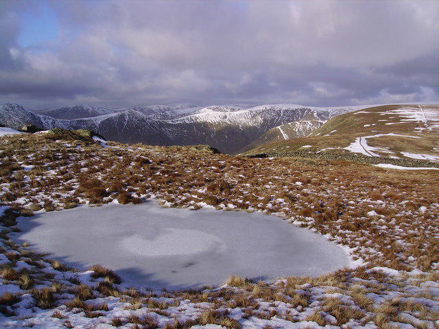 Photo could not load
NY4607 : Frozen Tarn, Kentmere Pike
Michael Graham
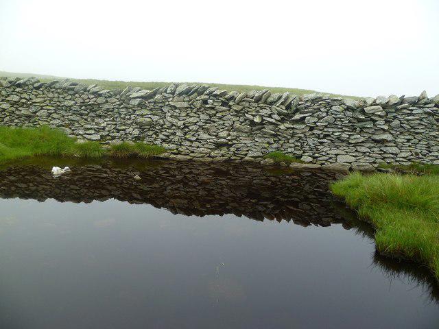 Photo could not load
NY4607 : Wall on the Water
Michael Graham
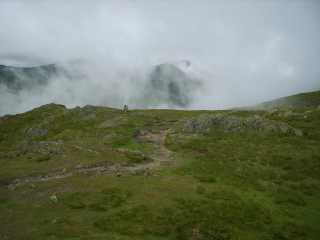 Photo could not load
NY4607 : On Kentmere Pike
Michael Graham
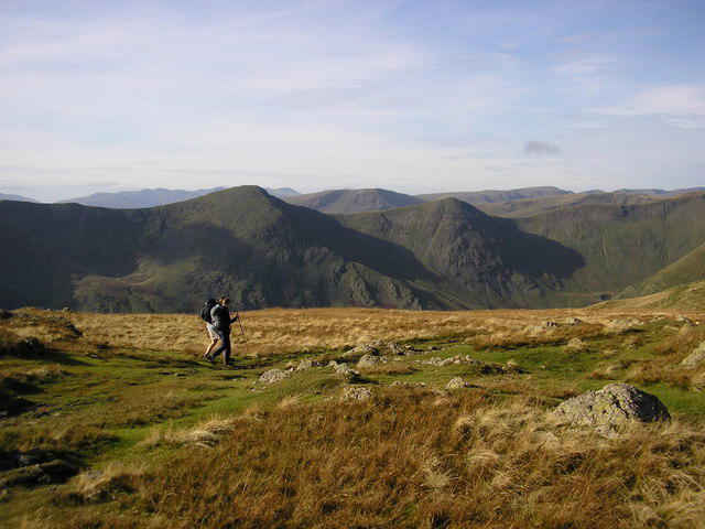 Photo could not load
NY4607 : Crossing Kentmere Pike
Karl and Ali
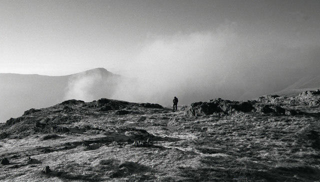 Photo could not load
NY4607 : Arriving at Kentmere Pike
Tom Richardson
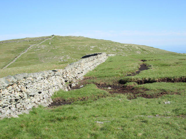 Photo could not load
NY4607 : Kentmere Pike
Peter S
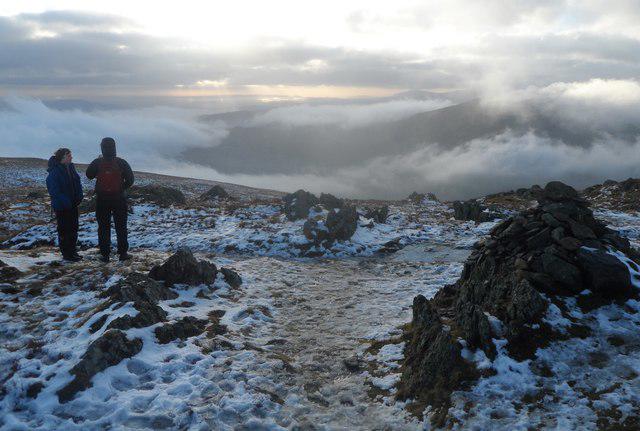 Photo could not load
NY4607 : On Kentmere Pike
Anthony Parkes
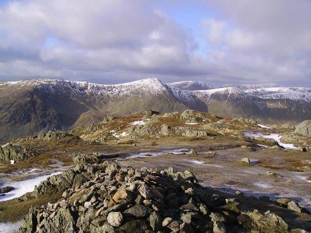 Photo could not load
NY4607 : Summit Cairn, Kentmere Pike
Michael Graham
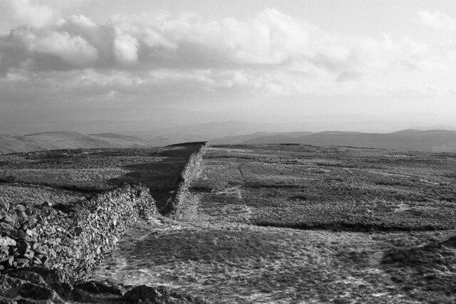
NY4607 : Dry-stone wall
Richard Sutcliffe
Hill facts and local notes
Classifications
Elevation
730m
2,397 ft
Prominence
40m
Coordinates
54.4627, -2.8260
NY465077
OS Map
90
Explorer: OL7N
At the Summit
The summit boasts a large stone cairn and a trig point, offering photo opportunities and a sense of achievement for those who reach it.
Terrain & Geology
Kentmere Pike is primarily composed of volcanic rock, specifically andesite, which is characteristic of the area's rugged topography. The age of the rock is around 450 million years, dating back to the Ordovician period.
Views & Scenery
Stunning views of the Kentmere Valley, surrounding fells such as Yoke and Ill Bell, and the distant peaks of the Central Lake District.
History & Heritage
Name Origin
The name derives from the Old Norse 'kenn' meaning 'to know' and 'mere', which refers to a lake or pool, indicating the area's heritage.
Historical Significance
Kentmere has historical significance as it has been inhabited since prehistoric times, with evidence of ancient settlements found nearby.
Getting There & Facilities
Parking
The nearest parking is available at Kentmere Village, with space for approximately 20 cars. Please arrive early during peak season!
Public Transport
The nearest public transport is a bus service from Kendal to Kentmere, though it's limited, so check the timetable ahead of time.
Nearby Facilities
There are no facilities on the mountain itself, but Kentmere Village offers a local pub serving refreshments and has public toilets.
Safety Information
Known Hazards
- Be cautious of slippery rocks and muddy paths, particularly after rain.
General Safety Tips
- Check weather conditions before setting out
- Carry appropriate clothing and equipment
- Let someone know your planned route
- Take a map, compass, and GPS device
- Carry emergency supplies: food, water, first aid kit, torch
Hills
Some common questions about the hills answered
Are there group walks up Kentmere Pike?
Many walkers use Walkmates to join or organise walks with others. You can check for group walks around Kentmere Pike through the maps
Are there other walkers around Kentmere Pike?
Activity varies by location and time, but Walkmates lets you see whether others have shared walks or shown interest in this area. Find other people through the walking friends search walking friends for Kentmere Pike search or of course create your own walk for Kentmere Pike
Can I organise a walk to Kentmere Pike?
Yes. If there aren’t any walks listed already, you can create a walk and make it available for others to join.
If you're signed up to Walkmates, you can create a walk to Kentmere Pike.
How do I find a walk up this hill?
There are often multiple ways to walk this hill, depending on experience and route preference. Walkmates helps you explore walks and routes that others have shared.
Can I suggest a new route up Kentmere Pike?
Yes. You can suggest or create routes to share with others. Walkmates focuses on the social side of walking, so routes are used to help people organise walks and explore areas together, rather than as detailed navigation tools or route libraries.
Other uses really appreciate knowledgeable walkers sharing their routes. Share your favourite route to Kentmere Pike here
The is an error or something incorrect about this hill. How do I let you know?
We always strive to keep the information on Walkmates as accurate as possible. If you find an error, please let us know through the contact form and we'll aim to correct it as quickly as possible
Community Discussion
Comments
Location
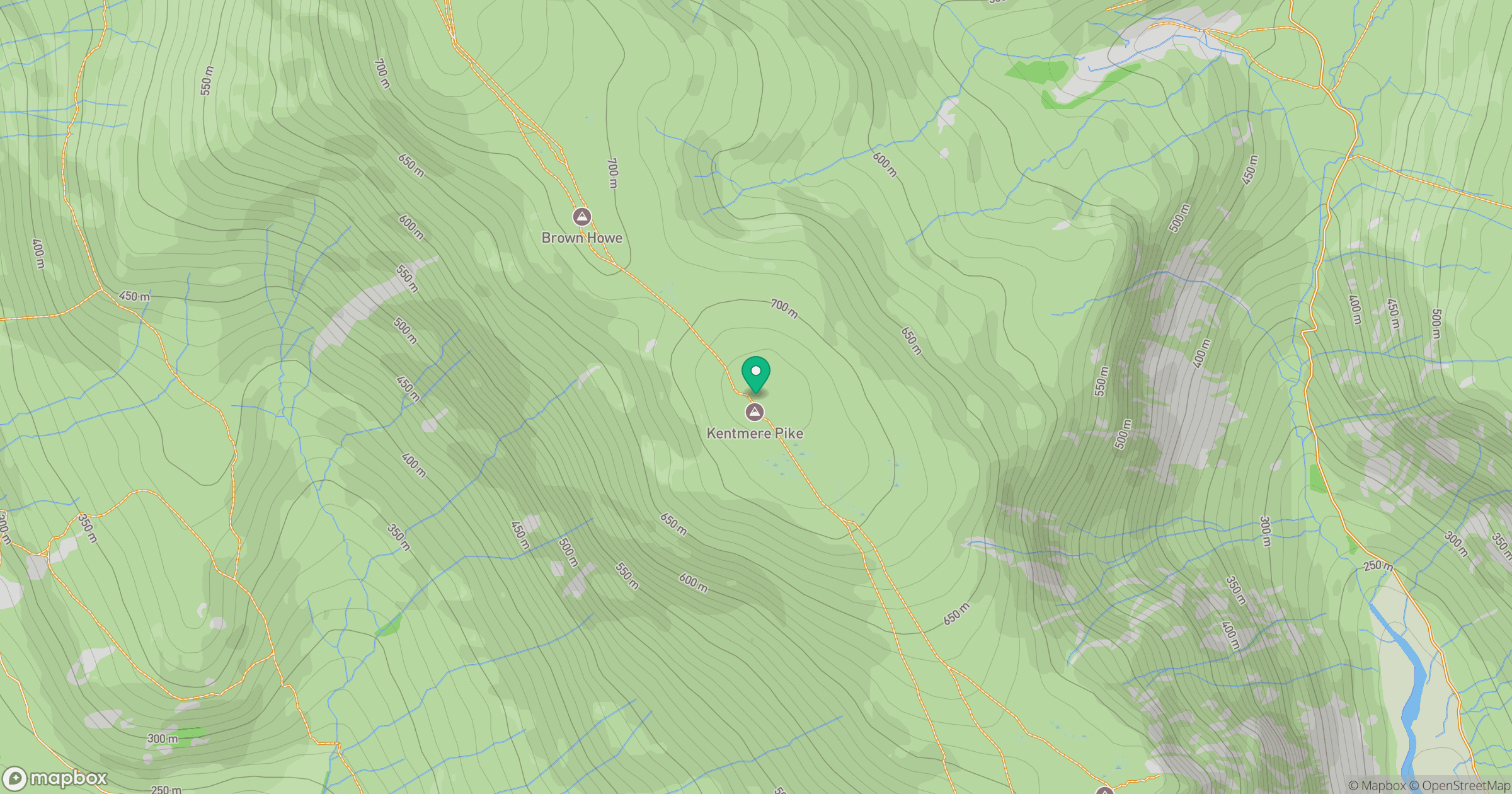
Grid reference: NY465077
View on OpenStreetMapOpens a map in a new tab, centred on the hill.

No comments yet. Be the first.