

Isle of May
Good walks are even better shared.
NT6599 : Lighthouse or Stately Home?
John McMillan Photo source
Overview
Isle of May
Nestled in the Firth of Forth, the Isle of May is a nature lover's paradise, offering breathtaking scenery and a chance to see some of Britain’s most iconic seabirds. At a modest elevation of only 49 meters, don’t let the height fool you; the views from the top are nothing short of spectacular!
Geology
The island's geology is largely shaped by ancient volcanic activity, with basalt formations creating a unique landscape that has evolved into a diverse ecosystem. As you explore, keep an eye out for interesting rock formations that tell a story of the earth’s tumultuous past.
Access and Parking
Getting to the Isle of May is half the adventure. Visit from Anstruther where a short, scenic boat ride will ferry you across the Firth of Forth. Parking is available in Anstruther, so make sure to grab a spot before you embark on your trip!
Public transportation options to Anstruther include regular bus services from neighboring towns, making it convenient for day-trippers. Just don't forget to grab some fish and chips before you set sail!
Terrain and Routes
The terrain is primarily grassy with rocky outcrops offering varied exploration opportunities. One of the best routes to take is the boat trip from Anstruther, which is an easy jaunt perfect for families and casual hikers alike. While you're on the island, take time to wander around and appreciate both the tranquility and the sound of puffins squawking as they flutter about.
Summit Features
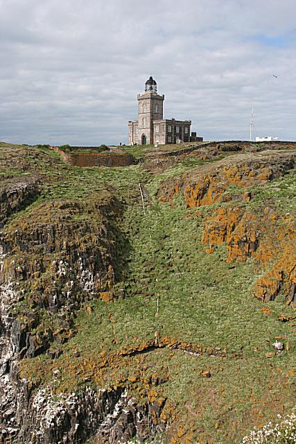
At the summit, you’ll find the historic 1816 lighthouse, along with remnants of St. Adrian's chapel—perfect spots for a photo op (just make sure you don't photobomb the puffins!). These features not only add character but also hold historical significance as guiding lights for sailors.
Views
Keep your eyes peeled for stunning vistas! From the summit, expect stunning views of the Firth of Forth and beyond to the Fife coastline and Edinburgh on clear days. The best time to catch these sights? Spring to summer, especially during bird nesting season - a bonus for birdwatchers!
Hazards
While exploring, it’s worth noting the hazards: coastal winds can be unexpectedly strong, and rocks might be slick, so tread carefully. Respect wildlife habitats and keep your distance from nesting areas.
So, whether you're a seasoned hiker or a curious visitor, the Isle of May offers a delightful escape into nature. Remember, the only thing you should be taking home are photos—leave only footprints behind!
Last Updated: 2023-10-10
Source: Ordnance Survey
Explore routes near Isle of May
Walks starting near this hill. Open a route to check its map, distance and full itinerary.
Tentsmuir Forest: Ice House Trail
View route
Cottyburn to Haddington: East Lothian Railway Walk return
View route
Cockburnspath to Dunglass Dean and Old Bridge
View route
St Abbs Head Lighthouse and Pettico Wick
View route
Route planning notes
These notes describe possible approaches. Check a route's map and access information when planning your walk.
Visit from Anstruther
This is the main route taken by visitors, involving a scenic boat trip to the island.
Make a day of it, together
Find someone to share the walk with, or organise a day out along a route you like.
Photo Gallery
View all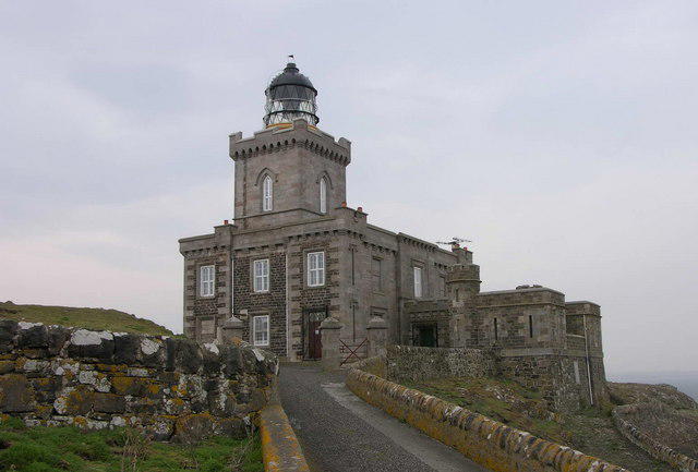 Photo could not load
NT6599 : Lighthouse or Stately Home?
John McMillan
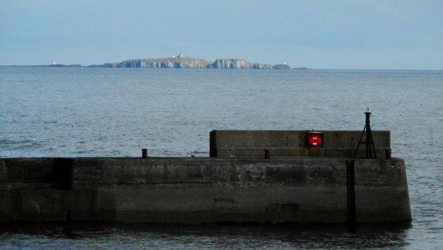 Photo could not load
NT6599 : The Isle of May
Richard Sutcliffe
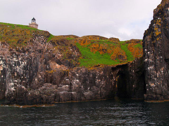 Photo could not load
NT6599 : Cliffs with Arch below the Lighthouse Isle of May
Clive Nicholson
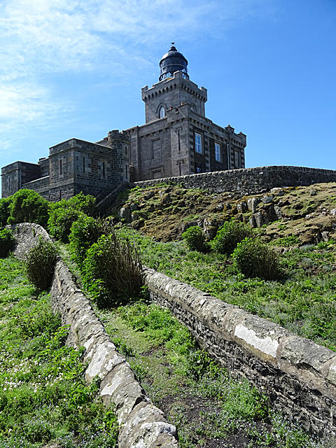 Photo could not load
NT6599 : Overgrown Path
Anne Burgess
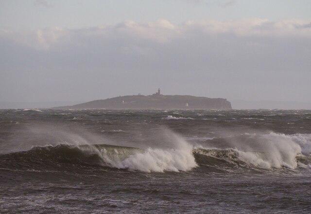 Photo could not load
NT6599 : Isle of May from Crail
Jackie Proven
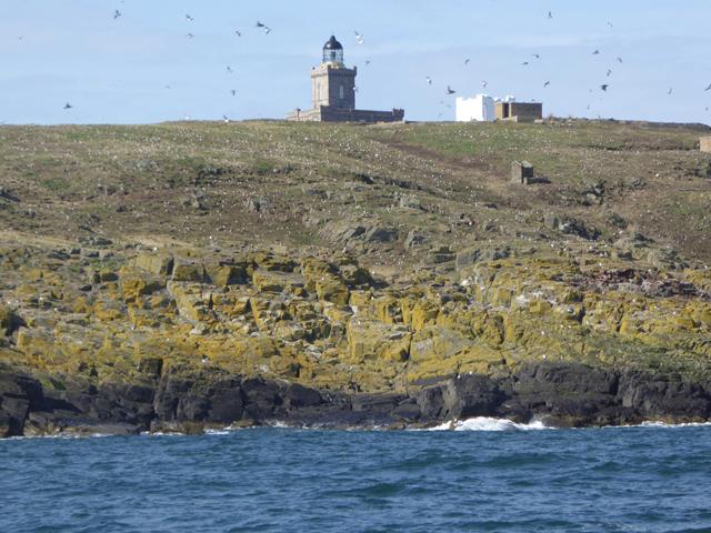 Photo could not load
NT6599 : East coast of the Isle of May
Oliver Dixon
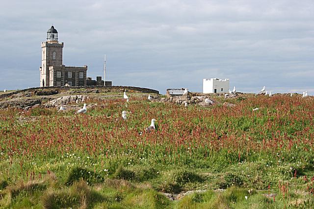 Photo could not load
NT6599 : The Main Light and the Beacon
Anne Burgess
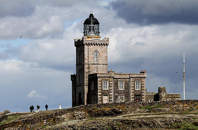 Photo could not load
NT6599 : The Isle of May Lighthouse
Walter Baxter
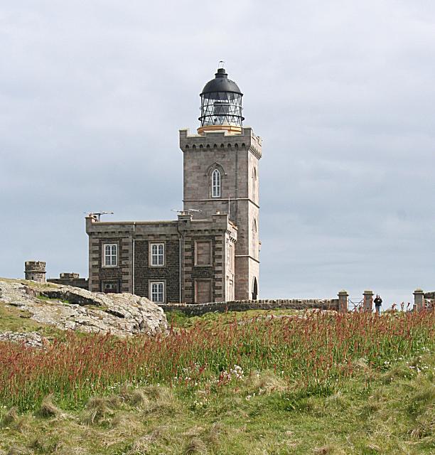 Photo could not load
NT6599 : The Main Light
Anne Burgess
NT6599 : The Main Light from Mill Door Viewpoint
Anne Burgess
Hill facts and local notes
Classifications
Elevation
51m
167 ft
Prominence
51m
Coordinates
56.1856, -2.5584
NT654993
OS Map
59
Explorer: 371S
At the Summit
The summit features a historic lighthouse built in 1816 and a small ruin of St. Adrian's chapel, providing a stark contrast to the surrounding natural beauty.
Terrain & Geology
The Isle of May is primarily composed of volcanic rock, specifically basalt, which gives the island its unique rugged landscape. The geology has shaped both the physical structure and the ecology of the island.
Views & Scenery
From the summit, you can see sweeping views of the Firth of Forth, the Fife coastline, and even across to Edinburgh on a clear day.
History & Heritage
Name Origin
The name 'Isle of May' is believed to derive from Saint Adrian, who had links with seabirds and the island.
Historical Significance
The island has historically been a beacon for sailors, housing a lighthouse and serving as a refuge for various bird species during migratory periods.
Getting There & Facilities
Parking
Parking is available in Anstruther, approximately 10 minutes from the harbour where boats to the island depart.
Public Transport
Regular bus services run to Anstruther from nearby towns such as St Andrews and Crail.
Nearby Facilities
There are no facilities on the island itself, but visitors can find cafes and toilets in Anstruther before embarking on their trip.
Safety Information
Known Hazards
- Strong coastal winds and slippery rocks, particularly when near the cliff edges. Also, beware of wildlife when walking through their nesting areas.
General Safety Tips
- Check weather conditions before setting out
- Carry appropriate clothing and equipment
- Let someone know your planned route
- Take a map, compass, and GPS device
- Carry emergency supplies: food, water, first aid kit, torch
Hills
Some common questions about the hills answered
Are there group walks up Isle of May?
Many walkers use Walkmates to join or organise walks with others. You can check for group walks around Isle of May through the maps
Are there other walkers around Isle of May?
Activity varies by location and time, but Walkmates lets you see whether others have shared walks or shown interest in this area. Find other people through the walking friends search walking friends for Isle of May search or of course create your own walk for Isle of May
Can I organise a walk to Isle of May?
Yes. If there aren’t any walks listed already, you can create a walk and make it available for others to join.
If you're signed up to Walkmates, you can create a walk to Isle of May.
How do I find a walk up this hill?
There are often multiple ways to walk this hill, depending on experience and route preference. Walkmates helps you explore walks and routes that others have shared.
Can I suggest a new route up Isle of May?
Yes. You can suggest or create routes to share with others. Walkmates focuses on the social side of walking, so routes are used to help people organise walks and explore areas together, rather than as detailed navigation tools or route libraries.
Other uses really appreciate knowledgeable walkers sharing their routes. Share your favourite route to Isle of May here
The is an error or something incorrect about this hill. How do I let you know?
We always strive to keep the information on Walkmates as accurate as possible. If you find an error, please let us know through the contact form and we'll aim to correct it as quickly as possible
Community Discussion
Comments
Location
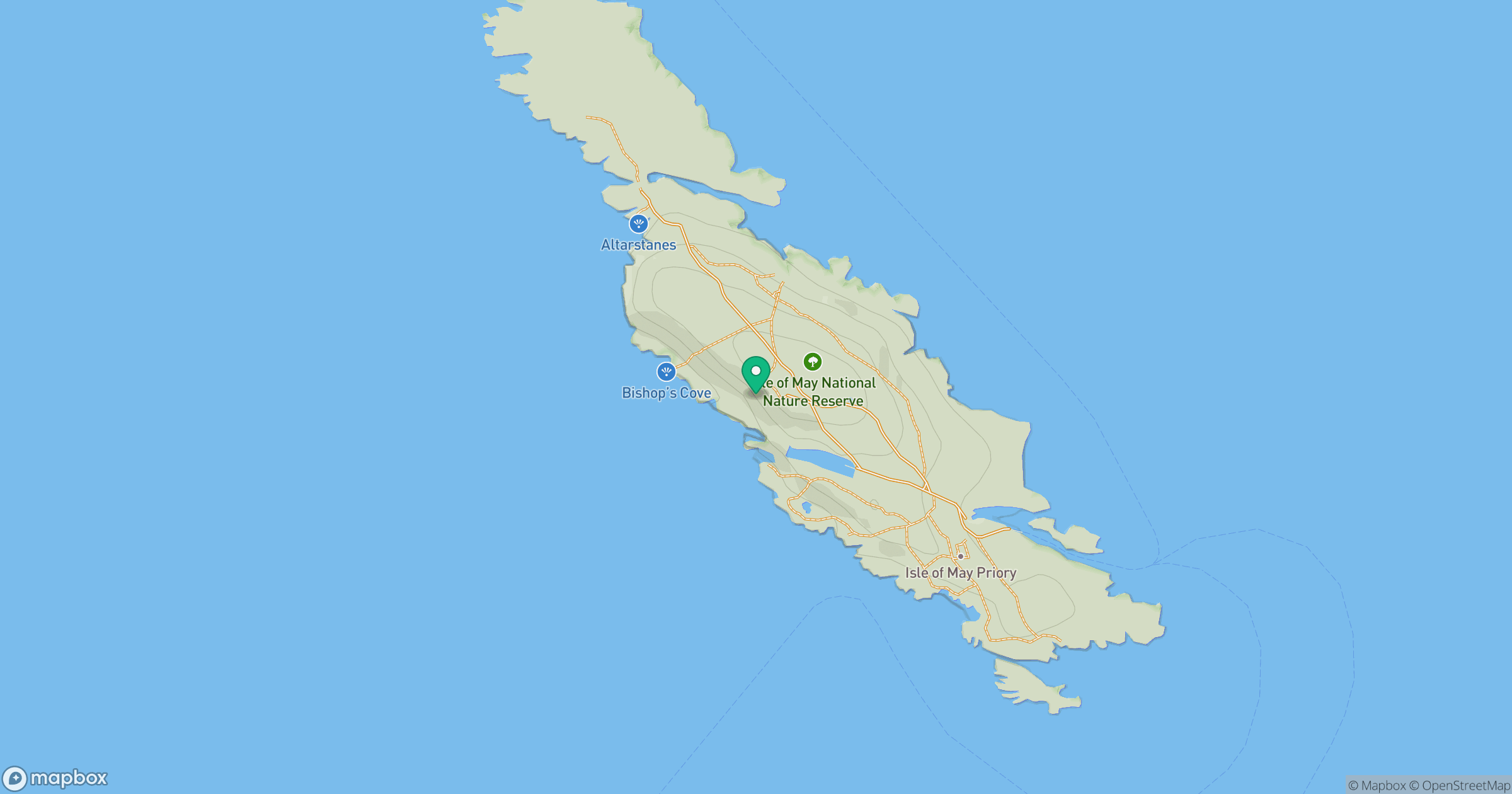
Grid reference: NT654993
View on OpenStreetMapOpens a map in a new tab, centred on the hill.




No comments yet. Be the first.