

High Crags (Newlands)
Good walks are even better shared.
NY2117 : High Crags
David Purchase Photo source
Overview
High Crags (Newlands)
High Crags stands as a daring outpost in the Lake District, rising to 627 meters. Don’t let the height deceive you—those with a fondness for rocky scrambles and scenic views will find their joy here. Its prominence might not be overwhelming, but its charm? Absolutely undeniable.
Geology
High Crags is proudly composed of Skiddaw slate, a testament to the ancient forces that shaped the landscape we see today. The geology not only offers a fascinating look into the Earth’s past but also yields dramatic vistas that take the breath away—well, at least figuratively unless you forget to pace yourself.
Routes
Two popular routes leading to the summit are the Newlands Valley Loop and the Catbells Approach. For those wanting a challenge, the Newlands Valley Loop provides a 9 km experience filled with delightful ups and downs. If family-friendliness is more your order of the day, the Catbells Approach offers 7.5 km of scenic, accessible pathways.
Summit Features
As you trudge towards the summit, keep your eyes peeled for a rocky outcrop that serves as your final destination. Views from the top are nothing short of magnificent—perfect for that inevitable triumphal selfie!
Terrain
Be prepared for rocky and grassy areas, with the occasional bog trying to sneak up on you. Staying vigilant on your footing can turn stubborn mud into mere memory.
Views
From the summit, you’ll be rewarded with views stretching across the Skiddaw range and Derwentwater. Perfect for lording it over fellow hikers (just kidding, sharing is caring!). For the best experience, spring and autumn provide glorious colours, while early mornings can be quite magical.
Hazards
While the mountain is lovely, it’s essential to watch out for wet paths, particularly in winter. Be prepared for the possibility of sudden weather changes—it’s the Lake District, not the Maldives!
Access
Getting to High Crags is half the adventure. The nearest parking at Newlands Church fills up quicker than you can say ‘just five more minutes’. Public transport from Keswick can bring you close to the action, but a bit of walking is inevitable. Keswick is the nearest town, bursting with cafes to refuel those energy reserves after your hike.
Facilities
Once you've conquered High Crags, head back to Keswick for a well-deserved treat. The town has a wealth of options—from cafes to shops that offer plenty of gear if you've forgotten anything (gasp!).
History
The name 'High Crags' captures its essence beautifully, hinting at lofty heights and dramatic cliffs. This mountain is not just a playground for hikers but a beloved landmark with cultural significance among the fell running community and walking circles alike.
So lace up those boots and get ready to bask in both the splendour of nature and the glory of a weekend well spent. Happy hiking!
Explore routes near High Crags (Newlands)
Walks starting near this hill. Open a route to check its map, distance and full itinerary.
Scafell Pike from Seathwaite via the Corridor Route
View route
Whinlatter dark skies walk
View route
Whinlatter dark skies walk
View route
Derwentwater Walk: full lakeside circuit from Keswick
View route
Route planning notes
These notes describe possible approaches. Check a route's map and access information when planning your walk.
Newlands Valley Loop
A scenic route starting from the Newlands Valley that takes you through picturesque hills and offers a good workout.
Catbells Approach
An easily accessible path leading up from the shores of Derwentwater to the summit of High Crags, suitable for families and less experienced hikers.
Make a day of it, together
Find someone to share the walk with, or organise a day out along a route you like.
Photo Gallery
View all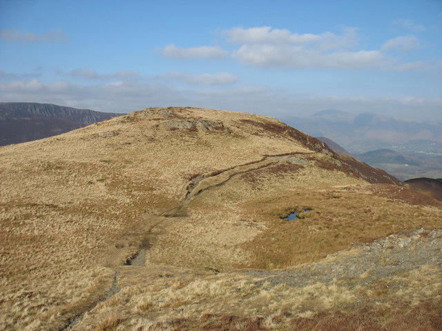 Photo could not load
NY2117 : High Crags
David Purchase
Hill facts and local notes
Classifications
Elevation
529m
1,736 ft
Prominence
11m
Coordinates
54.5467, -3.2112
NY217174
OS Map
89 90
Explorer: OL4S
At the Summit
The summit features a rocky outcrop with stunning views, but alas, no free WiFi.
Terrain & Geology
Composed primarily of Skiddaw slate, with occasional volcanic rocks adding a splash of drama to the landscape. The rugged terrain offers an insight into the geological history resulting from ancient tectonic activity.
Views & Scenery
Breathtaking panoramic views of the Skiddaw range, Derwentwater, and the surrounding fells. On a clear day, you might spot the peaks of Great Gable and the Scafells in the distance.
History & Heritage
Name Origin
The name 'High Crags' suggests lofty cliffs and heights, fitting for a mountain that offers a high vantage point.
Historical Significance
High Crags is part of the traditional walking routes cherished by fell runners and hikers alike, lending cultural significance to outdoor enthusiasts in the region.
Getting There & Facilities
Parking
There is parking available at the Newlands Church, which serves as a perfect starting point for various walking routes, albeit filling up fast on sunny weekends.
Public Transport
Regular buses run from Keswick to nearby villages, with a walk towards Newlands Valley serving as an excellent warm-up.
Nearby Facilities
While there aren't any facilities directly on the mountain, Keswick nearby offers ample cafes, shops, and public toilets. Remember to hydrate and refuel before or after your trek!
Safety Information
Known Hazards
- Wet and slippery paths in winter; sudden weather changes can occur, so be prepared!
General Safety Tips
- Check weather conditions before setting out
- Carry appropriate clothing and equipment
- Let someone know your planned route
- Take a map, compass, and GPS device
- Carry emergency supplies: food, water, first aid kit, torch
Hills
Some common questions about the hills answered
Are there group walks up High Crags (Newlands)?
Many walkers use Walkmates to join or organise walks with others. You can check for group walks around High Crags (Newlands) through the maps
Are there other walkers around High Crags (Newlands)?
Activity varies by location and time, but Walkmates lets you see whether others have shared walks or shown interest in this area. Find other people through the walking friends search walking friends for High Crags (Newlands) search or of course create your own walk for High Crags (Newlands)
Can I organise a walk to High Crags (Newlands)?
Yes. If there aren’t any walks listed already, you can create a walk and make it available for others to join.
If you're signed up to Walkmates, you can create a walk to High Crags (Newlands).
How do I find a walk up this hill?
There are often multiple ways to walk this hill, depending on experience and route preference. Walkmates helps you explore walks and routes that others have shared.
Can I suggest a new route up High Crags (Newlands)?
Yes. You can suggest or create routes to share with others. Walkmates focuses on the social side of walking, so routes are used to help people organise walks and explore areas together, rather than as detailed navigation tools or route libraries.
Other uses really appreciate knowledgeable walkers sharing their routes. Share your favourite route to High Crags (Newlands) here
The is an error or something incorrect about this hill. How do I let you know?
We always strive to keep the information on Walkmates as accurate as possible. If you find an error, please let us know through the contact form and we'll aim to correct it as quickly as possible
Community Discussion
Comments
Location
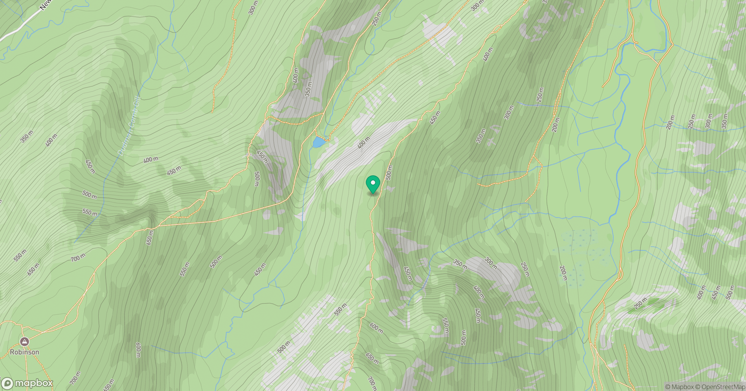
Grid reference: NY217174
View on OpenStreetMapOpens a map in a new tab, centred on the hill.

No comments yet. Be the first.