

Hen Comb
Good walks are even better shared.
Overview
A 506.2-metre Wainwright above Loweswater, with a summit cairn and a long northern ridge.
Hen Comb
Hen Comb is a 506.2-metre Wainwright in the western Lake District. Its summit cairn stands at NY 13216 18117. Summit record
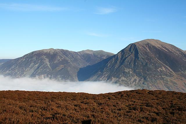
Across Mosedale, Mellbreak fills the middle distance, with Grasmoor, Whiteless Pike and Robinson beyond. The small cairn makes a good place to pause and pick out the skyline. Summit photograph
The northern approach rises past Little Dodd, eases along the ridge and finishes with a steeper climb. Loweswater opens behind you, while Buttermere comes into view from the summit. Fell photographs
Loweswater via Little Dodd
Mosedale Beck rises quickly after rain; slippery stones and cascades make its ford hazardous. Avoid this circuit during or after rain. Do not cross high, rising or fast-flowing water. Turn back at the initial ford if unsafe. The southern bridge does not bypass smaller return fords: never force a crossing or wade. Beck and ground conditions
Start at Church Bridge in Loweswater and follow the lane past Kirkgate Farm into the walled track. Beyond its gate, turn right beside the plantation and follow the wall down to Mosedale Beck at NY137200. On the far bank, climb northwest to the wall, follow it southwest, then turn south beside the fence. Cross the stile and climb over Little Dodd. Continue along the ridge, cross the fence and tackle the steeper final slope to Hen Comb. Ascent landmarks
Descend south from the cairn beside the fence. At the bridleway, turn left before the gateway; do not go through. Take the left fork at the indistinct split, keeping to higher ground. Curve around the southern slopes to the Mosedale Beck footbridge. Beyond it, follow the track north through a gate, around the fenced enclosure and across side streams to the clearer Mosedale track. With Mellbreak on your right, return to the plantation gate, Kirkgate Farm and Church Bridge. Return route
Parking near Church Bridge is limited and informal. Check signs, keep access clear and have another plan if there is no suitable space. Starting point
Beneath your feet
Hen Comb’s bedrock belongs to the Kirk Stile Formation of the Skiddaw Group. Local geology
These sedimentary rocks include mudstone and siltstone, laid down in thin layers. BGS rock description
Before you set out
Use maps to check public rights of way, access land and restrictions. Follow local signs and closures, share bridleways considerately and keep dogs under close control. National Park access guidance
Check the mountain forecast and allow enough daylight for the full return. Carry a map and compass, headtorch, warm layers, suitable footwear, food and water. Leave your route and finish time with someone. Turn back while a safe retreat remains if conditions worsen. In an emergency, call 999 or 112 and ask for Police, then Mountain Rescue. Mountain Rescue advice
Explore routes near Hen Comb
Public walks starting within 80 km of this hill. Nearby does not mean a route reaches the summit; check its map and access before setting out.
Scafell Pike via Brown Tongue and Hollow Stones
View route
Scafell Pike from Seathwaite via the Corridor Route
View route
Derwentwater Walk: full lakeside circuit from Keswick
View route
Binsey from Binsey Lodge Direct Out and Back Wainwright
View route
Route planning notes
These notes describe possible approaches, not verified navigable routes or permission to cross land. Check current paths, local access rules and conditions before setting out.
Loweswater and Little Dodd circuit
Climb from Church Bridge via Little Dodd; descend south and return through Mosedale. Avoid wet-weather crossings.
Make a day of it, together
Find someone to share the walk with, or organise a day out along a route you like.
Photo Gallery
View all Photo could not load
NY1318 : On Hen Comb
Michael Graham
 Photo could not load
NY1318 : On Hen Comb
Michael Graham
 Photo could not load
NY1318 : Approaching Hen Comb
Michael Graham
 Photo could not load
NY1318 : Hen Comb
Steve Partridge
 Photo could not load
NY1318 : On Hen Comb
Michael Graham
 Photo could not load
NY1318 : On Hen Comb
Michael Graham
 Photo could not load
NY1318 : Ascending Hen Comb
Michael Graham
 Photo could not load
NY1318 : Hen Comb from Mosedale
David Purchase
 Photo could not load
NY1318 : Hen Comb
Rude Health

NY1318 : Hen Comb summit
Shaun Ferguson
Hill facts and local notes
Classifications
Elevation
506m
1,661 ft
Prominence
139m
Coordinates
54.5509, -3.3433
NY132181
OS Map
89
Explorer: OL4S 303
At the Summit
Cairn at NY 13216 18117.
Terrain & Geology
Kirk Stile Formation: sedimentary mudstone and siltstone within the Skiddaw Group.
Views & Scenery
Mellbreak, Grasmoor, Whiteless Pike and Robinson.
Getting There & Facilities
Check current local access restrictions, parking rules and transport timetables before travelling. These notes do not confirm public access to the summit.
Parking
Limited informal space near Church Bridge, Loweswater. Check signs and keep access clear.
Nearby Facilities
Bring food and water for the full walk.
Safety Information
Known Hazards
- Unsafe stream crossings after rain: never force a crossing or wade.
- Boggy ground and faint paths require careful navigation.
- Check access restrictions and obey local closures.
Seasonal Hazards
Short daylight and deteriorating weather can make the return harder.
General Safety Tips
- Check weather conditions before setting out
- Carry appropriate clothing and equipment
- Let someone know your planned route
- Take a map, compass, and GPS device
- Carry emergency supplies: food, water, first aid kit, torch
Hills
Some common questions about the hills answered
Are there group walks up Hen Comb?
Many walkers use Walkmates to join or organise walks with others. You can check for group walks around Hen Comb through the maps
Are there other walkers around Hen Comb?
Activity varies by location and time, but Walkmates lets you see whether others have shared walks or shown interest in this area. Find other people through the walking friends search walking friends for Hen Comb search or of course create your own walk for Hen Comb
Can I organise a walk to Hen Comb?
Yes. If there aren’t any walks listed already, you can create a walk and make it available for others to join.
If you're signed up to Walkmates, you can create a walk to Hen Comb.
How do I find a walk up this hill?
There are often multiple ways to walk this hill, depending on experience and route preference. Walkmates helps you explore walks and routes that others have shared.
Can I suggest a new route up Hen Comb?
Yes. You can suggest or create routes to share with others. Walkmates focuses on the social side of walking, so routes are used to help people organise walks and explore areas together, rather than as detailed navigation tools or route libraries.
Other uses really appreciate knowledgeable walkers sharing their routes. Share your favourite route to Hen Comb here
The is an error or something incorrect about this hill. How do I let you know?
We always strive to keep the information on Walkmates as accurate as possible. If you find an error, please let us know through the contact form and we'll aim to correct it as quickly as possible
Community Discussion
Comments
Location
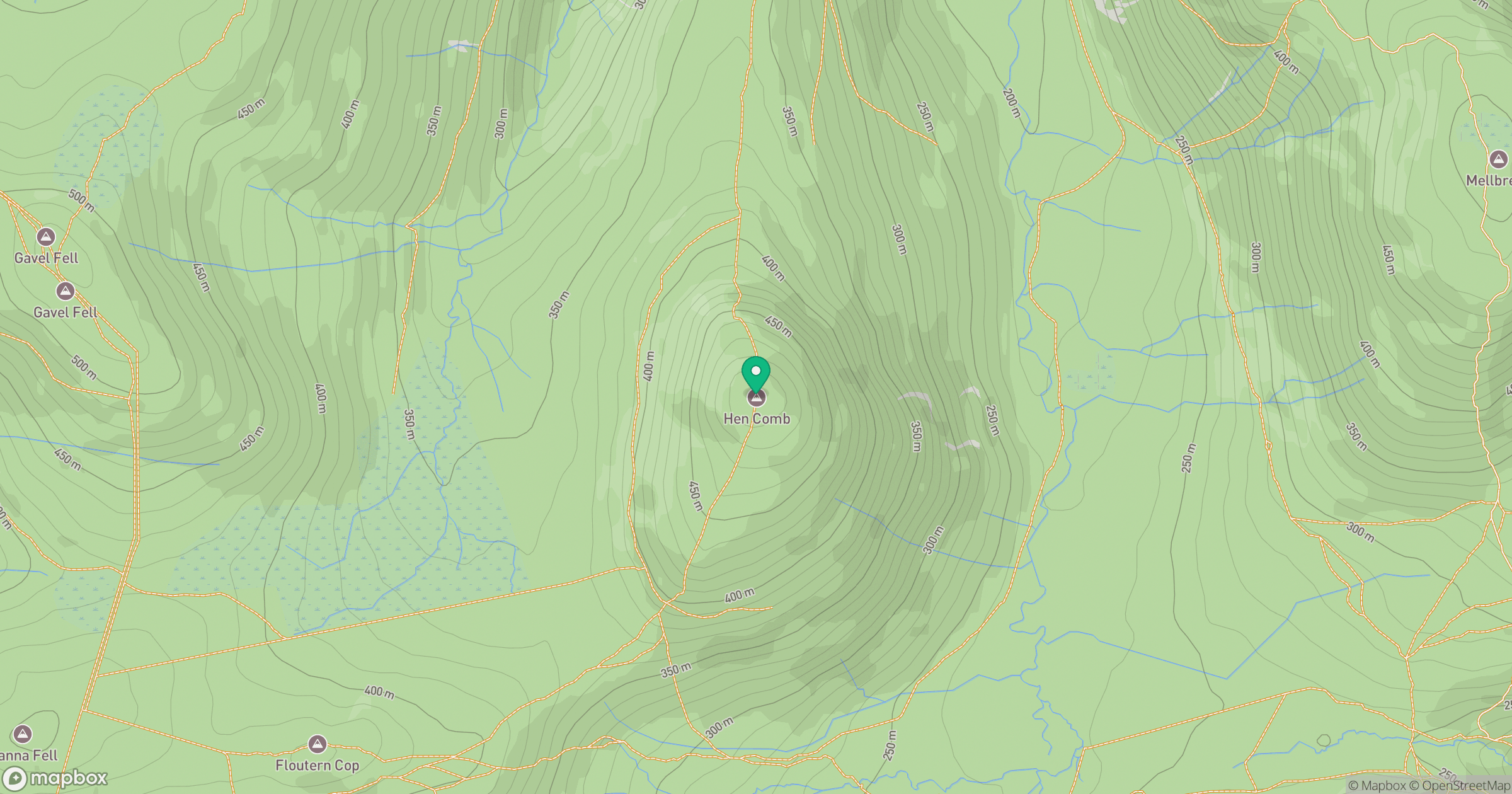
Grid reference: NY132181
View on OpenStreetMapOpens a map in a new tab, centred on the hill.
Hills within 30 km
Straight-line distance, not a walking route or confirmation of access.
High Stile [Grey Crag - High Stile]
806m
Grasmoor
852m

Pillar
892m

Crag Hill [Eel Crag]
839m

Grisedale Pike
790m
No comments yet. Be the first.