
Harrop Edge
Good walks are even better shared.
Overview
Harrop Edge: A Gem of the Peak District
Nestled in the heart of the Peak District, Harrop Edge offers a delightful escape for outdoor enthusiasts. With an elevation of 434 meters, it's not the highest peak around, but it definitely has a charm that makes it a worthy stop.
Geology
Harrop Edge is primarily composed of gritstone and sandstone, presenting a fascinating tableau of geological history. The rock faces tell tales of ancient river beds and the wear of time, where climbers often find challenging routes that feel more like a dance than a climb.
Routes
For walkers, Harrop Edge is accessible via various routes:
- Harrop Ales: A gentle ascent that allows for leisurely conversation while taking in the scenery. At approximately 4.5 km, it’s perfect for a family outing.
- Old Road Circuit: For those seeking a bit more of a challenge, this 6 km route will push you, especially with its tricky terrain and steep sections.
Summit Features
Once you reach the top, a modest stone cairn greets you, providing a perfect backdrop for photos. It's a popular spot for a picnic too, but mind the local wildlife; they have an uncanny knack for being too friendly!
Terrain Type
Expect grassy paths intertwined with rocky outcrops. While it’s generally non-technical, be prepared for muddy spots that can test your footing. An old proverb rings true here: “If you’re not getting muddy, you’re not having fun!”
Views
Prepare to feast your eyes on breathtaking panoramas! From Kinder Scout to the rolling hills of the dark Peak, the views are stunning throughout the seasons. Spring and Autumn offer the best experiences, with the landscape blooming or painting itself in warm hues, respectively.
Hazards
As lovely as it sounds, do watch your step; the path can be a tad slippery after rain, and it’s known that sheep might leave a little surprise for the unwary hiker.
Nearby Summits
If your legs are up for more, consider visiting:
- Kinder Scout (636 m)
- Bleaklow Hill (624 m)
Access
Convenient access is one of Harrop Edge's best features. The nearest parking is along Harrop Edge Road, where you can find ample space to leave your vehicle. However, arriving early is the key if you want to avoid a parking adventure.
Crowd-surfing on public transport? Buses from New Mills drop you close, but be prepared to walk a bit.
Facilities
While at Harrop Edge, you won't find cafés and toilets at the summit, but a warm cuppa can be found post-hike in New Mills, a short drive away.
History
The name 'Harrop' originates from Old English, meaning 'river bank' or 'river hollow', a suitable descriptor for the picturesque scenery. Historically, this area has drawn walkers since the 19th century, reflecting the Peak District's enduring appeal.
In summary, Harrop Edge may not be the highest peak, but it boasts its own unique charm that beckons hikers of all levels. Just remember to pack your sense of adventure—and perhaps a light snack to stave off any potential hunger-induced grumpiness.
Happy hiking!
Explore routes near Harrop Edge
Walks starting near this hill. Open a route to check its map, distance and full itinerary.
Old Glossop and Bleaklow Head Circular with B-29 Crash Site
View route
Mill Hill Liberator Wreckage via Harry Hut
View route
the Medieval Quarter walking tour
View route
the Real Manchester walking tour
View route
Route planning notes
These notes describe possible approaches. Check a route's map and access information when planning your walk.
Harrop Ales
A gentle ascent from the Harrop Edge Road, leading you through rolling hills and striking views.
Old Road Circuit
Starting in the nearby village, this route winds around the perimeter of Harrop Edge before ascending to the summit.
Make a day of it, together
Find someone to share the walk with, or organise a day out along a route you like.
Hill facts and local notes
Classifications
Elevation
305m
1,001 ft
Prominence
58m
Coordinates
53.4641, -2.0265
SJ983963
OS Map
109
Explorer: OL1W
At the Summit
At the summit, you'll find a stone cairn marking the high point, offering ample room for a picnic or a group photo—just watch out for those pesky sheep who might want to photobomb!
Terrain & Geology
Harrop Edge is primarily composed of gritstone and sandstone, typical of the Peak District. The area exhibits fascinating wear patterns and rock formations shaped by millennia of erosion.
Views & Scenery
From the summit, you can enjoy panoramic views of the surrounding hills and valleys, including the iconic Kinder Scout and the rolling peaks of the Dark Peak.
History & Heritage
Name Origin
The name 'Harrop' is derived from Old English, meaning 'river bank' or 'river hollow', likely indicative of the nearby streams.
Historical Significance
This area has been a popular spot for walkers and climbers since the late 19th century, with significant historical influences from the Industrial Revolution apparent in the nearby towns.
Getting There & Facilities
Parking
Car parking is available at Harrop Edge Road, with ample space for a few vehicles. Arrive early during weekends as it can fill up quickly.
Public Transport
Buses run from Buxton to nearby villages, but a bit of a walk is necessary to reach the trailheads.
Nearby Facilities
There are no facilities directly on the mountain, but you can find a cafe in New Mills for a post-walk treat. Public toilets are available in town.
Safety Information
Known Hazards
- Muddy patches can be slippery, especially after rain; keep an eye out for sheep droppings, as they may surprise you when you least expect it.
General Safety Tips
- Check weather conditions before setting out
- Carry appropriate clothing and equipment
- Let someone know your planned route
- Take a map, compass, and GPS device
- Carry emergency supplies: food, water, first aid kit, torch
Hills
Some common questions about the hills answered
Are there group walks up Harrop Edge?
Many walkers use Walkmates to join or organise walks with others. You can check for group walks around Harrop Edge through the maps
Are there other walkers around Harrop Edge?
Activity varies by location and time, but Walkmates lets you see whether others have shared walks or shown interest in this area. Find other people through the walking friends search walking friends for Harrop Edge search or of course create your own walk for Harrop Edge
Can I organise a walk to Harrop Edge?
Yes. If there aren’t any walks listed already, you can create a walk and make it available for others to join.
If you're signed up to Walkmates, you can create a walk to Harrop Edge.
How do I find a walk up this hill?
There are often multiple ways to walk this hill, depending on experience and route preference. Walkmates helps you explore walks and routes that others have shared.
Can I suggest a new route up Harrop Edge?
Yes. You can suggest or create routes to share with others. Walkmates focuses on the social side of walking, so routes are used to help people organise walks and explore areas together, rather than as detailed navigation tools or route libraries.
Other uses really appreciate knowledgeable walkers sharing their routes. Share your favourite route to Harrop Edge here
The is an error or something incorrect about this hill. How do I let you know?
We always strive to keep the information on Walkmates as accurate as possible. If you find an error, please let us know through the contact form and we'll aim to correct it as quickly as possible
Community Discussion
Comments
Location
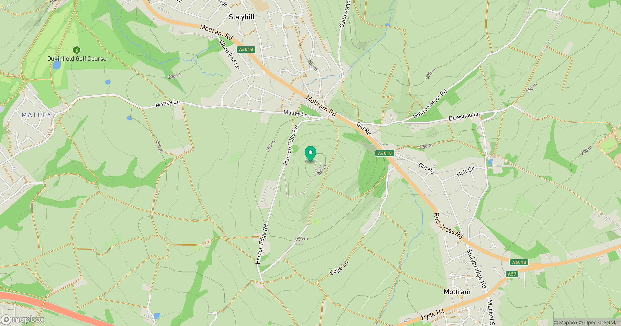
Grid reference: SJ983963
View on OpenStreetMapOpens a map in a new tab, centred on the hill.
Nearby Hills

Kinder Scout
636m
The Roaches
505m
Rombalds Moor [Ilkley Moor]
402m

Pendle Hill
557m
Winter Hill
456m
No comments yet. Be the first.