

Hallin Fell
Good walks are even better shared.
NY4319 : On Hallin Fell
Michael Graham Photo source
Overview
Hallin Fell is a 388 m Wainwright above Howtown and Ullswater, with views into Martindale and across the surrounding fells. The usual short summit walk starts opposite St Peter's Church at Martindale Hause and climbs grassy slopes to a large stone obelisk. This is a small fell with some steep ground: grass can be slippery, and the optional northern descent is much steeper. The lakeshore path around the fell is a separate walk unless a summit ascent is added. Arriving by boat at Howtown offers an alternative to the limited church-area parking.
Hallin Fell
Hallin Fell rises to 388 m above Howtown on the eastern side of Ullswater. It is one of the Far Eastern Wainwrights and a Marilyn, with a prominence of 161 m. The summit offers a broad lake panorama and views into Boredale and Martindale.
Summit
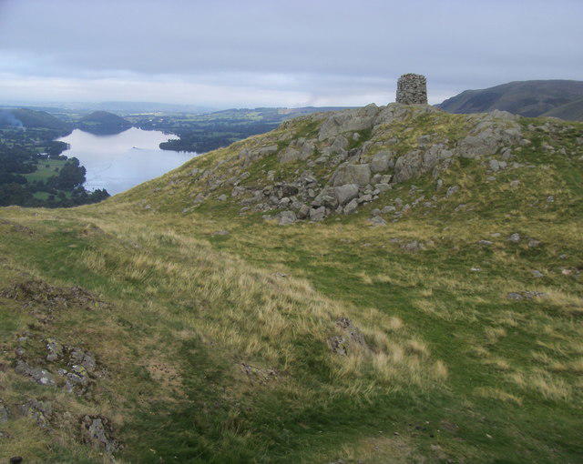
The landmark is a substantial stone obelisk cairn. DoBIH records the summit on its southwest side at NY 43303 19819, and notes similar-height ground 45 m SSE at NY 43323 19781.
Short summit walk from St Peter's Church
The usual high start is the limited parking opposite St Peter's Church at Martindale Hause. WalkLakes describes a 2 km summit circuit with 160 m of ascent and a minimum walking time of 40 minutes. Its ascent begins slightly down the road towards Howtown, turns uphill near a water tank and reaches the obelisk over a rocky rise. The wider main church path provides the return. Allow time for rests and the views.
This is a short hill walk, but the slopes include steep grass. Slips are a real concern, especially on wet ground. In mist, keep to the main church path for descent. UKHillwalking also describes an extended route down the northern side: that descent is substantially steeper and should not be confused with the straightforward church return.
Howtown and the lakeshore
A boat-linked summit visit starts at Howtown pier. The approach joins the lane up to the church, where the main summit path begins. Return the same way for the boat. This starts lower than the church circuit and adds walking and climbing.
The Ullswater lakeshore route around the foot of Hallin Fell does not itself reach the summit. Its wooded, uneven ground makes it a different outing, and continuing to Glenridding is a much longer lakeshore walk. Glenridding is a departure point for a boat to Howtown, not the start of a short direct ascent of this fell.
Getting there and facilities
The lane from Howtown to the church is narrow and steep. Park only where permitted and leave the road and church access clear. Ullswater 'Steamers' states there is no parking at Howtown pier. Glenridding and Pooley Bridge provide alternatives for visitors arriving by boat; check the current timetable and final return sailing before setting out.
Howtown Tearoom offers refreshments below the fell. Check its opening for the day and carry water for the walk.
Geology and name
British Geological Survey identifies Hallin Fell as a reference section of the Birker Fell Andesite Formation, in the Borrowdale Volcanic Group. Andesite lava sheets dominate the formation, with other volcanic rocks and deposits also present.
The origin of the name Hallin is uncertain. Scholarly place-name research treats its etymology as obscure rather than establishing a meaning of 'hollow'.
Further reading
Explore routes near Hallin Fell
Walks starting near this hill. Open a route to check its map, distance and full itinerary.
Striding Edge, Helvellyn and Catstye Cam
View route
Helvellyn via Striding Edge
View route
Bannerdale Crags from Mungrisdale Wainwright
View route
Mungrisdale Common and Bowscale Fell from Mosedale Valley Wainwright
View route
Route planning notes
These notes describe possible approaches. Check a route's map and access information when planning your walk.
Hallin Fell summit circuit from St Peter's Church
Follow WalkLakes' summit circuit: start opposite St Peter's Church, take the path slightly down the road towards Howtown, climb via the water-tank junction to the obelisk, and return by the wide main church path. Expect steep grass and a rocky final rise. The 40-minute time is a minimum before stops. In mist, use the main church path for descent.
Hallin Fell summit from Howtown pier
From Howtown pier, follow the shore-side approach inland to the lane up to St Peter's Church, then climb the main grassy path to the summit obelisk. Return by the main church path and retrace the approach. This adds ascent to the high-start church walk. Boat arrivals can start at Glenridding or Pooley Bridge; plan around the last return sailing. The lakeshore path alone does not visit the summit.
Make a day of it, together
Find someone to share the walk with, or organise a day out along a route you like.
Photo Gallery
View all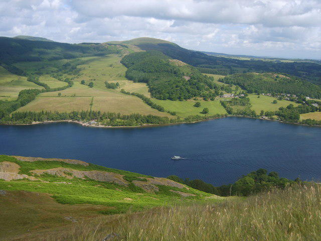 Photo could not load
NY4319 : On Hallin Fell
Michael Graham
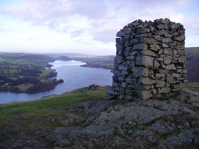 Photo could not load
NY4319 : Obelisk, Hallin Fell
Michael Graham
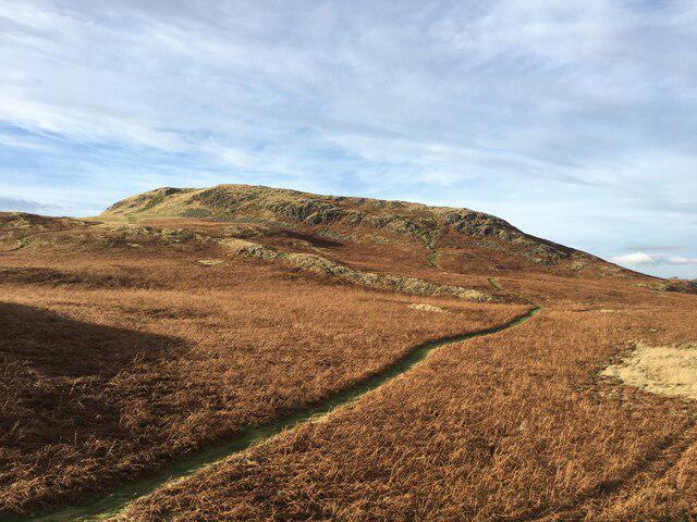 Photo could not load
NY4319 : Hallin Fell
Steven Brown
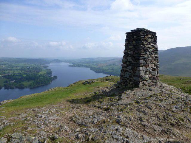 Photo could not load
NY4319 : Obelisk on Hallin Fell
Russel Wills
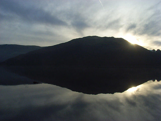 Photo could not load
NY4319 : Silhouette of Hallin Fell reflected in Ullswater
Andrew Smith
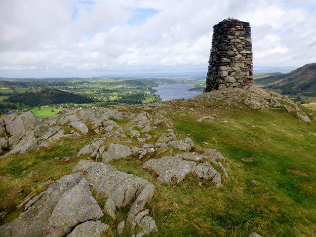 Photo could not load
NY4319 : Hallin Fell
Rude Health
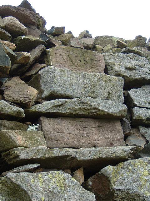 Photo could not load
NY4319 : Inscribed stones on Hallin Fell summit cairn
Jim Barton
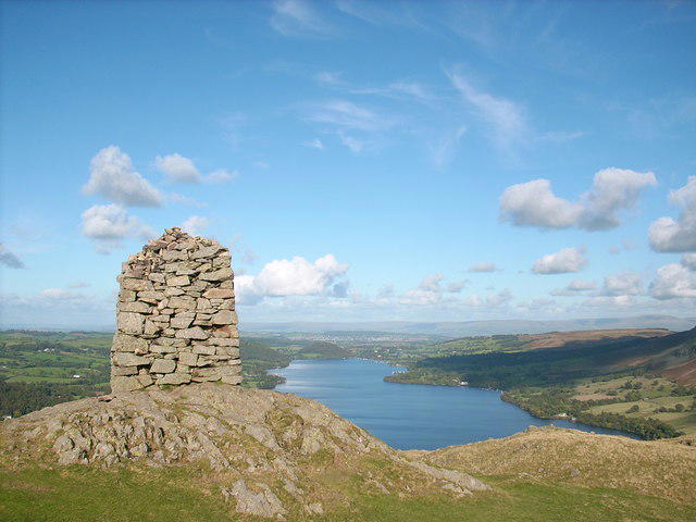 Photo could not load
NY4319 : The obelisk on the summit of Hallin Fell
Stephen Middlemiss
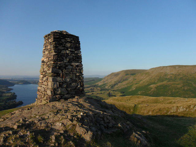 Photo could not load
NY4319 : Hallin Fell Summit Obelisk
Anthony Foster
NY4319 : Hallin Fell Summit
Shaun Ferguson
Hill facts and local notes
Classifications
Elevation
388m
1,273 ft
Prominence
161m
Coordinates
54.5704, -2.8785
NY433198
OS Map
90
Explorer: OL5S
At the Summit
Large stone obelisk cairn. The recorded summit is on its southwest side at NY 43303 19819; ground 45 m SSE at NY 43323 19781 is of similar height.
Terrain & Geology
Hallin Fell is a reference section of the Birker Fell Andesite Formation, part of the Borrowdale Volcanic Group. Its volcanic rocks are predominantly andesite lava sheets, with other volcanic rocks and deposits also present.
Views & Scenery
Views over Ullswater and into Boredale and Martindale, with surrounding fells including the Helvellyn range.
History & Heritage
Name Origin
The origin of 'Hallin' is uncertain. Place-name scholarship treats its etymology as obscure; a confident translation as 'hollow' is not supported.
Historical Significance
Hallin Fell is one of Wainwright's Far Eastern Fells and is also listed as a Marilyn and a Birkett.
Getting There & Facilities
Parking
Limited parking opposite St Peter's Church at Martindale Hause, reached by the narrow, steep lane from Howtown. Follow signs and keep church access and the road clear. There is no parking at Howtown pier. For a boat-linked approach, park at Glenridding or Pooley Bridge and sail to Howtown.
Public Transport
Ullswater 'Steamers' connect Glenridding and Pooley Bridge with Howtown. From Howtown pier, walk to the lane up to St Peter's Church and the summit path. Check the current timetable and last return sailing before setting out. The lakeshore walk to Glenridding is a separate, longer journey, not a short direct summit ascent.
Nearby Facilities
Howtown Tearoom offers refreshments below the fell; check current opening before relying on it. Glenridding and Pooley Bridge have services for boat-linked visits. Carry drinking water for the walk.
Safety Information
Known Hazards
- Steep grass can be slippery, especially when wet; wear footwear with good grip.
- The optional northern descent is much steeper than the main church path and passes rocky outcrops.
- In mist, descend by the main path to St Peter’s Church; avoid unfamiliar shortcuts towards the lake.
General Safety Tips
- Check weather conditions before setting out
- Carry appropriate clothing and equipment
- Let someone know your planned route
- Take a map, compass, and GPS device
- Carry emergency supplies: food, water, first aid kit, torch
Hills
Some common questions about the hills answered
Are there group walks up Hallin Fell?
Many walkers use Walkmates to join or organise walks with others. You can check for group walks around Hallin Fell through the maps
Are there other walkers around Hallin Fell?
Activity varies by location and time, but Walkmates lets you see whether others have shared walks or shown interest in this area. Find other people through the walking friends search walking friends for Hallin Fell search or of course create your own walk for Hallin Fell
Can I organise a walk to Hallin Fell?
Yes. If there aren’t any walks listed already, you can create a walk and make it available for others to join.
If you're signed up to Walkmates, you can create a walk to Hallin Fell.
How do I find a walk up this hill?
There are often multiple ways to walk this hill, depending on experience and route preference. Walkmates helps you explore walks and routes that others have shared.
Can I suggest a new route up Hallin Fell?
Yes. You can suggest or create routes to share with others. Walkmates focuses on the social side of walking, so routes are used to help people organise walks and explore areas together, rather than as detailed navigation tools or route libraries.
Other uses really appreciate knowledgeable walkers sharing their routes. Share your favourite route to Hallin Fell here
The is an error or something incorrect about this hill. How do I let you know?
We always strive to keep the information on Walkmates as accurate as possible. If you find an error, please let us know through the contact form and we'll aim to correct it as quickly as possible
Community Discussion
Comments
Location
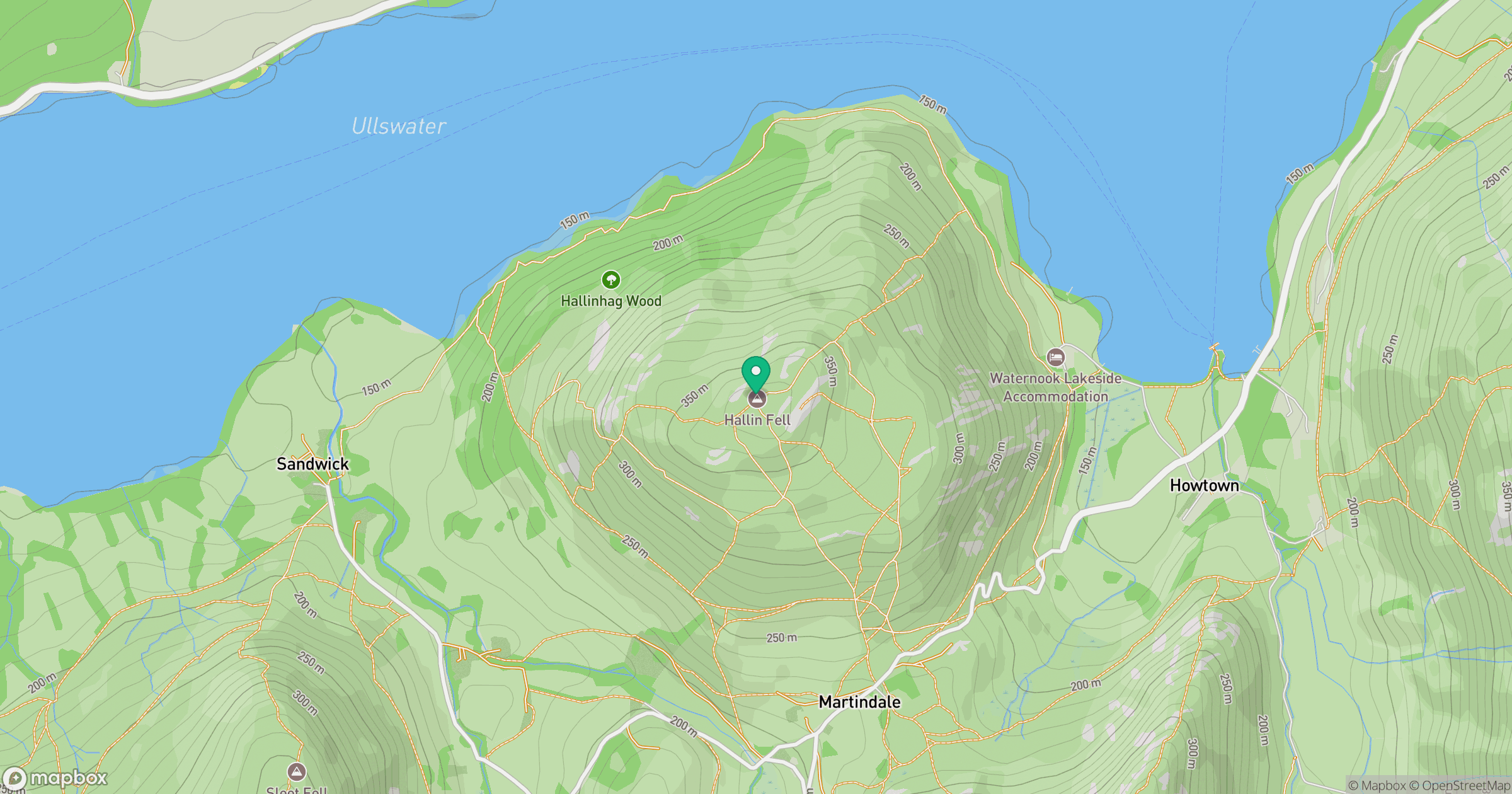
Grid reference: NY433198
View on OpenStreetMapOpens a map in a new tab, centred on the hill.

No comments yet. Be the first.