

Graystones
Good walks are even better shared.
NY1726 : Old Wall, Greystones
Michael Graham Photo source
Overview
Graystones: A Hiker’s Paradise
Graystones, standing at a proud 528 metres, is a Marilyn of the Lake District that promises not just an enjoyable trek, but also a feast for the eyes. This mountain is perfect for anyone looking to escape the hustle and bustle of the everyday grind and connect with nature.
Geology
The geological composition of Graystones is primarily volcanic rock, which tells a tale of ancient geological processes. The occasional rocky outcrop not only adds to the landscape's intrigue but also serves as a reminder of the Earth's volatile past. Remember, though, this is no place to start collecting 'free samples' of rock!
Routes
One favoured route is the Patterdale Circular. This moderate jaunt spans approximately 8.5 km and typically takes around 4 hours to complete, allowing hikers to soak in the scenic beauty of the surrounding landscape. You’ll even get a decent workout—perfect for burning off that cake you indulged in at the cafe.
Summit Features
Upon reaching the summit, hikers are greeted by a large stone cairn and a trig point. This is an ideal spot to pause, catch your breath, and snap a few photos for your social media feed—because if you didn’t Instagram it, did you even go?
Terrain
Expect rocky and grassy terrain, peppered with the occasional boggy patch that will challenge your balance and humour. A good pair of hiking boots is your best friend here!
Views
The panoramic views from Graystones are nothing short of astounding. On a clear day, the shimmering Ullswater can be seen, framed by other notable peaks such as Place Fell and Helvellyn. The best times for these views are late spring through early autumn, when the weather is most favourable.
Hazards
While embarking on your hiking adventure, be mindful of several hazards. Slippery rocks are often lurking in wait, especially after a downpour. And let's not forget the boggy areas—these will happily swallow a not-so-cautious hiker whole!
Nearby Summits
Don’t miss nearby hills such as Place Fell (657 m) and Helvellyn (950 m) for further exploration and challenges.
Access
Getting to Graystones is a breeze—just head to Patterdale, where you’ll find ample parking close to the trek's start. Public transport also serves the area, with Stagecoach buses running from nearby towns like Penrith and Ambleside.
Facilities
Post-trek, the village of Patterdale offers a couple of delightful cafes to refuel, not to mention public toilets—a basic necessity after a long walk!
History
The name 'Graystones' hints at its distinctive grey stones, while the mountain holds cultural significance tied to the history of adventuring in this stunning part of the UK.
So pack your bags, lace up your boots, and get ready to explore Graystones. Happy hiking!
Explore routes near Graystones
Walks starting near this hill. Open a route to check its map, distance and full itinerary.
Whinlatter dark skies walk
View route
Whinlatter dark skies walk
View route
Binsey from Binsey Lodge Direct Out and Back Wainwright
View route
Brae Fell from Longlands Wainwright
View route
Route planning notes
These notes describe possible approaches. Check a route's map and access information when planning your walk.
Patterdale Circular
A scenic circular route starting from Patterdale, offering breathtaking views as you ascend towards the summit.
Make a day of it, together
Find someone to share the walk with, or organise a day out along a route you like.
Photo Gallery
View all Photo could not load
NY1726 : Old Wall, Greystones
Michael Graham
 Photo could not load
NY1726 : OS Bench Mark
Phil Johnstone
 Photo could not load
NY1726 : Ruined wall north of Greystones
Phil Johnstone
 Photo could not load
NY1726 : On Graystones
Michael Graham
 Photo could not load
NY1726 : Cairn, Greystones
Michael Graham
 Photo could not load
NY1726 : Near the summit of Greystones.
steven ruffles
 Photo could not load
NY1726 : Old Wall
Michael Graham
 Photo could not load
NY1726 : Ground on Graystones beyond ruined wall
Trevor Littlewood
Hill facts and local notes
Classifications
Elevation
450m
1,478 ft
Prominence
9m
Coordinates
54.6280, -3.2776
NY176266
OS Map
89 90
Explorer: OL4S
At the Summit
The summit features a large stone cairn and a trig point, perfect for your 'I was here' selfies and to contemplate your life choices.
Terrain & Geology
Graystones is primarily composed of volcanic rock, which is quite common in this region. The rocky outcrops provide a glimpse into the geological history of the area, featuring a mixture of slate and ash deposits indicative of past volcanic activity.
Views & Scenery
From the summit, you can see Ullswater and the surrounding peaks, such as Helvellyn and Place Fell.
History & Heritage
Name Origin
The name 'Graystones' likely derives from the grey-coloured stones found in abundance around the mountain.
Historical Significance
The area has historical significance due to its association with early mountaineering and its stunning natural beauty, which has been a draw for adventurers for generations.
Getting There & Facilities
Parking
There is ample parking available at Patterdale, which is a short walk from the trailhead.
Public Transport
Easily accessible via Stagecoach buses from nearby towns like Penrith and Ambleside.
Nearby Facilities
There are a couple of quaint cafes in Patterdale for a hearty meal post-hike, as well as public toilets.
Safety Information
Known Hazards
- Beware of slippery rocks, particularly after rain. Also, be cautious around boggy areas which can surprise even the most seasoned hiker.
General Safety Tips
- Check weather conditions before setting out
- Carry appropriate clothing and equipment
- Let someone know your planned route
- Take a map, compass, and GPS device
- Carry emergency supplies: food, water, first aid kit, torch
Hills
Some common questions about the hills answered
Are there group walks up Graystones?
Many walkers use Walkmates to join or organise walks with others. You can check for group walks around Graystones through the maps
Are there other walkers around Graystones?
Activity varies by location and time, but Walkmates lets you see whether others have shared walks or shown interest in this area. Find other people through the walking friends search walking friends for Graystones search or of course create your own walk for Graystones
Can I organise a walk to Graystones?
Yes. If there aren’t any walks listed already, you can create a walk and make it available for others to join.
If you're signed up to Walkmates, you can create a walk to Graystones.
How do I find a walk up this hill?
There are often multiple ways to walk this hill, depending on experience and route preference. Walkmates helps you explore walks and routes that others have shared.
Can I suggest a new route up Graystones?
Yes. You can suggest or create routes to share with others. Walkmates focuses on the social side of walking, so routes are used to help people organise walks and explore areas together, rather than as detailed navigation tools or route libraries.
Other uses really appreciate knowledgeable walkers sharing their routes. Share your favourite route to Graystones here
The is an error or something incorrect about this hill. How do I let you know?
We always strive to keep the information on Walkmates as accurate as possible. If you find an error, please let us know through the contact form and we'll aim to correct it as quickly as possible
Community Discussion
Comments
Location
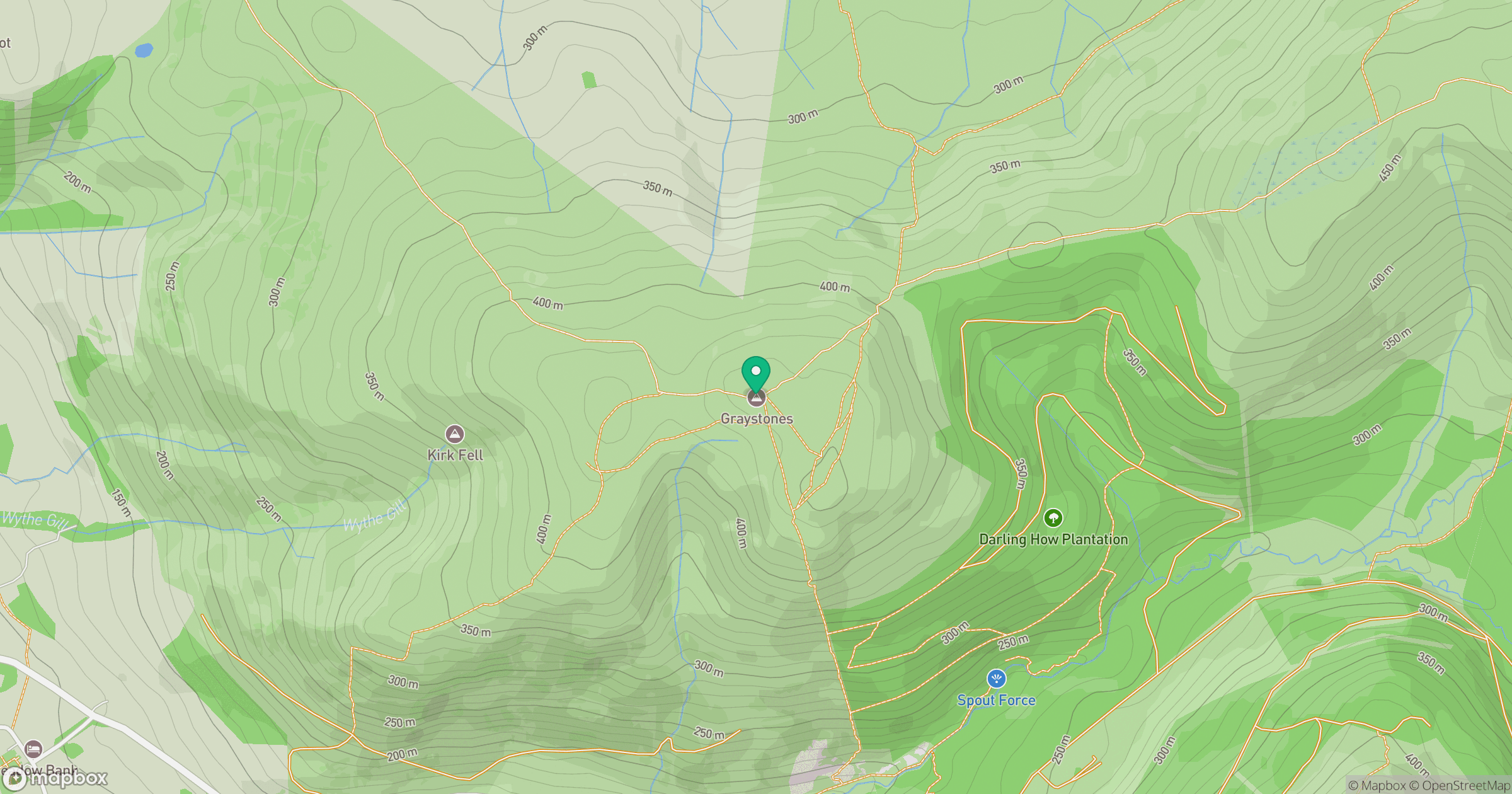
Grid reference: NY176266
View on OpenStreetMapOpens a map in a new tab, centred on the hill.
Nearby Hills
Grisedale Pike
790m
Grasmoor
852m
Crag Hill [Eel Crag]
839m
High Stile [Grey Crag - High Stile]
806m
Fleetwith Pike
649m
No comments yet. Be the first.