

Glatting Beacon
Good walks are even better shared.
SU9613 : Western edge of the National Trusts Bignor Hill
Dave Spicer Photo source
Overview
Glatting Beacon: A Gem in the South Downs
Introduction
Glatting Beacon, standing proudly at 204 meters above sea level, is a Marilyn located in the picturesque South Downs. Not only does it offer a gentle challenge for walkers, but upon arrival, you’re greeted with immense beauty and rich history.
Geology
The landscape here is primarily chalk, shaped over millennia. This unique formation gives rise to the characteristic slopes and cliffs that define the South Downs. At Glatting Beacon, you will observe grassy hills decorated with flints that crackle like fireworks if you kick them just right!
Route Overview
One popular route is the Glatting Beacon Circular, which spans around 8 km and typically takes about 2.5 hours to complete. Starting from the friendly village of Storrington, this circular trek provides a delightful variety of terrain, suitable for both families and seasoned hikers alike.
At The Summit
The summit boasts a sizeable stone cairn, a perfect spot for a well-deserved pause and a few scenic photos. Don’t forget to locate the trig point—it’s easily recognizable and serves as a great conversation starter about the enigma of trigonometrics versus whisky measurements!
Terrain and Views
Expect grassy slopes that roll gently with patches of rocky outcrops. The vistas from the top are nothing short of breathtaking. You may even catch sight of the English Channel stretching into the distance on clear days. Late spring and autumn are particularly beautiful times to enjoy the scenery.
Hazards
Be mindful of the weather. The South Downs can be unpredictable, so packing an extra layer is always a wise choice—it could come in handy when the sun dips behind the clouds.
Nearby Attractions
If you're up for more exploration, consider nearby summits such as Wolstonbury Hill or Ditchling Beacon. Each spot brings its own charm and beauty to the table—it's an outdoor buffet that keeps on giving!
Access and Facilities
Getting here is straightforward. There’s a small parking lot at the base, though it fills up quickly. Public transport options are also available. After your hike, reward yourself at the local café in Storrington, where a slice of cake and a cup of tea await!
Conclusion
Glatting Beacon, with its rich blend of natural beauty and easy accessibility, is a must-visit for any hiking enthusiast. Whether you're looking to conquer your first hill or are a seasoned mountaineer, this beacon shines bright on the map of Britain’s outdoor treasures.
Remember, while hiking is about enjoying nature, safety is paramount. Stay alert, share the pathways, and bring home stories to tell!
Last Updated: 2023-10-15
Source: Ordnance Survey
Explore routes near Glatting Beacon
Walks starting near this hill. Open a route to check its map, distance and full itinerary.
Petworth Walk with Men Walking & Talking
View route
Petworth Park: Capability Brown Hills and Lower Pond Circuit
View route
Littlehampton Walk & Talk
View route
Littlehampton Walk & Talk
View route
Route planning notes
These notes describe possible approaches. Check a route's map and access information when planning your walk.
Glatting Beacon Circular
Starting from the nearby village of Storrington, this circular route offers a mix of gentle inclines and flatter sections, making it suitable for families and beginners.
Make a day of it, together
Find someone to share the walk with, or organise a day out along a route you like.
Photo Gallery
View all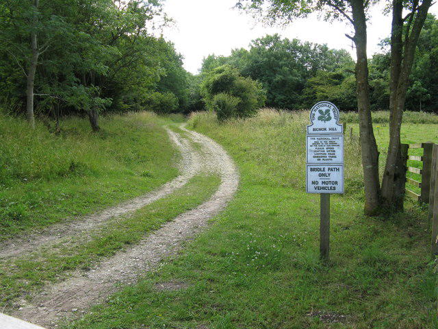 Photo could not load
SU9613 : Western edge of the National Trusts Bignor Hill
Dave Spicer
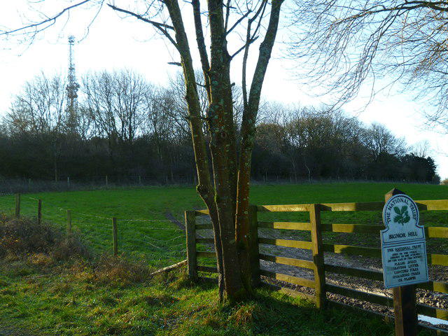 Photo could not load
SU9613 : National Trust notice on Bignor Hill
Shazz
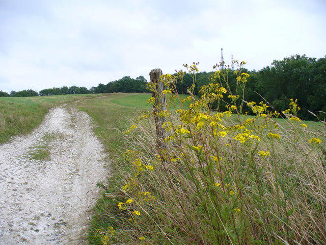 Photo could not load
SU9613 : Footpath to Glatting Beacon.
Colin Smith
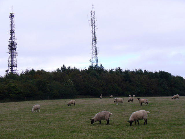 Photo could not load
SU9613 : Masts on Glatting Beacon
Colin Smith
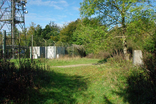 Photo could not load
SU9613 : Structures on Glatting Beacon
Robin Webster
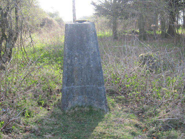 Photo could not load
SU9613 : Ordnance Survey Trig Pillar S1519
Peter Wood
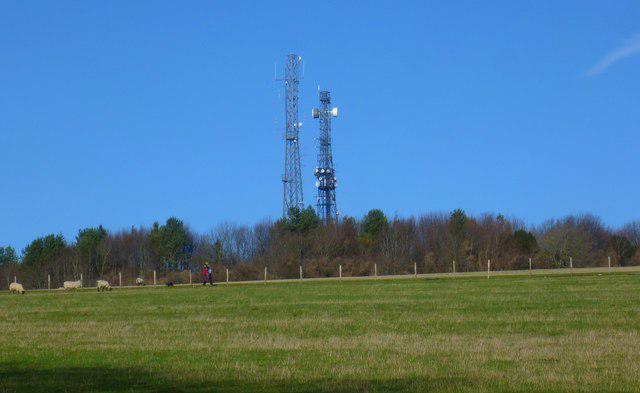 Photo could not load
SU9613 : The masts at Glatting Beacon
Shazz
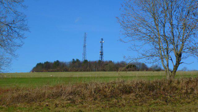 Photo could not load
SU9613 : Glatting Beacon seen from the south east
Shazz
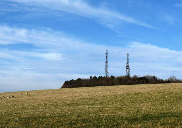 Photo could not load
SU9613 : Glatting Beacon
Dave Spicer
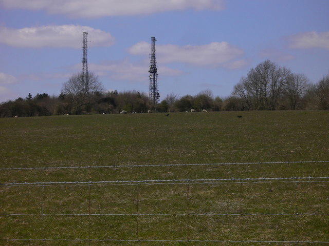
SU9613 : Glatting Beacon
Shazz
Hill facts and local notes
Classifications
Elevation
245m
804 ft
Prominence
96m
Coordinates
50.9094, -0.6274
SU965131
OS Map
197
Explorer: OL10 121
At the Summit
The summit features a large stone cairn, perfect for a photo op, and a trig point that might just spark a debate about its alignment towards the nearest café.
Terrain & Geology
The South Downs are predominantly chalk, forming stunning cliffs and rolling hills. Glatting Beacon exemplifies this with its grassy slopes and occasional flint outcrops.
Views & Scenery
On a clear day, hikers can enjoy panoramic views over the Weald and the distant outline of the English Channel.
History & Heritage
Name Origin
The name 'Glatting' is believed to be derived from Old English, referring to the hill's rounded shape.
Historical Significance
Historically, the South Downs have been significant to the local community for centuries, providing grazing land and routes for local trade.
Getting There & Facilities
Parking
There is a small parking area at the base of the hill, off the A283, with room for around 10 vehicles. Arrive early to secure a spot!
Public Transport
Regular bus services operate from nearby towns such as Storrington and Pulborough. Check local services for the latest timetable.
Nearby Facilities
A quaint café in Storrington serves delicious cakes and hot drinks, perfect for refueling before or after your hike. Public toilets are also available in the village.
Safety Information
Known Hazards
- Potential for sudden weather changes, especially in winter months; ensure you're dressed for all seasons!
General Safety Tips
- Check weather conditions before setting out
- Carry appropriate clothing and equipment
- Let someone know your planned route
- Take a map, compass, and GPS device
- Carry emergency supplies: food, water, first aid kit, torch
Hills
Some common questions about the hills answered
Are there group walks up Glatting Beacon?
Many walkers use Walkmates to join or organise walks with others. You can check for group walks around Glatting Beacon through the maps
Are there other walkers around Glatting Beacon?
Activity varies by location and time, but Walkmates lets you see whether others have shared walks or shown interest in this area. Find other people through the walking friends search walking friends for Glatting Beacon search or of course create your own walk for Glatting Beacon
Can I organise a walk to Glatting Beacon?
Yes. If there aren’t any walks listed already, you can create a walk and make it available for others to join.
If you're signed up to Walkmates, you can create a walk to Glatting Beacon.
How do I find a walk up this hill?
There are often multiple ways to walk this hill, depending on experience and route preference. Walkmates helps you explore walks and routes that others have shared.
Can I suggest a new route up Glatting Beacon?
Yes. You can suggest or create routes to share with others. Walkmates focuses on the social side of walking, so routes are used to help people organise walks and explore areas together, rather than as detailed navigation tools or route libraries.
Other uses really appreciate knowledgeable walkers sharing their routes. Share your favourite route to Glatting Beacon here
The is an error or something incorrect about this hill. How do I let you know?
We always strive to keep the information on Walkmates as accurate as possible. If you find an error, please let us know through the contact form and we'll aim to correct it as quickly as possible
Community Discussion
Comments
Location
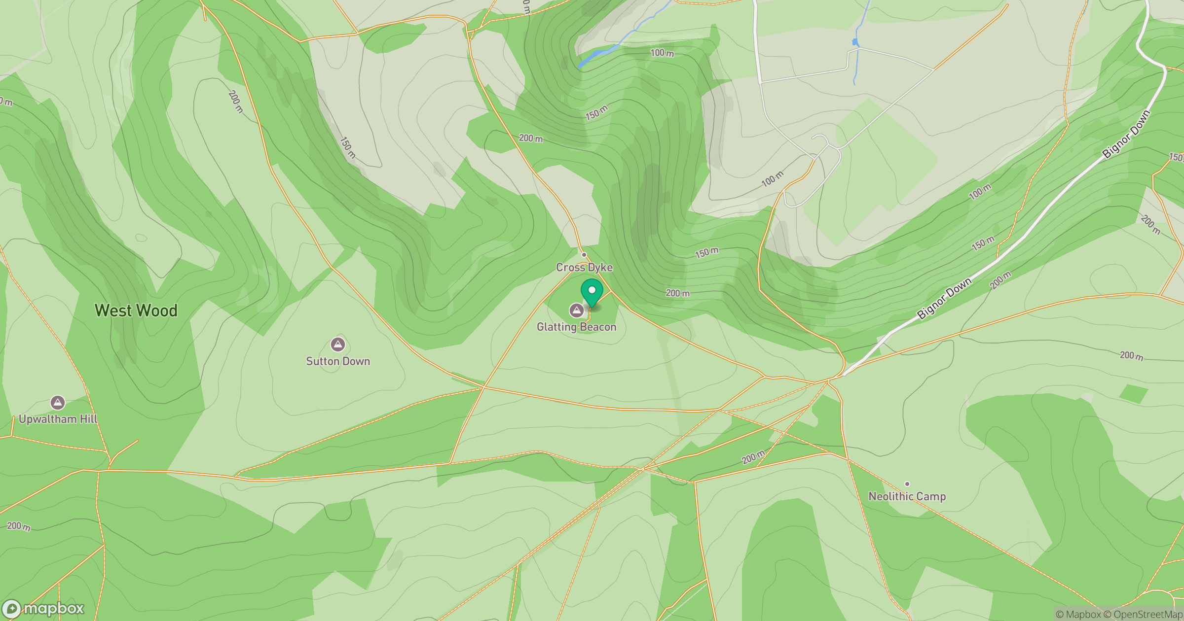
Grid reference: SU965131
View on OpenStreetMapOpens a map in a new tab, centred on the hill.
Nearby Hills
Leith Hill
294m
Ditchling Beacon
248m
Glastonbury Tor
158m
Worcestershire Beacon
425m
Titterstone Clee Hill
533m
No comments yet. Be the first.