

Glas Tulaichean
Good walks are even better shared.
NO0575 : Corrie headwall, Glas Tulaichean
Richard Webb Photo source
Overview
Introduction
Nestled within the stunning Scottish Highlands, Glas Tulaichean towers at an impressive 1,037 meters, serving as a captivating retreat for adventurers and nature enthusiasts alike. Its unique charm is a blend of moderate routes, panoramic views, and intriguing geological features that make it a delightful mountain to explore.
Geology
Glas Tulaichean's landscape is shaped by its geological history, predominantly consisting of granitic gneiss and schist. As you trek the trails, you'll encounter weathered outcrops that show evidence of ancient glacial movements, providing a fascinating insight into the earth's history. These geological features contribute to Glas Tulaichean's rugged yet serene beauty.
Routes
- The Glenlochsie Route: Widely regarded as the favourite for many hikers, this route is gentle on the legs and offers breathtaking views as you ascend. Expect a pleasing 10.5 km journey that takes around 4 hours, making it an ideal option for a leisurely day hike.
- The Allt Oisgill Route: For those seeking a bit more of a challenge, this steeper option leads you through stunning landscapes and takes about 3.5 hours for an 8 km hike. Just ensure your boots are up to the task!
Summit Features
At the summit, you'll be greeted by a significant cairn, a fine spot for snapping photos and enjoying the sheer beauty that stretches across the Highlands. And you may find fellow hikers sharing a laugh or two about the efforts it took to get there!
Terrain
The terrain is an eclectic mix, with rocky patches, heather-laden slopes, and a few boggy bits to keep you on your toes. The variety makes the hike all the more interesting (as long as you stay upright!).
Views
Views from Glas Tulaichean are nothing short of spectacular. From the top, a commanding panorama of the Cairn Toul and the surrounding Glen Callater makes all the effort worthwhile. The best times to take it all in are during the late spring and early autumn, when the Highlands really show off their colours.
Hazards
Being in the Highlands, the weather can turn on a dime. Always check the forecast before heading out, and pack accordingly. Additionally, watch out for boggy patches that can be tricky, especially after rain. Good boots are your best friend!
Access
Getting to Glas Tulaichean is convenient, with parking available at Glenlochsie Lodge. While public transport options are scant, Blairgowrie nearby is the hub for any basic needs you might have before or after your hike.
Facilities
For a good pit stop, Glenlochsie Lodge has basic facilities, but venture into Blairgowrie for a more substantial meal or a soothing cup of coffee before or after your hike.
Conclusion
In summary, Glas Tulaichean is more than just another Munro; it’s a treasure trove of stunning scenery, fascinating geology, and perhaps a dash of humour to boot. So lace up your hiking boots and prepare for an adventure that promises to be both enjoyable and memorable!
Explore routes near Glas Tulaichean
Walks starting near this hill. Open a route to check its map, distance and full itinerary.
Aberfeldy: Glassie Woodland and River Tay Circular
View route
Unled club outing: West Drumochter/Beinn Udlamain (coach departure)
View route
Unled club outing: Glenesk (coach departure)
View route
Unled club outing: Xmas Walk - Bankfoot - Dunkeld (coach departure)
View route
Route planning notes
These notes describe possible approaches. Check a route's map and access information when planning your walk.
The Glenlochsie Route
A popular route starting from the southern end of the mountain, this path offers scenic views and a steady uphill climb, perfect for a relaxed yet invigorating hike.
The Allt Oisgill Route
This trail takes a slightly steeper approach, offering hikers a more challenging ascent while treating them to stunning vistas along the way.
Make a day of it, together
Find someone to share the walk with, or organise a day out along a route you like.
Photo Gallery
View all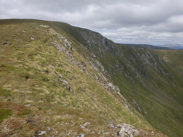 Photo could not load
NO0575 : Corrie headwall, Glas Tulaichean
Richard Webb
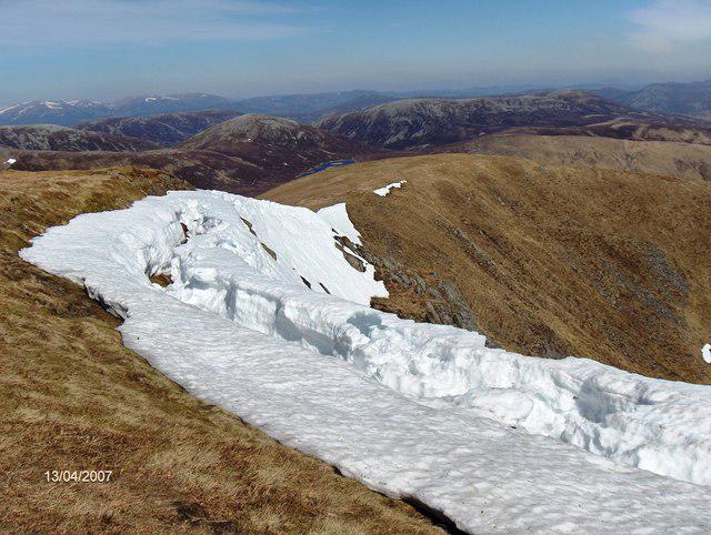 Photo could not load
NO0575 : Glas Tulaichean, Dalmunzie, Glenshee
victor cammack
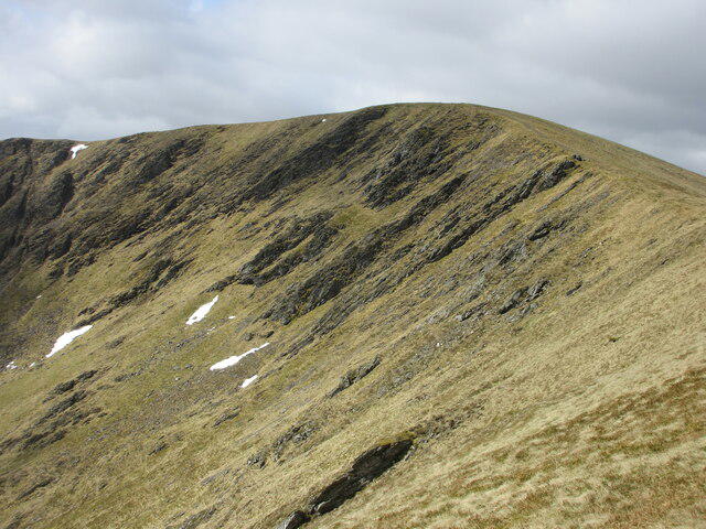 Photo could not load
NO0576 : Glas Choire Mhòr of Glas Tulaichean
Scott Cormie
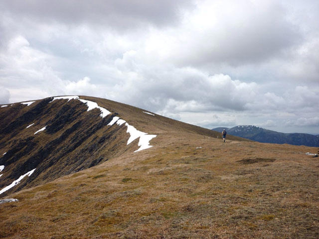 Photo could not load
NO0576 : Nearing the summit of Glas Tulaichean
Karl and Ali
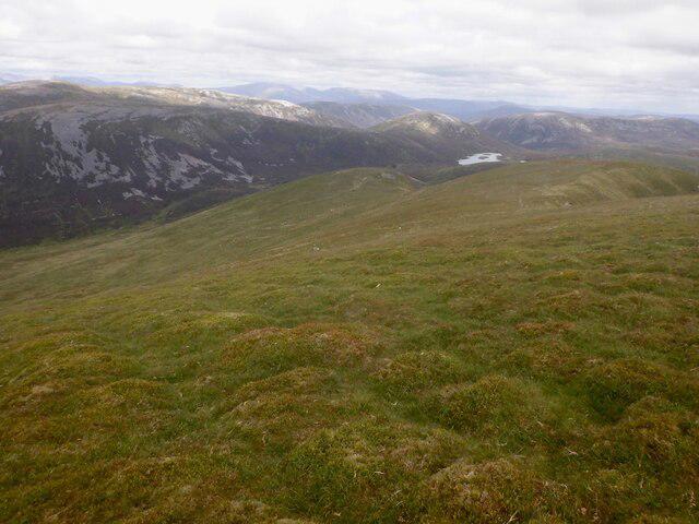 Photo could not load
NO0576 : North ridge, Glas Tulaichean
Richard Webb
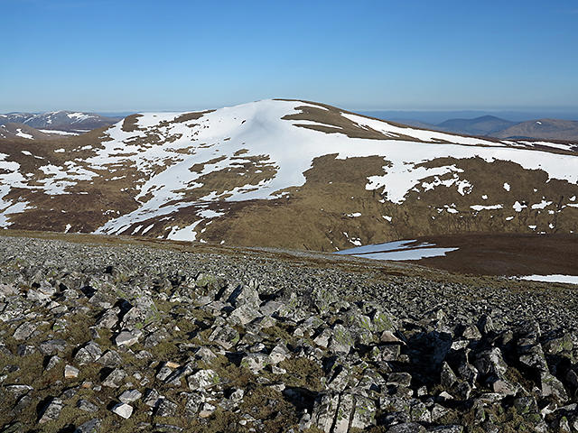 Photo could not load
NO0576 : Glas Tulaichean from Carn an Righ
William Starkey
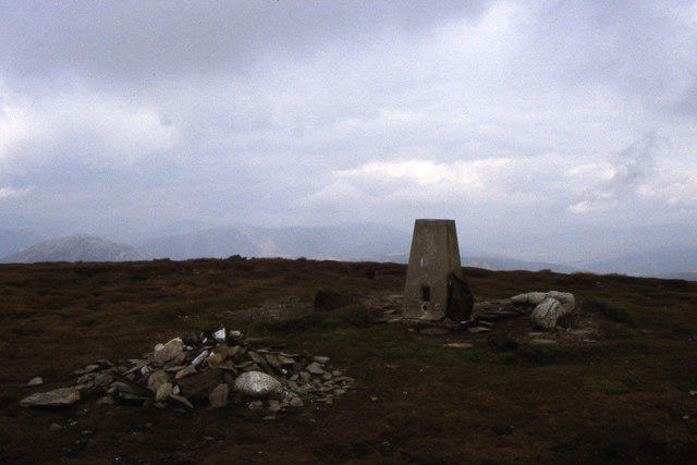 Photo could not load
NO0576 : Trig point on Glas Tulaichean
Colin Park
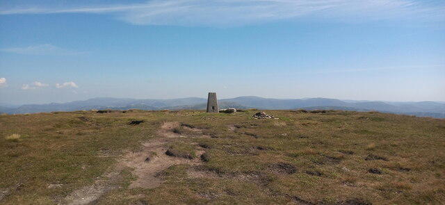 Photo could not load
NO0576 : Summit of Glas Tulaichean
Iain Russell
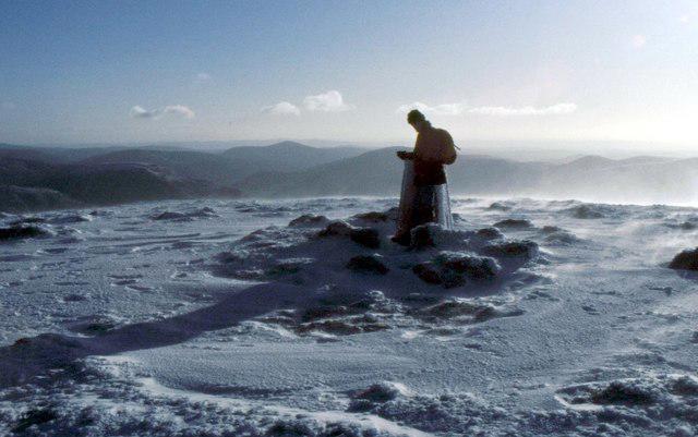 Photo could not load
NO0576 : Summit trig point on Glas Tulaichean
Russel Wills
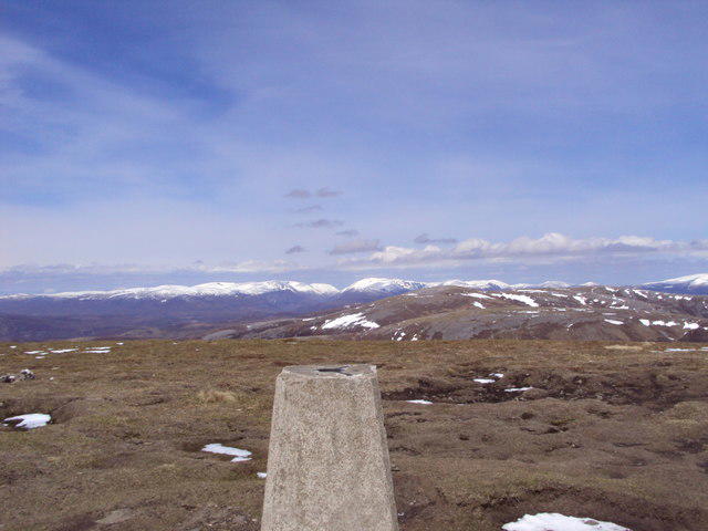
NO0576 : The Lairig Ghru from Glas Tulaichean
Alan Batty
Hill facts and local notes
Classifications
Elevation
1,051m
3,448 ft
Prominence
384m
Coordinates
56.8658, -3.5582
NO051760
OS Map
43
Explorer: OL52N 387N
At the Summit
The summit of Glas Tulaichean is marked by a substantial cairn, alongside spectacular 360-degree views of the surrounding mountains and glens. Look sharp; you might just spot a fellow hiker doing the happy dance upon reaching the top!
Terrain & Geology
Glas Tulaichean is primarily composed of granitic gneiss and schist, featuring well-weathered outcrops that tell tales of ancient geological processes. The dramatic landscape includes glacial features, which add to the majesty of the surroundings.
Views & Scenery
From the summit, one can enjoy breathtaking views of the nearby peaks, including the mighty Cairn Toul and the expansive vistas of the surrounding Glen Callater.
History & Heritage
Name Origin
The name 'Glas Tulaichean' is derived from Scottish Gaelic, meaning 'Gray Hill of the Hillock', a fitting description that captures its character in a poetic fashion.
Historical Significance
Historically, this area was inhabited by early Celtic tribes and later was a hideout for those escaping from the 18th-century clearances, giving it a rich cultural tapestry.
Getting There & Facilities
Parking
The nearest parking is located at the car park near the Glenlochsie Lodge, which offers ample space for walkers. This is a great starting point for your adventure.
Public Transport
Public transport options are limited, but there are bus services from Blairgowrie to nearby villages; check local timetables for the latest schedules.
Nearby Facilities
Basic facilities like toilets can be found at the Glenlochsie Lodge. If you're in dire need of a caffeine fix or a snack, Blairgowrie has a selection of cafes and shops.
Safety Information
Known Hazards
- The unpredictable and rapidly changing weather in the Highlands can pose a risk; be sure to check forecasts and prepare adequately. Additionally, some areas could be boggy and slippery, so robust footwear is recommended to avoid unfortunate slips.
General Safety Tips
- Check weather conditions before setting out
- Carry appropriate clothing and equipment
- Let someone know your planned route
- Take a map, compass, and GPS device
- Carry emergency supplies: food, water, first aid kit, torch
Hills
Some common questions about the hills answered
Are there group walks up Glas Tulaichean?
Many walkers use Walkmates to join or organise walks with others. You can check for group walks around Glas Tulaichean through the maps
Are there other walkers around Glas Tulaichean?
Activity varies by location and time, but Walkmates lets you see whether others have shared walks or shown interest in this area. Find other people through the walking friends search walking friends for Glas Tulaichean search or of course create your own walk for Glas Tulaichean
Can I organise a walk to Glas Tulaichean?
Yes. If there aren’t any walks listed already, you can create a walk and make it available for others to join.
If you're signed up to Walkmates, you can create a walk to Glas Tulaichean.
How do I find a walk up this hill?
There are often multiple ways to walk this hill, depending on experience and route preference. Walkmates helps you explore walks and routes that others have shared.
Can I suggest a new route up Glas Tulaichean?
Yes. You can suggest or create routes to share with others. Walkmates focuses on the social side of walking, so routes are used to help people organise walks and explore areas together, rather than as detailed navigation tools or route libraries.
Other uses really appreciate knowledgeable walkers sharing their routes. Share your favourite route to Glas Tulaichean here
The is an error or something incorrect about this hill. How do I let you know?
We always strive to keep the information on Walkmates as accurate as possible. If you find an error, please let us know through the contact form and we'll aim to correct it as quickly as possible
Community Discussion
Comments
Location
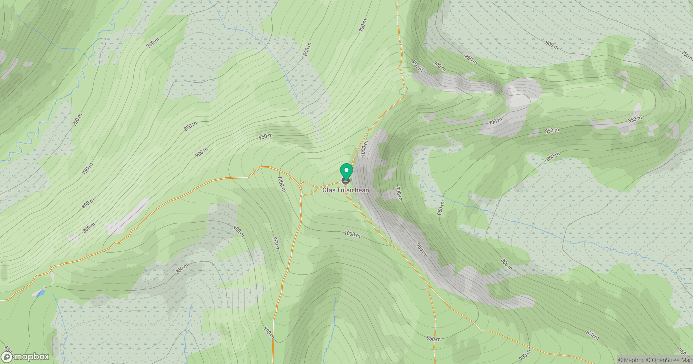
Grid reference: NO051760
View on OpenStreetMapOpens a map in a new tab, centred on the hill.
![Ben Macdui [Beinn Macduibh]](https://cdn.walkmates.com/gallery-images/e60cf32aeb394c3282fcdd14a63368f0.jpg)
No comments yet. Be the first.