
Glas Bheinn
Good walks are even better shared.
Overview
Overview
Glas Bheinn is a delightful Marilyn standing proudly within the rolling hills of the Scottish Highlands. With an elevation of 661 meters, it may not hold the title of the highest peak, but it boasts plenty of charm and stunning views that beg to be explored.
Geology
The landscape around Glas Bheinn is primarily made up of metamorphic schist. The mountain has been shaped over millennia by geological processes, including glacial activity. If you're into geology, you'll find yourself captivated by the layers of rock displaying nature's artistry—just don't forget to take a picture lest you forget what a rock looks like.
Routes
The most popular route to Glas Bheinn starts at Knockderry. This path takes about 3.5 hours and covers 8 km. The trek offers a moderate challenge, with plenty of scenic breaks along the way. Perfect for those who love to amble and appreciate nature's wonders.
Summit Features
At the summit, you'll find a well-tended cairn that gives a good reason to stop and catch your breath—just be careful of the flying rocks; just kidding, it's quite safe! The rolling landscapes below are a feast for the eyes.
Views
From the top, on clear days, you’ll gasp at the magnificent sights of Loch Fyne and the distant beauty of the Arran Islands. Make sure your camera is charged, or risk eternal regret!
Hazards
As with any Highland adventure, the weather can be unpredictable. The rocky paths can also be slippery, especially after rainfall. Keep an eye out for hidden bogs that seem more inviting than they actually are. Stay alert and pack your sense of adventure.
Nearby Summits
Don’t miss the chance to check out nearby Ben More, the towering giant in the area, though you may want to leave that trek for another day!
Access
Parking is available in a lay-by near Knockderry, perfect for a quick stop before your hike. Public transport options are around, with bus services operating to nearby Inveraray.
Facilities
Inveraray's charming cafes and shops provide a perfect spot to refuel after your climb. Check out local delicacies—who can resist a good scone?
History
The name Glas Bheinn, meaning 'Grey Mountain', hints at its rugged beauty. The peaks have been part of local folklore, enriching the area’s charming stories.
Put your hiking boots on, grab your trusty walking stick, and set out on an adventure to Glas Bheinn. Remember, the journey starts not just at the foot of the mountain but also in your spirit of adventure—so make it a good one!
Explore routes near Glas Bheinn
Walks starting near this hill. Open a route to check its map, distance and full itinerary.
Crinan Canal: Bellanoch and Dunardry towpath return
View route
Goatfell from Cladach
View route
Glen Kin group walk
View route
Bishop’s Glen group walk
View route
Route planning notes
These notes describe possible approaches. Check a route's map and access information when planning your walk.
From Knockderry
This scenic route begins at the small village of Knockderry and meanders through lush forests before ascending to the summit.
Make a day of it, together
Find someone to share the walk with, or organise a day out along a route you like.
Hill facts and local notes
Classifications
Elevation
562m
1,844 ft
Prominence
279m
Coordinates
55.8573, -5.9959
NR500699
OS Map
61
Explorer: 355S
At the Summit
The summit is marked by a small cairn which can often resemble a pile of well-placed rocks, perfect for a photo opportunity. On a clear day, you might wonder if the rocks are pretending to be a monument.
Terrain & Geology
Composed primarily of metamorphic schist, Glas Bheinn showcases the rugged beauty typical of the Scottish Highlands. The mountain's geology is visible in its steep slopes and dramatic cliffs, providing a rich tapestry of rock formations and glacial features.
Views & Scenery
From the summit, one can enjoy sweeping views of Loch Fyne and the distant Arran Islands, as well as the breathtaking backdrop of the surrounding peaks.
History & Heritage
Name Origin
Glas Bheinn translates to 'Grey Mountain' in Gaelic, a fitting name considering its rocky appearance.
Historical Significance
This mountain is significant to local folklore, often featured in tales told by the fireside in nearby villages.
Getting There & Facilities
Parking
There is a lay-by near Knockderry which can accommodate a few cars. Arrive early to secure a spot!
Public Transport
Buses run to nearby towns like Inveraray, but you'll need to taxi or walk the final stretch to the trailhead.
Nearby Facilities
Inveraray offers several cafes and places to grab a bite, as well as public toilets. Always a good idea before a long walk!
Safety Information
Known Hazards
- Unpredictable weather changes, rocky terrain, and areas of soft ground can present challenges. It’s good to keep your wits about you.
General Safety Tips
- Check weather conditions before setting out
- Carry appropriate clothing and equipment
- Let someone know your planned route
- Take a map, compass, and GPS device
- Carry emergency supplies: food, water, first aid kit, torch
Hills
Some common questions about the hills answered
Are there group walks up Glas Bheinn?
Many walkers use Walkmates to join or organise walks with others. You can check for group walks around Glas Bheinn through the maps
Are there other walkers around Glas Bheinn?
Activity varies by location and time, but Walkmates lets you see whether others have shared walks or shown interest in this area. Find other people through the walking friends search walking friends for Glas Bheinn search or of course create your own walk for Glas Bheinn
Can I organise a walk to Glas Bheinn?
Yes. If there aren’t any walks listed already, you can create a walk and make it available for others to join.
If you're signed up to Walkmates, you can create a walk to Glas Bheinn.
How do I find a walk up this hill?
There are often multiple ways to walk this hill, depending on experience and route preference. Walkmates helps you explore walks and routes that others have shared.
Can I suggest a new route up Glas Bheinn?
Yes. You can suggest or create routes to share with others. Walkmates focuses on the social side of walking, so routes are used to help people organise walks and explore areas together, rather than as detailed navigation tools or route libraries.
Other uses really appreciate knowledgeable walkers sharing their routes. Share your favourite route to Glas Bheinn here
The is an error or something incorrect about this hill. How do I let you know?
We always strive to keep the information on Walkmates as accurate as possible. If you find an error, please let us know through the contact form and we'll aim to correct it as quickly as possible
Community Discussion
Comments
Location
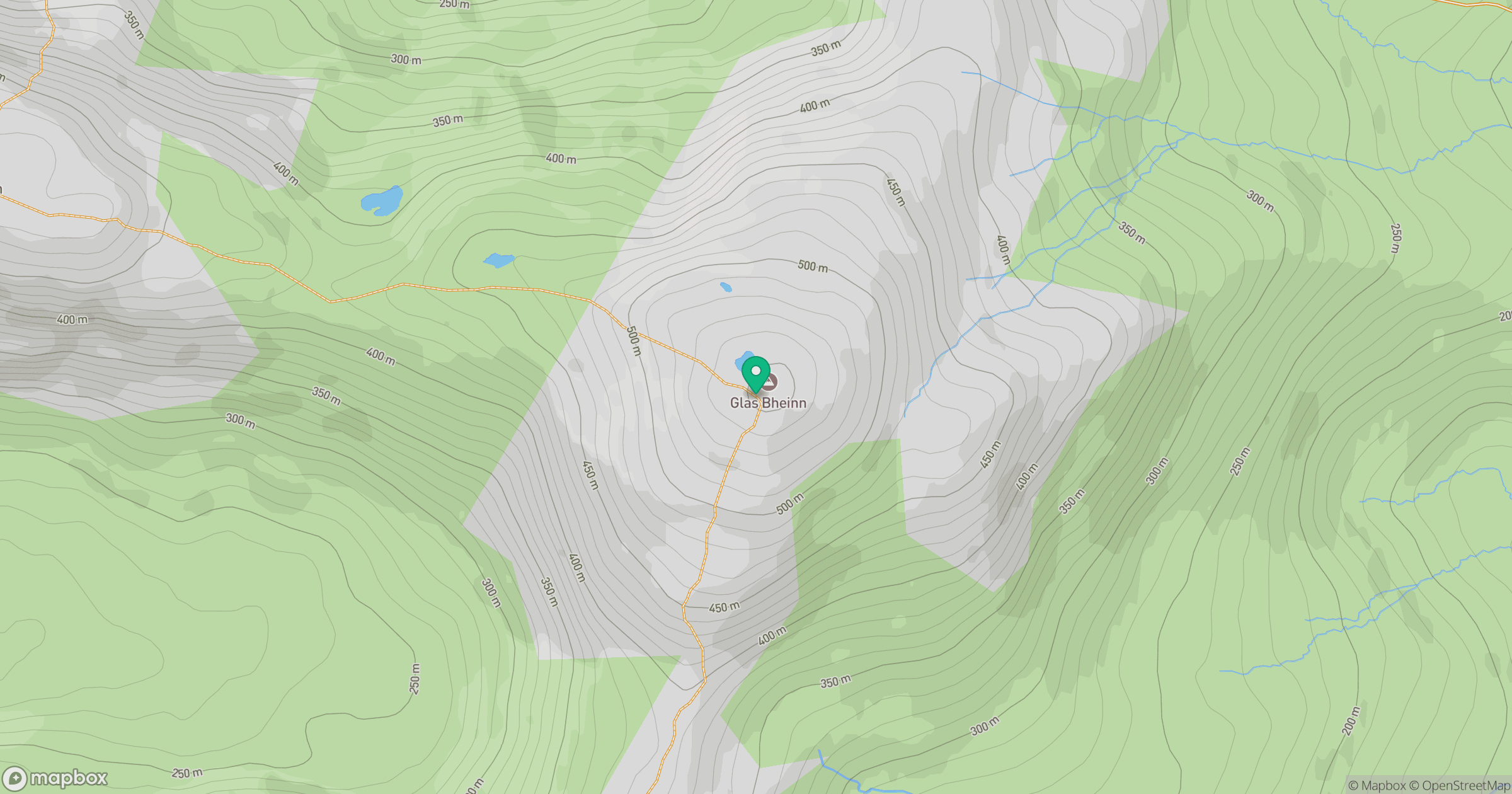
Grid reference: NR500699
View on OpenStreetMapOpens a map in a new tab, centred on the hill.
No comments yet. Be the first.