
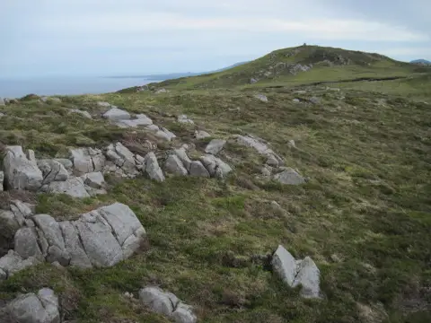
Brat Bheinn
Good walks are even better shared.
Overview
Brat Bheinn: A Highland Gem
Brat Bheinn, towering at 882 meters, is a celebrated Munro in the stunning Scottish Highlands. If you ever fancy a walk that makes you feel like you’re on top of the world (literally), this is the spot for you!
Geology
This rugged mountain is primarily formed of Old Red Sandstone. Its fascinating geology contributes to the iconic landscape of the region, harbouring a rich variety of flora and fauna. You might even spot some peculiar rock formations that look like they've been placed there by some celestial artist!
Routes
Glen Kinglas Approach
Starting at the Glen Kinglas Car Park, this route spans about 13.5 km. It’s a moderate adventure with a steady ascent through forests that can make you think you are on the set of a fantasy film. Allow around 5 hours to enjoy this lovely journey. Bring a picnic, as there are few better spots to enjoy a scone!
Inveraray Circuit
This challenging route brings together Brat Bheinn and several nearby peaks, perfect for those craving a day of adventure. At 18 km and taking about 7 hours, prepare for some breathtaking views that’ll make your friends jealous of your Instagram feed!
Summit Features
The summit proudly showcases a cairn and provides unrivaled panoramic views of the Scottish landscape, including the iconic Ben Arthur and Loch Fyne. It’s a fantastic spot to catch your breath – and to show off your summit selfie skills!
Terrain
Expect rocky and grassy paths, interspersed with patches of heather and some boggy sections that might challenge your footwork! Good boots are a must.
Views
The views from Brat Bheinn are nothing short of spectacular, particularly in the spring and early autumn when the weather is more forgiving. On a clear day, you'll be treated to sights that will keep your camera clicking!
Hazards
The terrain can get muddy, particularly after rain. Do check the weather forecast, as Highland weather is as changeable as a cat on a hot tin roof! Be cautious of loose stones on the rocky paths; they can be more slippery than an eel in oil.
Access
Nearest Parking
Park at Glen Kinglas Car Park, just off the A83 road. Get there early – it’s a popular starting point!
Public Transport
Buses run between Glasgow and Inveraray. From there, a taxi or a long walk will take you closer to the mountain.
Nearest Town
Inveraray is a charming town to stop by for supplies and a bite to eat.
Facilities
You'll find several cafes and shops in Inveraray, though make sure to pack everything you need before ascending. The mountain is devoid of facilities, so plan accordingly!
History
Name Meaning
Brat Bheinn translates to 'Mountain of the Nest' in Gaelic. Folks say the area is home to wildlife, making it deserving of the name.
Significance
Rich in cultural significance, Brat Bheinn holds a place in local folklore and Highland clan histories.
In conclusion, whether you are a seasoned hiker or a casual walker, Brat Bheinn offers something for everyone. Just remember, a great view awaits those who put in the effort – and a bit of mud never hurt anyone, right?
Happy hiking!
Explore routes near Brat Bheinn
Public walks starting within 80 km of this hill. Nearby does not mean a route reaches the summit; check its map and access before setting out.
Crinan Canal: Bellanoch and Dunardry towpath return
View route
Goatfell from Cladach
View route
Glen Kin group walk
View route
Bishop’s Glen group walk
View route
Route planning notes
These notes describe possible approaches, not verified navigable routes or permission to cross land. Check current paths, local access rules and conditions before setting out.
Glen Kinglas Approach
A popular route that starts from the car park at Glen Kinglas, traversing through lush forests and open moorland before a steady ascent to the summit.
Inveraray Circuit
An adventurous route that incorporates Brat Bheinn with other nearby peaks, offering stunning views throughout the journey.
Make a day of it, together
Find someone to share the walk with, or organise a day out along a route you like.
Photo Gallery
View all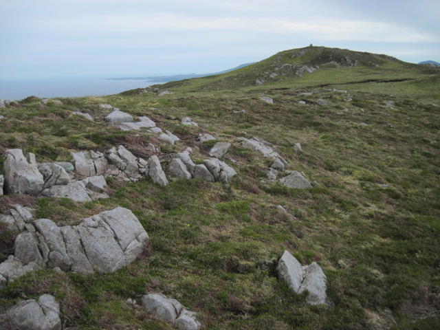 Photo could not load
NR4966 : Towards Brat Bheinn summit
Chris Wimbush
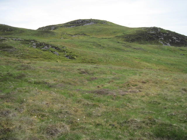 Photo could not load
NR4966 : Brat Bheinn
Chris Wimbush
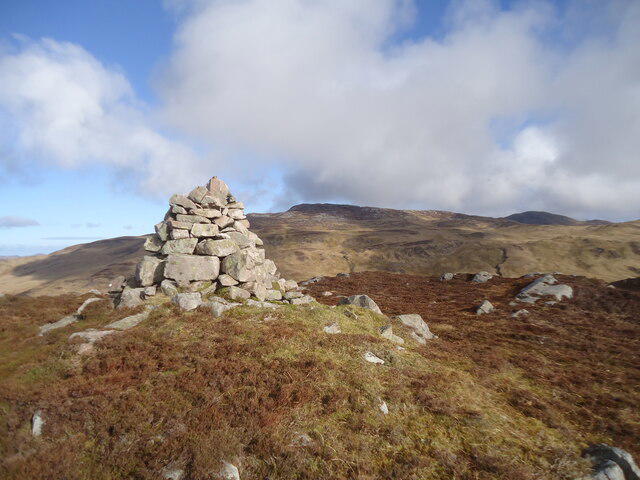 Photo could not load
NR4966 : The summit of Brat Bheinn, Jura
Michael Earnshaw
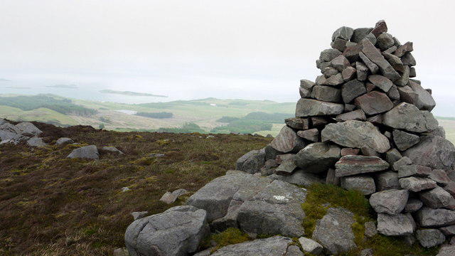 Photo could not load
NR4966 : Summit cairn on Brat Bheinn
Andrew Curtis
Hill facts and local notes
Classifications
Elevation
342m
1,122 ft
Prominence
104m
Coordinates
55.8243, -6.0008
NR495662
OS Map
60 61
Explorer: 355S
At the Summit
The summit is marked by a prominent cairn and provides panoramic views of the surrounding landscape, including the rugged peaks of the Southern Highlands.
Terrain & Geology
Brat Bheinn is primarily composed of Old Red Sandstone, with some areas of volcanic rock contributing to its sharp features. This unique geology gives the mountain a striking appearance and supports various flora.
Views & Scenery
From the summit, climbers can see the distinctive outline of Ben Arthur (The Cobbler) and the expansive Loch Fyne, alongside numerous glens and other Munros.
History & Heritage
Name Origin
The name 'Brat Bheinn' translates from Gaelic to 'Mountain of the Nest', possibly referencing the myriad of nests you might find if you look close enough!
Historical Significance
Steeped in local folklore, Brat Bheinn has had a significant role in the cultural narratives of the Highland clans.
Getting There & Facilities
Check current local access restrictions, parking rules and transport timetables before travelling. These notes do not confirm public access to the summit.
Parking
The nearest parking is at the Glen Kinglas Car Park, located just off the A83 road. It's a popular spot, so come early to nab a space!
Public Transport
The nearest bus service operates between Glasgow and Inveraray. From there, it's a taxi or a long walk to the Glen Kinglas starting point.
Nearby Facilities
Inveraray offers several cafes, a local shop, and public toilets. However, facilities on the mountain are non-existent, so make sure to bring plenty of snacks and fluids.
Safety Information
Known Hazards
- Muddy areas can be treacherous, particularly after rainfall. Also, be mindful of sudden weather changes typical of the Highlands. Watch for loose stones on rocky paths.
General Safety Tips
- Check weather conditions before setting out
- Carry appropriate clothing and equipment
- Let someone know your planned route
- Take a map, compass, and GPS device
- Carry emergency supplies: food, water, first aid kit, torch
Hills
Some common questions about the hills answered
Are there group walks up Brat Bheinn?
Many walkers use Walkmates to join or organise walks with others. You can check for group walks around Brat Bheinn through the maps
Are there other walkers around Brat Bheinn?
Activity varies by location and time, but Walkmates lets you see whether others have shared walks or shown interest in this area. Find other people through the walking friends search walking friends for Brat Bheinn search or of course create your own walk for Brat Bheinn
Can I organise a walk to Brat Bheinn?
Yes. If there aren’t any walks listed already, you can create a walk and make it available for others to join.
If you're signed up to Walkmates, you can create a walk to Brat Bheinn.
How do I find a walk up this hill?
There are often multiple ways to walk this hill, depending on experience and route preference. Walkmates helps you explore walks and routes that others have shared.
Can I suggest a new route up Brat Bheinn?
Yes. You can suggest or create routes to share with others. Walkmates focuses on the social side of walking, so routes are used to help people organise walks and explore areas together, rather than as detailed navigation tools or route libraries.
Other uses really appreciate knowledgeable walkers sharing their routes. Share your favourite route to Brat Bheinn here
The is an error or something incorrect about this hill. How do I let you know?
We always strive to keep the information on Walkmates as accurate as possible. If you find an error, please let us know through the contact form and we'll aim to correct it as quickly as possible
Community Discussion
Comments
Location
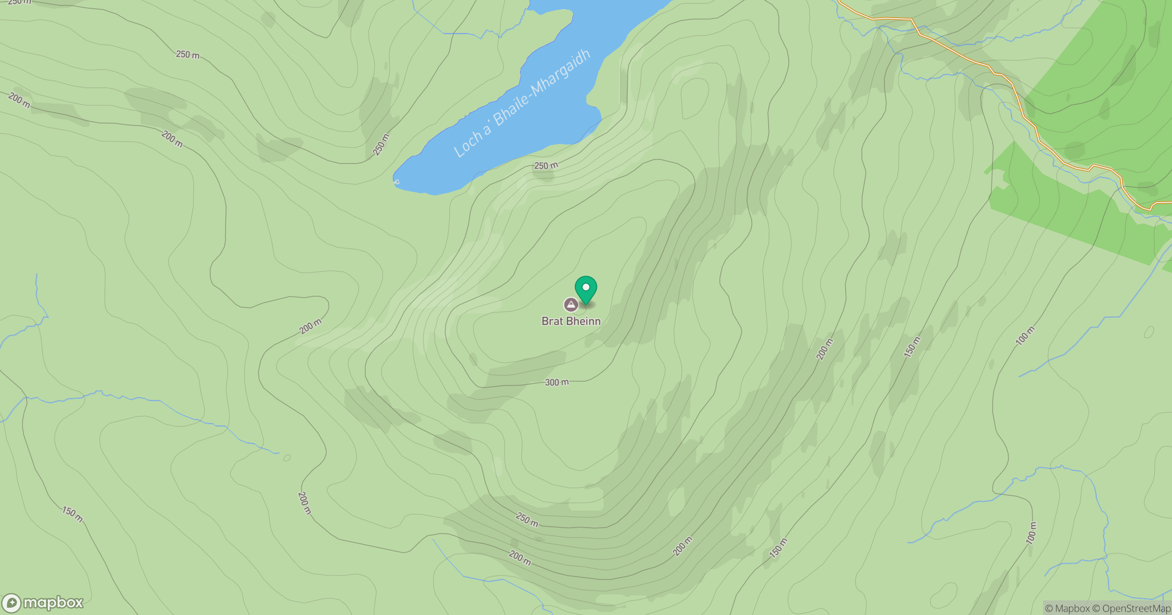
Grid reference: NR495662
View on OpenStreetMapOpens a map in a new tab, centred on the hill.
Hills within 30 km
Straight-line distance, not a walking route or confirmation of access.
No comments yet. Be the first.