

Froswick
Good walks are even better shared.
NY4308 : Path under Froswick
Michael Graham Photo source
Overview
Froswick: A Jewel in the Lake District
Froswick stands proudly at 712 meters, offering hikers an invigorating experience in the heart of the Lake District. Known for its rugged beauty and stunning vistas, it's no wonder that this Wainwright is a popular choice for both seasoned hikers and those just looking to stretch their legs.
Geology
Froswick’s geological composition tells a tale of volcanic origins, featuring andesitic and basaltic rock that has withstood the test of time. The incredible landscape shaped by these materials creates a stunning backdrop for your adventures.
Routes
The most popular route to summit Froswick starts at Thornthwaite Beacon. This circular route stretches about 8.5 km and takes approximately 3.5 hours to complete, making it a moderate trek that is achievable for most hiking enthusiasts.
Summit Features
At the summit, you will be greeted by a well-constructed cairn. It’s a great spot to catch your breath and grab a quick selfie, as Instagram demands!
Terrain
The terrain is mainly rocky with occasional grassy areas, perfect for a quick sit-down if your legs start protesting. Just be wary of loose rocks, especially after a bit of rain!
Views
On a clear day, Froswick offers breathtaking views of the iconic Langdale Pikes and shimmering Lake Windermere. Make sure to pack your camera!
Hazards
While the hike is generally safe, be cautious of unpredictable weather and the occasional loose rock. Keep an eye out for local sheep—they seem to have a knack for straying into the path!
Access
The nearest parking is available at Thornthwaite car park, with buses connecting from Windermere to nearby Troutbeck. The charming town of Windermere, full of cafes and shops, is just a short drive away.
Facilities
Although facilities directly on the mountain are sparse, you’ll find plenty in Windermere, offering everything from delicious cakes to restrooms.
History
Froswick’s name carries a hint of its Norse heritage, possibly referring to the lively streams that frolic down its slopes. A significant part of the Lake District, this mountain has inspired poets like Wordsworth and provides a reminder of the region’s rich cultural tapestry.
In conclusion, whether you're a seasoned walker or just fancy a lovely day out, Froswick offers an enjoyable hike with magnificent views and a taste of the great outdoors. Don’t forget your walking boots!
Happy Hiking!
Explore routes near Froswick
Walks starting near this hill. Open a route to check its map, distance and full itinerary.
Striding Edge, Helvellyn and Catstye Cam
View route
Helvellyn via Striding Edge
View route
Tarn Hows Fast Route
View route
Bow Fell from Langdale
View route
Route planning notes
These notes describe possible approaches. Check a route's map and access information when planning your walk.
Froswick from Thornthwaite Beacon
A circular route taking you past the beautiful Thornthwaite Beacon, providing a gentle ascent and scenic views throughout.
Make a day of it, together
Find someone to share the walk with, or organise a day out along a route you like.
Photo Gallery
View all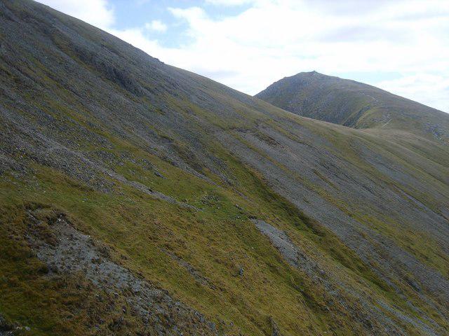 Photo could not load
NY4308 : Path under Froswick
Michael Graham
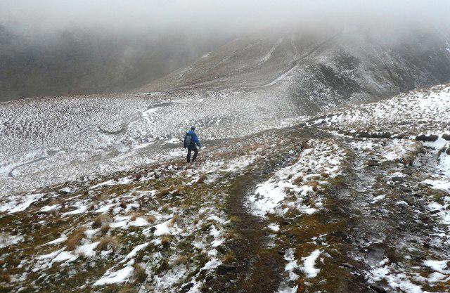 Photo could not load
NY4308 : Descending Froswick
Anthony Parkes
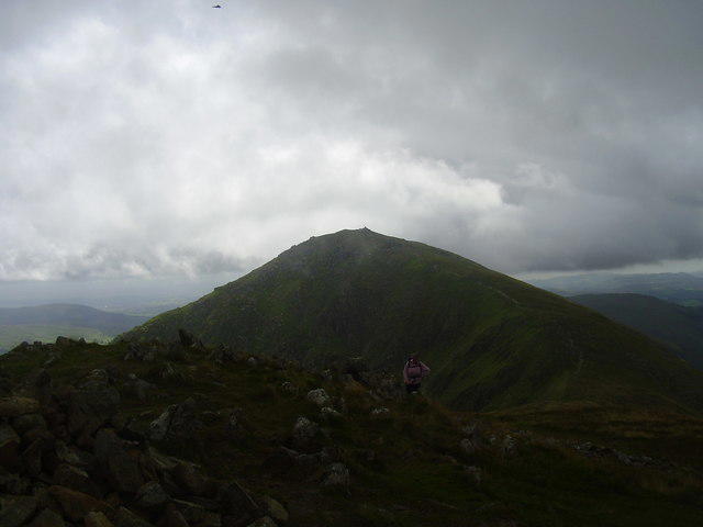 Photo could not load
NY4308 : Summit of Froswick
steven ruffles
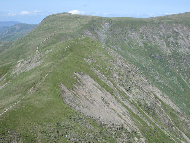 Photo could not load
NY4308 : Froswick and Thornthwaite Crag
Peter S
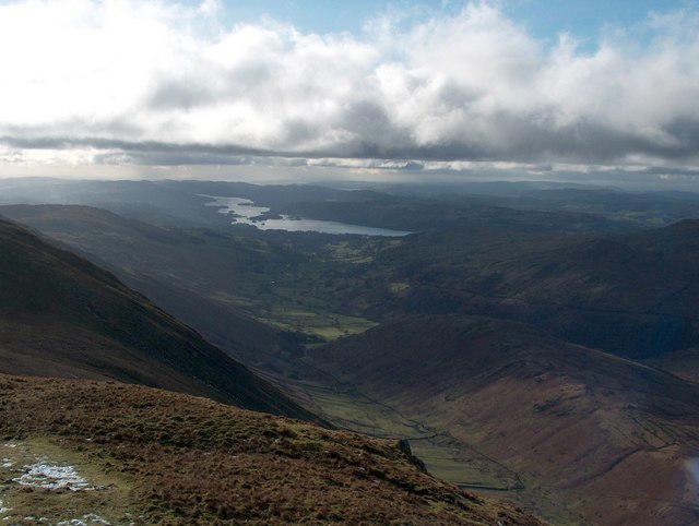 Photo could not load
NY4308 : The west side of Froswick summit
Bill Boaden
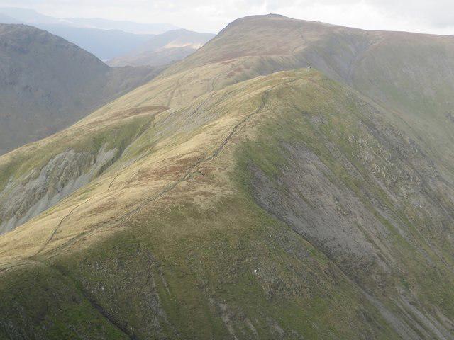 Photo could not load
NY4308 : Froswick seen from Ill Bell
Graham Robson
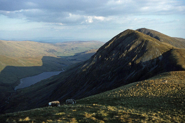 Photo could not load
NY4308 : Froswick
Ian Taylor
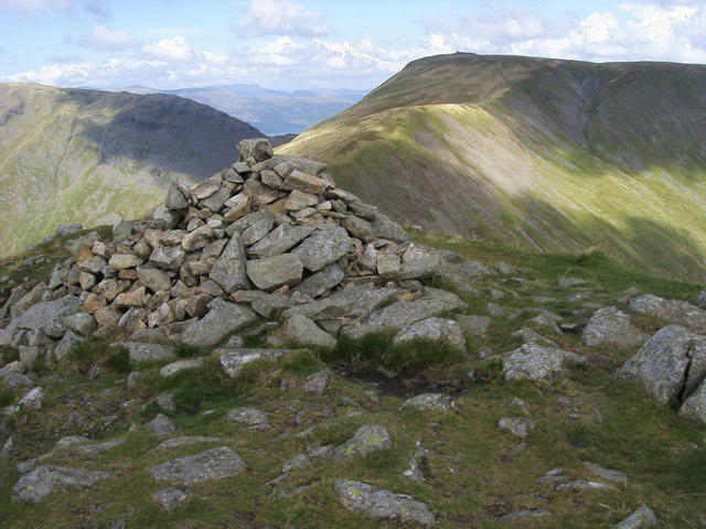 Photo could not load
NY4308 : Froswick Summit
Shaun Ferguson
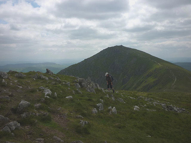 Photo could not load
NY4308 : On top of Froswick
Karl and Ali
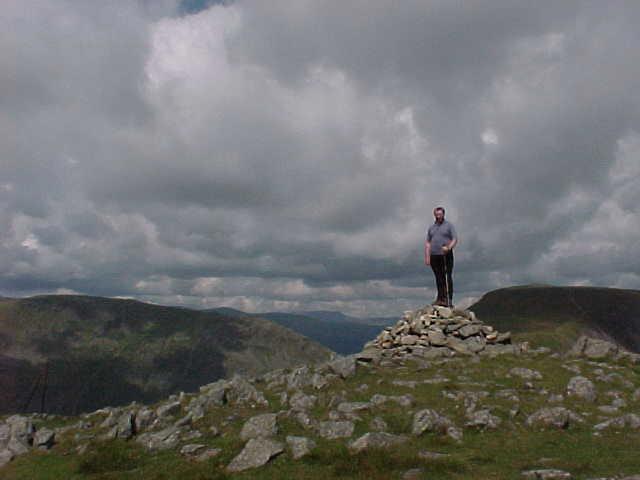
NY4308 : Summit of Froswick
Tim Glover
Hill facts and local notes
Classifications
Elevation
720m
2,362 ft
Prominence
75m
Coordinates
54.4690, -2.8730
NY435085
OS Map
90
Explorer: OL7N
At the Summit
The summit of Froswick features a prominent cairn, an essential stop for every summit bagger. Don't forget to snap a pic for the 'Instagram of Gaiters'!
Terrain & Geology
Froswick is primarily composed of volcanic rock, featuring a mix of andesite and basalt, which gives it a rugged, impressive appearance. The area's geological history is marked by extensive volcanic activity during the early Palaeogene period.
Views & Scenery
From the summit, you can enjoy panoramic views of the surrounding peaks including the iconic Langdale Pikes, as well as Windermere shimmering in the distance on a clear day.
History & Heritage
Name Origin
The name 'Froswick' is believed to derive from the Old Norse 'Fros', meaning 'frothing' or 'foaming', likely referring to the streams that cascade down its slopes.
Historical Significance
Froswick is not just a mountain but part of the iconic Lake District landscape, celebrated by poets and writers, including William Wordsworth.
Getting There & Facilities
Parking
Thornthwaite car park, a spacious spot where you can get your bearings before heading out and pretending to know what you're doing.
Public Transport
Buses run from Windermere to the nearby village of Troutbeck, making it accessible for those using public transport.
Nearby Facilities
Facilities are limited on the mountain trails, but Windermere has plenty of cafes and toilets to refresh those weary legs after a hike.
Safety Information
Known Hazards
- Loose rocks can cause slips, especially in wet weather. There's also the occasional sheep that thinks they're an expert guide, but might lead you astray.
General Safety Tips
- Check weather conditions before setting out
- Carry appropriate clothing and equipment
- Let someone know your planned route
- Take a map, compass, and GPS device
- Carry emergency supplies: food, water, first aid kit, torch
Hills
Some common questions about the hills answered
Are there group walks up Froswick?
Many walkers use Walkmates to join or organise walks with others. You can check for group walks around Froswick through the maps
Are there other walkers around Froswick?
Activity varies by location and time, but Walkmates lets you see whether others have shared walks or shown interest in this area. Find other people through the walking friends search walking friends for Froswick search or of course create your own walk for Froswick
Can I organise a walk to Froswick?
Yes. If there aren’t any walks listed already, you can create a walk and make it available for others to join.
If you're signed up to Walkmates, you can create a walk to Froswick.
How do I find a walk up this hill?
There are often multiple ways to walk this hill, depending on experience and route preference. Walkmates helps you explore walks and routes that others have shared.
Can I suggest a new route up Froswick?
Yes. You can suggest or create routes to share with others. Walkmates focuses on the social side of walking, so routes are used to help people organise walks and explore areas together, rather than as detailed navigation tools or route libraries.
Other uses really appreciate knowledgeable walkers sharing their routes. Share your favourite route to Froswick here
The is an error or something incorrect about this hill. How do I let you know?
We always strive to keep the information on Walkmates as accurate as possible. If you find an error, please let us know through the contact form and we'll aim to correct it as quickly as possible
Community Discussion
Comments
Location
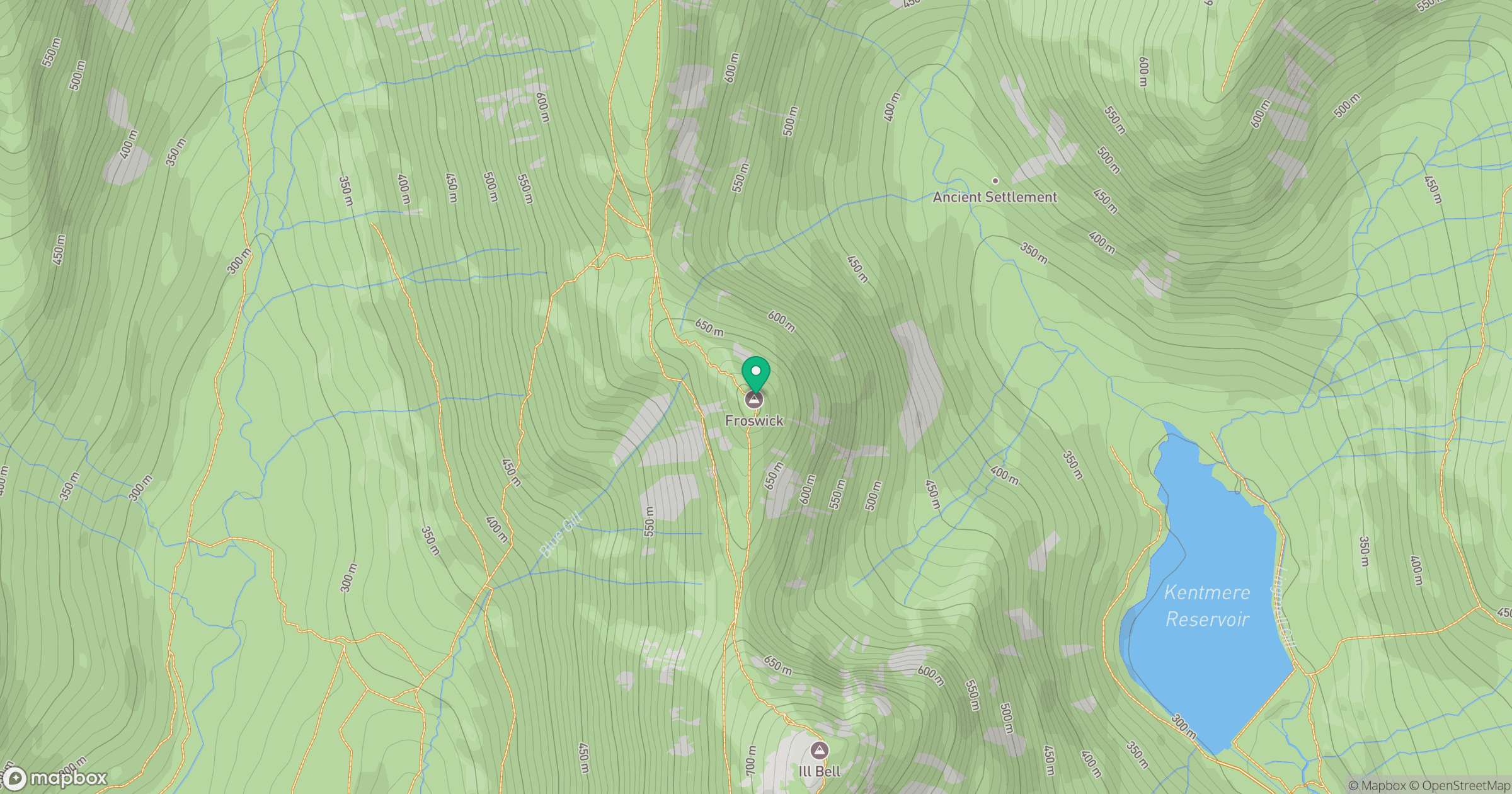
Grid reference: NY435085
View on OpenStreetMapOpens a map in a new tab, centred on the hill.

No comments yet. Be the first.