
Fossy Mountain
Good walks are even better shared.
Overview
Fossy Mountain
Fossy Mountain, standing tall at 548 meters, is a gem tucked away in the tranquil Lake District. It may not be the highest peak in the area, but its charm lies in its accessible routes and breathtaking views.
Geology
The mountain primarily consists of sedimentary rock such as sandstone and limestone. The unique geological features make it a fascinating study for amateur geologists and curious hikers alike. You may even spot fossilised remains—so keep your eyes peeled and perhaps say a little prayer to the geological gods!
Routes
The Fossy Summit Trail is the most popular route to the summit. Starting at the scenic Fossy Bridge, this moderate hike takes about three hours and covers 7.5 kilometers. Ascend through picturesque woodlands rich with wildlife before tackling the rocky terrain that leads to the summit.
Summit Features
Upon reaching the summit, you'll be greeted by a delightful cairn and a trig point, perfect spots to catch your breath. As you gaze out over the breathtaking expanse of the Lake District, you might even feel your worries melt away. Or maybe that’s just the altitude!
Terrain
The terrain is predominantly rocky, with grassy patches and a few boggy areas to keep you on your toes. A sturdy pair of boots will be your best friend here, especially as you navigate the sometimes slippery rocks.
Views
The summit offers spectacular panoramic views of neighbouring peaks like Scafell Pike and Helvellyn. Spring and autumn are the best times to visit, providing clear skies that make the scenery positively jaw-dropping. Don’t forget your camera!
Hazards
As with any hike, there are a few hazards to keep in mind. Slippery rocks can be found, especially after rain, so tread carefully. Sudden weather changes can occur, so it's wise to be prepared for a quick change in climate, just like expecting a quiet day that turns into a wild adventure!
Access
- Nearest Parking: Accessible parking is found at the base of Fossy Bridge for about 10 vehicles. Arrive early to avoid disappointment!
- Public Transport: The closest bus stop is in Coniston, around 5 km away, so do check the local timetable.
- Nearest Town: Coniston is the closest town, hosting various cafes and amenities.
Facilities
Facilities are found in Coniston, where you can indulge in a slice of cake and a good cup of tea—after all, what's a good hike without some tasty rewards?
History
The name 'Fossy' hails from Old Norse origins, meaning 'waterfall.' The mountain has cultural significance for hikers, offering a break from the busier paths nearby while immersing visitors in the awe-inspiring scenery of the Lake District.
Whether you're a seasoned hiker or just looking for a pleasant day out, Fossy Mountain has plenty to offer. Lace up those boots and embrace the adventure!
Enjoy your hike!
Explore routes near Fossy Mountain
Public walks starting within 80 km of this hill. Nearby does not mean a route reaches the summit; check its map and access before setting out.
No public routes are currently listed within 80 km of Fossy Mountain on Walkmates. This does not mean there are no paths here. Explore the map and check local access information before planning a walk.
Route planning notes
These notes describe possible approaches, not verified navigable routes or permission to cross land. Check current paths, local access rules and conditions before setting out.
Fossy Summit Trail
A well-marked trail starting from the Fossy bridge, gradually ascending through beautiful woodlands before leading to the rocky summit. Perfect for a good leg stretch and some quality time with nature.
Make a day of it, together
Find someone to share the walk with, or organise a day out along a route you like.
Hill facts and local notes
Classifications
Elevation
332m
1,089 ft
Prominence
123m
Coordinates
52.9447, -7.1707
S558885
OS Map
61
At the Summit
At the summit, you'll find a distinctive cairn and a trig point offering a perfect spot to catch your breath and take in the sights, or perhaps ponder the universe's mysteries. Or at least why you thought this was a good idea.
Terrain & Geology
Fossy Mountain's rugged geology primarily consists of sedimentary rock, predominantly sandstone and limestone, which gives rise to its steep flanks and craggy features. The mountain showcases fascinating geological processes that have shaped its current form over millions of years, including erosion and sediment deposition.
Views & Scenery
From the summit, enjoy panoramic views of the surrounding Lake District peaks, including Scafell Pike and Helvellyn, with stunning valleys sprawling below.
History & Heritage
Name Origin
The name 'Fossy' is derived from the Old Norse word meaning 'waterfall,' likely referring to the small streams cascading down its slopes.
Historical Significance
Fossy Mountain is a popular spot for local hikers and tourists alike, offering a quieter alternative to the more heavily trafficked peaks in the region while still showcasing the stunning beauty of the Lake District.
Getting There & Facilities
Check current local access restrictions, parking rules and transport timetables before travelling. These notes do not confirm public access to the summit.
Parking
Parking is available at the bottom of the Fossy Bridge, with space for around 10 vehicles. Arrive early to secure a spot!
Public Transport
The nearest bus stop is in the village of Coniston, approximately 5km away. Local services are available during the day, but check the timetable to avoid a long walk back.
Nearby Facilities
The nearest facilities are in Coniston, where you can find cafes, pubs, and public toilets to refuel before or after your hike.
Safety Information
Known Hazards
- Beware of slippery rocks, especially after rain. Also, watch out for sudden weather changes—Mother Nature can be quite fickle in the Lakes!
General Safety Tips
- Check weather conditions before setting out
- Carry appropriate clothing and equipment
- Let someone know your planned route
- Take a map, compass, and GPS device
- Carry emergency supplies: food, water, first aid kit, torch
Hills
Some common questions about the hills answered
Are there group walks up Fossy Mountain?
Many walkers use Walkmates to join or organise walks with others. You can check for group walks around Fossy Mountain through the maps
Are there other walkers around Fossy Mountain?
Activity varies by location and time, but Walkmates lets you see whether others have shared walks or shown interest in this area. Find other people through the walking friends search walking friends for Fossy Mountain search or of course create your own walk for Fossy Mountain
Can I organise a walk to Fossy Mountain?
Yes. If there aren’t any walks listed already, you can create a walk and make it available for others to join.
If you're signed up to Walkmates, you can create a walk to Fossy Mountain.
How do I find a walk up this hill?
There are often multiple ways to walk this hill, depending on experience and route preference. Walkmates helps you explore walks and routes that others have shared.
Can I suggest a new route up Fossy Mountain?
Yes. You can suggest or create routes to share with others. Walkmates focuses on the social side of walking, so routes are used to help people organise walks and explore areas together, rather than as detailed navigation tools or route libraries.
Other uses really appreciate knowledgeable walkers sharing their routes. Share your favourite route to Fossy Mountain here
The is an error or something incorrect about this hill. How do I let you know?
We always strive to keep the information on Walkmates as accurate as possible. If you find an error, please let us know through the contact form and we'll aim to correct it as quickly as possible
Community Discussion
Comments
Location
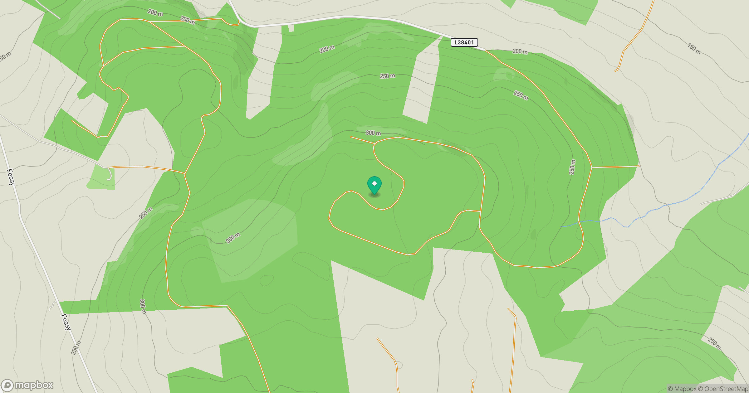
Grid reference: S558885
View on OpenStreetMapOpens a map in a new tab, centred on the hill.
Hills within 30 km
Straight-line distance, not a walking route or confirmation of access.
Cullenagh Mountain [Sliabh Chuileannai]
317m
Clogrennan Hill [Rossmore Hill] [Cnoc Chloch Grianain]
336m
Knockmannon Hill
313m
Carrigeen Hill
298m
Ballaghmore Hill
268m
No comments yet. Be the first.