
Carrigeen Hill
Good walks are even better shared.
Overview
Carrigeen Hill
Overview
Carrigeen Hill, a prominent Marilyn in the Blackstairs Mountains, boasts an elevation of 616 meters. An esteemed destination for hikers and nature enthusiasts alike, it offers panoramic views and a wealth of natural beauty.
Geology
The hill is primarily composed of Old Red Sandstone, which provides a varied geology that supports diverse ecosystems. The rugged landscape and rocky outcrops add to the charm and challenge of the hike.
Hiking Routes
One popular route is the Blackstairs Mountain Trail, a 9.5 km loop that can typically be completed in 3.5 hours. The trail winds through lush greenery, offering a moderate challenge suitable for most hikers. It's advisable to pack a picnic; there are plenty of nice spots to rest and recharge.
Summit Features
The summit features a commanding cairn and an old trig point, perfect for those heartfelt summit selfies. Take a moment to enjoy the breathtaking scenery that unfolds around you.
Terrain Type
Expect grassy meadows interspersed with rocky sections. While the terrain is generally accessible, the rocky patches can be a little tricky, particularly in wet conditions. A sturdy pair of walking boots is your best friend here!
Views
From the top, on a clear day, the view stretches over the verdant valleys to the iconic Wicklow Mountains. Springtime brings a vibrant palette, while autumn can reveal fiery hues amid the changing leaves. The best seasons for these delightful vistas are spring and autumn.
Hazards
Always keep an eye on the sky, as weather can change quicker than a cat can lick its ear! Slippery paths post-rain can be a little treacherous, so proceed with caution and watch your footing.
Nearby Summits
If you're keen to conquer more peaks, nearby summits such as Ballycrystal Hill (596 meters) and Mount Leinster (796 meters) await your adventurous spirit.
Access
The nearest parking is conveniently located at S840874, offering easy access to the trails. Public transport is limited, but bus services from Kiltealy can get you in the vicinity. Kiltealy itself is a charming village, perfect for a quick stop.
Facilities
Visitors can find basic facilities, such as toilets and picnic areas, in nearby Kiltealy, which also boasts charming local cafes, ideal for a warm meal or a refreshing drink after your trek.
History
The name Carrigeen comes from the Irish 'Carraigín', meaning 'little rock'. This hill has cultural significance, deeply rooted in local folklore, enriched by tales from times gone by.
In summary, Carrigeen Hill is not just a hike; it’s an experience that nourishes the soul. Happy trekking!
Explore routes near Carrigeen Hill
Public walks starting within 80 km of this hill. Nearby does not mean a route reaches the summit; check its map and access before setting out.
No public routes are currently listed within 80 km of Carrigeen Hill on Walkmates. This does not mean there are no paths here. Explore the map and check local access information before planning a walk.
Route planning notes
These notes describe possible approaches, not verified navigable routes or permission to cross land. Check current paths, local access rules and conditions before setting out.
Blackstairs Mountain Trail
A scenic loop trail starting from the nearby car park, offering gentle inclines and stunning views.
Make a day of it, together
Find someone to share the walk with, or organise a day out along a route you like.
Hill facts and local notes
Classifications
Elevation
298m
978 ft
Prominence
103m
Coordinates
52.9447, -6.7512
S840889
OS Map
61
At the Summit
The summit features a large cairn and an old trig point, ideal for that all-important photo op.
Terrain & Geology
The hill is primarily composed of Old Red Sandstone, resulting in steep slopes and rich, diverse flora.
Views & Scenery
On a clear day, you can see the distant Wicklow Mountains and the lush valleys below.
History & Heritage
Name Origin
The name Carrigeen is derived from the Irish 'Carraigín', meaning 'little rock'.
Historical Significance
This area is steeped in folklore, with tales of ancient rituals and events reflecting its cultural heritage.
Getting There & Facilities
Check current local access restrictions, parking rules and transport timetables before travelling. These notes do not confirm public access to the summit.
Parking
There is a small car park located at S840874, which is a convenient starting point for your hike.
Public Transport
Public transport options are limited, but bus services run to the nearby town of Kiltealy.
Nearby Facilities
There are basic facilities (toilets and picnic areas) in Kiltealy, and several local cafes for a nice cuppa before or after your hike.
Safety Information
Known Hazards
- Be cautious of sudden weather changes, and the terrain can be slippery after rain.
General Safety Tips
- Check weather conditions before setting out
- Carry appropriate clothing and equipment
- Let someone know your planned route
- Take a map, compass, and GPS device
- Carry emergency supplies: food, water, first aid kit, torch
Hills
Some common questions about the hills answered
Are there group walks up Carrigeen Hill?
Many walkers use Walkmates to join or organise walks with others. You can check for group walks around Carrigeen Hill through the maps
Are there other walkers around Carrigeen Hill?
Activity varies by location and time, but Walkmates lets you see whether others have shared walks or shown interest in this area. Find other people through the walking friends search walking friends for Carrigeen Hill search or of course create your own walk for Carrigeen Hill
Can I organise a walk to Carrigeen Hill?
Yes. If there aren’t any walks listed already, you can create a walk and make it available for others to join.
If you're signed up to Walkmates, you can create a walk to Carrigeen Hill.
How do I find a walk up this hill?
There are often multiple ways to walk this hill, depending on experience and route preference. Walkmates helps you explore walks and routes that others have shared.
Can I suggest a new route up Carrigeen Hill?
Yes. You can suggest or create routes to share with others. Walkmates focuses on the social side of walking, so routes are used to help people organise walks and explore areas together, rather than as detailed navigation tools or route libraries.
Other uses really appreciate knowledgeable walkers sharing their routes. Share your favourite route to Carrigeen Hill here
The is an error or something incorrect about this hill. How do I let you know?
We always strive to keep the information on Walkmates as accurate as possible. If you find an error, please let us know through the contact form and we'll aim to correct it as quickly as possible
Community Discussion
Comments
Location
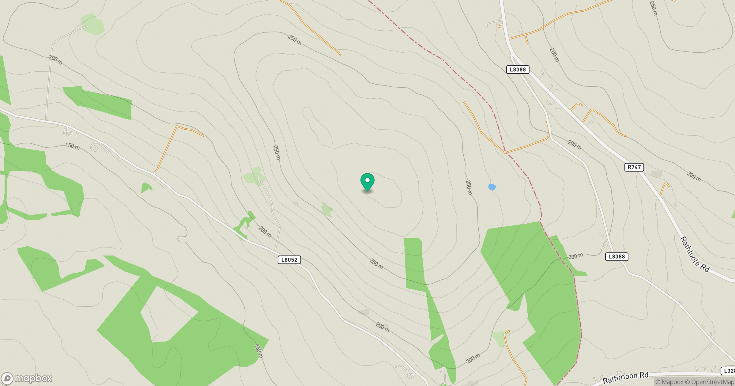
Grid reference: S840889
View on OpenStreetMapOpens a map in a new tab, centred on the hill.
Hills within 30 km
Straight-line distance, not a walking route or confirmation of access.
Lugnaquilla [Log na Coille]
925m
Mullaghcleevaun
847m
Baltinglass Hill [Pinnacle]
382m
Spinans Hill [Eadestown Hill] [Cnoc na Spionan]
408m
Cloghnagaune
380m
No comments yet. Be the first.