
Ballaghmore Hill
Good walks are even better shared.
Overview
Overview
Ballaghmore Hill, standing majestically at 460 meters, is a must-see for any lover of the great outdoors. Nestled in the Slieve Bloom Mountains, this hill is more than just a bump in the landscape; it’s a gateway to breathtaking views and intriguing geological features. With its limestone and sandstone composition, the hill offers a little lesson in geology alongside your adventure.
Routes
One of the most popular routes is the Ballaghmore Hill Circuit, which begins in the quaint village of Killeigh. Spanning approximately 8.5 km, this moderate loop takes roughly 3.5 hours to complete and is perfect for those looking to stretch their legs while soaking in the scenery. Remember, while this route is manageable, a decent pair of boots will serve you well against the grassy and rocky terrain, not to mention the occasional bog!
Summit Features
At the top, hikers are greeted by a proud stone cairn and a trig point, both of which provide great opportunities for a photo op. Just make sure to check your camera settings first—there's nothing worse than a blurry summit shot!
Terrain and Views
The terrain ranges from grassy stretches to rocky outcrops, with pockets of bog in between—ideal for channeling your inner explorer. And the views? Oh, they’re nothing short of spectacular! On a clear day, catch sight of the vast Slieve Bloom Mountains and even the distant Sperrins. Late spring and early autumn are your best bets for clarity, with vibrant colours adding to the picturesque landscape.
Hazards
Every great adventure comes with its share of risks. Beware during wet weather, as paths can turn into slippery mud baths. Additionally, the hill can be exposed to sudden, strong winds, so don't be caught off guard! Make sure to plan accordingly.
Access and Facilities
Access to Ballaghmore Hill is quite straightforward, with parking available in Killeigh. However, don’t dawdle; it’s a cosy spot, and a good early start will help you secure a space. If you’re relying on public transport, buses connect Tullamore to Killeigh, but always check the latest schedules. In terms of facilities, while Killeigh has a shop for your essentials, more options wait for you in Tullamore, around 15 km away.
History
The etymology of Ballaghmore Hill—'Bealach Mór'—translates to 'the great pass', underscoring its historical role as a conduit for local tribes. This hill has been a silent witness to centuries of history, and visiting not only offers a hike but a journey through time.
So whether you’re scaling the heights for the views, the camaraderie, or the inevitable post-hike scone, Ballaghmore Hill welcomes you with open arms. Strap on your boots, grab your backpack, and enjoy every delightful step. Happy hiking!
Explore routes near Ballaghmore Hill
Public walks starting within 80 km of this hill. Nearby does not mean a route reaches the summit; check its map and access before setting out.
No public routes are currently listed within 80 km of Ballaghmore Hill on Walkmates. This does not mean there are no paths here. Explore the map and check local access information before planning a walk.
Route planning notes
These notes describe possible approaches, not verified navigable routes or permission to cross land. Check current paths, local access rules and conditions before setting out.
Ballaghmore Hill Circuit
A loop route that starts from the village of Killeigh and takes hikers around the lower slopes before ascending to the summit.
Make a day of it, together
Find someone to share the walk with, or organise a day out along a route you like.
Hill facts and local notes
Classifications
Elevation
268m
879 ft
Prominence
146m
Coordinates
52.9912, -7.1281
S586937
OS Map
55
At the Summit
The summit features a distinctive stone cairn and a trig point, making it a perfect spot for photos—if your camera is in focus, that is.
Terrain & Geology
Ballaghmore Hill is primarily composed of limestone and sandstone, offering unique geological features such as exposed rock faces along the ascent, which provide insights into the region's sedimentary history.
Views & Scenery
From the summit, one can enjoy panoramic views of the surrounding Slieve Bloom Mountains and the distant Sperrin Mountains.
History & Heritage
Name Origin
The name Ballaghmore Hill derives from the Irish 'Bealach Mór', meaning 'the great pass', hinting at its historical significance as a route through the hills.
Historical Significance
Historically, Ballaghmore Hill served as a point of navigation for local tribes and later for traders, contributing to the cultural tapestry of the region.
Getting There & Facilities
Check current local access restrictions, parking rules and transport timetables before travelling. These notes do not confirm public access to the summit.
Parking
Parking is available at Killeigh village. It's a small area, so make sure to arrive early to secure a spot.
Public Transport
Buses run from Tullamore to Killeigh, but schedules may vary, so check in advance.
Nearby Facilities
The village of Killeigh offers a local shop for supplies, with cafes available 15 km away in Tullamore.
Safety Information
Known Hazards
- During wet weather, paths can become muddy and slippery; always watch your step!
- The area can be exposed to strong winds, so be prepared for sudden gusts.
General Safety Tips
- Check weather conditions before setting out
- Carry appropriate clothing and equipment
- Let someone know your planned route
- Take a map, compass, and GPS device
- Carry emergency supplies: food, water, first aid kit, torch
Hills
Some common questions about the hills answered
Are there group walks up Ballaghmore Hill?
Many walkers use Walkmates to join or organise walks with others. You can check for group walks around Ballaghmore Hill through the maps
Are there other walkers around Ballaghmore Hill?
Activity varies by location and time, but Walkmates lets you see whether others have shared walks or shown interest in this area. Find other people through the walking friends search walking friends for Ballaghmore Hill search or of course create your own walk for Ballaghmore Hill
Can I organise a walk to Ballaghmore Hill?
Yes. If there aren’t any walks listed already, you can create a walk and make it available for others to join.
If you're signed up to Walkmates, you can create a walk to Ballaghmore Hill.
How do I find a walk up this hill?
There are often multiple ways to walk this hill, depending on experience and route preference. Walkmates helps you explore walks and routes that others have shared.
Can I suggest a new route up Ballaghmore Hill?
Yes. You can suggest or create routes to share with others. Walkmates focuses on the social side of walking, so routes are used to help people organise walks and explore areas together, rather than as detailed navigation tools or route libraries.
Other uses really appreciate knowledgeable walkers sharing their routes. Share your favourite route to Ballaghmore Hill here
The is an error or something incorrect about this hill. How do I let you know?
We always strive to keep the information on Walkmates as accurate as possible. If you find an error, please let us know through the contact form and we'll aim to correct it as quickly as possible
Community Discussion
Comments
Location
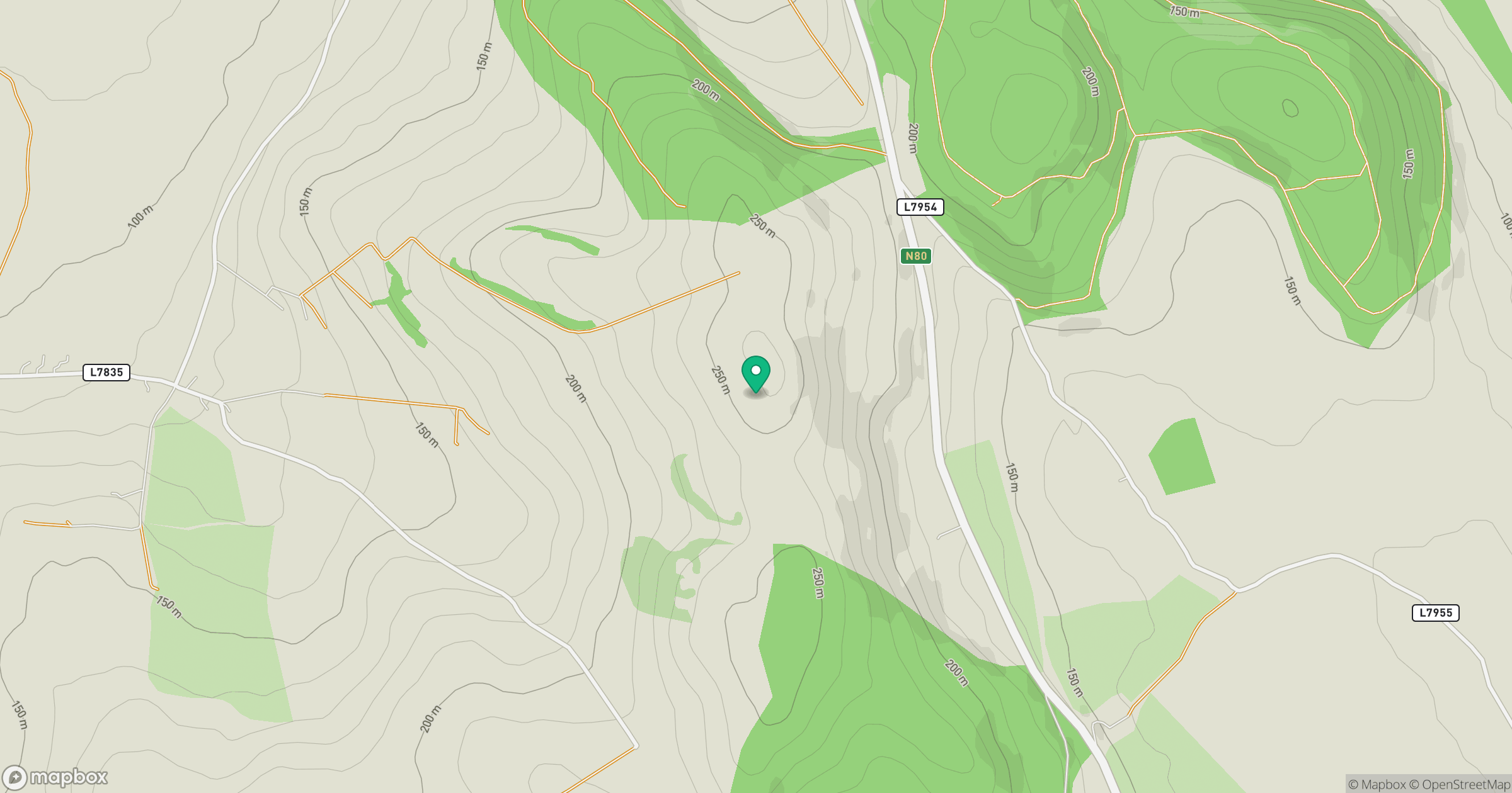
Grid reference: S586937
View on OpenStreetMapOpens a map in a new tab, centred on the hill.
Hills within 30 km
Straight-line distance, not a walking route or confirmation of access.
Fossy Mountain
332m
Cullenagh Mountain [Sliabh Chuileannai]
317m
Clogrennan Hill [Rossmore Hill] [Cnoc Chloch Grianain]
336m
Carrigeen Hill
298m
Hewson Hill
261m
No comments yet. Be the first.