
Newtown Hill
Good walks are even better shared.
Overview
Newtown Hill: A Hidden Gem in the Shropshire Hills
Nestled in the scenic landscape of the Shropshire Hills, Newtown Hill stands at a modest elevation of 164 meters, yet it promises delightful views and a charming hike that can be enjoyed by both seasoned walkers and families alike.
Geology
The terrain is primarily composed of Silurian sandstone, a remnant of ancient geological processes. As you make your ascent, keep an eye out for unique sedimentary formations that add a touch of character to the hill. It's like nature's artwork, albeit without the price tag.
Access and Parking
Getting to Newtown Hill is straightforward. The nearest parking is a small layby off the B 4386, ideally suited for a handful of vehicles. If you’re travelling by public transport, buses from Shrewsbury will drop you within walking distance, allowing you to stretch your legs before the climb even begins.
The Ascent
Starting from the Newtown Common Trail, walkers meander through rich woodlands before reaching the hill's summit. The trail is engaging enough to keep your mind occupied, with occasional glimpses of wildlife to pepper your hike with excitement. The distance is approximately 3.5 km, and it should take around 1.5 hours depending on your pace and how many selfies you take.
Summit Features
Upon reaching the summit, you're greeted by a modest cairn, a perfect backdrop for that all-important post-hike selfie. Just remember, no one likes a photo bomb from a sheep!
Views to Savour
From the top, enjoy panoramic views of the Shropshire landscape. It is particularly enchanting in spring and autumn when the foliage bursts into a riot of colours. On a clear day, you might just glimpse the distant peaks of Long Mynd.
Hazards
While the hike is relatively easy, it’s best to be mindful of wet conditions. Paths can become slippery, particularly in wooded areas. And, of course, always keep an eye out for the occasional sheep wandering too close for comfort!
Nearby Attractions
You'll find yourself within close distance to other notable hills like Cader Idris and The Wrekin, both worthy of exploration if you fancy extending your adventure.
Conclusion
Newtown Hill is a delightful spot that marries simple charm with stunning views, perfect for an afternoon escape into nature. Whether you’re after a solo retreat or a family day out, it serves up the beauty without requiring an Everest-level effort. Just remember to pack your sandwiches!
Explore routes near Newtown Hill
Public walks starting within 80 km of this hill. Nearby does not mean a route reaches the summit; check its map and access before setting out.
No public routes are currently listed within 80 km of Newtown Hill on Walkmates. This does not mean there are no paths here. Explore the map and check local access information before planning a walk.
Route planning notes
These notes describe possible approaches, not verified navigable routes or permission to cross land. Check current paths, local access rules and conditions before setting out.
Newtown Common Trail
A popular walking trail starting from Newtown Common, leading gently up to the summit while weaving through scenic woodlands.
Make a day of it, together
Find someone to share the walk with, or organise a day out along a route you like.
Hill facts and local notes
Classifications
Elevation
208m
682 ft
Prominence
109m
Coordinates
52.7349, -6.8904
S750654
OS Map
61
At the Summit
The summit is marked by a modest cairn and offers space for a well-deserved snack break, perhaps while contemplating life’s greatest mysteries.
Terrain & Geology
Primarily composed of Silurian age sandstone, the rock layers exhibit interesting sedimentary structures, revealing a rich geological history shaped by ancient seas.
Views & Scenery
Panoramic views of the surrounding Shropshire Hills, including the distant peaks of Long Mynd and the lush valleys of the region.
History & Heritage
Name Origin
The name 'Newtown' suggests a newer settlement or development, potentially in the context of post-medieval agriculture.
Historical Significance
The area has historically been significant for sheep farming, contributing to the local economy and landscape.
Getting There & Facilities
Check current local access restrictions, parking rules and transport timetables before travelling. These notes do not confirm public access to the summit.
Parking
There is a small layby off the B 4386 near Newtown Common, with space for a few cars. Larger cars should take care.
Public Transport
Bus services from Shrewsbury run regularly to Newtown, with subsequent short walks to the trailhead.
Nearby Facilities
There are no facilities at the summit, but nearby Church Stretton offers cafes, pubs, and public toilets.
Safety Information
Known Hazards
- Slippery paths in wet conditions, particularly in the wooded sections. Watch for the occasional rogue sheep!
General Safety Tips
- Check weather conditions before setting out
- Carry appropriate clothing and equipment
- Let someone know your planned route
- Take a map, compass, and GPS device
- Carry emergency supplies: food, water, first aid kit, torch
Hills
Some common questions about the hills answered
Are there group walks up Newtown Hill?
Many walkers use Walkmates to join or organise walks with others. You can check for group walks around Newtown Hill through the maps
Are there other walkers around Newtown Hill?
Activity varies by location and time, but Walkmates lets you see whether others have shared walks or shown interest in this area. Find other people through the walking friends search walking friends for Newtown Hill search or of course create your own walk for Newtown Hill
Can I organise a walk to Newtown Hill?
Yes. If there aren’t any walks listed already, you can create a walk and make it available for others to join.
If you're signed up to Walkmates, you can create a walk to Newtown Hill.
How do I find a walk up this hill?
There are often multiple ways to walk this hill, depending on experience and route preference. Walkmates helps you explore walks and routes that others have shared.
Can I suggest a new route up Newtown Hill?
Yes. You can suggest or create routes to share with others. Walkmates focuses on the social side of walking, so routes are used to help people organise walks and explore areas together, rather than as detailed navigation tools or route libraries.
Other uses really appreciate knowledgeable walkers sharing their routes. Share your favourite route to Newtown Hill here
The is an error or something incorrect about this hill. How do I let you know?
We always strive to keep the information on Walkmates as accurate as possible. If you find an error, please let us know through the contact form and we'll aim to correct it as quickly as possible
Community Discussion
Comments
Location
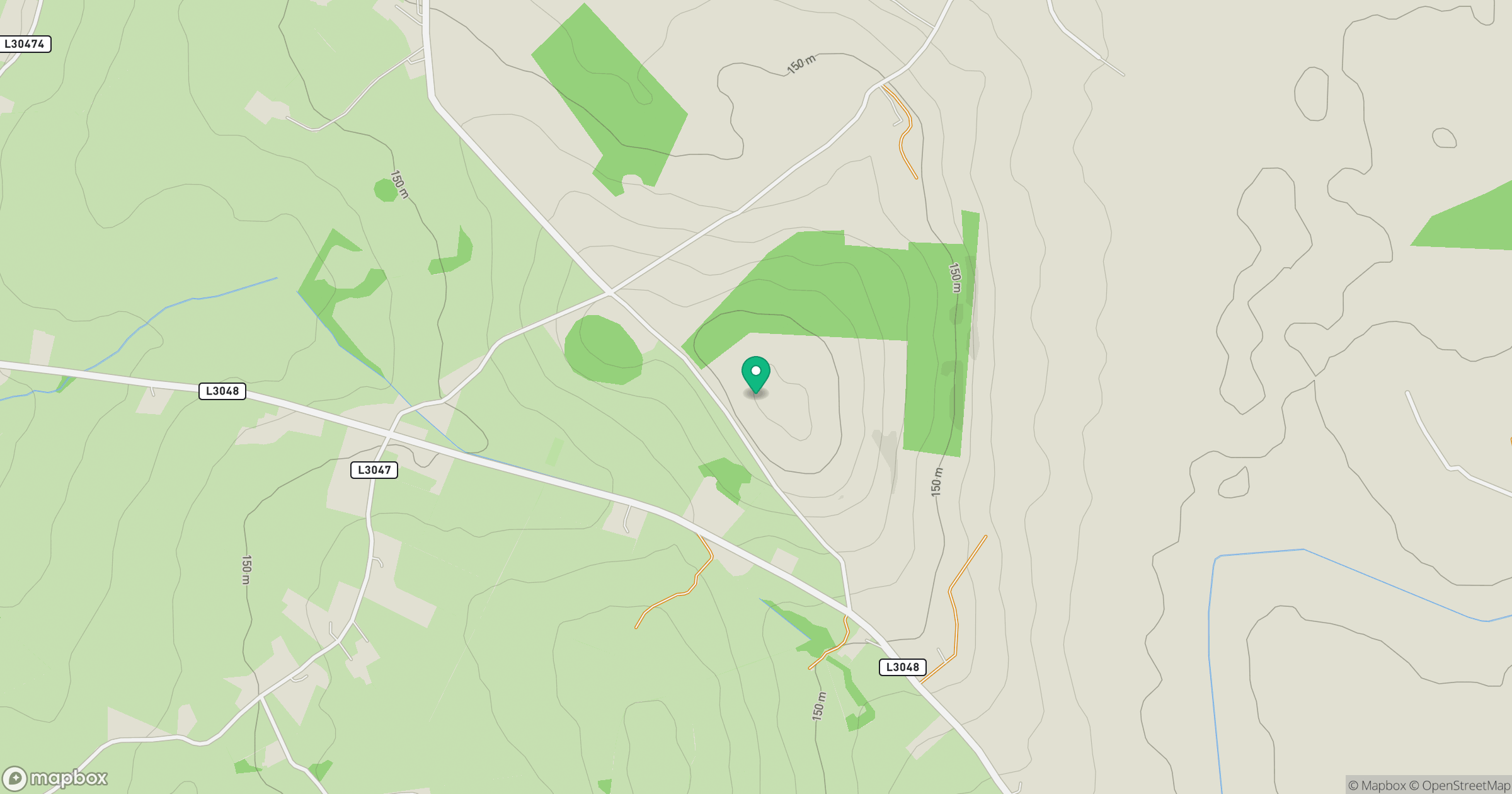
Grid reference: S750654
View on OpenStreetMapOpens a map in a new tab, centred on the hill.
Hills within 30 km
Straight-line distance, not a walking route or confirmation of access.
Croaghaun [An Cruachan]
456m
Clogrennan Hill [Rossmore Hill] [Cnoc Chloch Grianain]
336m
Knockmore
228m
Mount Leinster [Stua Laighean]
794m
Blackstairs Mountain [Na Staighri Dubha]
732m
No comments yet. Be the first.