
Corballis Hill
Good walks are even better shared.
Overview
Corballis Hill: A Hidden Gem
Introduction
Nestled in the picturesque landscape of Northern Ireland, Corballis Hill offers an inviting escape for hikers of all levels. Standing at 300 meters, this Marilyn may not be the tallest in the area, but its charm and the stunning vistas from the summit are hard to beat.
Geology
Corballis Hill is primarily composed of sandstone, creating a mixture of grassy slopes and rocky outcrops. The erosion of this sedimentary rock has shaped the landscape, leading to a variety of microhabitats that support local wildlife.
Routes
The Corballis Hill Circular Route is a popular choice for hikers. Covering around 5 km and taking approximately 2 hours to complete, this route provides a great balance of challenge and enjoyment. It is family friendly, so pack a picnic and make a day of it!
Summit Features
As you reach the summit, you'll be greeted by a prominent trig point and a small stone cairn, offering perfect spots for a well-deserved rest and a photo opportunity. Just don’t forget to take a selfie – your followers demand proof!
Terrain
The terrain is predominantly grassy, with rocky outcrops that make for interesting navigation, particularly towards the top. It's advisable to wear sturdy boots, especially if the weather has been less than ideal.
Views
The views from the top are truly spectacular. On a clear day, you can see the Mourne Mountains to the south and a plethora of pastoral beauty stretching out before you. Whether you're a photography enthusiast or simply a lover of scenic beauty, you won't be disappointed.
Hazards
While the hike is relatively safe, be aware of uneven terrain and potential muddy spots after rainfall. A good pair of hiking boots will keep you from turning an enjoyable hike into a slip-and-slide adventure!
Nearby Summits
For the more adventurous, consider also tackling nearby peaks such as Slieve Donard and Slieve Martin, which provide additional challenges and spectacular landscapes.
Access
Parking
The nearest parking is available along the P6 Ancillary Road, where space can accommodate around 10-15 vehicles.
Public Transport
Buses from Newcastle make it easy to reach the hill, providing a convenient transport option.
Nearest Town
Newcastle, just a short drive away, has all the amenities you could need.
Facilities
After a long hike, you can unwind in one of the local cafes in Newcastle. They offer everything from coffee to hearty meals, ensuring you're fuelled up for your journey home.
History
The name 'Corballis' reflects the hill's significance over centuries, with its origins rooted in local culture. It's a place where whispers of history linger amidst the winds.
Conclusion
In summary, Corballis Hill is a delightful spot for outdoor enthusiasts looking for a picturesque hike with rewarding views. Whether you come for the scenery, the exercise, or simply to escape the hustle and bustle, this hill will not disappoint. Just be sure to bring your sense of adventure and a camera – memories are best captured outdoors!
Explore routes near Corballis Hill
Public walks starting within 80 km of this hill. Nearby does not mean a route reaches the summit; check its map and access before setting out.
No public routes are currently listed within 80 km of Corballis Hill on Walkmates. This does not mean there are no paths here. Explore the map and check local access information before planning a walk.
Route planning notes
These notes describe possible approaches, not verified navigable routes or permission to cross land. Check current paths, local access rules and conditions before setting out.
Corballis Hill Circular Route
A scenic loop that takes you around the base of Corballis Hill before ascending to the summit. Ideal for those wanting a taste of the local landscape without a heavy commitment.
Make a day of it, together
Find someone to share the walk with, or organise a day out along a route you like.
Hill facts and local notes
Classifications
Elevation
258m
846 ft
Prominence
120m
Coordinates
52.9305, -6.7769
S823873
OS Map
61
At the Summit
At the summit, you'll find a small stone cairn, a testament to previous hikers who wanted to leave their mark. There's also a prominent trig point which may cause you to wonder if it’s a fancy piece of garden decor or an actual survey marker.
Terrain & Geology
Corballis Hill is primarily composed of sedimentary rock, specifically sandstone, which is typical of the surrounding area. This geological formation gives the hill its distinct slopes and grassy patches, perfect for both flora and fauna.
Views & Scenery
From the summit, there are splendid views of the Mourne Mountains to the south and the rolling countryside to the north. On a clear day, you might even spot the distant outline of the Irish Sea.
History & Heritage
Name Origin
The name 'Corballis' is derived from the Irish 'Corbaile', meaning 'the hill of the shouts', which may refer to its historical significance as a meeting point.
Historical Significance
Corballis Hill has been a landmark in local folklore, often associated with tales of ancient gatherings and folklore.
Getting There & Facilities
Check current local access restrictions, parking rules and transport timetables before travelling. These notes do not confirm public access to the summit.
Parking
Parking available at the base of the hill on the P6 Ancillary Road, suitable for 10-15 vehicles. Be mindful of any no-parking signs.
Public Transport
Bus service available from Newcastle. Check local schedules for the most current routes and times.
Nearby Facilities
There are cafes and local shops in Newcastle, where you can grab a bite or a hot drink before or after your hike. Public toilets are also available in the town centre.
Safety Information
Known Hazards
- Uneven terrain can be a tripping hazard, particularly after rain. Watch out for slippery rocks and muddy patches.
General Safety Tips
- Check weather conditions before setting out
- Carry appropriate clothing and equipment
- Let someone know your planned route
- Take a map, compass, and GPS device
- Carry emergency supplies: food, water, first aid kit, torch
Hills
Some common questions about the hills answered
Are there group walks up Corballis Hill?
Many walkers use Walkmates to join or organise walks with others. You can check for group walks around Corballis Hill through the maps
Are there other walkers around Corballis Hill?
Activity varies by location and time, but Walkmates lets you see whether others have shared walks or shown interest in this area. Find other people through the walking friends search walking friends for Corballis Hill search or of course create your own walk for Corballis Hill
Can I organise a walk to Corballis Hill?
Yes. If there aren’t any walks listed already, you can create a walk and make it available for others to join.
If you're signed up to Walkmates, you can create a walk to Corballis Hill.
How do I find a walk up this hill?
There are often multiple ways to walk this hill, depending on experience and route preference. Walkmates helps you explore walks and routes that others have shared.
Can I suggest a new route up Corballis Hill?
Yes. You can suggest or create routes to share with others. Walkmates focuses on the social side of walking, so routes are used to help people organise walks and explore areas together, rather than as detailed navigation tools or route libraries.
Other uses really appreciate knowledgeable walkers sharing their routes. Share your favourite route to Corballis Hill here
The is an error or something incorrect about this hill. How do I let you know?
We always strive to keep the information on Walkmates as accurate as possible. If you find an error, please let us know through the contact form and we'll aim to correct it as quickly as possible
Community Discussion
Comments
Location
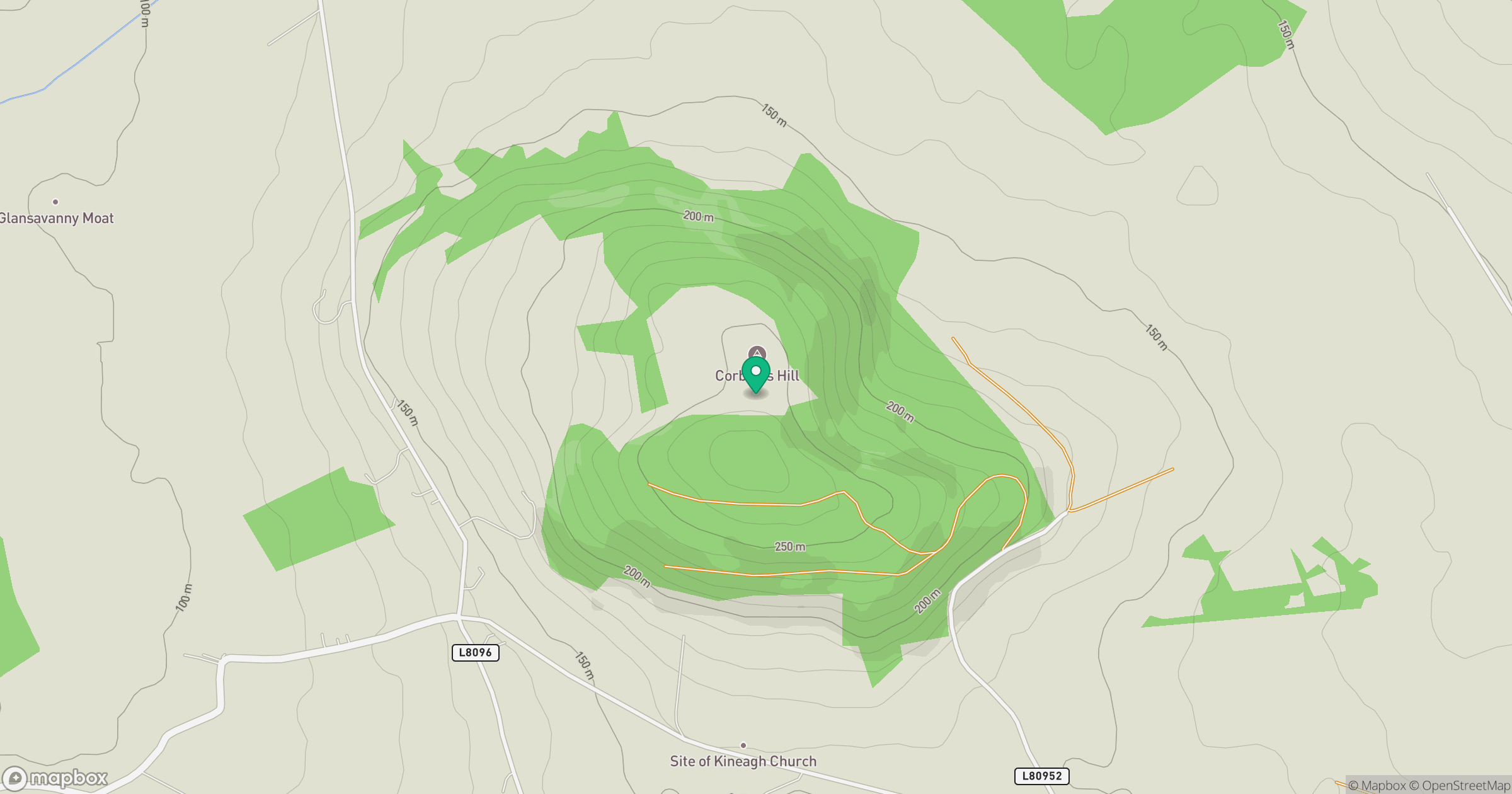
Grid reference: S823873
View on OpenStreetMapOpens a map in a new tab, centred on the hill.
Hills within 30 km
Straight-line distance, not a walking route or confirmation of access.
Lugnaquilla [Log na Coille]
925m
Carrigeen Hill
298m
Baltinglass Hill [Pinnacle]
382m
Spinans Hill [Eadestown Hill] [Cnoc na Spionan]
408m
Cloghnagaune
380m
No comments yet. Be the first.