
Caponellan Hill
Good walks are even better shared.
Overview
Caponellan Hill
Caponellan Hill, with an elevation of 272 meters, lies snugly in the Southern Uplands of Scotland. This Marilyn, perfect for wandering souls, offers both beauty and serenity, allowing hikers to escape the hustle and bustle of daily life.
Geology
The geological makeup of Caponellan Hill speaks volumes of its ancient past. Primarily constructed of sedimentary rocks, such as sandstone and mudstone, the hill showcases the slow processes of nature that have shaped it over the ages. Hikers will find the terrain varies from gentle slopes to more rugged, rocky areas near the summit. It's a gentle reminder that Mother Nature doesn't rush her masterpieces.
Routes
One of the most frequented routes is the Creetown Trail. This moderate trail begins in the charming village of Creetown and meanders through lovely woodlands before leading you right to the summit. This path, approximately 5 km long, typically takes a couple of hours, depending on your pace. Don't forget to stop and smell the (potentially imaginary) roses along the way!
Summit Features
When you reach the summit, you'll be greeted by a modest cairn — a perfect spot for yet another 'summit selfie’. The rocky outcrop allows you to sit for a spell and enjoy a well-deserved snack while soaking in the sweeping views.
Terrain Type
Expect a mix of grassy and moorland terrain, with some rocky patches near the summit. A sturdy pair of boots will serve you well, especially after a rainy spell where certain areas can become rather slippery.
Views
Caponellan Hill does not disappoint when it comes to views. On a clear day, you’ll be able to spot the stunning Galloway Hills and the Solway Firth. The best seasons to visit are spring and early autumn; nature's colour palette is particularly vibrant during these times, and the weather is generally favourable for hiking.
Hazards
As with any outdoor outing, it's wise to be aware of potential hazards. Watch for wet and slippery patches, especially following rainfall, and be cautious around rocky outcrops. A slip here or there could ruin your day, especially if you happen to be a fan of dry clothes.
Nearby Summits
Just a stone's throw away, seeking more adventure? Bennan Hill, rising to an elevation of 210 meters, is a worthy companion for your outdoor exploits.
Access
Nearest Parking: There is a small parking area at the edge of Creetown, suitable for around 10 vehicles — get there early if you're aiming for a prime spot!
Public Transport: Buses regularly run from nearby towns, with the nearest stop conveniently located in Creetown itself.
Nearest Town: Creetown provides the necessary amenities, including a quaint café to refuel after your hike.
Facilities
While Creetown may be modest, it offers a few essential facilities, including a charming café and public toilets, ensuring your comfort before and after the trek.
History
The name 'Caponellan' is believed to stem from Gaelic roots meaning 'cattle' and 'glen'. This hints at the pastoral legacy the area may have once enjoyed. Today, it is a spot cherished by locals for its community events and natural beauty.
In conclusion, Caponellan Hill is a delightful escape into the great outdoors, combining moderate hiking challenges with breathtaking scenery. So lace up those boots, pack some nibbles, and take to the hills — adventure awaits!
Happy hiking!
Explore routes near Caponellan Hill
Public walks starting within 80 km of this hill. Nearby does not mean a route reaches the summit; check its map and access before setting out.
No public routes are currently listed within 80 km of Caponellan Hill on Walkmates. This does not mean there are no paths here. Explore the map and check local access information before planning a walk.
Route planning notes
These notes describe possible approaches, not verified navigable routes or permission to cross land. Check current paths, local access rules and conditions before setting out.
Creetown Trail
A popular route that begins at the village of Creetown and traverses through lush woodlands leading up to the summit.
Make a day of it, together
Find someone to share the walk with, or organise a day out along a route you like.
Hill facts and local notes
Classifications
Elevation
253m
830 ft
Prominence
129m
Coordinates
52.8239, -7.4000
S405749
OS Map
60
At the Summit
The summit features a modest cairn that offers a good photo opportunity, along with a natural rocky outcrop perfect for a picnic while admiring the views.
Terrain & Geology
Caponellan Hill is primarily composed of sedimentary rocks, including sandstone and mudstone, indicative of the area's rich geological history. The gentle slopes give way to a more rugged summit, showcasing the effects of erosion over millennia.
Views & Scenery
On a clear day, you can catch glimpses of the Galloway Hills and the Solway Firth, making for a stunning panorama.
History & Heritage
Name Origin
The name 'Caponellan' is believed to derive from a combination of Gaelic roots meaning 'cattle' and 'glen', suggesting pastoral activity in the past.
Historical Significance
Caponellan Hill has local significance and is often a part of community events, offering a nice backdrop for outdoor activities.
Getting There & Facilities
Check current local access restrictions, parking rules and transport timetables before travelling. These notes do not confirm public access to the summit.
Parking
There is a small parking area at the edge of Creetown, suitable for around 10 vehicles.
Public Transport
Regular bus services operate from nearby towns, with the nearest bus stop located in Creetown itself.
Nearby Facilities
Limited facilities in Creetown, including a quaint café and basic public toilets.
Safety Information
Known Hazards
- Wet and slippery patches, particularly after rainfall; be cautious around rocky outcrops.
General Safety Tips
- Check weather conditions before setting out
- Carry appropriate clothing and equipment
- Let someone know your planned route
- Take a map, compass, and GPS device
- Carry emergency supplies: food, water, first aid kit, torch
Hills
Some common questions about the hills answered
Are there group walks up Caponellan Hill?
Many walkers use Walkmates to join or organise walks with others. You can check for group walks around Caponellan Hill through the maps
Are there other walkers around Caponellan Hill?
Activity varies by location and time, but Walkmates lets you see whether others have shared walks or shown interest in this area. Find other people through the walking friends search walking friends for Caponellan Hill search or of course create your own walk for Caponellan Hill
Can I organise a walk to Caponellan Hill?
Yes. If there aren’t any walks listed already, you can create a walk and make it available for others to join.
If you're signed up to Walkmates, you can create a walk to Caponellan Hill.
How do I find a walk up this hill?
There are often multiple ways to walk this hill, depending on experience and route preference. Walkmates helps you explore walks and routes that others have shared.
Can I suggest a new route up Caponellan Hill?
Yes. You can suggest or create routes to share with others. Walkmates focuses on the social side of walking, so routes are used to help people organise walks and explore areas together, rather than as detailed navigation tools or route libraries.
Other uses really appreciate knowledgeable walkers sharing their routes. Share your favourite route to Caponellan Hill here
The is an error or something incorrect about this hill. How do I let you know?
We always strive to keep the information on Walkmates as accurate as possible. If you find an error, please let us know through the contact form and we'll aim to correct it as quickly as possible
Community Discussion
Comments
Location
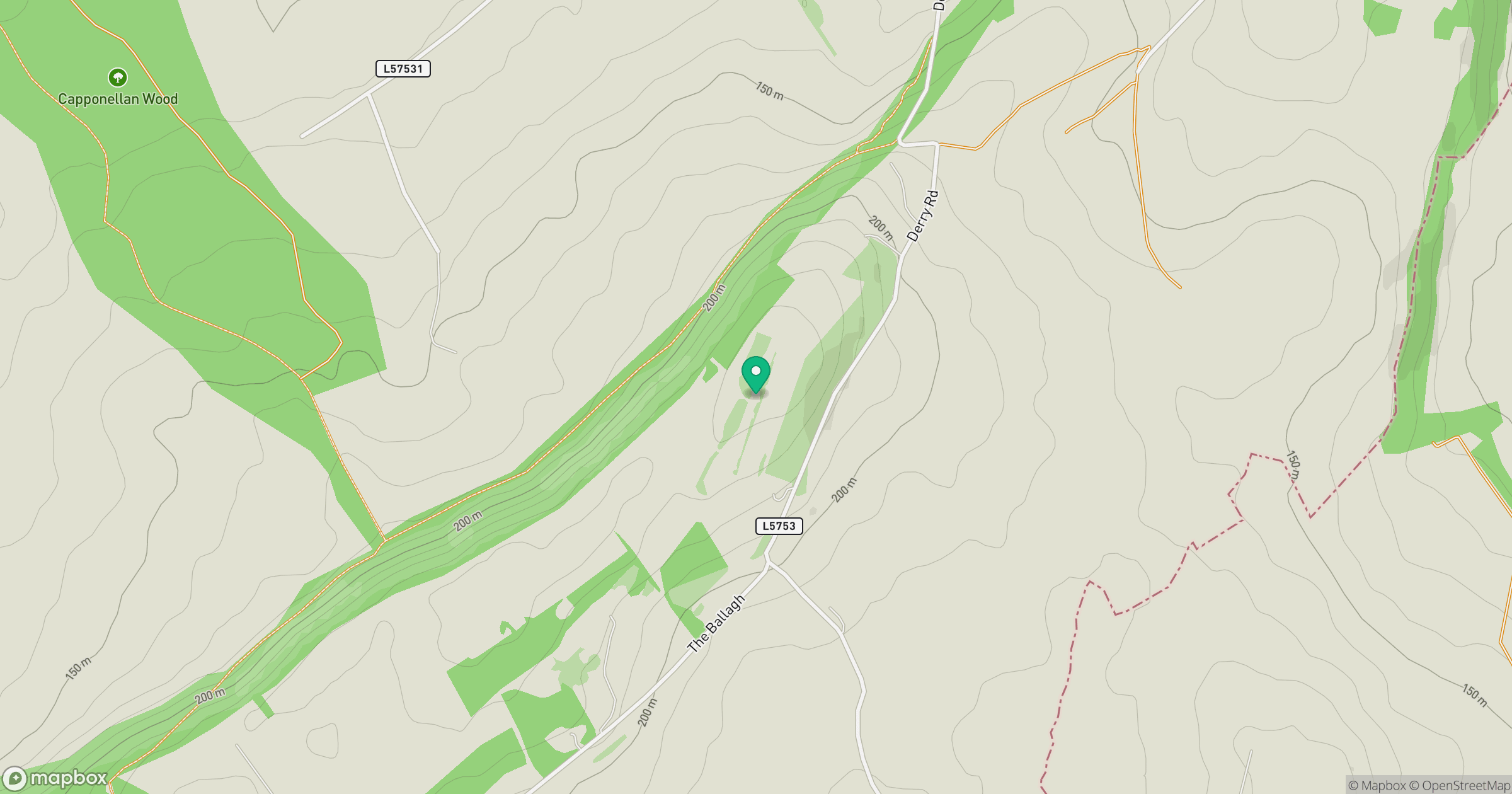
Grid reference: S405749
View on OpenStreetMapOpens a map in a new tab, centred on the hill.
Hills within 30 km
Straight-line distance, not a walking route or confirmation of access.
Knockmannon Hill
313m
Clomantagh Hill [Killoshulan] [Cnoc na Cloiche Mantai]
349m
Cullenagh Mountain [Sliabh Chuileannai]
317m
Knocknamuck [Cnoc na Muc]
340m
Fossy Mountain
332m
No comments yet. Be the first.