
Foel Fryniau
Good walks are even better shared.
Overview
Foel Fryniau: A Welsh Jewel
Foel Fryniau stands proud in the heart of Snowdonia National Park, with an elevation of 452 meters and a prominence of 266 meters, offering not only a delightful hike but also breathtaking views to reward your efforts.
Geology
This hill is a wonder sectioned with volcanic rock, characteristic of the Welsh highlands. If hills could talk, Foel Fryniau would probably be telling tales of ancient volcanic activity and rock formations that have stood the test of time! Notably, you may encounter some sandstone and slate, adding to the geological richness of the area.
Getting There
The journey begins in the picturesque town of Llangollen, a delightful spot where you can stock up on snacks and enjoy the views of the River Dee before heading off. Nearest parking is conveniently located about a 1 km from the starting point of popular routes. For those relying on public transport, both buses and the scenic railway service the area, ensuring access for all.
Hiking Routes
Foel Fryniau Loop from Llangollen
This loop offers a comprehensive experience of the area, taking roughly 3.5 hours to complete, with a moderate challenge that shouldn’t leave you puffing too hard. At around 10 km, this route meanders through charming countryside, showcasing the best of both nature and Welsh culture.
North-South Ridge Walk
A perfect option for the more adventurous souls, this route along the ridge proves to be a challenging yet rewarding experience. With around 8 km to conquer, take approximately 4 hours for this journey- ideal for those looking to stretch their legs and skills!
Summit Features
At the summit, you'll find a small but mighty cairn and a trig point serving as perfect spots for that all-important photo. And don’t forget to look around; the views from up here are nothing short of spectacular! Just watch out for those sheep – they’re quite the experts at photobombing!
Terrain Type
From grassy inclines to rocky outcrops, the terrain can be as varied as the moods of the Welsh weather! Be prepared for some boggy patches, just to keep things interesting, of course.
Views
Your efforts will be handsomely rewarded with views that stretch across Snowdonia, taking in the majestic peaks and the lush Llangollen Valley. The best seasons to capture these views are spring and autumn when the clarity of the air seems to really bring the landscape alive! An early morning hike can be magical, with the sunrise illuminating the hills in golden hues.
Hazards
Be aware that weather in this region can change faster than you can say 'biscuit'! Slippery rocks and muddy trails post-rain deal the same hand, so tread carefully. Or form a game plan – more fun that way!
Nearby Summits
Don’t forget to explore nearby peaks like Moel y Gamelin (558 m) and Cadair Berwyn (830 m) while you’re in the area. They each offer unique experiences to further expand your adventure!
Conclusion
Foel Fryniau may not be the highest peak in Snowdonia, but it is certainly one that offers a wealth of natural beauty and history. So lace up those boots and set out on an adventure that you won’t soon forget. Happy hiking!
Explore routes near Foel Fryniau
Walks starting near this hill. Open a route to check its map, distance and full itinerary.
Northern Rhinogydd guided mountain walk
View route
Coed y Brenin: Pont Ty'n-y-groes and Mawddach Forest Trail
View route
Mawddach Trail: Penmaenpool to Arthog Estuary Return
View route
Mawddach Trail: Penmaenpool to Dolgellau Riverside Return
View route
Route planning notes
These notes describe possible approaches. Check a route's map and access information when planning your walk.
Foel Fryniau Loop from Llangollen
A scenic loop starting from the charming town of Llangollen, taking you through lush woods and open fields before ascending the hill for panoramic views.
North-South Ridge Walk
An adventurous trek along the ridge providing stunning vistas, best suited for those familiar with off-path walking.
Make a day of it, together
Find someone to share the walk with, or organise a day out along a route you like.
Hill facts and local notes
Classifications
Elevation
221m
725 ft
Prominence
31m
Coordinates
52.8561, -4.0313
SH633306
OS Map
124
Explorer: OL18W
At the Summit
The summit features a small cairn and a modest trig point. The views from the top are simply breathtaking, provided you’re not being photobombed by a passing sheep!
Terrain & Geology
Foel Fryniau is primarily composed of volcanic rock, which contributes to its rugged appearance and steep slopes. The hill features a mix of sandstone and slate, typical of the Snowdonia region, making it an excellent study for geology enthusiasts.
Views & Scenery
From the summit, one can see the stunning peaks of Snowdonia, the expansive views of the Llangollen Valley, and on clear days, even the distant Berwyn Mountains.
History & Heritage
Name Origin
Foel Fryniau derives from Welsh, where 'Foel' means 'hill' and 'Fryniau' refers to its ‘slopes’ - so, literally translating to ‘Hill of Slopes’.
Historical Significance
Historically, this area was significant for its rich mining heritage and offers a glimpse into Victorian industry alongside stunning nature.
Getting There & Facilities
Parking
There is a small parking lot near the start of the Llangollen Loop, about 1 km from the town centre.
Public Transport
Llangollen is accessible via bus services from larger towns like Wrexham and Llangollen railway station offers scenic train rides, perfect for your next adventure.
Nearby Facilities
The town of Llangollen has several quaint cafes, restaurants, and public toilets available, ensuring you’re well-fuelled before and after your hike.
Safety Information
Known Hazards
- Beware of sudden weather changes typical to the Welsh hills. Slippery rocks and muddy paths can be found especially after rainfall, so watch your step!
- Some areas may have loose stones, particularly on the steeper parts of the ascent.
General Safety Tips
- Check weather conditions before setting out
- Carry appropriate clothing and equipment
- Let someone know your planned route
- Take a map, compass, and GPS device
- Carry emergency supplies: food, water, first aid kit, torch
Hills
Some common questions about the hills answered
Are there group walks up Foel Fryniau?
Many walkers use Walkmates to join or organise walks with others. You can check for group walks around Foel Fryniau through the maps
Are there other walkers around Foel Fryniau?
Activity varies by location and time, but Walkmates lets you see whether others have shared walks or shown interest in this area. Find other people through the walking friends search walking friends for Foel Fryniau search or of course create your own walk for Foel Fryniau
Can I organise a walk to Foel Fryniau?
Yes. If there aren’t any walks listed already, you can create a walk and make it available for others to join.
If you're signed up to Walkmates, you can create a walk to Foel Fryniau.
How do I find a walk up this hill?
There are often multiple ways to walk this hill, depending on experience and route preference. Walkmates helps you explore walks and routes that others have shared.
Can I suggest a new route up Foel Fryniau?
Yes. You can suggest or create routes to share with others. Walkmates focuses on the social side of walking, so routes are used to help people organise walks and explore areas together, rather than as detailed navigation tools or route libraries.
Other uses really appreciate knowledgeable walkers sharing their routes. Share your favourite route to Foel Fryniau here
The is an error or something incorrect about this hill. How do I let you know?
We always strive to keep the information on Walkmates as accurate as possible. If you find an error, please let us know through the contact form and we'll aim to correct it as quickly as possible
Community Discussion
Comments
Location
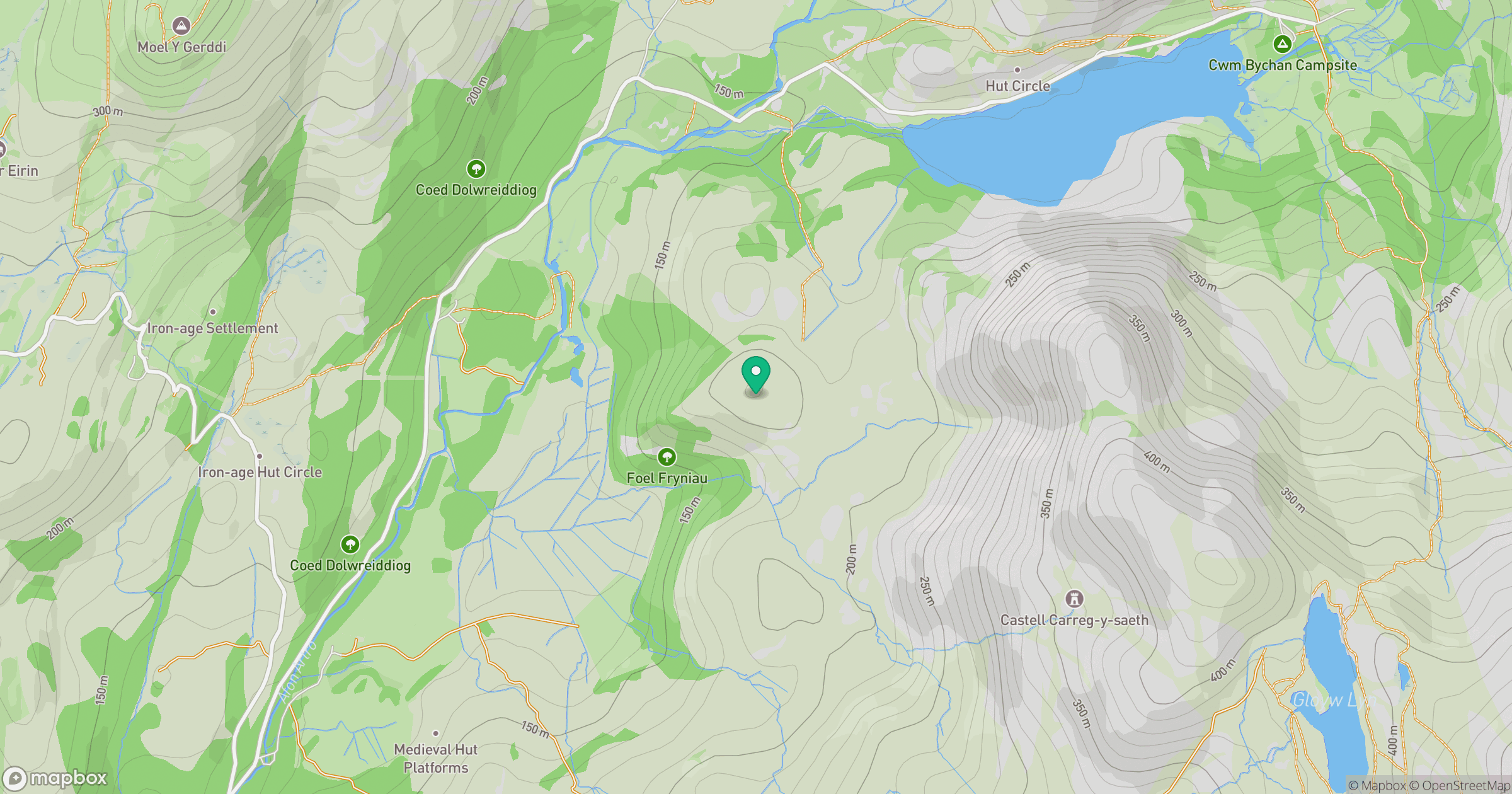
Grid reference: SH633306
View on OpenStreetMapOpens a map in a new tab, centred on the hill.
No comments yet. Be the first.