
Foel Ddu
Good walks are even better shared.
Overview
Foel Ddu: The Black Hill of Snowdonia
Introduction
Nestled within the stunning landscapes of Snowdonia National Park, Foel Ddu is a gem of a hill that might not be the tallest but certainly knows how to capture the attention of a hiker. Standing at 461 meters, this Marilyn offers both charm and challenge.
Geology
Foel Ddu's geology is a delightful mix of Cambrian mudstones and sandstones. These ancient formations give the area a rugged beauty and impart a historical story of the Earth's evolution over the eons. Just don't try to collect any rocks; they know how to throw you a proper Welsh tantrum.
The Routes
One of the popular routes scaling Foel Ddu starts at Llanberis. It’s about 5.5 km long, and with a moderate difficulty, it’s perfect for those who want to stretch their legs without needing a mountain guide. Plus, you can hop into the village afterwards for a well-deserved cake.
Summit Features
Reaching the summit, you've got a modest stone cairn, which is less about being a trophy and more about showing you’re at the top. The view is where the real prize lies—stretching across the breathtaking Snowdonia landscape, it’s perfect for any Instagram enthusiast!
Terrain
The terrain around Foel Ddu is predominantly grassy with curious rocky outcrops that may catch you off guard if you’re not paying attention. Best to put your boots on and get lost in the green before you get lost in the bushes!
Views
From its summit, the highlights include iconic vistas of the Snowdon massif and the shimmering Llyn Padarn. The best times to soak in these views is during spring and autumn, where you’ll have nature putting on its best show.
Hazards
Be mindful that the trails can be slippery in wet conditions, and visibility can drop like a lead balloon in poor weather. It’s wise to be prepared, as nature doesn’t carry GPS.
Nearby Summits
Don’t miss out on the nearby peaks like Foel Goch or Snowdon itself. A challenge for those who want to conquer multiple summits in one go!
Access
Nearest parking is found in Llanberis, where taking a bus is also a feasible option from surrounding towns.
Facilities
Llanberis is well-equipped with cafes, shops, and public facilities, so fear not if hunger strikes!
Conclusion
Foel Ddu is quite the delightful hill. Perfect for a casual hike, stunning views, and an opportunity to experience the wild side of Snowdonia without facing a full-on mountain challenge. Pack your sandwiches and enjoy!
Explore routes near Foel Ddu
Walks starting near this hill. Open a route to check its map, distance and full itinerary.
Snowdon Pyg Track returning by Miner's Track
View route
Beddgelert Forest: Derwen Circuit and Llyn Llywelyn
View route
Beddgelert Forest: Llyn Llywelyn Woodland Circuit
View route
Northern Rhinogydd guided mountain walk
View route
Route planning notes
These notes describe possible approaches. Check a route's map and access information when planning your walk.
Llanberis Path
A scenic walk starting from the village of Llanberis that winds up through the stunning landscape surrounding Foel Ddu.
Make a day of it, together
Find someone to share the walk with, or organise a day out along a route you like.
Hill facts and local notes
Classifications
Elevation
590m
1,937 ft
Prominence
24m
Coordinates
52.9950, -3.9835
SH669460
OS Map
115
Explorer: OL17W
At the Summit
The summit features a simple stone cairn and offers an excellent viewpoint for panoramic views of the surrounding hills and valleys.
Terrain & Geology
Foel Ddu is primarily composed of Cambrian mudstones and sandstones, providing a mix of rugged and rolling landscapes. The rock formations offer intriguing insights into the geological history of the area.
Views & Scenery
From the summit, hikers can enjoy views of the iconic Snowdon massif, Llyn Padarn, and the picturesque village of Llanberis.
History & Heritage
Name Origin
Foel Ddu translates to 'black hill' in Welsh, possibly reflecting its rocky appearance or dark terrain.
Historical Significance
This mountain has been a part of local culture for generations, often featuring in folklore and being a popular destination for hikers of all abilities.
Getting There & Facilities
Parking
Llanberis has several car parks available, including one near the starting point of the Llanberis Path.
Public Transport
Regular bus services operate from nearby towns, including Caernarfon and Bangor, making it accessible by public transport.
Nearby Facilities
Llanberis offers a variety of facilities including cafes, shops, and public toilets for the convenience of hikers.
Safety Information
Known Hazards
- Lack of path visibility in poor weather, rocky terrain that can be slippery when wet, and steep descents in certain areas.
General Safety Tips
- Check weather conditions before setting out
- Carry appropriate clothing and equipment
- Let someone know your planned route
- Take a map, compass, and GPS device
- Carry emergency supplies: food, water, first aid kit, torch
Hills
Some common questions about the hills answered
Are there group walks up Foel Ddu?
Many walkers use Walkmates to join or organise walks with others. You can check for group walks around Foel Ddu through the maps
Are there other walkers around Foel Ddu?
Activity varies by location and time, but Walkmates lets you see whether others have shared walks or shown interest in this area. Find other people through the walking friends search walking friends for Foel Ddu search or of course create your own walk for Foel Ddu
Can I organise a walk to Foel Ddu?
Yes. If there aren’t any walks listed already, you can create a walk and make it available for others to join.
If you're signed up to Walkmates, you can create a walk to Foel Ddu.
How do I find a walk up this hill?
There are often multiple ways to walk this hill, depending on experience and route preference. Walkmates helps you explore walks and routes that others have shared.
Can I suggest a new route up Foel Ddu?
Yes. You can suggest or create routes to share with others. Walkmates focuses on the social side of walking, so routes are used to help people organise walks and explore areas together, rather than as detailed navigation tools or route libraries.
Other uses really appreciate knowledgeable walkers sharing their routes. Share your favourite route to Foel Ddu here
The is an error or something incorrect about this hill. How do I let you know?
We always strive to keep the information on Walkmates as accurate as possible. If you find an error, please let us know through the contact form and we'll aim to correct it as quickly as possible
Community Discussion
Comments
Location
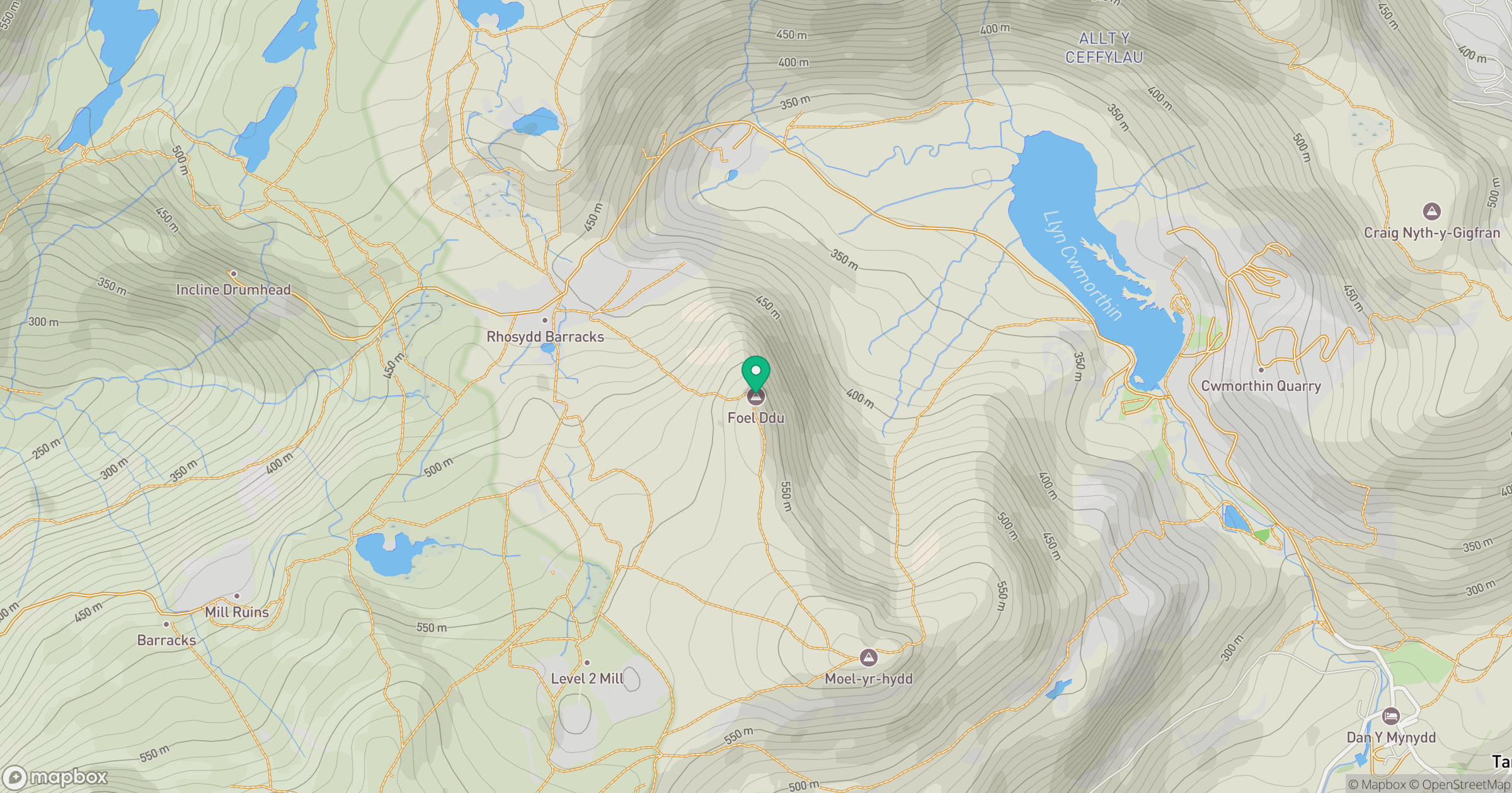
Grid reference: SH669460
View on OpenStreetMapOpens a map in a new tab, centred on the hill.
No comments yet. Be the first.