

Easdale
Good walks are even better shared.
NM7317 : Easdale - Quarry of the Hill
Rob Farrow Photo source
Overview
Explore Easdale
Easdale, a charming little hill nestled in Argyll and Bute, offers hikers a lovely excursion with stunning vistas and a rich history. With an elevation of 250 meters, it's modest by Munro standards but welcomes both seasoned hikers and those just looking for a picturesque stroll.
Geology
Easdale is a geologist's delight, predominantly made up of slate. The remnants of the historical slate industry are visible throughout the region, especially with the flooded quarries on Easdale Island, which once buzzed with miners' activity. So, if you fancy a geological treasure hunt, this is the place! Just remember, no taking home samples, as tempting as that might be!
Routes
The Easdale Island Loop is the recommended route for most visitors. Spanning 3.5 km, this easy hike takes around 1.5 hours, making it perfect for families and more leisurely outings. As you circle the island, enjoy the gorgeous coastal scenery, and don't forget to say hello to any locals—particularly the friendly seabirds!
Summit Features
At the summit, you’ll find a quaint cairn, standing proudly amidst the surrounding landscape, offering a great spot for a rest and some photos. The view, as the saying goes, is worth a thousand words.
Terrain Type
The terrain is predominantly grassy with rocky outcrops, showing signs of well-trodden paths. Just be mindful of slippery sections after rain, as they can lead to unexpected ‘slip-and-slide’ moments.
Views
The summit offers sweeping views of Easdale Island, the glimmering waters surrounding it, and far-off neighbouring islands, including Mull and the striking Ben More. To catch the views at their best, visit in spring or fall when nature puts on its finest displays.
Hazards
While Easdale is generally safe, keep an eye out for slippery rocks, especially when the rain decides to join your adventure. Additionally, weather can change quickly, so carrying a lightweight raincoat is not a bad idea.
Nearby Summits
For those keen to explore more, nearby summits such as Ben More and Sgorr a'Choise offer additional hiking opportunities and challenges for the more intrepid. Just remember, the higher you go, the heavier your ‘snack’ bag will feel on the way back!
Access
Getting to Easdale is simple. There is parking at the Easdale Island ferry terminal, with numerous bus services operating from Oban to the terminal. A ferry ride across to the island adds an element of adventure to your visit!
Facilities
On Easdale Island itself, you can find a lovely café for refreshments and public toilets for those essential pit stops. Given the island's quaint nature, it's always wise to bring your own snacks along as well.
History
Easdale has historical significance infused with its name; 'Eas Dail' evokes the imagery of serene landscapes and rushing waters. The slate industry shaped the local communities in the 19th century, leaving behind a remarkable legacy that contributes to the island's charm today.
Conclusion
Overall, Easdale is a gem worth exploring, combining ease of access, stunning views, and a dash of exciting history. So, lace up those hiking boots, pack your sandwich, and get ready to enjoy everything this little treasure has to offer!
Explore routes near Easdale
Walks starting near this hill. Open a route to check its map, distance and full itinerary.
Crinan Canal: Bellanoch and Dunardry towpath return
View route
Glen Kin group walk
View route
Beinn Ime from Succoth
View route
The Cobbler from Succoth Carpark
View route
Route planning notes
These notes describe possible approaches. Check a route's map and access information when planning your walk.
Easdale Island Loop
A pleasant circuit around Easdale Island, taking in scenic coastal views and historical landmarks.
Make a day of it, together
Find someone to share the walk with, or organise a day out along a route you like.
Photo Gallery
View all Photo could not load
NM7317 : Easdale - Quarry of the Hill
Rob Farrow
 Photo could not load
NM7317 : Easdale Island to Mull
Carroll Pierce
 Photo could not load
NM7317 : The track of a tramway on Easdale
Elliott Simpson
 Photo could not load
NM7317 : Easdale - Quarry of the Hill from the northwest
Rob Farrow
 Photo could not load
NM7317 : Easdale - Former quarry buildings
Rob Farrow
 Photo could not load
NM7317 : Easdale - Former quarry, northernmost quarry
Rob Farrow
 Photo could not load
NM7317 : Easdale - Former quarry buildings
Rob Farrow
 Photo could not load
NM7317 : Easdale - Gull perched on ruin
Rob Farrow
 Photo could not load
NM7317 : Easdale - Duckweed covered pool
Rob Farrow

NM7317 : Easdale - pathway to flooded quarry
Rob Farrow
Hill facts and local notes
Classifications
Elevation
38m
125 ft
Prominence
38m
Coordinates
56.2922, -5.6593
NM736171
OS Map
55
Explorer: 359
At the Summit
The summit features a modest cairn, offering panoramic views of the surrounding islands and a sense of accomplishment for reaching the top.
Terrain & Geology
Easdale is primarily composed of slate, a remnant of the ancient geological activity that shaped this region. The slate quarries of Easdale Island, now flooded, highlight the historical mining that has taken place here.
Views & Scenery
From the summit, enjoy breathtaking views of the Slate Islands, with the majestic Ben More and the distant peaks of Mull visible on a clear day.
History & Heritage
Name Origin
The name Easdale comes from the Gaelic 'Eas Dail', meaning 'waterfall of the meadow', a nod to the natural beauty of the area.
Historical Significance
Easdale played a pivotal role in the slate quarrying industry, and its historical significance is tied to the livelihoods of many local families during the 19th century.
Getting There & Facilities
Parking
Parking is available at the Easdale Island ferry terminal, around 1 km from the start point of the route.
Public Transport
Frequent bus services from Oban to Easdale ferry terminal. The ferry provides access across the water.
Nearby Facilities
Easdale Island has a small café and public toilets available for visitors. Facilities are limited, so it's advisable to carry any provisions you might need.
Safety Information
Known Hazards
- Slippery rocks, particularly in wet weather, and the potential for sudden changes in weather conditions.
General Safety Tips
- Check weather conditions before setting out
- Carry appropriate clothing and equipment
- Let someone know your planned route
- Take a map, compass, and GPS device
- Carry emergency supplies: food, water, first aid kit, torch
Hills
Some common questions about the hills answered
Are there group walks up Easdale?
Many walkers use Walkmates to join or organise walks with others. You can check for group walks around Easdale through the maps
Are there other walkers around Easdale?
Activity varies by location and time, but Walkmates lets you see whether others have shared walks or shown interest in this area. Find other people through the walking friends search walking friends for Easdale search or of course create your own walk for Easdale
Can I organise a walk to Easdale?
Yes. If there aren’t any walks listed already, you can create a walk and make it available for others to join.
If you're signed up to Walkmates, you can create a walk to Easdale.
How do I find a walk up this hill?
There are often multiple ways to walk this hill, depending on experience and route preference. Walkmates helps you explore walks and routes that others have shared.
Can I suggest a new route up Easdale?
Yes. You can suggest or create routes to share with others. Walkmates focuses on the social side of walking, so routes are used to help people organise walks and explore areas together, rather than as detailed navigation tools or route libraries.
Other uses really appreciate knowledgeable walkers sharing their routes. Share your favourite route to Easdale here
The is an error or something incorrect about this hill. How do I let you know?
We always strive to keep the information on Walkmates as accurate as possible. If you find an error, please let us know through the contact form and we'll aim to correct it as quickly as possible
Community Discussion
Comments
Location
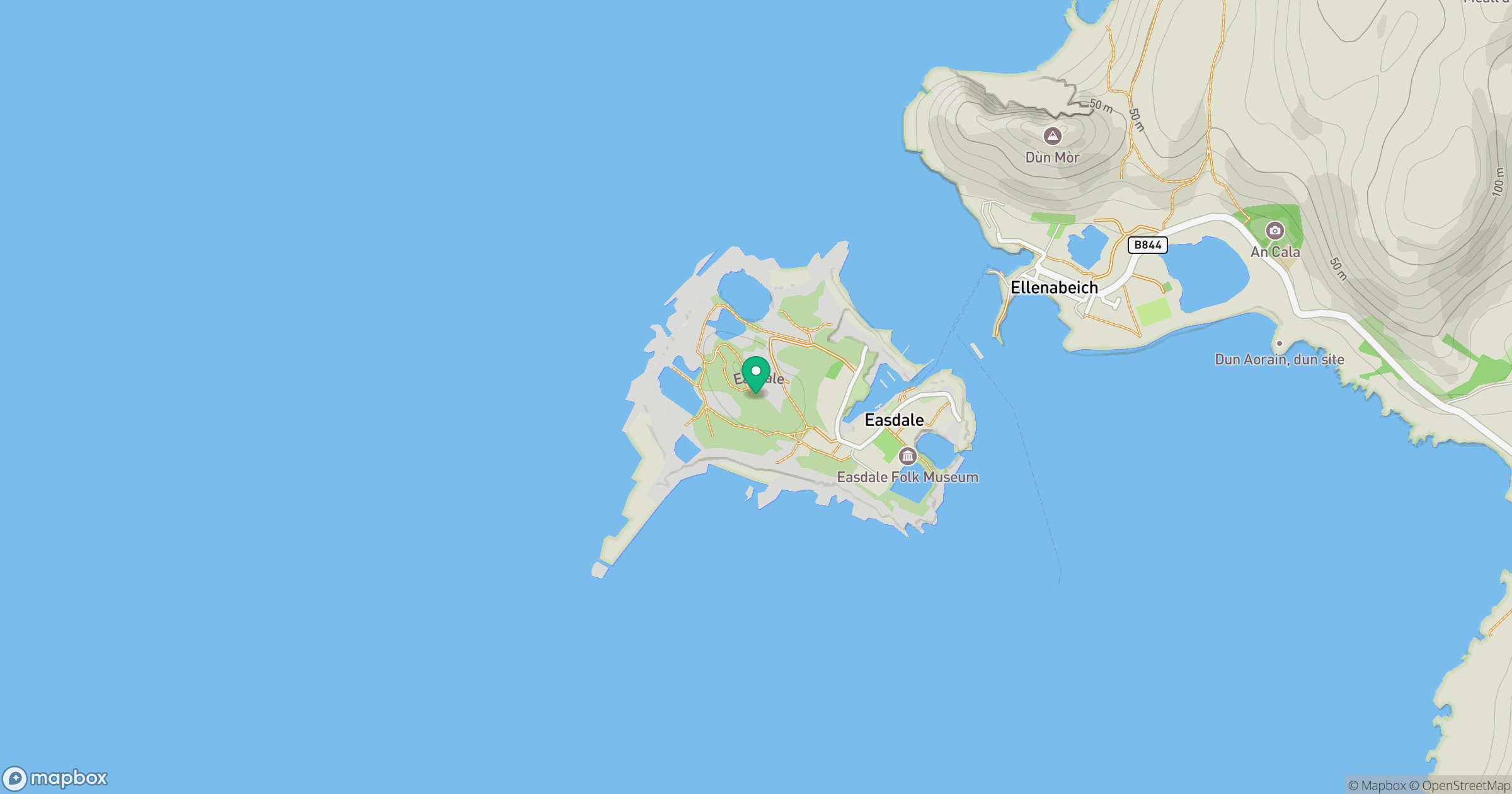
Grid reference: NM736171
View on OpenStreetMapOpens a map in a new tab, centred on the hill.
No comments yet. Be the first.