

Bidein na h-Iolaire
Good walks are even better shared.
Overview
Bidein na h-Iolaire
Bidein na h-Iolaire is a prominent Munro standing at 785 meters in the awe-inspiring Scottish Highlands. Its sheer beauty and mystique attract hikers all year round, just be sure to take your camera because the views are simply stunning!
Geology
The mountain's foundation is formed from ancient Lewisian gneiss, a rock type that has stood the tests of time. The intricate layers are a testament to the geological processes that have shaped the landscape over billions of years. The valley's glacial remnants frame the mountain perfectly, making it both a stunning and educational climb.
Routes
Two popular routes ascend Bidein na h-Iolaire:
- Bob's Bidein Route - A moderate route starting from Invergarry requiring approximately 4.5 hours. Don’t forget your walking boots!
- The Direct Ascent - This more challenging route is for the bold-hearted adventurers who crave a direct assault to the summit, taking around 5 hours.
Summit Features
At the peak, hikers are greeted by a proud cairn and a steadfast trig point. This spot is perfect for taking in the sweeping vistas while pretending to be atop the world.
Terrain
Expect a mix of rocky outcrops and grassy slopes interspersed with boggy areas. Tread carefully—nature would prefer your boots to stay on dry land!
Views
The summit offers breathtaking sights of Loch Shiel and the majestic surrounding ridges. Clear days will reward hikers with panoramic views, but as always, keep an eye on the sky for any weather changes. Best visits are usually during spring or autumn.
Hazards
Take heed of the swift-changing weather and be cautious of lingering snow in the upper reaches well into spring. It can turn from sunny to misty faster than you can say 'Bidein na h-Iolaire'!
Access
Parking is available at a small area off the A82, and public transport options are viable from Fort William to Invergarry. The quaint village nearby offers the necessary comfort and refreshments.
Facilities
There are a few cafés, but extensive amenities can be found in Fort William if you feel you need more than a scone and a cup of tea.
History
The name of the mountain offers a glimpse into local culture, meaning 'little eagle's hill'. It’s a cherished climbing route steeped in tradition, making it more than just a pretty face.
Happy Hiking—don't forget to bring your sense of adventure!
Explore routes near Bidein na h-Iolaire
Public walks starting within 80 km of this hill. Nearby does not mean a route reaches the summit; check its map and access before setting out.
Crinan Canal: Bellanoch and Dunardry towpath return
View route
Glen Kin group walk
View route
Bishop’s Glen group walk
View route
West Bay walk and talk
View route
Route planning notes
These notes describe possible approaches, not verified navigable routes or permission to cross land. Check current paths, local access rules and conditions before setting out.
Bob's Bidein Route
This route starts from the car park at Invergarry and leads you up through scenic glens and rocky outcrops to the summit of Bidein na h-Iolaire.
The Direct Ascent
A more challenging ascent directly from the east, this route is steep but offers stunning views for those who are game.
Make a day of it, together
Find someone to share the walk with, or organise a day out along a route you like.
Photo Gallery
View all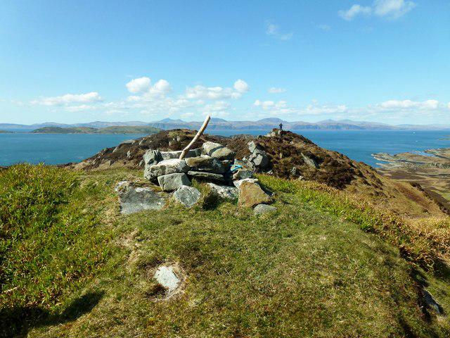 Photo could not load
NM7008 : Bidein na h-Iolaire, Lunga
Rude Health
Hill facts and local notes
Classifications
Elevation
101m
331 ft
Prominence
101m
Coordinates
56.2146, -5.7002
NM706086
OS Map
55
Explorer: 359
At the Summit
The summit features a prominent cairn and a trig point, perfect for that 'I was here' photo op. Don't forget to salute the panoramic views while you’re at it!
Terrain & Geology
Bidein na h-Iolaire is primarily composed of ancient Lewisian gneiss, which is renowned for its resilience and distinct banding. The summit offers fantastic insights into the geological history of the area, with impressive glacial features adorning its slopes.
Views & Scenery
You can see the dramatic ridges of the surrounding mountains and the sparkling waters of Loch Shiel below. On a clear day, those views are nothing short of majestic.
History & Heritage
Name Origin
The name 'Bidein na h-Iolaire' translates to 'little eagle's hill', a nod to local wildlife and possibly a few fantastical tales involving majestic eagles.
Historical Significance
The mountain is a beloved training ground for climbers and hikers and forms part of the traditional routes used by locals for generations.
Getting There & Facilities
Check current local access restrictions, parking rules and transport timetables before travelling. These notes do not confirm public access to the summit.
Parking
There is a small parking area at the start of the path off the A82, capable of accommodating several vehicles. It’s best to arrive early during peak seasons.
Public Transport
Buses from Fort William to Invergarry operate regularly, but check schedules, as they may vary.
Nearby Facilities
There are limited facilities in Invergarry, including a charming café and public toilets. For anything more substantial, one might have to venture towards Fort William.
Safety Information
Known Hazards
- Be wary of changing weather conditions, as they can turn from clear skies to swirling mists with alarming speed. Also, snow and ice may linger on the upper reaches well into spring.
General Safety Tips
- Check weather conditions before setting out
- Carry appropriate clothing and equipment
- Let someone know your planned route
- Take a map, compass, and GPS device
- Carry emergency supplies: food, water, first aid kit, torch
Hills
Some common questions about the hills answered
Are there group walks up Bidein na h-Iolaire?
Many walkers use Walkmates to join or organise walks with others. You can check for group walks around Bidein na h-Iolaire through the maps
Are there other walkers around Bidein na h-Iolaire?
Activity varies by location and time, but Walkmates lets you see whether others have shared walks or shown interest in this area. Find other people through the walking friends search walking friends for Bidein na h-Iolaire search or of course create your own walk for Bidein na h-Iolaire
Can I organise a walk to Bidein na h-Iolaire?
Yes. If there aren’t any walks listed already, you can create a walk and make it available for others to join.
If you're signed up to Walkmates, you can create a walk to Bidein na h-Iolaire.
How do I find a walk up this hill?
There are often multiple ways to walk this hill, depending on experience and route preference. Walkmates helps you explore walks and routes that others have shared.
Can I suggest a new route up Bidein na h-Iolaire?
Yes. You can suggest or create routes to share with others. Walkmates focuses on the social side of walking, so routes are used to help people organise walks and explore areas together, rather than as detailed navigation tools or route libraries.
Other uses really appreciate knowledgeable walkers sharing their routes. Share your favourite route to Bidein na h-Iolaire here
The is an error or something incorrect about this hill. How do I let you know?
We always strive to keep the information on Walkmates as accurate as possible. If you find an error, please let us know through the contact form and we'll aim to correct it as quickly as possible
Community Discussion
Comments
Location
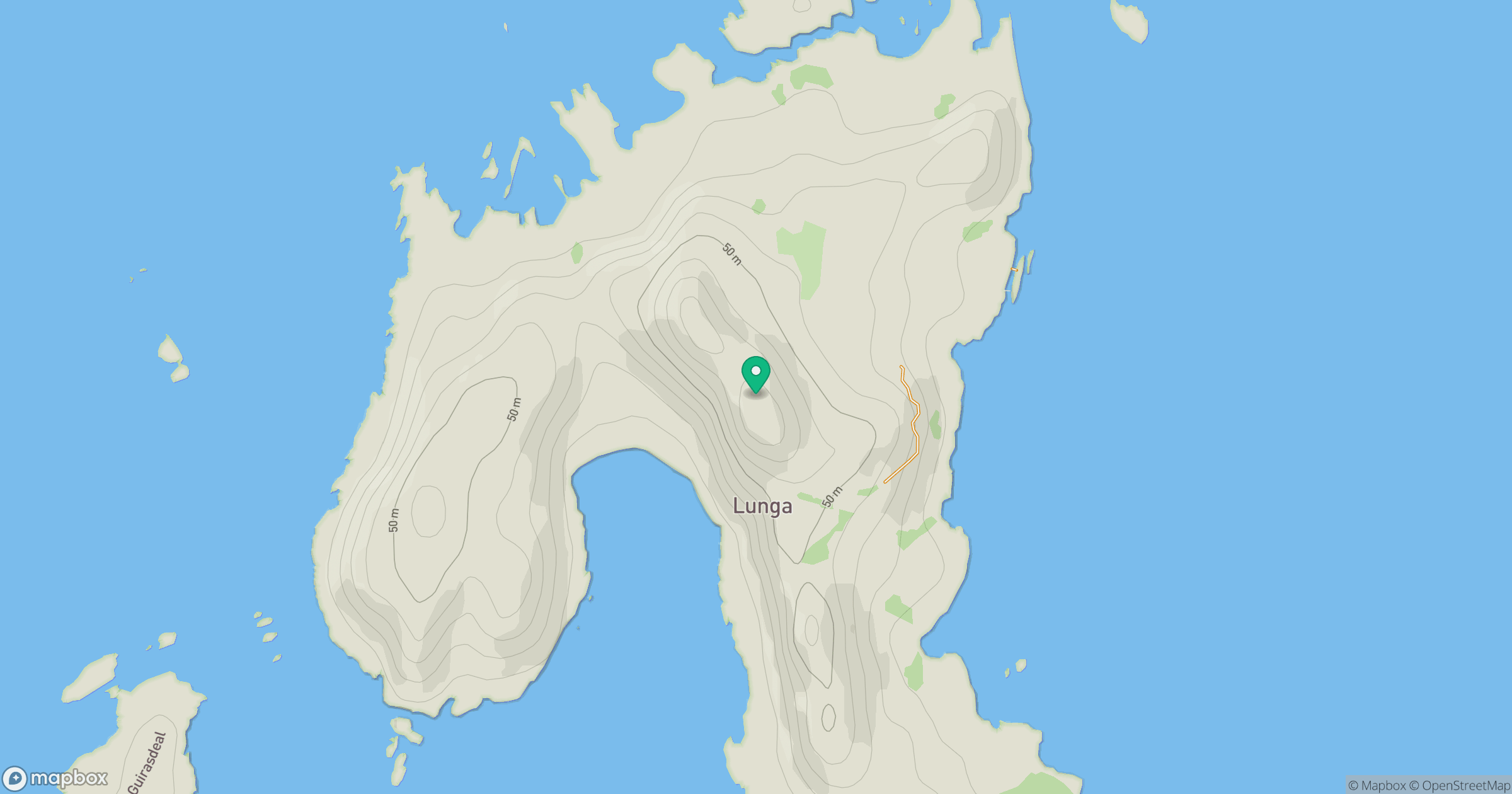
Grid reference: NM706086
View on OpenStreetMapOpens a map in a new tab, centred on the hill.
Hills within 30 km
Straight-line distance, not a walking route or confirmation of access.
No comments yet. Be the first.