

Earncraig Hill
Good walks are even better shared.
Overview
Earncraig Hill
Nestled in the breathtaking Scottish Highlands, Earncraig Hill stands proudly at an elevation of 469 meters (1,539 feet). With its classification as a Marilyn, it's a notable peak in the region that beckons hikers eager to escape into nature.
Geology
The geology of Earncraig Hill is predominantly Old Red Sandstone, which bathes the landscape in a warm, reddish tint. This striking hue doesn’t merely make the hill look attractive; it’s also a testament to the geological history that shaped this region millions of years ago.
Routes
The most popular route is the Glen Strathfarrar Route, which spans approximately 8.5 km and typically takes around 3.5 hours to complete. The path meanders through stunning valleys and past trickling streams, providing ample opportunity to stop and enjoy the scenery. The difficulty is moderate, making it accessible for most reasonably fit walkers.
Summit Features
Arriving at the summit, hikers will find a simple yet inviting cairn, which has seen countless summits—and hopefully equally as many sandwiches. It’s a peaceful spot to take a moment to appreciate the efforts that brought you there.
Terrain
Earncraig Hill boasts a diverse terrain ranging from grassy slopes to rugged rocky outcrops. The air is often sweetened by the perfume of blooming heather, an additional delight for the senses.
Views
On a clear day, the views from the top of Earncraig Hill are nothing short of spectacular. You can catch glimpses of Loch Ness shining in the distance and the majestic outline of Ben Nevis. For the best vistas, aim to hike in spring or autumn, when nature cloaks the landscape in vibrant colours.
Hazards
As is true to the Scottish Highlands, the weather can change in a heartbeat. Obtain weather updates before setting out, and keep an eye on the terrain to avoid slippery patches, especially after rain.
Nearby Summits
Not far from Earncraig are notable peaks like Sgurr na Ruaidhe (630 meters) and Creag Dubh (580 meters), providing excellent options for those looking to stretch their legs a bit more after bagging this hill.
Access
For those driving, parking is available near the entrance to Glen Strathfarrar. Public transport is rather limited, but the scenic village of Beauly, located roughly 13 miles away, is your nearest hope for bus access. A good rule of thumb: don’t forget your sandwiches!
Facilities
While Earncraig Hill itself is a back-to-nature experience, the nearby town of Beauly offers several cafes, shops, and public toilets to cater to your pre-hike needs. Grab a cup of tea before heading off!
History
The name 'Earncraig' translates to 'Eagle Rock', hinting at a past rich in natural symbolism and perhaps a few feathered friends. The hill is steeped in lore, and many locals share tales of legendary creatures that once roamed its slopes.
So grab your boots, pack your essentials, and enjoy a splendid day at Earncraig Hill, where every step is a step into the heart of Scotland's enchanting landscape!
Explore routes near Earncraig Hill
Public walks starting within 80 km of this hill. Nearby does not mean a route reaches the summit; check its map and access before setting out.
Forest of Ae Water of Ae Riverside Trail
View route
Moffat Gallow Hill Woodland and Viewpoint Circuit
View route
Mabie Forest Dalshinnie Glen and Loch
View route
Hoddom Castle and River Annan Woodland Circuit
View route
Route planning notes
These notes describe possible approaches, not verified navigable routes or permission to cross land. Check current paths, local access rules and conditions before setting out.
Glen Strathfarrar Route
A scenic route that starts from Glen Strathfarrar leading through lush valleys and across bubbling brooks.
Make a day of it, together
Find someone to share the walk with, or organise a day out along a route you like.
Photo Gallery
View all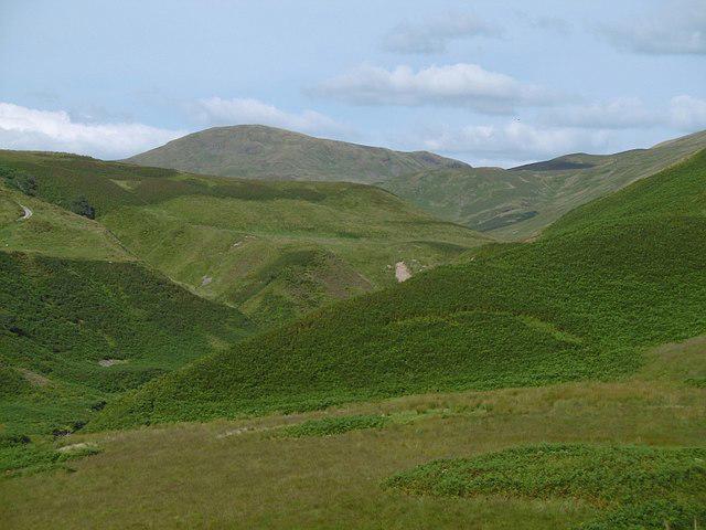 Photo could not load
NS9701 : Earncraig Hill
Richard Webb
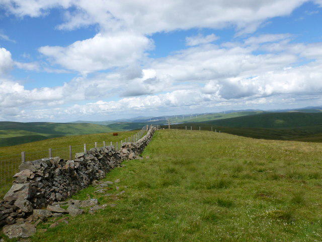 Photo could not load
NS9701 : March fence on Earncraig Hill
Alan O'Dowd
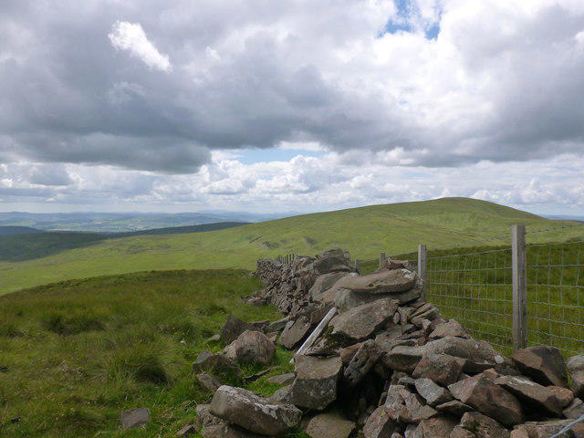 Photo could not load
NS9701 : Summit of Earncraig Hill
Alan O'Dowd
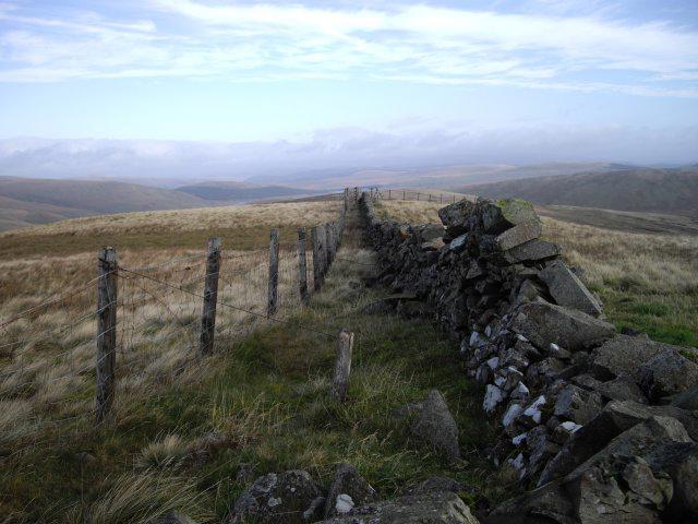 Photo could not load
NS9701 : Fence and wall
Callum Black
Hill facts and local notes
Classifications
Elevation
611m
2,005 ft
Prominence
109m
Coordinates
55.2958, -3.6187
NS973013
OS Map
78
Explorer: 329
At the Summit
The summit features a modest cairn, offering the perfect spot for a celebratory snack (or an energy bar, if you're being healthy).
Terrain & Geology
The hill is primarily composed of Old Red Sandstone, giving it a unique reddish hue that's reminiscent of a fine wine—perfect for a picnic, though perhaps not for drinking!
Views & Scenery
From the summit, you can feast your eyes on the stunning landscapes of the Scottish Highlands, including Loch Ness and distant mountains like the iconic Ben Nevis.
History & Heritage
Name Origin
The name 'Earncraig' derives from the Scots Gaelic 'Eàrn', meaning 'the Eagle', suggesting a majestic presence in the area.
Historical Significance
With a history rich in Scottish folklore, the hill is said to be a former haunt of legendary creatures that inspire local tales.
Getting There & Facilities
Check current local access restrictions, parking rules and transport timetables before travelling. These notes do not confirm public access to the summit.
Parking
Parking available near the entrance to Glen Strathfarrar; please ensure not to block any gates.
Public Transport
Limited public transport; the nearest bus stop is in the village of Beauly, approximately 13 miles away.
Nearby Facilities
While the mountain itself has no facilities, Beauly offers several cafes, shops, and public restrooms for your pre-hike needs.
Safety Information
Known Hazards
- Be cautious of sudden weather changes in the Highlands, as well as potentially slippery terrain when it rains.
General Safety Tips
- Check weather conditions before setting out
- Carry appropriate clothing and equipment
- Let someone know your planned route
- Take a map, compass, and GPS device
- Carry emergency supplies: food, water, first aid kit, torch
Hills
Some common questions about the hills answered
Are there group walks up Earncraig Hill?
Many walkers use Walkmates to join or organise walks with others. You can check for group walks around Earncraig Hill through the maps
Are there other walkers around Earncraig Hill?
Activity varies by location and time, but Walkmates lets you see whether others have shared walks or shown interest in this area. Find other people through the walking friends search walking friends for Earncraig Hill search or of course create your own walk for Earncraig Hill
Can I organise a walk to Earncraig Hill?
Yes. If there aren’t any walks listed already, you can create a walk and make it available for others to join.
If you're signed up to Walkmates, you can create a walk to Earncraig Hill.
How do I find a walk up this hill?
There are often multiple ways to walk this hill, depending on experience and route preference. Walkmates helps you explore walks and routes that others have shared.
Can I suggest a new route up Earncraig Hill?
Yes. You can suggest or create routes to share with others. Walkmates focuses on the social side of walking, so routes are used to help people organise walks and explore areas together, rather than as detailed navigation tools or route libraries.
Other uses really appreciate knowledgeable walkers sharing their routes. Share your favourite route to Earncraig Hill here
The is an error or something incorrect about this hill. How do I let you know?
We always strive to keep the information on Walkmates as accurate as possible. If you find an error, please let us know through the contact form and we'll aim to correct it as quickly as possible
Community Discussion
Comments
Location
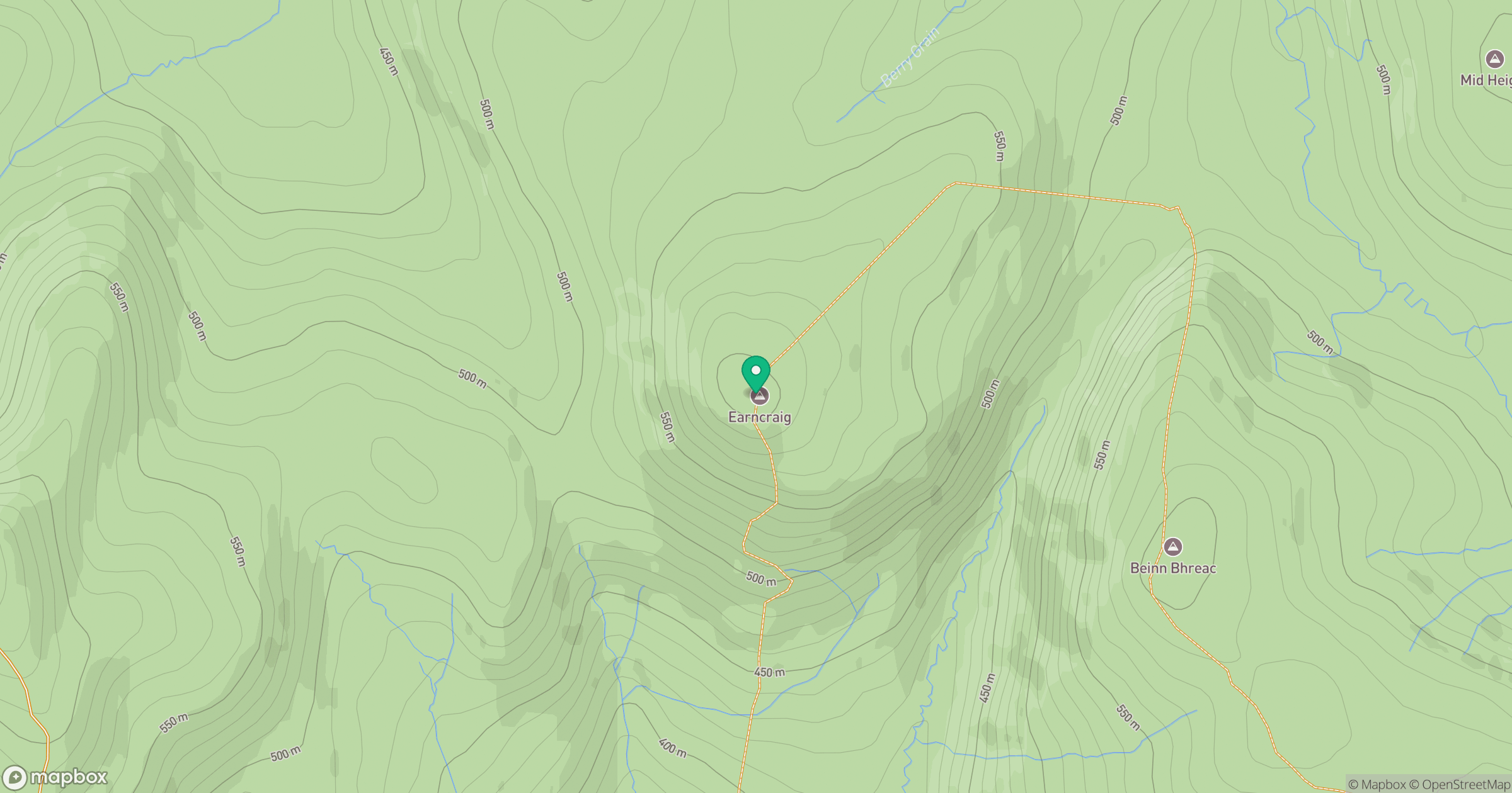
Grid reference: NS973013
View on OpenStreetMapOpens a map in a new tab, centred on the hill.
Hills within 30 km
Straight-line distance, not a walking route or confirmation of access.
No comments yet. Be the first.