

Ballencleuch Law
Good walks are even better shared.
NS9304 : Southeast slopes of Ballencleuch Law
Richard Webb Photo source
Overview
Ballencleuch Law
Nestled in the heart of the Scottish Borders, Ballencleuch Law is a charming Marilyn that promises a delightful hike and stunning views. Standing at an elevation of 662 meters, this mountain is ideal for those looking to escape the hustle and bustle of everyday life. Whether you are a seasoned hiker or a novice looking to dip your toes into the wonderful world of outdoor adventures, Ballencleuch Law has something to offer.
Geology
The mountain is primarily formed from sedimentary rock, which tells an intriguing story of the land's geological past. The sandstone and limestone layers not only provide a solid footing but also feature interesting formations that can pique the curiosity of geology enthusiasts!
Hiking Routes
Common Route from South-East
This popular route starts from the south-east and leads hikers through rolling grassy slopes. Approximately 6.5 km in distance, it's a moderate trek suitable for most abilities. Expect to take around 2.5 hours to reach the summit if you stop to take photos of the scenery along the way (seriously, you’ll want to).
Summit Features
At the summit, a sturdy concrete trig point stands proudly beside a stone cairn, both perfect for photo ops. Feel free to take a moment to catch your breath and soak in the magnificent vistas before strutting your stuff back down.
Terrain
The terrain transitions from grassy expanses to rocky outcrops as you ascend, adding a bit of variety to your trek. Just keep an eye out for muddy patches—it’s not a party until someone slips!
Views
Looking out from the summit, you’ll be treated to remarkable views that include the rugged outlines of the Eildon Hills and the distant Cheviots. And if it’s a clear day? You might just catch a glimpse of the North Sea shimmering in the distance. Timing your visit during late spring or early autumn can ensure the best views and weather.
Hazards
While the ascent is manageable, there are some hazards to keep in mind. Muddy paths can be an issue after rainfall, and the rocky terrain near the summit requires a little care—better safe than sorry!
Nearby Summits
If you’re feeling adventurous, you can also explore nearby peaks like Black Hill (654 m) and Holly Tree Hill (630 m) which are both within a manageable distance for a proper day out.
Access
The nearest parking is conveniently situated at the A703 road, with space for several vehicles. If you’re using public transport, the bus stop in the village of Stow is the closest, but be sure to check the service timetable as it’s limited. Galashiels is the closest town where you can find essential facilities like cafes and toilets.
History
The name 'Ballencleuch' means 'the valley of the rock' in Scots Gaelic, a fitting descriptor for this rugged landscape. Historically, the mountain has been a guide for shepherds and features in various regional folk tales—a dash of intrigue to your hiking narrative!
So pack your boots, grab your walking pole, and get ready to explore Ballencleuch Law! Whether you're in it for the views or the fresh air, this mountain will surely make your day.
Explore routes near Ballencleuch Law
Walks starting near this hill. Open a route to check its map, distance and full itinerary.
Moffat Gallow Hill Woodland and Viewpoint Circuit
View route
Forest of Ae Water of Ae Riverside Trail
View route
Mabie Forest Dalshinnie Glen and Loch
View route
Hoddom Castle and River Annan Woodland Circuit
View route
Route planning notes
These notes describe possible approaches. Check a route's map and access information when planning your walk.
Common route from south-east
A scenic route that meanders through grassy slopes before ascending to the summit, offering a pleasant hike for most outdoor enthusiasts.
Make a day of it, together
Find someone to share the walk with, or organise a day out along a route you like.
Photo Gallery
View all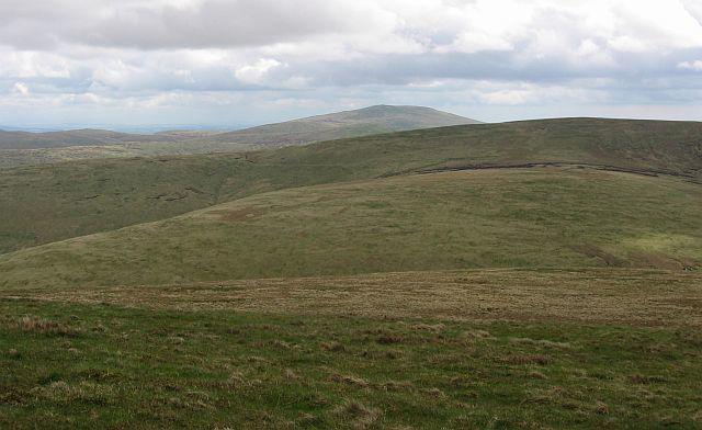 Photo could not load
NS9304 : Southeast slopes of Ballencleuch Law
Richard Webb
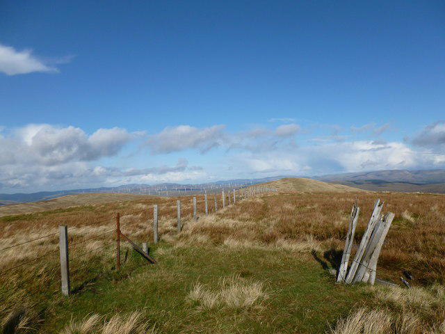 Photo could not load
NS9304 : Summit of Ballencleuch Law
Alan O'Dowd
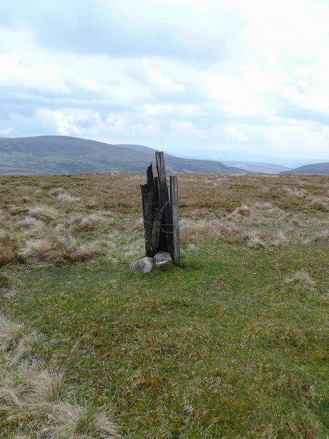 Photo could not load
NS9304 : Summit, Ballencleuch Law
Gordon Brown
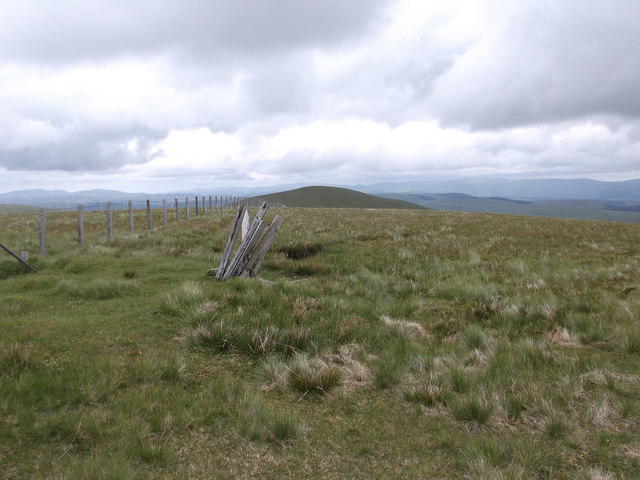 Photo could not load
NS9304 : Summit of Ballencleuch Law
Iain Russell
Hill facts and local notes
Classifications
Elevation
691m
2,268 ft
Prominence
204m
Coordinates
55.3272, -3.6792
NS935049
OS Map
78
Explorer: 329
At the Summit
The summit features a large concrete trig point along with a small stone cairn that offers a nice place to catch your breath and take in the views.
Terrain & Geology
The area is primarily composed of sedimentary rock formations, such as sandstone and limestone, which provide a fascinating insight into the geological history of the region.
Views & Scenery
From the summit, you can enjoy panoramic views of the surrounding hills, including the Eildon Hills and the Cheviots. On a clear day, the North Sea might even make a cheeky appearance on the horizon.
History & Heritage
Name Origin
The name 'Ballencleuch' is derived from Scots Gaelic, meaning 'the valley of the rock' which reflects the local terrain.
Historical Significance
Ballencleuch Law has served as a landmark for local shepherds and has been a part of regional folklore for centuries.
Getting There & Facilities
Parking
There is parking available at the start of the route, just off the A703 road, with space for several cars.
Public Transport
The nearest bus stop is in the village of Stow, approximately 7 km away, with limited service, so check timings.
Nearby Facilities
Facilities are quite limited in the area, but there are cafes and toilets available in Galashiels and Stow.
Safety Information
Known Hazards
- Muddy patches can be common after rainfall, and care should be taken near the summit where the terrain can become rocky.
General Safety Tips
- Check weather conditions before setting out
- Carry appropriate clothing and equipment
- Let someone know your planned route
- Take a map, compass, and GPS device
- Carry emergency supplies: food, water, first aid kit, torch
Hills
Some common questions about the hills answered
Are there group walks up Ballencleuch Law?
Many walkers use Walkmates to join or organise walks with others. You can check for group walks around Ballencleuch Law through the maps
Are there other walkers around Ballencleuch Law?
Activity varies by location and time, but Walkmates lets you see whether others have shared walks or shown interest in this area. Find other people through the walking friends search walking friends for Ballencleuch Law search or of course create your own walk for Ballencleuch Law
Can I organise a walk to Ballencleuch Law?
Yes. If there aren’t any walks listed already, you can create a walk and make it available for others to join.
If you're signed up to Walkmates, you can create a walk to Ballencleuch Law.
How do I find a walk up this hill?
There are often multiple ways to walk this hill, depending on experience and route preference. Walkmates helps you explore walks and routes that others have shared.
Can I suggest a new route up Ballencleuch Law?
Yes. You can suggest or create routes to share with others. Walkmates focuses on the social side of walking, so routes are used to help people organise walks and explore areas together, rather than as detailed navigation tools or route libraries.
Other uses really appreciate knowledgeable walkers sharing their routes. Share your favourite route to Ballencleuch Law here
The is an error or something incorrect about this hill. How do I let you know?
We always strive to keep the information on Walkmates as accurate as possible. If you find an error, please let us know through the contact form and we'll aim to correct it as quickly as possible
Community Discussion
Comments
Location
View the hill's mapped position and surrounding paths.
Grid reference: NS935049
View on OpenStreetMapOpens a map in a new tab, centred on the hill.

No comments yet. Be the first.