
Whiteside Hill
Good walks are even better shared.
Overview
Whiteside Hill: A Marvel of the Lake District
Nestled within the scenic grandeur of the Lake District, Whiteside Hill stands proudly at 535 meters. As a classified Marilyn, this peak beckons hikers both seasoned and new, enraptured by its remarkable views and engaging trails.
Geology
Whiteside's intriguing geology tells the story of its volcanic roots. The predominant andesitic rocks provide a rocky yet alluring terrain perfect for exploration. As you hike up, take a moment to appreciate how the layers of history have shaped this majestic hill.
Routes
Several routes tempt adventurers to explore Whiteside Hill:
- Whiteside from Stair (7.5 km, 3.5 hours, Moderate)
- Starting from Stair Car Park, enjoy a winding ascent through enchanting forests. Ideal for a family outing!
- Whiteside via Wandope (8.0 km, 4.0 hours, Challenging)
- For enthusiastic scramblers, this route offers a thrilling challenge that’s well worth the effort. Just don't forget your sense of adventure!
Summit Features
At the summit, you're greeted by a lofty stone cairn and a trig point. Perfect for the obligatory summit photo or just a moment to savour the views that seem to stretch on forever.
Terrain
Expect a mix of rocky paths and grassy knolls, with a fair share of boggy spots to keep you on your toes. Wearing sturdy footwear is highly recommended; those stylish trainers may not fare so well!
Views
From the top, divine views of Crummock Water, Buttermere, and the surrounding peaks will leave you breathless (and not just from the hike). Spring and autumn are particularly lovely, showcasing nature's colour palette at its finest.
Hazards
Be mindful of the weather – the Lake District is known for its quick changes! Be careful on wet surfaces, especially when negotiating the rocky pathways.
Nearby Summits
Nearby, you'll find towering giants such as Grasmoor and High Stile, perfect for those who crave even more heights.
Access
Accessing Whiteside Hill is relatively straightforward:
- Nearest Parking: The Stair Car Park, which fills quickly, so arrive early!
- Public Transport: Limited options, but buses from Keswick can get you close.
- Nearest Town: Keswick is the bustling hub filled with shops and cafes.
Facilities
Rest assured, several delightful cafés in Keswick await your return, alongside public conveniences for that post-hike refreshment.
History
Etymologically, ‘Whiteside’ hails from Old Norse, referencing its famed light-coloured rocks. Historically, it's served as a revered navigation point for local shepherds throughout the stunning Lake District.
So whether you're in it for the hike, the views, or a timeless tale of nature's grandeur, Whiteside Hill promises an adventure that won't disappoint. Happy hiking!
Explore routes near Whiteside Hill
Public walks starting within 80 km of this hill. Nearby does not mean a route reaches the summit; check its map and access before setting out.
Moffat Gallow Hill Woodland and Viewpoint Circuit
View route
Forest of Ae Water of Ae Riverside Trail
View route
Mabie Forest Dalshinnie Glen and Loch
View route
Hoddom Castle and River Annan Woodland Circuit
View route
Route planning notes
These notes describe possible approaches, not verified navigable routes or permission to cross land. Check current paths, local access rules and conditions before setting out.
Whiteside from Stair
This popular route begins at the Stair car park and winds through lush forests before ascending to the summit, offering a blend of mild exertion and breathtaking scenery.
Whiteside via Wandope
Tackling this route takes adventurous souls through delightful valleys and onto rocky paths on the eastern slopes. Expect a little scramble which adds to the fun!
Make a day of it, together
Find someone to share the walk with, or organise a day out along a route you like.
Hill facts and local notes
Classifications
Elevation
554m
1,818 ft
Prominence
130m
Coordinates
55.3257, -3.5960
NS988046
OS Map
78
Explorer: 329
At the Summit
The summit features a substantial stone cairn, crowned by a trig point, providing an excellent photo opportunity and a fine vantage point for eager hikers.
Terrain & Geology
Whiteside Hill is primarily composed of volcanic rocks, predominantly andesitic in nature, offering a rugged terrain that speaks to the area's geological history of tectonic activity.
Views & Scenery
From the summit, one can bask in unparalleled views of Crummock Water, Buttermere, and the higher peaks of the surrounding Lake District. On a clear day, you might even spot the Isle of Man on the horizon!
History & Heritage
Name Origin
The name 'Whiteside' comes from the Old Norse 'hvítr' meaning 'white', likely referring to the light-coloured rocks that adorn its peaks.
Historical Significance
Historically, Whiteside Hill has been a significant landmark for local shepherds and serves as a point of navigation in the dramatic landscapes of the Lake District.
Getting There & Facilities
Check current local access restrictions, parking rules and transport timetables before travelling. These notes do not confirm public access to the summit.
Parking
The nearest parking is at Stair, where you will find a small car park (beware as it can fill up quickly during peak seasons).
Public Transport
Public transport options are limited, but local buses run from Keswick to nearby villages; consider walking the last stretch to immerse yourself in the beautiful scenery.
Nearby Facilities
Facilities nearby include several cafes in Keswick, public toilets, and even a shop for those last-minute essentials.
Safety Information
Known Hazards
- Unforgiving weather changes, particularly in winter, and potential slipping on wet rocky surfaces. Keep an eye on the path because it can get a bit boggy!
General Safety Tips
- Check weather conditions before setting out
- Carry appropriate clothing and equipment
- Let someone know your planned route
- Take a map, compass, and GPS device
- Carry emergency supplies: food, water, first aid kit, torch
Hills
Some common questions about the hills answered
Are there group walks up Whiteside Hill?
Many walkers use Walkmates to join or organise walks with others. You can check for group walks around Whiteside Hill through the maps
Are there other walkers around Whiteside Hill?
Activity varies by location and time, but Walkmates lets you see whether others have shared walks or shown interest in this area. Find other people through the walking friends search walking friends for Whiteside Hill search or of course create your own walk for Whiteside Hill
Can I organise a walk to Whiteside Hill?
Yes. If there aren’t any walks listed already, you can create a walk and make it available for others to join.
If you're signed up to Walkmates, you can create a walk to Whiteside Hill.
How do I find a walk up this hill?
There are often multiple ways to walk this hill, depending on experience and route preference. Walkmates helps you explore walks and routes that others have shared.
Can I suggest a new route up Whiteside Hill?
Yes. You can suggest or create routes to share with others. Walkmates focuses on the social side of walking, so routes are used to help people organise walks and explore areas together, rather than as detailed navigation tools or route libraries.
Other uses really appreciate knowledgeable walkers sharing their routes. Share your favourite route to Whiteside Hill here
The is an error or something incorrect about this hill. How do I let you know?
We always strive to keep the information on Walkmates as accurate as possible. If you find an error, please let us know through the contact form and we'll aim to correct it as quickly as possible
Community Discussion
Comments
Location
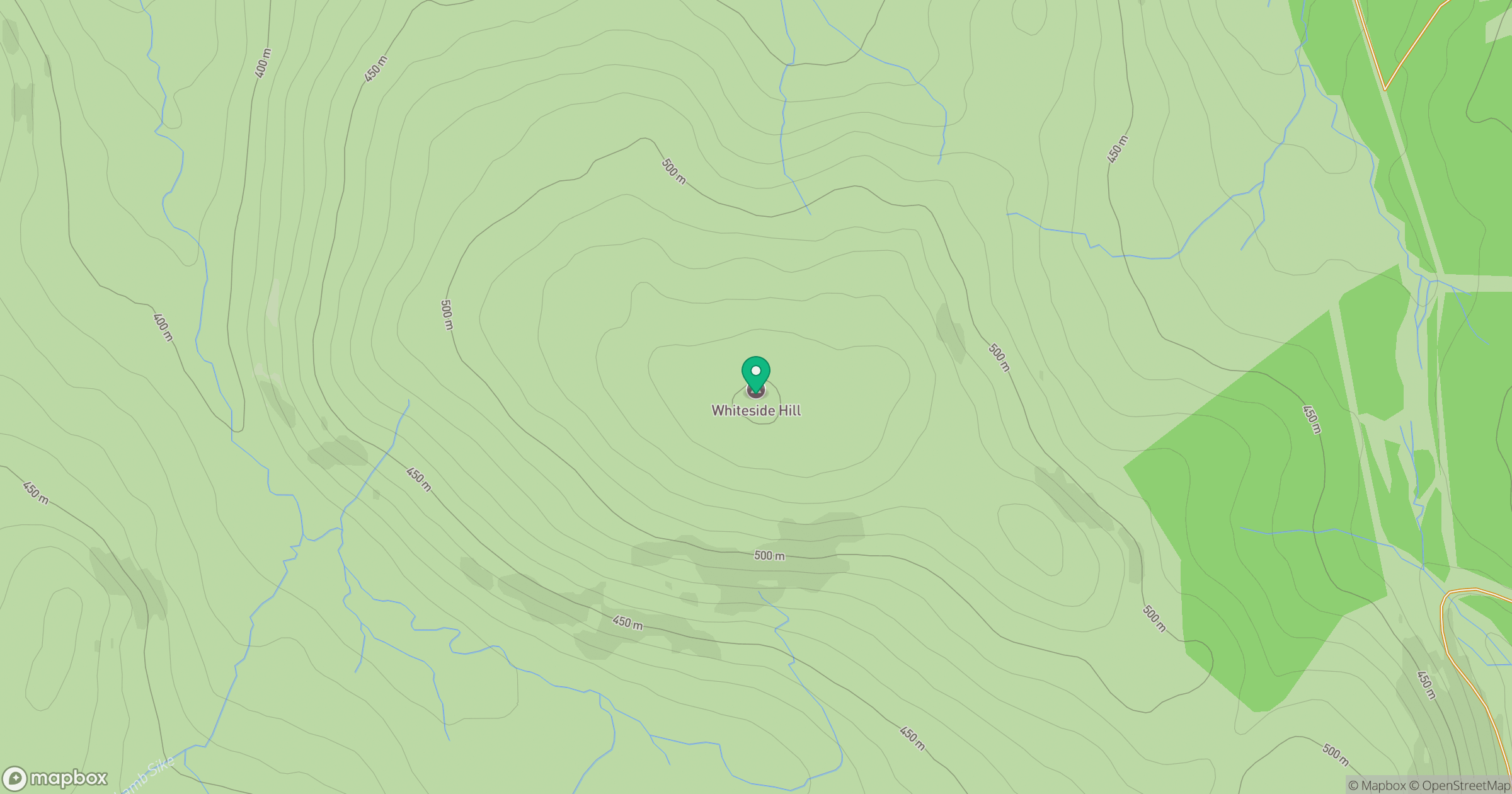
Grid reference: NS988046
View on OpenStreetMapOpens a map in a new tab, centred on the hill.
Hills within 30 km
Straight-line distance, not a walking route or confirmation of access.

No comments yet. Be the first.