
Druim Fada
Good walks are even better shared.
Overview
Druim Fada
Druim Fada, a Marilyn standing proud at 668 meters, offers a delightful adventure for hikers venturing into the Scottish Highlands. Located near the serene Loch Awe, it is a peak that promises stunning vistas and a satisfying challenge.
Geology
The mountain is primarily made up of an intricate mix of schist and granitic formations, shaped over millennia by the relentless forces of nature. These hardy rocks not only define the landscape but also narrate a rich geological history of the Highlands, marked by glaciation and erosion.
Routes
One of the most popular routes is the Glen Kieth Route, a moderate trek starting from the head of Glen Kieth. This 7 km hike typically takes around 3 hours, depending on your pace (and how much you stop to take selfies). You'll traverse a mixture of rocky outcrops and grassy slopes — keep an eye out for the local wildlife!
Summit Features
Upon reaching the summit of Druim Fada, you will be greeted by a modest cairn, a perfect spot for an epic summit selfie. From here, the views are nothing short of spectacular, extending across Loch Awe and the magnificent Ben Cruachan, with the Grampians looming in the distance.
Terrain
Prepare for a mixed bag of terrain — rocky sections polished smooth by countless boots, patches of heather stubbornly clinging to life, and some delightful grassy slopes. Make sure to wear sturdy boots and stay nimble!
Views
The panoramas here are delightful, best experienced in spring and autumn, when the air is crisp and clear. You'll get jaw-dropping vistas as far as the eye can see, so be sure to bring your camera.
Hazards
While not overly technical, the terrain can be slippery, particularly after a rainy spell. Careful navigation is advised, especially near the summit where slopes can get steep.
Nearby Summits
Just a stone's throw away is Ben Cruachan, a towering neighbour at 1126 meters, which is definitely worth a visit for those looking to conquer another peak!
Access
For access, the nearest parking is at Glen Kieth (NN061835), with room for several cars. Be sure to arrive early during peak seasons to secure a spot. Public transport can be a bit tricky, but Crianlarich is your best bet — you can catch a train there and arrange a taxi.
Facilities
Before embarking on your adventure, stop by one of the cafes in Crianlarich for a hearty meal or a cuppa. Don’t assume you’ll find anything on the mountain; it’s all about the great outdoors and the wonderful views!
History
The name 'Druim Fada' means 'long ridge' in Gaelic, which brilliantly describes its elongated shape. As you climb, ponder the tales of yore often shared about the local wildlife and the spirits of nature that have graced these lands.
So, lace up your hiking boots and embark on a journey to Druim Fada — it may not be the highest peak in Scotland, but it sure has a heart and beauty that will warm yours. Happy hiking!
Explore routes near Druim Fada
Walks starting near this hill. Open a route to check its map, distance and full itinerary.
Banavie to Glen Loy Aqueduct: Neptune’s Staircase Canal Towpath
View route
Ben Nevis via Mountain Path
View route
Fort Augustus to Kytra Lock: Caledonian Canal Towpath
View route
Great Glen Way low route: Fort Augustus to Invermoriston Old Bridge
View route
Route planning notes
These notes describe possible approaches. Check a route's map and access information when planning your walk.
Glen Kieth Route
Starting from the head of Glen Kieth, this straightforward path leads you directly to the summit, offering stunning views along the way.
Make a day of it, together
Find someone to share the walk with, or organise a day out along a route you like.
Hill facts and local notes
Classifications
Elevation
744m
2,441 ft
Prominence
518m
Coordinates
56.8934, -5.1423
NN086824
OS Map
41
Explorer: 392 399
At the Summit
The summit is crowned with a small cairn, providing a perfect spot for a well-deserved rest and a chance to soak in the panoramic views.
Terrain & Geology
Druim Fada is primarily composed of highland schist and granitic rocks, characteristic of the Scottish Highlands, providing a robust, rugged landscape that tells the tale of glacial activity in the region.
Views & Scenery
From the summit, one can enjoy breathtaking views of Loch Awe, Ben Cruachan, and beyond to the distant peaks of the Grampians.
History & Heritage
Name Origin
The name 'Druim Fada' translates to 'long ridge' in Gaelic, aptly describing its elongated shape.
Historical Significance
Druim Fada has been a site of local folklore, with numerous tales of local wildlife and nature spirits told by the Highlands' original inhabitants.
Getting There & Facilities
Parking
Parking is available at the Glen Kieth access point (NN061835), which can accommodate several cars but can fill up quickly during peak seasons.
Public Transport
The nearest public transport is from Crianlarich, accessible by train, followed by a taxi or a long walk to Glen Kieth.
Nearby Facilities
While there are no facilities at the summit itself, visitors can find cafes and toilets in Crianlarich for a final pit stop before heading into the wild.
Safety Information
Known Hazards
- Steep sections near the summit may be slippery, especially after rainfall. Always watch your footing and be cautious near cliffs.
General Safety Tips
- Check weather conditions before setting out
- Carry appropriate clothing and equipment
- Let someone know your planned route
- Take a map, compass, and GPS device
- Carry emergency supplies: food, water, first aid kit, torch
Hills
Some common questions about the hills answered
Are there group walks up Druim Fada?
Many walkers use Walkmates to join or organise walks with others. You can check for group walks around Druim Fada through the maps
Are there other walkers around Druim Fada?
Activity varies by location and time, but Walkmates lets you see whether others have shared walks or shown interest in this area. Find other people through the walking friends search walking friends for Druim Fada search or of course create your own walk for Druim Fada
Can I organise a walk to Druim Fada?
Yes. If there aren’t any walks listed already, you can create a walk and make it available for others to join.
If you're signed up to Walkmates, you can create a walk to Druim Fada.
How do I find a walk up this hill?
There are often multiple ways to walk this hill, depending on experience and route preference. Walkmates helps you explore walks and routes that others have shared.
Can I suggest a new route up Druim Fada?
Yes. You can suggest or create routes to share with others. Walkmates focuses on the social side of walking, so routes are used to help people organise walks and explore areas together, rather than as detailed navigation tools or route libraries.
Other uses really appreciate knowledgeable walkers sharing their routes. Share your favourite route to Druim Fada here
The is an error or something incorrect about this hill. How do I let you know?
We always strive to keep the information on Walkmates as accurate as possible. If you find an error, please let us know through the contact form and we'll aim to correct it as quickly as possible
Community Discussion
Comments
Location
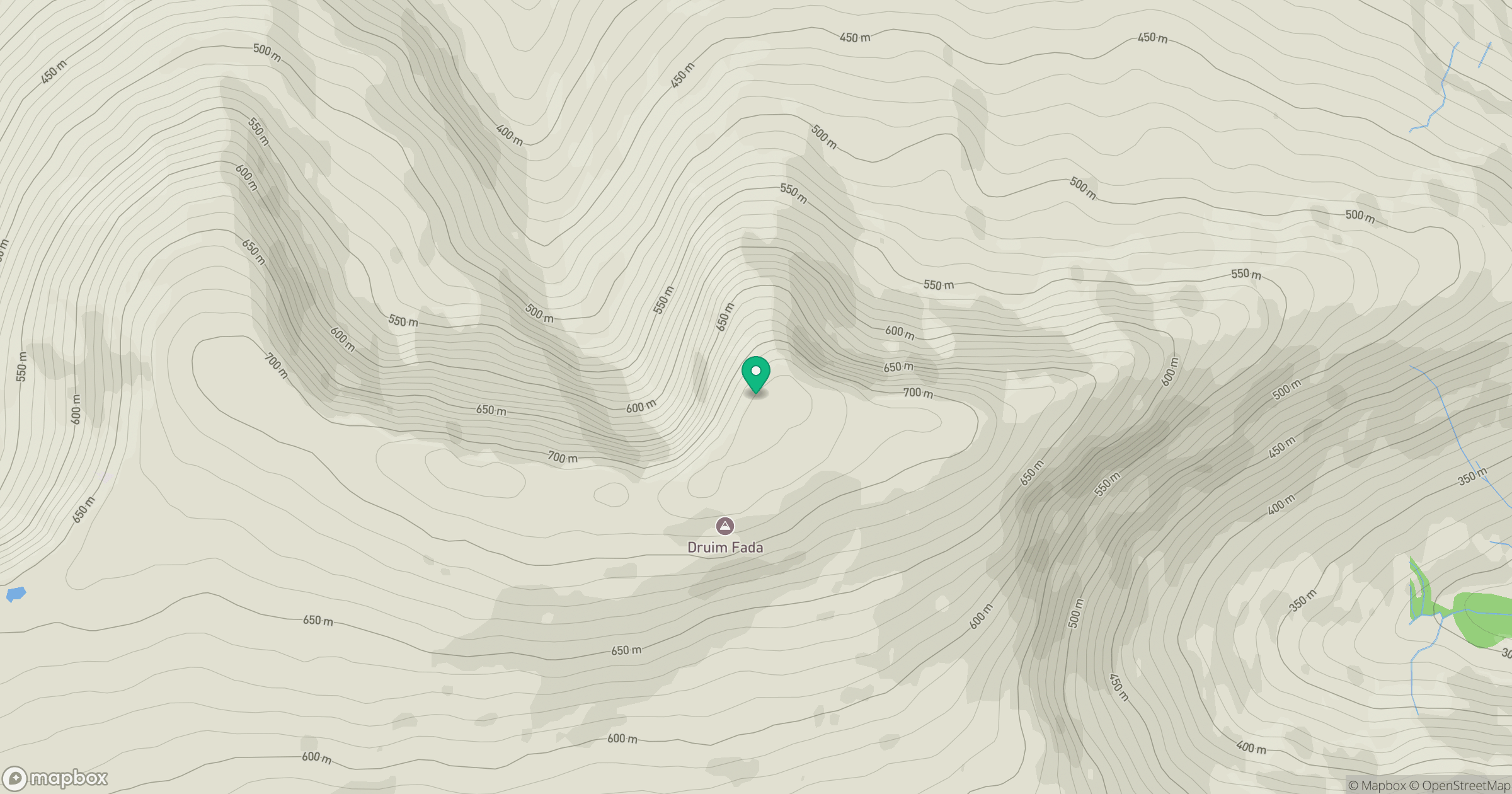
Grid reference: NN086824
View on OpenStreetMapOpens a map in a new tab, centred on the hill.
![Ben Nevis [Beinn Nibheis]](https://cdn.walkmates.com/gallery-images/44e34d25abc849e78f7b99a97863fffb.jpg)
No comments yet. Be the first.