

Culteuchar Hill
Good walks are even better shared.
Overview
Culteuchar Hill
Culteuchar Hill is a charming Marilyn nestled in Central Scotland, boasting an elevation of 436 meters. Though it may not tower like some of its taller counterparts, it offers a delightful escape into the Scottish landscape with stunning views and engaging trails.
Geology
A rich tapestry of sedimentary rocks forms the foundation of this hill, showcasing the remnants of glacial activity from decades past. The rugged terrain is a testament to the raw power of nature, and geologists might revel in the disclosures offered by the rocky faces along the climb.
Route Information
Route: Culteuchar Hill from Farg
This moderate route begins at the Farg Road, presenting a well-defined path that winds up the hill. The hike is approximately 5 km long and typically takes around 2.5 hours. Prepare for some boggy spots; sturdy boots are a must. It's the sort of terrain that could leave you feeling like a proud mountaineer or an undiscovered swamp monster!
Summit Features
On arriving at the summit, expect to be welcomed by a small cairn that stands as a tribute to those who have scaled its heights. The panoramic vistas from this peak are nothing short of spectacular. Peer over the Strathearn valleys and revel in the dramatic outlines of the Ochil Hills lingering in the distance.
Terrain Type
Culteuchar Hill offers a diverse terrain experience; you'll traverse grassy slopes, rocky outcrops, and patches of heather that grace the journey. While the ascent is moderate, you'll find it an absolute joy, with nature's beauty wrapped around you like a well-worn wool jumper.
Views
The top gifts adventurers with breathtaking views. Rolling hills of Strathearn and the stunning Ochil Hills create a picturesque setting. On particularly clear days, you might even spot the majestic peaks of the Highlands peeking through the horizon—a reminder of Scotland's rugged charm. Spring and summer yield the best visibility, especially in the early morning when the mist playfully lifts from the hills.
Hazards
Be cautious of the occasional bog, particularly after rain, as your boots can quickly become more sludge than shoes. The weather can unexpectedly change—one moment it’s sunny, and the next, it’s Scottish mist. A good old saying, “If you don’t like the weather, just wait five minutes,” certainly applies here!
Nearby Summits
Consider overall planning to combine this hike with an adventure to nearby peaks, including Ben Chonzie at 931 meters and Ben Lawers at 1214 meters. They stand proudly alongside Culteuchar Hill, enhancing your Scottish hillwalking portfolio!
Access
For those driving, parking is available along Farg Road, approximately 1 km from the trailhead. Public transport to Crieff is feasible but infrequent; consult the latest travel timetables.
Crieff serves as the nearest hub, brimming with potential stops for refreshments, from cafes to shops. Make sure to top up on your treats before heading for the hills.
History
The name Culteuchar itself hints at its fascinating history—translating to 'the back of the island' in Gaelic. The area has long been home to shepherds and farmers who have ensured this enchanting location remains a sanctuary in the heart of Scotland, imparting both historical richness and cultural significance to every trekker lucky enough to wander here.
So, whether you're hunting for a leisurely walk or an engaging hike, Culteuchar Hill warmly invites you to take a step into its extraordinary embrace!
Explore routes near Culteuchar Hill
Public walks starting within 80 km of this hill. Nearby does not mean a route reaches the summit; check its map and access before setting out.
Club outing: Glen Ogle and Killin (coach departure)
View route
Loch Leven: Kinross Pier to RSPB Loch Leven Heritage Trail
View route
Loch Leven Heritage Trail: full circuit from Kinross Pier
View route
Fife Pilgrim Way: Markinch to Ceres
View route
Route planning notes
These notes describe possible approaches, not verified navigable routes or permission to cross land. Check current paths, local access rules and conditions before setting out.
Culteuchar Hill from Farg
A straightforward ascent starting from the Farg Road, making for a pleasant hike up to the summit. The path is well-defined but can be boggy in places, so sturdy boots are recommended.
Make a day of it, together
Find someone to share the walk with, or organise a day out along a route you like.
Photo Gallery
View all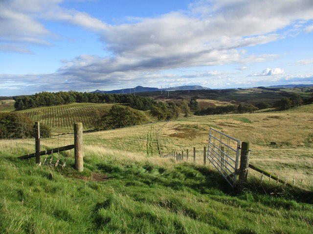 Photo could not load
NO0915 : Open gate on Culteuchar Hill
Alan O'Dowd
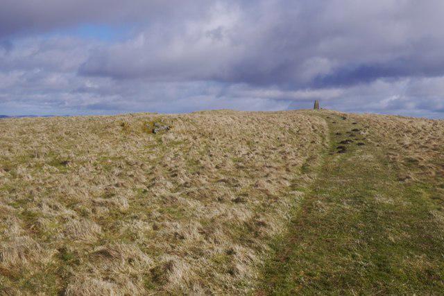 Photo could not load
NO0915 : Culteuchar Hill
Richard Webb
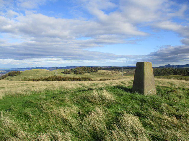 Photo could not load
NO0915 : Trig point on Culteuchar Hill
Alan O'Dowd
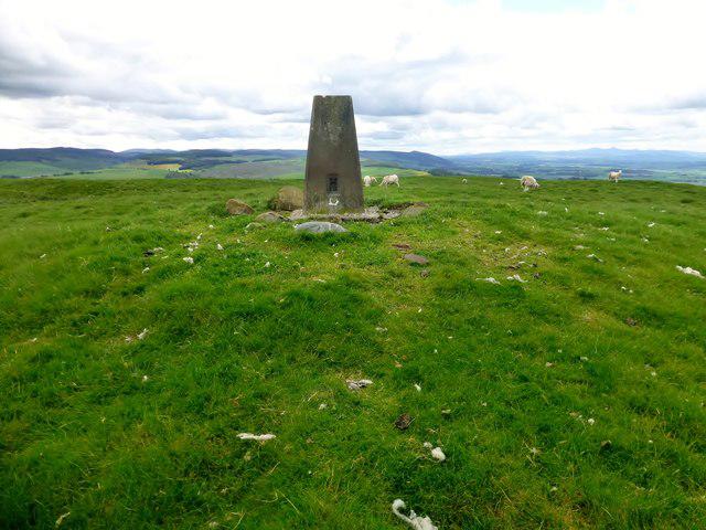 Photo could not load
NO0915 : Culteuchar Hill
Rude Health
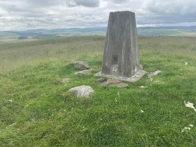 Photo could not load
NO0915 : Culteuchar Hill Trig Point Flush Bracket S6093
thejackrustles
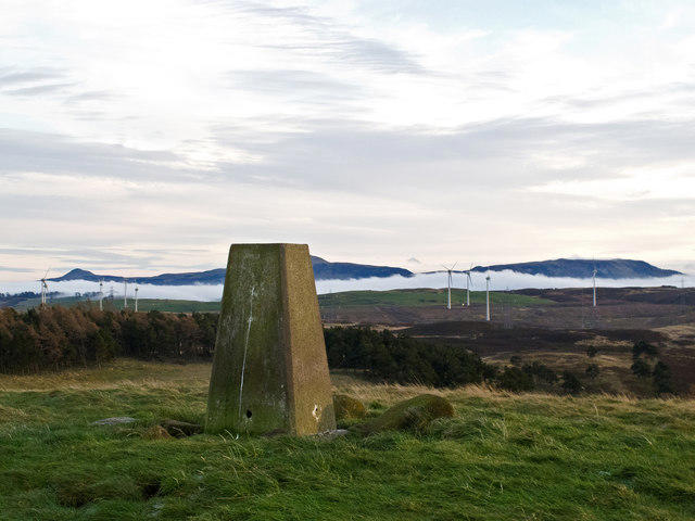 Photo could not load
NO0915 : Culteuchar Hill
William Starkey
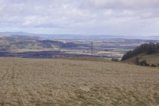 Photo could not load
NO0915 : View from Culteuchar Hill
Richard Webb
Hill facts and local notes
Classifications
Elevation
313m
1,027 ft
Prominence
129m
Coordinates
56.3206, -3.4626
NO096152
OS Map
58
Explorer: 369
At the Summit
The summit boasts a small cairn commemorating the hill's elevation, alongside breathtaking views of the Strathearn valley and the distant Ochil Hills.
Terrain & Geology
Culteuchar Hill is primarily composed of sedimentary rocks, with some fascinating features formed from ancient glacial activity. The rugged landscape provides an excellent glimpse into Scotland's geological history.
Views & Scenery
Visitors can gaze upon the rolling hills of Strathearn, the majestic Ochil Hills, and, on a clear day, perhaps even catch a glimpse of the towering peaks of the Highlands.
History & Heritage
Name Origin
Culteuchar is derived from Gaelic elements meaning 'the back of the island', referring to the hill's prominent position in the landscape.
Historical Significance
Historically, the region has been a site for farming and grazing, with many ancient paths carved by the hands of history leading through its scenic terrain.
Getting There & Facilities
Check current local access restrictions, parking rules and transport timetables before travelling. These notes do not confirm public access to the summit.
Parking
Parking is available along the Farg Road, approximately 1 km from the trailhead. Be mindful of local signage.
Public Transport
The nearest public transport stops are in Crieff, where buses run infrequently. It's advisable to check the latest timetables before planning your journey.
Nearby Facilities
Crieff offers various amenities, including cafes, shops, and public toilets. It's beneficial to refuel before hitting the trail.
Safety Information
Known Hazards
- Wet and boggy patches, especially after prolonged rainfall. Beware of sudden weather changes typical of the Scottish hills.
General Safety Tips
- Check weather conditions before setting out
- Carry appropriate clothing and equipment
- Let someone know your planned route
- Take a map, compass, and GPS device
- Carry emergency supplies: food, water, first aid kit, torch
Hills
Some common questions about the hills answered
Are there group walks up Culteuchar Hill?
Many walkers use Walkmates to join or organise walks with others. You can check for group walks around Culteuchar Hill through the maps
Are there other walkers around Culteuchar Hill?
Activity varies by location and time, but Walkmates lets you see whether others have shared walks or shown interest in this area. Find other people through the walking friends search walking friends for Culteuchar Hill search or of course create your own walk for Culteuchar Hill
Can I organise a walk to Culteuchar Hill?
Yes. If there aren’t any walks listed already, you can create a walk and make it available for others to join.
If you're signed up to Walkmates, you can create a walk to Culteuchar Hill.
How do I find a walk up this hill?
There are often multiple ways to walk this hill, depending on experience and route preference. Walkmates helps you explore walks and routes that others have shared.
Can I suggest a new route up Culteuchar Hill?
Yes. You can suggest or create routes to share with others. Walkmates focuses on the social side of walking, so routes are used to help people organise walks and explore areas together, rather than as detailed navigation tools or route libraries.
Other uses really appreciate knowledgeable walkers sharing their routes. Share your favourite route to Culteuchar Hill here
The is an error or something incorrect about this hill. How do I let you know?
We always strive to keep the information on Walkmates as accurate as possible. If you find an error, please let us know through the contact form and we'll aim to correct it as quickly as possible
Community Discussion
Comments
Location
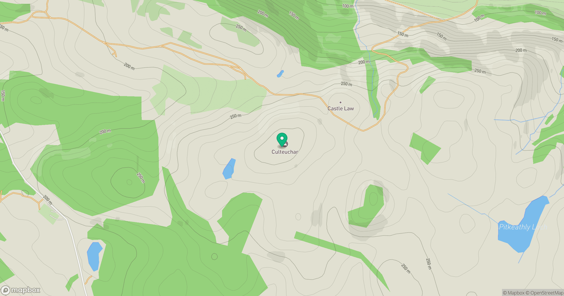
Grid reference: NO096152
View on OpenStreetMapOpens a map in a new tab, centred on the hill.
Hills within 30 km
Straight-line distance, not a walking route or confirmation of access.
Ben Cleuch
721m
Mailer Hill [Kirkton Hill]
182m
Moncreiffe Hill
223m
Corb Law
475m
Lendrick Hill
456m
No comments yet. Be the first.