

Moncreiffe Hill
Good walks are even better shared.
NO1320 : View from Moredun Top
Lis Burke Photo source
Overview
Moncreiffe Hill
Moncreiffe Hill may be a modest Marilyn, but what it lacks in height, it makes up for with stunning views and a delightful walking experience.
Geology
The hill boasts a composition primarily of sandstone, interspersed with limestone features. As you ascend, take a moment to marvel at the exposed geological strata, which bear witness to the Earth's rich history. Don’t forget to stop by the rocky outcrops; they make great photo opportunities!
Routes
One of the most popular routes is the Moncreiffe Hill Circular Walk. This 5.5 km trail meanders through lovely woodland paths and boasts a moderate difficulty level, making it suitable for families and seasoned hikers alike.
For those seeking a quick dash to the top, the Direct Ascent from the South is your best bet. Covering a straightforward 3 km, this route is a breeze and will have you high-fiving the trig point in no time.
Summit Features
Upon reaching the summit, you’ll find the trig point, always a beacon for hikers. Often, you can find a logbook here – feel free to scribble a little note! Just remember, it’s a hill, not a diary.
Terrain
The terrain is predominantly grassy, with a few rocky patches that keep it interesting. Good shoes are a must; you wouldn’t want to be vocabulary-less on a rocky descent!
Views
The summit rewards explorers with breathtaking views of the expansive River Tay as it winds its way through the countryside, while the city of Perth glows invitingly in the distance. The distant peaks of the Highlands frame this picturesque view. The best time to take it all in would be during spring or autumn; the colours are nothing short of a painter's palette.
Hazards
Though the ascent is generally safe, be mindful of the weather. Scottish conditions can be unpredictable; it might be sunny now, but don’t be surprised if you find yourself dodging raindrops shortly after! Also, watch your step in the rocky areas near the summit.
Access
Accessing Moncreiffe Hill is a walk in the park – quite literally! A small car park is available at the South Lodge entrance. For those relying on public transport, the nearest bus service will take you to Perth, from where you can grab a taxi.
Facilities
Nearby, you can find amenities in Perth, such as cafes where you can recharge post-hike, and public toilets. The perfect pit stop before you head home!
History
The name 'Moncreiffe' hints at the hill's ancient roots, and it has seen the footsteps of many over the centuries. From Gaelic origins referencing its lush surroundings to archaeological evidence of past inhabitants, this hill is steeped in history – much like your grandma’s favourite fruitcake.
Go on – lace up your boots and enjoy Moncreiffe Hill. You won’t regret it!
Explore routes near Moncreiffe Hill
Walks starting near this hill. Open a route to check its map, distance and full itinerary.
Club outing: Crianlarich and West Highland Way (coach departure)
View route
Club outing: Glen Ogle and Killin (coach departure)
View route
Loch Leven: Kinross Pier to RSPB Loch Leven Heritage Trail
View route
Unled club outing: West Drumochter/Beinn Udlamain (coach departure)
View route
Route planning notes
These notes describe possible approaches. Check a route's map and access information when planning your walk.
Moncreiffe Hill Circular Walk
A delightful circular route that showcases the natural beauty of the surrounding woodlands and opens up to some stunning views from the summit.
Direct Ascent from the South
A straightforward ascent that leads directly to the summit, perfect for those looking to bag the peak without any frills.
Make a day of it, together
Find someone to share the walk with, or organise a day out along a route you like.
Photo Gallery
View all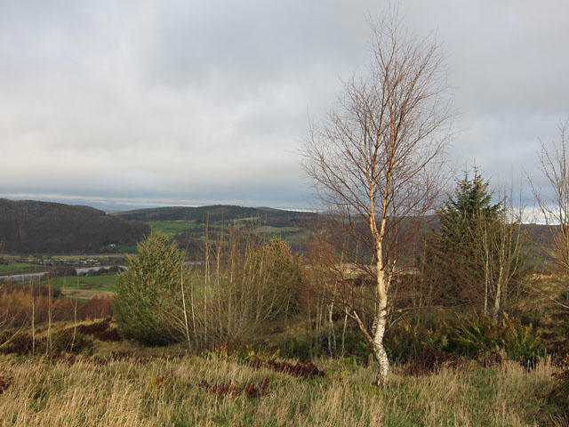 Photo could not load
NO1320 : View from Moredun Top
Lis Burke
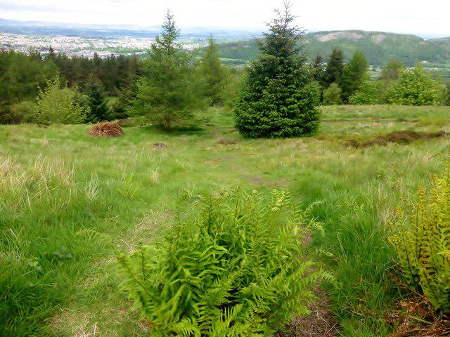 Photo could not load
NO1320 : Path Downhill
Rude Health
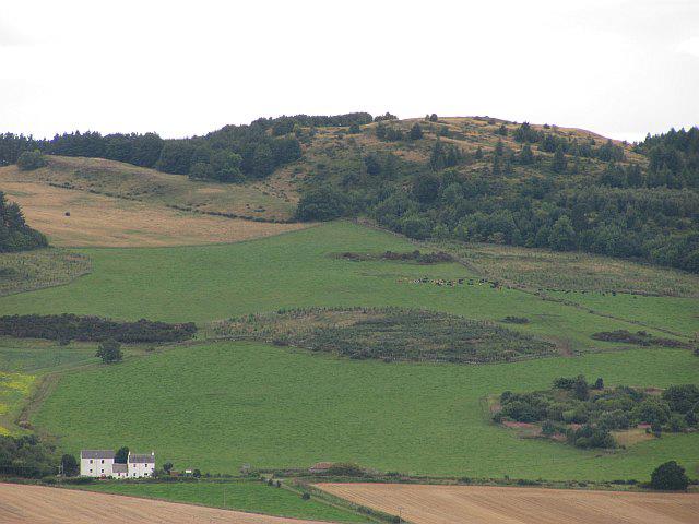 Photo could not load
NO1320 : Tarsappie Hill
Richard Webb
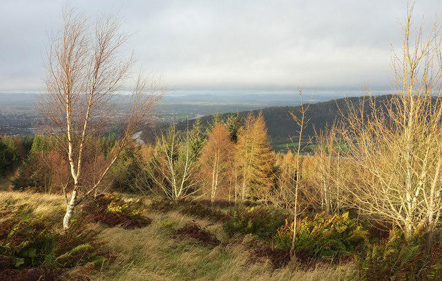 Photo could not load
NO1320 : Trees on Moredun Top
Rob Burke
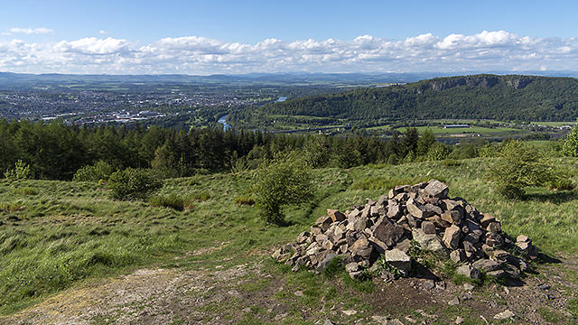 Photo could not load
NO1320 : Moredun Top
William Starkey
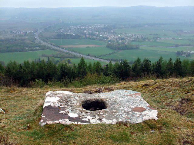 Photo could not load
NO1319 : Socket Stone on Moredun Top Hill Fort
ronnie leask
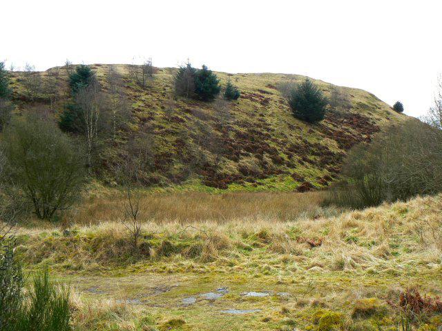 Photo could not load
NO1320 : Moredun Top
James Allan
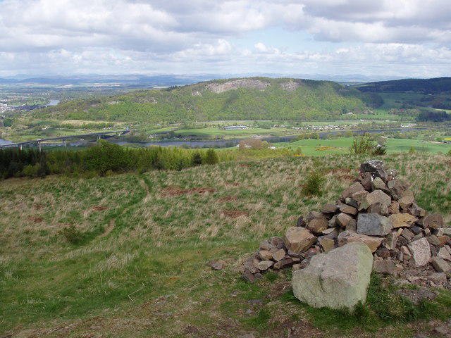 Photo could not load
NO1319 : Summit cairn of Moncreiffe Hill
Calum McRoberts
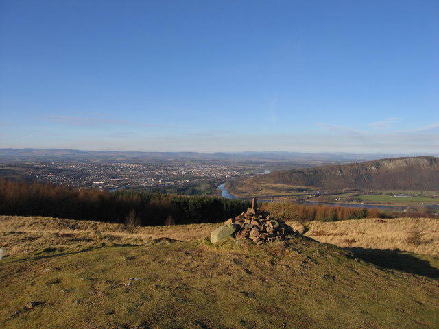 Photo could not load
NO1319 : Summit Cairn on Moncreiffe Hill - 223m
Steve Jones
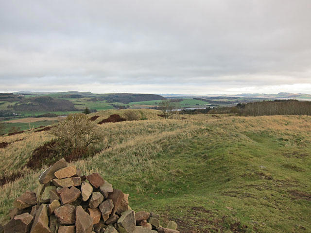
NO1319 : Moredun Top Hill Fort
Lis Burke
Hill facts and local notes
Classifications
Elevation
223m
732 ft
Prominence
185m
Coordinates
56.3642, -3.4005
NO135199
OS Map
58
Explorer: 369 380W
At the Summit
The summit features a trig point that serves as a local landmark and is often adorned with a visitor's logbook.
Terrain & Geology
The hill is predominantly composed of sandstone and limestone, giving rise to interesting geological features, including rocky outcrops and exposed strata.
Views & Scenery
From the summit, one can enjoy panoramic views of the River Tay, the city of Perth, and the distant mountains of the Scottish Highlands.
History & Heritage
Name Origin
The name 'Moncreiffe' is derived from the Gaelic 'Mon Creabh,' meaning 'hill of the clump,' reflecting the lush wooded areas around it.
Historical Significance
Historically, the area has been used for centuries, with archaeological evidence suggesting human activity dating back to ancient times.
Getting There & Facilities
Parking
There is a small car park located at the South Lodge entrance of the estate, which can accommodate a limited number of vehicles.
Public Transport
The nearest bus service connects to Perth city centre, from which local taxis can be arranged to reach the hill.
Nearby Facilities
There are public toilets available in Perth, and several cafes where you can grab a bite to eat before or after your hike.
Safety Information
Known Hazards
- Variable weather conditions can change rapidly; be prepared for rain even if the day seems clear. Loose rocks near the summit can pose a slipping hazard.
General Safety Tips
- Check weather conditions before setting out
- Carry appropriate clothing and equipment
- Let someone know your planned route
- Take a map, compass, and GPS device
- Carry emergency supplies: food, water, first aid kit, torch
Hills
Some common questions about the hills answered
Are there group walks up Moncreiffe Hill?
Many walkers use Walkmates to join or organise walks with others. You can check for group walks around Moncreiffe Hill through the maps
Are there other walkers around Moncreiffe Hill?
Activity varies by location and time, but Walkmates lets you see whether others have shared walks or shown interest in this area. Find other people through the walking friends search walking friends for Moncreiffe Hill search or of course create your own walk for Moncreiffe Hill
Can I organise a walk to Moncreiffe Hill?
Yes. If there aren’t any walks listed already, you can create a walk and make it available for others to join.
If you're signed up to Walkmates, you can create a walk to Moncreiffe Hill.
How do I find a walk up this hill?
There are often multiple ways to walk this hill, depending on experience and route preference. Walkmates helps you explore walks and routes that others have shared.
Can I suggest a new route up Moncreiffe Hill?
Yes. You can suggest or create routes to share with others. Walkmates focuses on the social side of walking, so routes are used to help people organise walks and explore areas together, rather than as detailed navigation tools or route libraries.
Other uses really appreciate knowledgeable walkers sharing their routes. Share your favourite route to Moncreiffe Hill here
The is an error or something incorrect about this hill. How do I let you know?
We always strive to keep the information on Walkmates as accurate as possible. If you find an error, please let us know through the contact form and we'll aim to correct it as quickly as possible
Community Discussion
Comments
Location
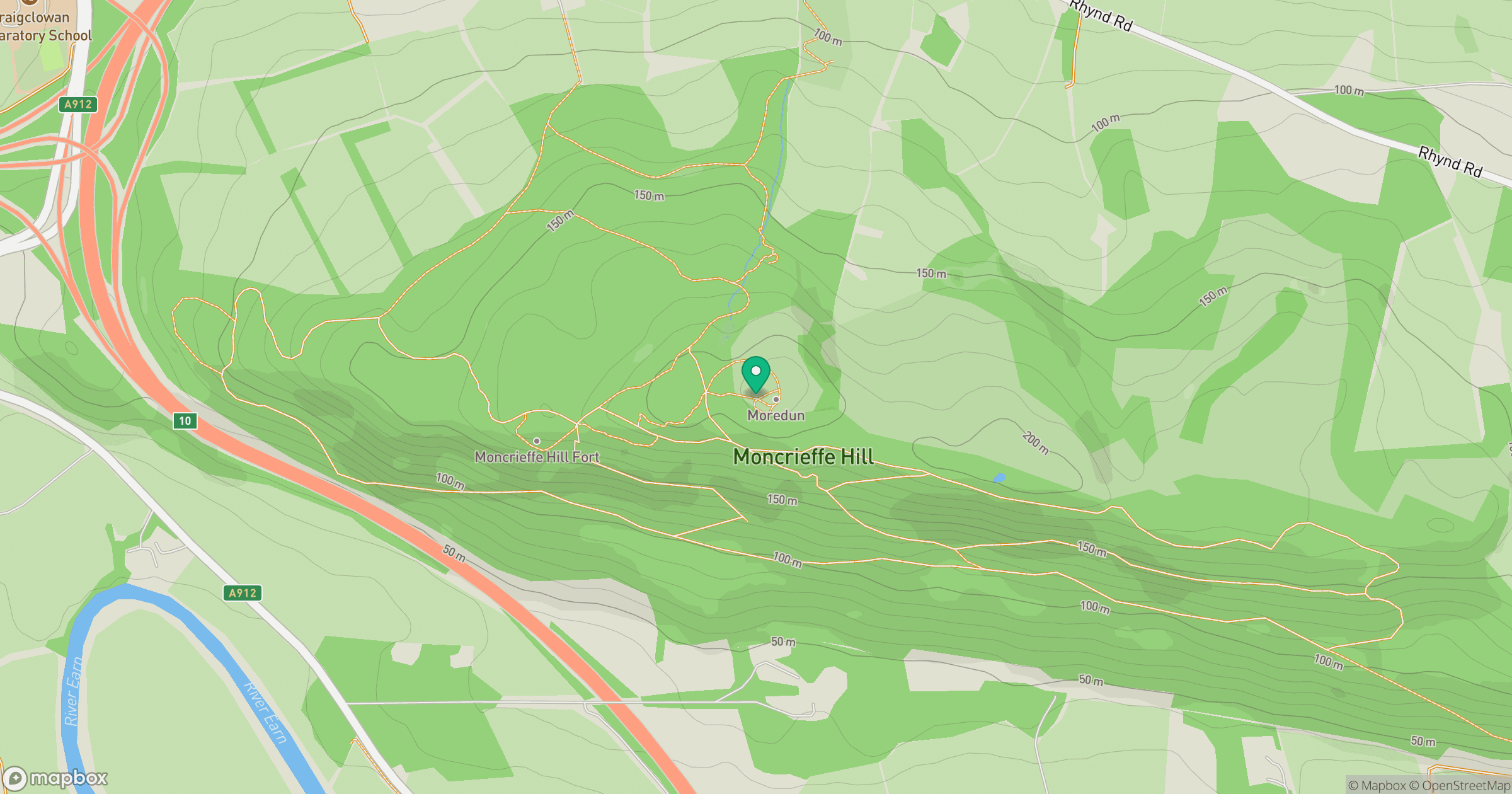
Grid reference: NO135199
View on OpenStreetMapOpens a map in a new tab, centred on the hill.

No comments yet. Be the first.