

Cronk ny Arrey Laa
Good walks are even better shared.
SC4699 : The Cliffs at Shellag Point
Glyn Baker Photo source
Overview
Cronk ny Arrey Laa
Nestled in the stunning Isle of Man, Cronk ny Arrey Laa stands at an elevation of 410 meters, offering both a moderate challenge and rewarding views for hikers. Its prominence of 164 meters makes it a distinguished feature of the landscape.
Geology
The mountain is primarily composed of sedimentary rocks, notably limestone and sandstone, shaped by time and nature. The glacial deposits present in the area serve as reminders of the last Ice Age. Keep an eye out for interesting rock formations that reveal the island's geological history!
Access
Access to Cronk ny Arrey Laa is convenient, with parking available in Port Erin, about 1.5 km from the trailhead. If you're feeling eco-friendly, hop on a bus from Douglas that will drop you in Port Erin, allowing you to skip the parking hassle. Just make sure you check the bus schedules!
Routes
One of the most popular routes begins at Bradda Head, offering scenic coastal views mixed with a delightful amble through lush greenery. Covering a distance of approximately 5.5 km, the hike generally takes about 2.5 hours, making it suitable for those who are moderately fit.
Terrain
As you climb, the terrain transforms from grassy slopes to rocky outcrops, with some boggy patches that are all part of the fun! Just be mindful of your footing after a rain; we wouldn't want you taking an unintended mud bath!
Summit Features
Upon reaching the summit, visitors are greeted with a splendid cairn, a perfect crag for a quick rest—and, of course, Instagram selfies. While you're at it, don’t forget to spot the local sheep who might be present, as they are part of the resident judging panel for hikers’ endurance and style.
Views
Highlights: The panoramic views from the summit are nothing short of breathtaking. To the north, you can see the sparkling Irish Sea and the Calf of Man, an island that has its own share of walking trails. On particularly clear days, the distant English coast appears like a mirage, adding to the allure.
Best Seasons: Spring and early autumn are prime times to visit for the best visibility and the most vibrant landscapes.
Hazards
Like any good adventure, there are hazards to heed. Wet paths can become slippery, so wear appropriate footwear. Additionally, loose rocks can be a tricky business; if you see them, give them a wide berth!
Nearby Summits
If you find yourself enamoured with the landscape, consider visiting nearby peaks such as Cronk ny Arrey Laa West (398 meters) and Greeba Mountain (610 meters), both of which offer equally captivating hikes.
Facilities
After your adventure, treat yourself in Port Erin where you will find cafes serving delightful snacks and public toilets to freshen up before your journey home.
Conclusion
Cronk ny Arrey Laa is not just a mountain; it is an experience waiting to happen. Whether you're a seasoned hiker or a novice eager for adventure, this hill promises magnificent vistas and a connection to the astounding natural beauty of the Isle of Man. So grab your boots and happy hiking!
Explore routes near Cronk ny Arrey Laa
Walks starting near this hill. Open a route to check its map, distance and full itinerary.
Kilsture Forest Woodpecker Trail
View route
Kirkcudbright Harbour to Barrhill Woods Circuit
View route
Kirroughtree Little Bruntis Lochs and Woodland Trail
View route
Rockcliffe to Kippford Jubilee Path and Waterfront
View route
Route planning notes
These notes describe possible approaches. Check a route's map and access information when planning your walk.
Bradda Head to Cronk ny Arrey Laa
A well-known route that offers stunning coastal views while making the ascent to the summit. The path meanders through lush hillsides before reaching the peak.
Make a day of it, together
Find someone to share the walk with, or organise a day out along a route you like.
Photo Gallery
View all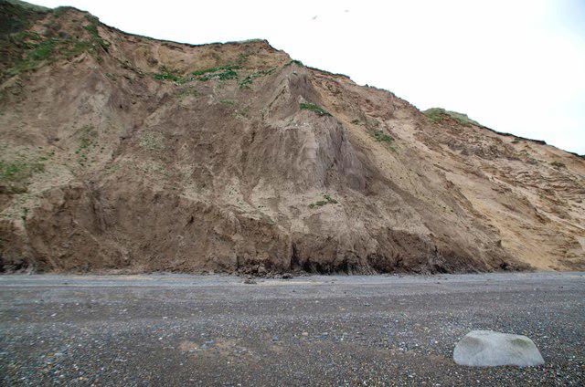 Photo could not load
SC4699 : The Cliffs at Shellag Point
Glyn Baker
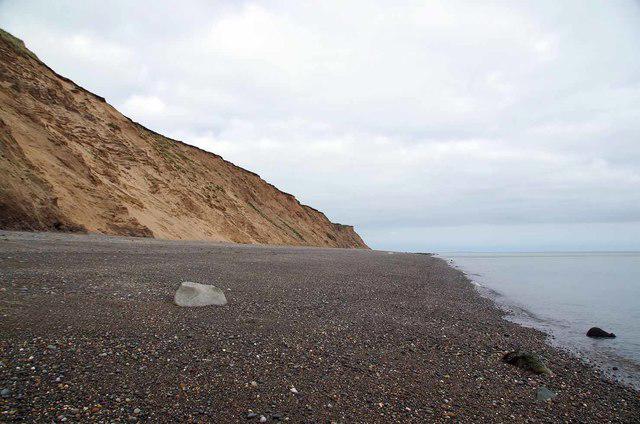 Photo could not load
SC4699 : The Beach at Shellag Point
Glyn Baker
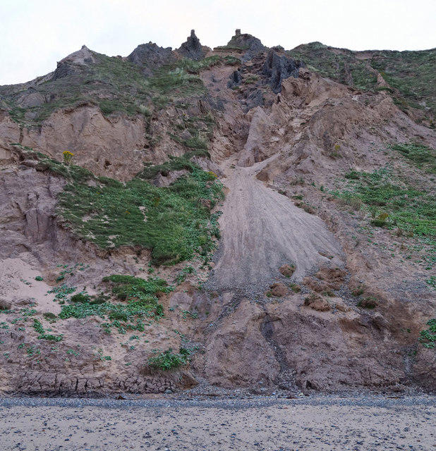 Photo could not load
SC4599 : Collapsing cliffs near Cronk ny Arrey Laa
Andy Stephenson
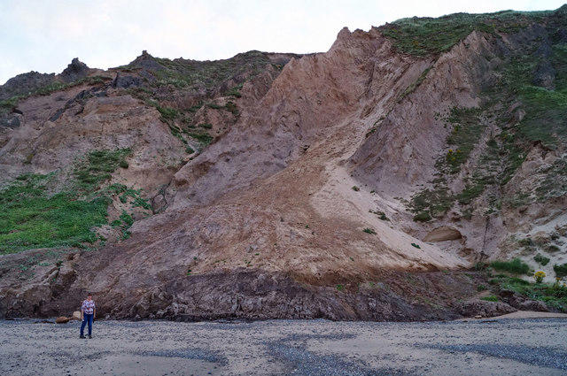 Photo could not load
SC4599 : Landslip near Shellag Point
Andy Stephenson
Hill facts and local notes
Classifications
Elevation
94m
308 ft
Prominence
41m
Coordinates
54.3712, -4.3752
SC458999
OS Map
95
Explorer: IoM OL
At the Summit
The summit features a substantial cairn made of local stone, which serves as a great focal point for photographs. From this point, you can also spot a few sheep, who may or may not be judging your hiking skills.
Terrain & Geology
Cronk ny Arrey Laa is primarily composed of sedimentary rocks, including limestone and sandstone, which create a varied and rich geological landscape. The area is also marked by glacial deposits from the last Ice Age that contribute to its unique topographical features.
Views & Scenery
Breathtaking views of the Irish Sea, the Calf of Man, and surrounding hills. On a clear day, you might even catch a glimpse of England's coast.
History & Heritage
Name Origin
The name 'Cronk ny Arrey Laa' translates to 'Hill of the Daylight', likely referencing its position where the first light of day breaks over the landscape.
Historical Significance
The mountain is a popular spot for locals and tourists alike, serving as a peaceful retreat with numerous walking routes, and is part of the rich cultural tapestry of the Isle of Man.
Getting There & Facilities
Parking
There is parking available at the base near Port Erin, approximately 1.5 km from the start of the trail.
Public Transport
Regular bus services operate to Port Erin from Douglas, making it accessible by public transport.
Nearby Facilities
Facilities are available in Port Erin, including cafes, public toilets, and a local shop for snacks and water supplies.
Safety Information
Known Hazards
- Slippery paths, particularly in wet weather. Watch out for loose rocks, and be mindful of the sheep!
General Safety Tips
- Check weather conditions before setting out
- Carry appropriate clothing and equipment
- Let someone know your planned route
- Take a map, compass, and GPS device
- Carry emergency supplies: food, water, first aid kit, torch
Hills
Some common questions about the hills answered
Are there group walks up Cronk ny Arrey Laa?
Many walkers use Walkmates to join or organise walks with others. You can check for group walks around Cronk ny Arrey Laa through the maps
Are there other walkers around Cronk ny Arrey Laa?
Activity varies by location and time, but Walkmates lets you see whether others have shared walks or shown interest in this area. Find other people through the walking friends search walking friends for Cronk ny Arrey Laa search or of course create your own walk for Cronk ny Arrey Laa
Can I organise a walk to Cronk ny Arrey Laa?
Yes. If there aren’t any walks listed already, you can create a walk and make it available for others to join.
If you're signed up to Walkmates, you can create a walk to Cronk ny Arrey Laa.
How do I find a walk up this hill?
There are often multiple ways to walk this hill, depending on experience and route preference. Walkmates helps you explore walks and routes that others have shared.
Can I suggest a new route up Cronk ny Arrey Laa?
Yes. You can suggest or create routes to share with others. Walkmates focuses on the social side of walking, so routes are used to help people organise walks and explore areas together, rather than as detailed navigation tools or route libraries.
Other uses really appreciate knowledgeable walkers sharing their routes. Share your favourite route to Cronk ny Arrey Laa here
The is an error or something incorrect about this hill. How do I let you know?
We always strive to keep the information on Walkmates as accurate as possible. If you find an error, please let us know through the contact form and we'll aim to correct it as quickly as possible
Community Discussion
Comments
Location
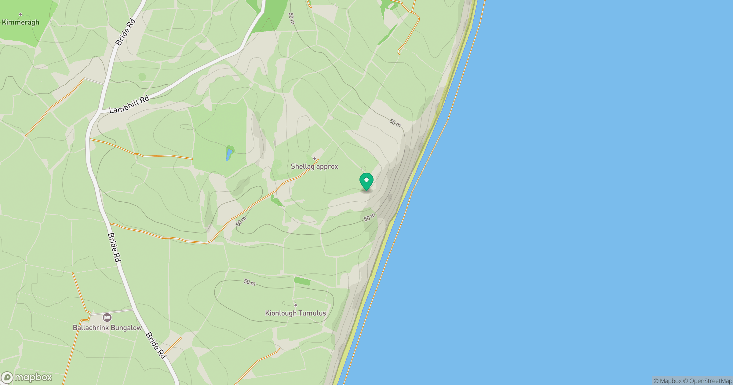
Grid reference: SC458999
View on OpenStreetMapOpens a map in a new tab, centred on the hill.
No comments yet. Be the first.