

Carn an Righ
Good walks are even better shared.
NO0277 : Summit of Carn an Righ
Iain Russell Photo source
Overview
Carn an Righ
Carn an Righ stands proudly at 1049 meters, making it a notable Munro in the stunning Scottish Highlands. With an elevation that grants hikers panoramic views and challenging yet rewarding routes, it's a favourite amongst both seasoned hikers and those looking for a weekend adventure.
Geology
The geology of Carn an Righ is intriguing, primarily composed of schist and granite. These rocks have been formed over millennia and twisted by the forces of nature, creating a rugged and beautiful landscape. As you ascend, keep an eye out for unique rock formations that tell a story of intense geological activity.
Routes
The most popular route is the Beinn a' Ghlo Circuit, a 14-kilometre trail coming in at a challenging 6-hour hike. Starting at the Ben Earar car park, this trail leads you through lush landscapes and ultimately to the summit of Carn an Righ, while allowing you to experience the beauty of neighbouring peaks.
Summit Features
Reaching the summit, climbers will be greeted by a grand cairn, perfect for a well-earned selfie. The summit area provides ample space to catch your breath and take in the breathtaking views of the Cairngorms.
Terrain
The terrain varies from grassy slopes to rocky outcrops as you make your way to the summit. It's essential to wear appropriate footwear as some sections can be a bit tricky.
Views
When it comes to views, Carn an Righ doesn't disappoint. On a clear day, the panorama includes dramatic sights of the Cairngorms and Ben Nevis. Spring is the prime season for optimal views, as you'll witness the beautiful heather bloom and enjoy mild weather.
Hazards
Though rewarding, hiking in the Highlands comes with its risks. Be prepared for sudden weather changes and dress accordingly. Watch for loose stones, especially on the ascent, and keep an eye out for boggy areas in the valleys.
Access
Access to Carn an Righ is convenient, with the nearest parking at the Ben Earar car park. For those relying on public transport, buses run from Blair Atholl, but be aware of limited schedules on weekends.
Facilities
Blair Atholl, the closest village, offers various cafes and pubs to refuel after your hike, as well as public toilets to freshen up.
History
The mountain's name, meaning 'Hill of the King', alludes to its significance in Scottish history, possibly related to the ancient kings who once roamed the Highlands. Its historical roots trace back to the times of the Jacobite risings, reinforcing its significance within Scottish culture.
So pack your rucksack, lace up those boots, and set off on an adventure to Carn an Righ - just remember, it’s not about the destination, it’s about the journey (and maybe the view from the top too)!
Have a great hike!
Explore routes near Carn an Righ
Walks starting near this hill. Open a route to check its map, distance and full itinerary.
Aberfeldy: Glassie Woodland and River Tay Circular
View route
Unled club outing: West Drumochter/Beinn Udlamain (coach departure)
View route
Unled club outing: Glenesk (coach departure)
View route
Unled club outing: Xmas Walk - Bankfoot - Dunkeld (coach departure)
View route
Route planning notes
These notes describe possible approaches. Check a route's map and access information when planning your walk.
Beinn a' Ghlo Circuit
A stunning circuit that can be tackled from the Ben Earar car park, culminating in a delightful ascent to Carn an Righ along with neighbouring peaks.
Make a day of it, together
Find someone to share the walk with, or organise a day out along a route you like.
Photo Gallery
View all Photo could not load
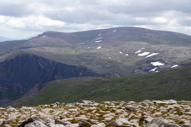
NO0277 : Summit of Carn an Righ
Iain Russell
 Photo could not load
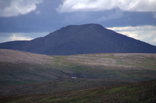
NO0277 : Summit of Carn an Righ
William Starkey
 Photo could not load
NO0277 : Summit cairn Carn an Righ
Ali Ogden
Hill facts and local notes
Classifications
Elevation
1,029m
3,376 ft
Prominence
258m
Coordinates
56.8766, -3.5953
NO028772
OS Map
43
Explorer: OL52N 387N
At the Summit
The summit boasts a large cairn, offering a perfect photo opportunity with the Highland vistas as a backdrop.
Terrain & Geology
The mountain is primarily composed of schist and granite, characteristic of the rugged Highland landscape. The erosion of these rocks has created some fascinating geological formations.
Views & Scenery
From the summit, one can gaze upon the sprawling Cairngorms, with Ben Nevis visible on a clear day. The view is complemented by rolling hills and vast glens that stretch as far as the eye can see.
History & Heritage
Name Origin
The name 'Carn an Righ' translates to 'Hill of the King' in Scots Gaelic, possibly hinting at its historical significance as a regal or ceremonial site.
Historical Significance
The area has been inhabited since ancient times and played a role in historical events, including the Jacobite risings.
Getting There & Facilities
Parking
The nearest parking facilities are located at the Ben Earar car park, with spaces for several vehicles and easy access to the trailheads.
Public Transport
The nearest public transport is available from Blair Atholl. Buses run regularly, but services may be limited on weekends, especially during winter.
Nearby Facilities
Local facilities in Blair Atholl include several cafes, pubs, and basic shops. Public toilets are also available near the village centre.
Safety Information
Known Hazards
- Be cautious of sudden weather changes; conditions can worsen rapidly in the Highlands. Watch out for loose stones on the scramble up and beware of boggy sections in the valleys.
General Safety Tips
- Check weather conditions before setting out
- Carry appropriate clothing and equipment
- Let someone know your planned route
- Take a map, compass, and GPS device
- Carry emergency supplies: food, water, first aid kit, torch
Hills
Some common questions about the hills answered
Are there group walks up Carn an Righ?
Many walkers use Walkmates to join or organise walks with others. You can check for group walks around Carn an Righ through the maps
Are there other walkers around Carn an Righ?
Activity varies by location and time, but Walkmates lets you see whether others have shared walks or shown interest in this area. Find other people through the walking friends search walking friends for Carn an Righ search or of course create your own walk for Carn an Righ
Can I organise a walk to Carn an Righ?
Yes. If there aren’t any walks listed already, you can create a walk and make it available for others to join.
If you're signed up to Walkmates, you can create a walk to Carn an Righ.
How do I find a walk up this hill?
There are often multiple ways to walk this hill, depending on experience and route preference. Walkmates helps you explore walks and routes that others have shared.
Can I suggest a new route up Carn an Righ?
Yes. You can suggest or create routes to share with others. Walkmates focuses on the social side of walking, so routes are used to help people organise walks and explore areas together, rather than as detailed navigation tools or route libraries.
Other uses really appreciate knowledgeable walkers sharing their routes. Share your favourite route to Carn an Righ here
The is an error or something incorrect about this hill. How do I let you know?
We always strive to keep the information on Walkmates as accurate as possible. If you find an error, please let us know through the contact form and we'll aim to correct it as quickly as possible
Community Discussion
Comments
Location
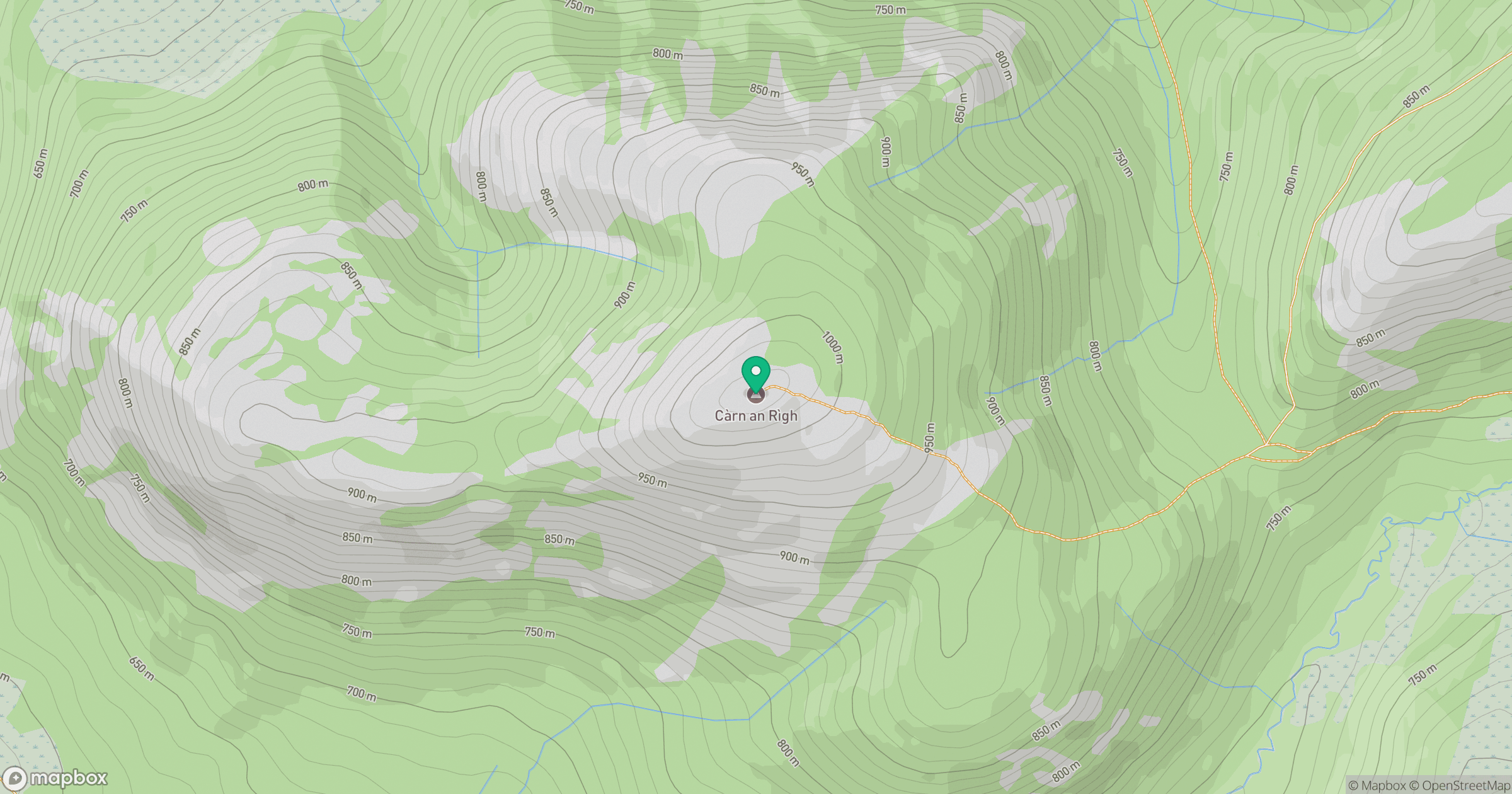
Grid reference: NO028772
View on OpenStreetMapOpens a map in a new tab, centred on the hill.
No comments yet. Be the first.